Forecasting Storm Duration Neil I Fox David Jankowski

- Slides: 20

Forecasting Storm Duration Neil I. Fox David Jankowski, Elizabeth Hatter and Liz Heiberg Dept. Soil, Environmental and Atmospheric Science University of Missouri - Columbia

Considering rear edge propagation velocity in flash flood forecasting Why worry about your rear u How your rear moves compared to your middle u Using knowledge of your rear to forecast rainfall totals u Stop the rear jokes u

Why worry about your rear? Current nowcasting tools (e. g. SCIT tracks) concentrate on arrival time u Excellent for Severe Weather warning u Flash flood forecasting: Interested in total duration of precipitation u Event management / Emergency services like to know end time u

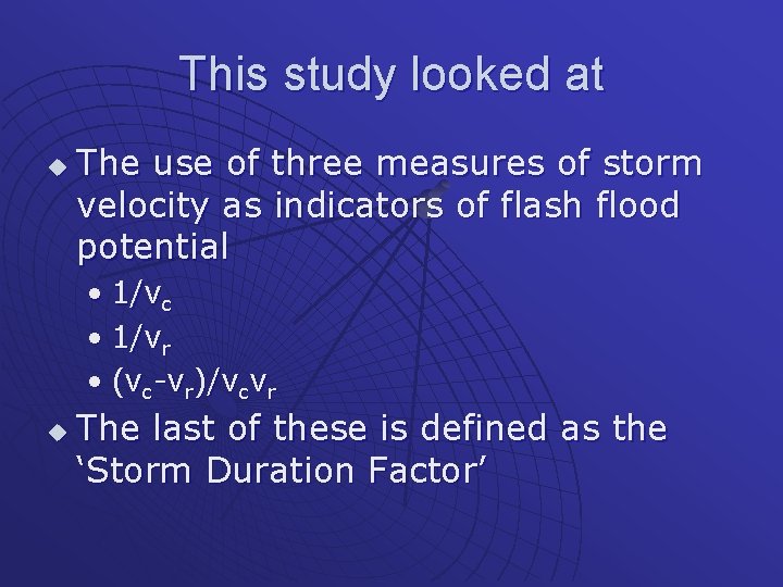
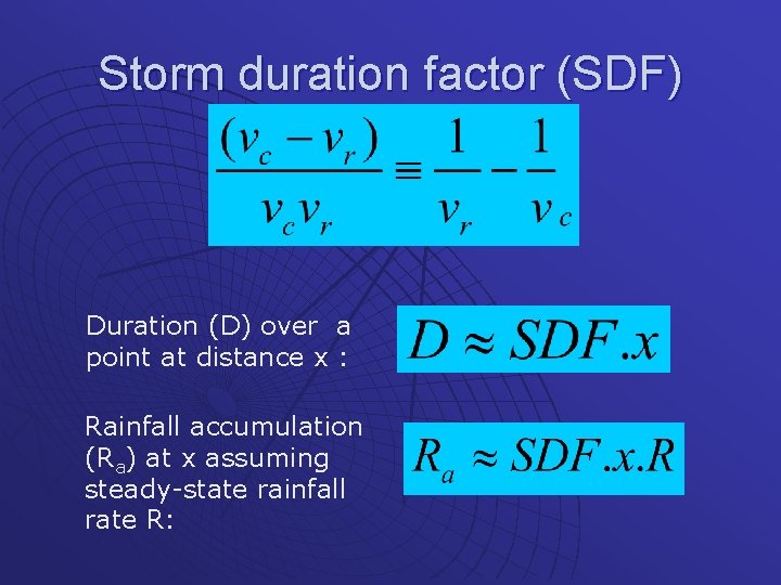
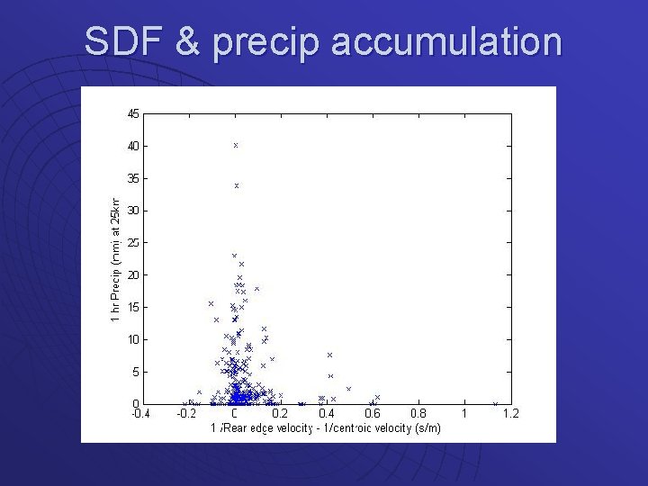
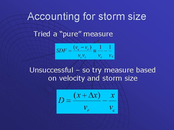
This study looked at u The use of three measures of storm velocity as indicators of flash flood potential • 1/vc • 1/vr • (vc-vr)/vcvr u The last of these is defined as the ‘Storm Duration Factor’

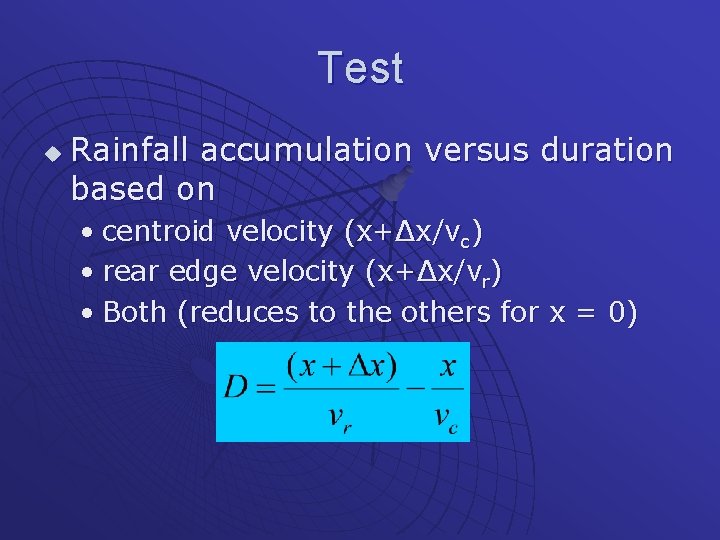
Storm duration factor (SDF) Duration (D) over a point at distance x : Rainfall accumulation (Ra) at x assuming steady-state rainfall rate R:

Data Initially data was taken from a number of cases where (flash) flooding occurred u A range of storm types, locations and situations u Not all storm cells observed caused flooding u Then more data for more cases u

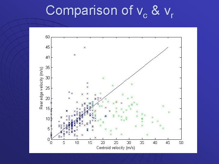
Analysis Centroid velocities found using the NSSL algorithms (SCIT) u Rear edge velocities found by locating position from tracing centroid vector backward until Z falls below threshold u

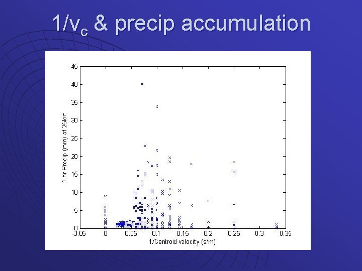
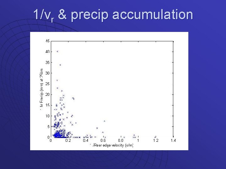
Analysis u The three measures were plotted against rainfall accumulations • for the subsequent 60 minutes • 0 km and 25 km ahead of storm center location • Greater distances saw very little rain (storms don’t move that fast or dissipate within the distance)

Comparison of vc & vr

1/vc & precip accumulation

1/vr & precip accumulation

SDF & precip accumulation

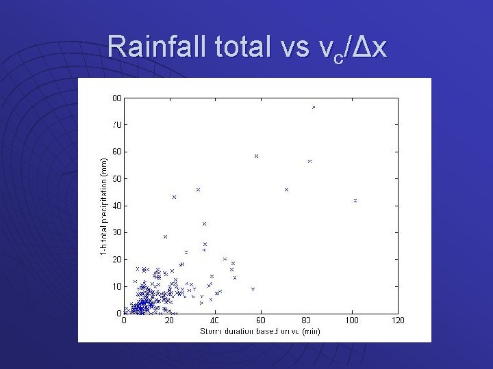
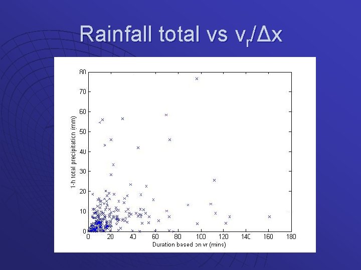
Results All correlation coefficients are horrible u If you squint you can kind of see what you want to see u More work required!! u

Next u This could be because • We don’t consider development/dissipation • We don’t consider size of storm • We don’t look at sensible distances or have good rainfall data

Accounting for storm size Tried a “pure” measure Unsuccessful – so try measure based on velocity and storm size

Test u Rainfall accumulation versus duration based on • centroid velocity (x+Δx/vc) • rear edge velocity (x+Δx/vr) • Both (reduces to the others for x = 0)

Rainfall total vs vc/Δx

Rainfall total vs vr/Δx

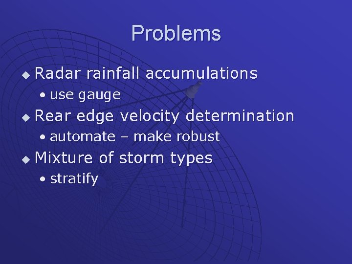
Problems u Radar rainfall accumulations • use gauge u Rear edge velocity determination • automate – make robust u Mixture of storm types • stratify

Thanks u Parts of this work have been funded by the COMET Partners Program and The University of Missouri Research Council