Follow the River Environmental Education Outreach Coordinator Theresa


- Slides: 20
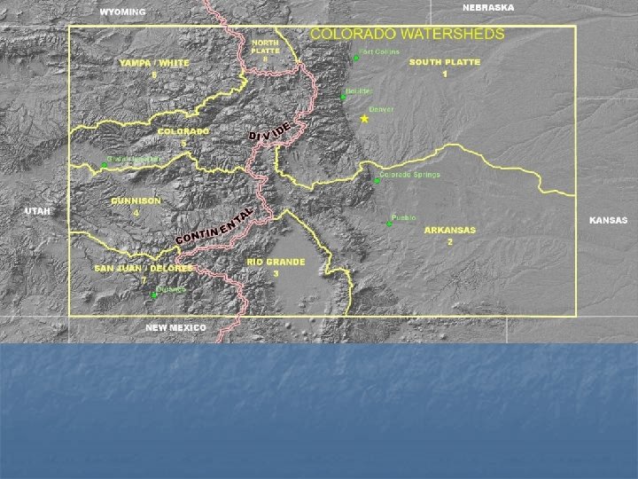
Follow the River Environmental Education Outreach Coordinator: Theresa Springer Maps By: GIS specialist Carrie Adair Watersheds, the Continental Divide and Rivers
Mountains look dark and large water bodies looks plain.
Outline of the lower forty eight states.
Atlantic Ocean Pacific Ocean Gulf of Mexico GIS mapping can add layers and change colors. The names of the lakes and the outline of the states are layers.
Atlantic Ocean Pacific Ocean Gulf of Mexico Name_____________________ Date_________
Atlantic Ocean Pacific Ocean Gulf of Mexico How close were you? Look where the Mississippi River begins.
Atlantic Ocean Pacific Ocean Gulf of Mexico Notice the circle in Wyoming. This area has lakes that drain into both sides of the Continental Divide.
Atlantic Ocean Pacific Ocean Gulf of Mexico
Atlantic Ocean Pacific Ocean Gulf of Mexico
State of Colorado Name_________________ Date___________
Interstate Highway - one of the system of highways linking major cities in the 48 contiguous states of the United States. http: //www. thefreedictionary. com/interstate+highway
Major cities in Colorado There are seven cities on this map. The GIS Specialist used the color green to label the cities. Is green a good choice? What would you change it to?
Critical thinking question: Why isn’t there a highway along the Continental Divide? Can you hike the Continental Divide?
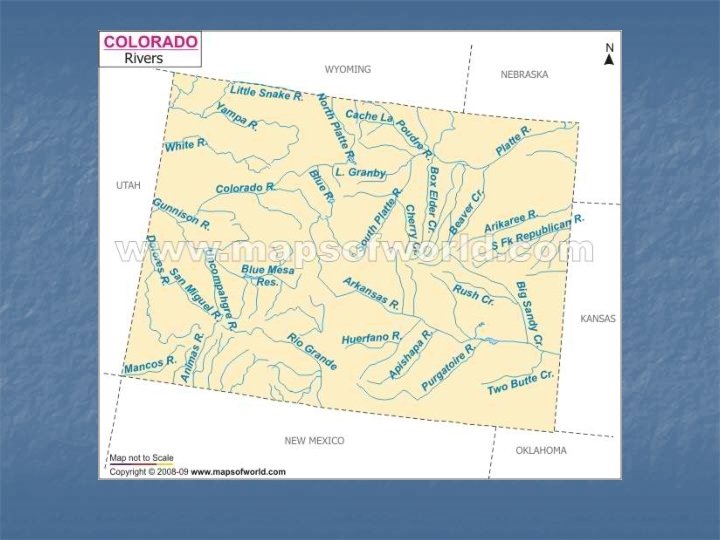
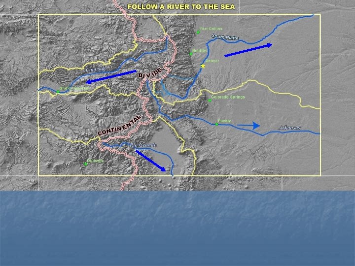
Side by side. Follow the Continental Divide by looking at where rivers begin. The Arkansas and the South Platte Rivers begin on different sides of the same mountain.
Notice that the South Platte has three forks: the North, Middle and South Forks.
Gulf of California Gulf of Mexico