Follow along on your blank map to put
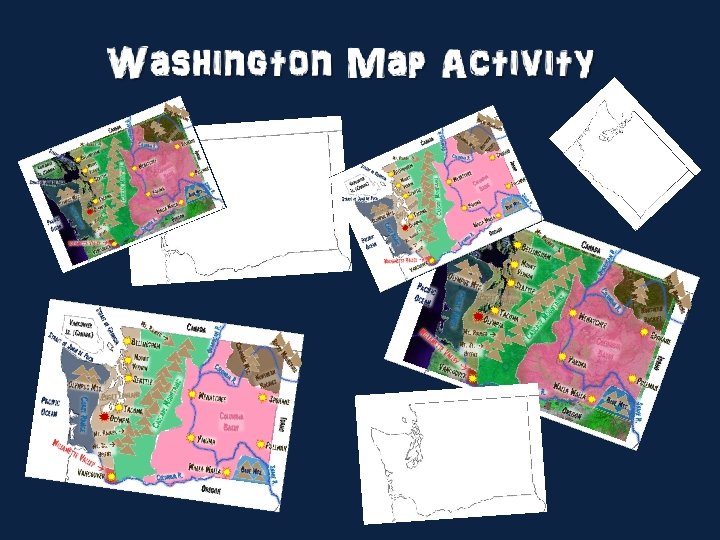

Follow along on your blank map to put 22 cities, rivers, lakes, and geographic features in and around the state… (use the satellite image version, or the blank map version)

Follow along on your blank map to put 22 cities, rivers, lakes, and geographic features in and around the state… (use the satellite image version, or the blank map version)

Follow along on your blank map to put 22 cities, rivers, lakes, and geographic features in and around the state…

Start here if you prefer to use a blank map background…

Step 1: Lightly Shade in 7 geographic regions of Washington (it has to be light because you will write words over it)

Step 2: label the seven geographic regions of Washington ette V alley de Mo Casca C oast Rang e Willam nd a l w o L t Puge untain s rn e h t Nor kies Roc Columbia Basin Blue Mts.

Step 3: Draw small triangles to indicate the Blue Mountains ette V alley de Mo Casca C oast Rang e Willam nd a l w o L t Puge untain s rn e h t Nor kies Roc Columbia Basin Blue Mts.

Step 4: Draw small triangles and label the Columbia Mountains and the Rocky Mountains ette V alley Casca de Mo untain s ts. ia M umb Col C oast Rang e Willam nd a l w o L t Puge Ro cky Mo un tain s n ther r o N kies Roc Columbia Basin Blue Mts.

Step 5: Draw many small triangles and label the Cascade Mountain Range ette V alley Casca de Mo untain s ts. ia M umb Col C oast Rang e Willam nd a l w o L t Puge Ro cky Mo un tain s n ther r o N kies Roc Columbia Basin Blue Mts.

Step 6: Label three of the highest peaks in the state ette V de Mo Casca C oast Rang e Willam nd a l w o L t Puge nier i a R. t M Mt. St. Helens alley Ro cky Mo un tain s n ther r o N kies Roc untain s ts. ia M umb Col Mt. B aker Columbia Basin Blue Mts.

Step 7: outline Vancouver Island, and label surrounding states and countries Canada Mt. B ette V de Mo Casca Columbia Basin nier i a R. t M Mt. St. Helens alley Idaho C oast Rang e Willam nd a l w o L t Puge untain s ts. ia M umb Col aker Vancouver Is. (Canada) Ro cky Mo un tain s n ther r o N kies Roc Blue Mts. Oregon

Step 8: label nearby bodies of water Canada Willam ette V de Mo Casca Columbia Basin nier i a R. t M Mt. St. Helens alley Idaho C oast Rang e Pacific Ocean nd a l w o L t Puge Ro cky Mo un tain s n ther r o N kies Roc untain s ts. ia M umb Col ia or g Ge of ait Str Vancouver Is. (Canada) Strait of Jua n de Fuca Mt. B aker Blue Mts. Oregon

Step 9: Trace the general location of the Snake River and label it Canada ette V de Mo Casca nier i a R. t M Mt. St. Helens alley Blue Mts. Oregon R. Snake Willam Columbia Basin Idaho C oast Rang e Pacific Ocean nd a l w o L t Puge Ro cky Mo un tain s n ther r o N kies Roc untain s ts. ia M umb Col ia or g Ge of ait Str Vancouver Is. (Canada) Strait of Jua n de Fuca Mt. B aker

Canada ette V de Mo Casca nier i a R. t M Mt. St. Helens alley Blue Mts. Oregon R. Snake Willam Columbia Basin Idaho C oast Rang e Pacific Ocean nd a l w o L t Puge Ro cky Mo un tain s n ther r o N kies Roc untain s ts. ia M umb Col ia or g Ge of ait Str Vancouver Is. (Canada) Strait of Jua n de Fuca Mt. B aker Okanogan R. Step 10: Trace the general location of the Okanogan River and label it

Canada ts. ia M umb Col ia or g Ge of ait Str Vancouver Is. (Canada) Strait of Jua n de Fuca Mt. B aker Okanogan R. Step 11: Trace the general location of the Columbia River and label it ette V de Mo Casca alley Blue Mts. ia R. b m u l o C Oregon R. Snake Willam nier i a R. t M Mt. St. Helens Columbia Basin Idaho C oast Rang e Pacific Ocean nd a l w o L t Puge untain s Colu mbi a R. Ro cky Mo un tain s n ther r o N kies Roc

Canada ts. ia M umb Col ia or g Ge of ait Str Vancouver Is. (Canada) Strait of Jua n de Fuca Mt. B aker Okanogan R. Step 12: Draw small triangles and label the Olympus Mountains ette V de Mo Casca alley Blue Mts. ia R. b m u l o C Oregon R. Snake Willam nier i a R. t M Mt. St. Helens Columbia Basin Idaho C oast Rang e Pacific Ocean Olympic Mts. nd a l w o L t Puge untain s Colu mbi a R. Ro cky Mo un tain s n ther r o N kies Roc

Canada ts. ia M umb Col ia or g Ge of ait Str Vancouver Is. (Canada) Strait of Jua n de Fuca Mt. B aker Okanogan R. Step 13: draw small stars and label five cities in the eastern reaches of the state ette V de Mo Casca alley ia R. b m u l o C Columbia Basin Yakima Walla Oregon Pullman Blue Mts. R. Snake Willam nier i a R. t M Mt. St. Helens Wenatchee Spokane Idaho C oast Rang e Pacific Ocean Olympus Mts. nd a l w o L t Puge untain s Colu mbi a R. Ro cky Mo un tain s n ther r o N kies Roc

Bellingham Colu mbi a R. untain de Mo Casca ia R. b m u l o C Columbia Basin Yakima Walla Oregon Spokane Pullman Blue Mts. R. Snake alley Vancouver Wenatchee Ro cky Mo un tain s n ther r o N kies Roc Idaho C oast Rang e ette V nier i a R. t M Mt. St. Helens s Mount Vernon Seattle Olympus Mts. nd a l w o L t Puge Tacoma Pacific Ocean Willam Canada ts. ia M umb Col ia or g Ge of ait Str Vancouver Is. (Canada) Strait of Jua n de Fuca Mt. B aker Okanogan R. Step 14: draw small stars and label five cities in the western reaches of the state

Bellingham Colu mbi a R. alley Vancouver s untain de Mo Casca ia R. b m u l o C Columbia Basin Yakima Walla Oregon Spokane Pullman Blue Mts. R. Snake ette V Mt. R Mt. St. Helens Wenatchee Ro cky Mo un tain s n ther r o N kies Roc Idaho Seattle Olympus Mts. nd a l w o L t Puge Tacoma Olympi a ainier Willam Mount Vernon C oast Rang e Pacific Ocean Canada ts. ia M umb Col ia or g Ge of ait Str Vancouver Is. (Canada) Strait of Jua n de Fuca Mt. B aker Okanogan R. Step 15: draw a larger red star and label the state capital

Colu mbi a R. s untain de Mo Casca ia R. b m u l o C Columbia Basin Yakima Walla Oregon Spokane Pullman Blue Mts. R. Snake alley Vancouver Wenatchee Ro cky Mo un tain s n ther r o N kies Roc Idaho ette V Mt. R Mt. St. Helens Okanogan R. Bellingham Seattle Olympus Mts. nd a l w o L t Puge Tacoma Olympi a ainier Willam Mount Vernon C oast Rang e Pacific Ocean Canada ts. ia M umb Col ia or g Ge of ait Str Vancouver Is. (Canada) Strait of Jua n de Fuca Mt. B aker

Start here if you prefer to use a satellite image background…

Step 1: Lightly Shade in 7 geographic regions of Washington (it has to be light because you will write words over it)

Step 2: label the seven geographic regions of Washington ette V alley de Mo Casca C oast Rang e Willam nd a l w o L t Puge untain s rn e h t Nor kies Roc Columbia Basin Blue Mts.

Step 3: Draw small triangles to indicate the Blue Mountains ette V alley de Mo Casca C oast Rang e Willam nd a l w o L t Puge untain s rn e h t Nor kies Roc Columbia Basin Blue Mts.

Step 4: Draw small triangles and label the Columbia Mountains and the Rocky Mountains ette V alley Casca de Mo untain s ts. ia M umb Col C oast Rang e Willam nd a l w o L t Puge Ro cky Mo un tain s n ther r o N kies Roc Columbia Basin Blue Mts.

Step 5: Draw many small triangles and label the Cascade Mountain Range ette V alley Casca de Mo untain s ts. ia M umb Col C oast Rang e Willam nd a l w o L t Puge Ro cky Mo un tain s n ther r o N kies Roc Columbia Basin Blue Mts.

Step 6: Label three of the highest peaks in the state ette V de Mo Casca C oast Rang e Willam nd a l w o L t Puge nier i a R. t M Mt. St. Helens alley Ro cky Mo un tain s n ther r o N kies Roc untain s ts. ia M umb Col Mt. B aker Columbia Basin Blue Mts.

Step 7: outline Vancouver Island, and label surrounding states and countries ette V de Mo Casca Columbia Basin nier i a R. t M Mt. St. Helens alley Idaho C oast Rang e Willam nd a l w o L t Puge Ro cky Mo un tain s n ther r o N kies Roc untain s Vancouver Is. (Canada) Canada ts. ia M umb Col Mt. B aker Blue Mts. Oregon

Step 8: label nearby bodies of water Canada Willam ette V de Mo Casca Columbia Basin nier i a R. t M Mt. St. Helens alley Idaho C oast Rang e Pacific Ocean nd a l w o L t Puge Ro cky Mo un tain s n ther r o N kies Roc untain s ts. ia M umb Col ia or g Ge of ait Str Vancouver Is. (Canada) Strait of Jua n de Fuca Mt. B aker Blue Mts. Oregon

Step 9: Trace the general location of the Snake River and label it Canada ette V de Mo Casca nier i a R. t M Mt. St. Helens alley Blue Mts. Oregon R. Snake Willam Columbia Basin Idaho C oast Rang e Pacific Ocean nd a l w o L t Puge Ro cky Mo un tain s n ther r o N kies Roc untain s ts. ia M umb Col ia or g Ge of ait Str Vancouver Is. (Canada) Strait of Jua n de Fuca Mt. B aker

Canada ette V de Mo Casca nier i a R. t M Mt. St. Helens alley Blue Mts. Oregon R. Snake Willam Columbia Basin Idaho C oast Rang e Pacific Ocean nd a l w o L t Puge Ro cky Mo un tain s n ther r o N kies Roc untain s ts. ia M umb Col ia or g Ge of ait Str Vancouver Is. (Canada) Strait of Jua n de Fuca Mt. B aker Okanogan R. Step 10: Trace the general location of the Okanogan River and label it

Canada ts. ia M umb Col ia or g Ge of ait Str Vancouver Is. (Canada) Strait of Jua n de Fuca Mt. B aker Okanogan R. Step 11: Trace the general location of the Columbia River and label it ette V de Mo Casca alley Blue Mts. ia R. b m u l o C Oregon R. Snake Willam nier i a R. t M Mt. St. Helens Columbia Basin Idaho C oast Rang e Pacific Ocean nd a l w o L t Puge untain s Colu mbi a R. Ro cky Mo un tain s n ther r o N kies Roc

Canada ts. ia M umb Col ia or g Ge of ait Str Vancouver Is. (Canada) Strait of Jua n de Fuca Mt. B aker Okanogan R. Step 12: Draw small triangles and label the Olympus Mountains ette V de Mo Casca alley Blue Mts. ia R. b m u l o C Oregon R. Snake Willam nier i a R. t M Mt. St. Helens Columbia Basin Idaho C oast Rang e Pacific Ocean Olympus Mts. nd a l w o L t Puge untain s Colu mbi a R. Ro cky Mo un tain s n ther r o N kies Roc

Canada ts. ia M umb Col ia or g Ge of ait Str Vancouver Is. (Canada) Strait of Jua n de Fuca Mt. B aker Okanogan R. Step 13: draw small stars and label five cities in the eastern reaches of the state ette V de Mo Casca alley ia R. b m u l o C Columbia Basin Yakima Walla Oregon Pullman Blue Mts. R. Snake Willam nier i a R. t M Mt. St. Helens Wenatchee Spokane Idaho C oast Rang e Pacific Ocean Olympus Mts. nd a l w o L t Puge untain s Colu mbi a R. Ro cky Mo un tain s n ther r o N kies Roc

Bellingham Colu mbi a R. untain de Mo Casca ia R. b m u l o C Columbia Basin Yakima Walla Oregon Spokane Pullman Blue Mts. R. Snake alley Vancouver Wenatchee Ro cky Mo un tain s n ther r o N kies Roc Idaho C oast Rang e ette V nier i a R. t M Mt. St. Helens s Mount Vernon Seattle Olympus Mts. nd a l w o L t Puge Tacoma Pacific Ocean Willam Canada ts. ia M umb Col ia or g Ge of ait Str Vancouver Is. (Canada) Strait of Jua n de Fuca Mt. B aker Okanogan R. Step 14: draw small stars and label five cities in the western reaches of the state

Bellingham Colu mbi a R. alley Vancouver s untain de Mo Casca ia R. b m u l o C Columbia Basin Yakima Walla Oregon Spokane Pullman Blue Mts. R. Snake ette V Mt. R Mt. St. Helens Wenatchee Ro cky Mo un tain s n ther r o N kies Roc Idaho Seattle Olympus Mts. nd a l w o L t Puge Tacoma Olympi a ainier Willam Mount Vernon C oast Rang e Pacific Ocean Canada ts. ia M umb Col ia or g Ge of ait Str Vancouver Is. (Canada) Strait of Jua n de Fuca Mt. B aker Okanogan R. Step 15: draw a larger red star and label the state capital

Colu mbi a R. s untain de Mo Casca ia R. b m u l o C Columbia Basin Yakima Walla Oregon Spokane Pullman Blue Mts. R. Snake alley Vancouver Wenatchee Ro cky Mo un tain s n ther r o N kies Roc Idaho ette V Mt. R Mt. St. Helens Okanogan R. Bellingham Seattle Olympus Mts. nd a l w o L t Puge Tacoma Olympi a ainier Willam Mount Vernon C oast Rang e Pacific Ocean Canada ts. ia M umb Col ia or g Ge of ait Str Vancouver Is. (Canada) Strait of Jua n de Fuca Mt. B aker
- Slides: 38