
Floodwater Management in Dallas TX Stephen Swan CE

- Slides: 15
Floodwater Management in Dallas, TX Stephen Swan CE 394 K 2 April 22, 2010 1
OUTLINE �Project Background �Dallas and the Trinity River �Flood of 1908 �Current Flood Control Measures �Initial Modeling �Future Work 2
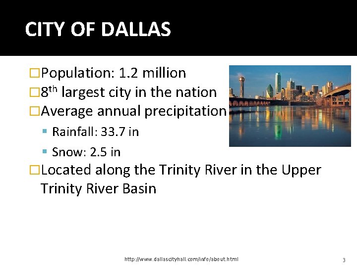
CITY OF DALLAS �Population: 1. 2 million � 8 th largest city in the nation �Average annual precipitation Rainfall: 33. 7 in Snow: 2. 5 in �Located along the Trinity River in the Upper Trinity River Basin http: //www. dallascityhall. com/info/about. html 3
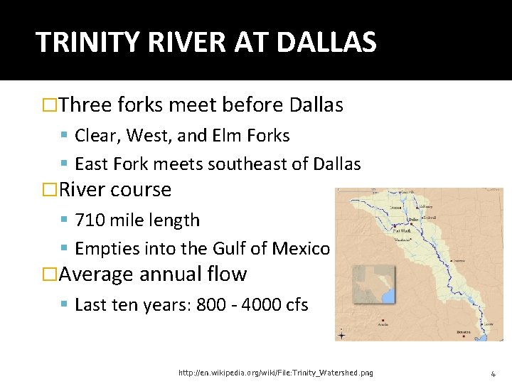
TRINITY RIVER AT DALLAS �Three forks meet before Dallas Clear, West, and Elm Forks East Fork meets southeast of Dallas �River course 710 mile length Empties into the Gulf of Mexico �Average annual flow Last ten years: 800 - 4000 cfs http: //en. wikipedia. org/wiki/File: Trinity_Watershed. png 4
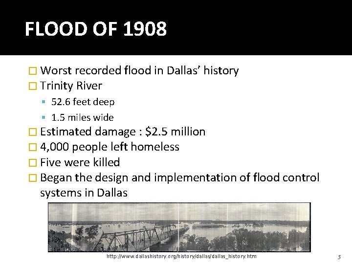
FLOOD OF 1908 � Worst recorded flood in Dallas’ history � Trinity River 52. 6 feet deep 1. 5 miles wide � Estimated damage : $2. 5 million � 4, 000 people left homeless � Five were killed � Began the design and implementation of flood control systems in Dallas http: //www. dallashistory. org/history/dallas_history. htm 5
DALLAS FLOOD CONTROL � Levees East Levee: 11. 5 mi West Levee: 13. 4 mi Rochester Levee: 5. 1 mi Average height: 28 ft � Pumping Stations: 16 Pumps: 63 Flow rate: 4, 399 cfs � Pressure Sewers: 6 Flow rate: 19, 868 cfs http: //www. ci. dallas. tx. us/sts/html/fc. html 6
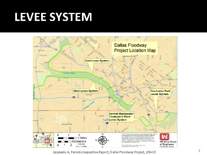
LEVEE SYSTEM Appendix A, Periodic Inspection Report, Dallas Floodway Project, USACE 7
USACE PERIODIC INPECTION 2007 �USACE 5 year inspection �Dallas levee system Unacceptable �East levee 47% below Standard Project Flood �West levee 42% below Standard Project Flood �Issues with other flood protection Periodic Inspection Report, Dallas Floodway Project, USACE 8
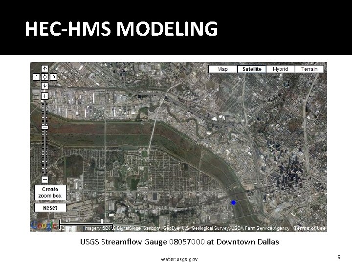
HEC-HMS MODELING USGS Streamflow Gauge 08057000 at Downtown Dallas water. usgs. gov 9
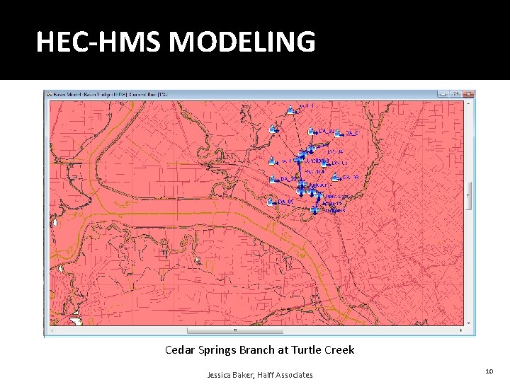
HEC-HMS MODELING Cedar Springs Branch at Turtle Creek Jessica Baker, Halff Associates 10
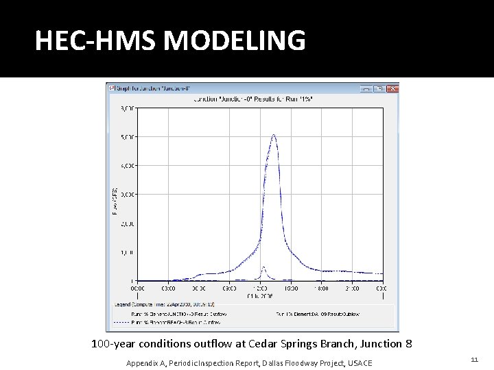
HEC-HMS MODELING 100 -year conditions outflow at Cedar Springs Branch, Junction 8 Appendix A, Periodic Inspection Report, Dallas Floodway Project, USACE 11
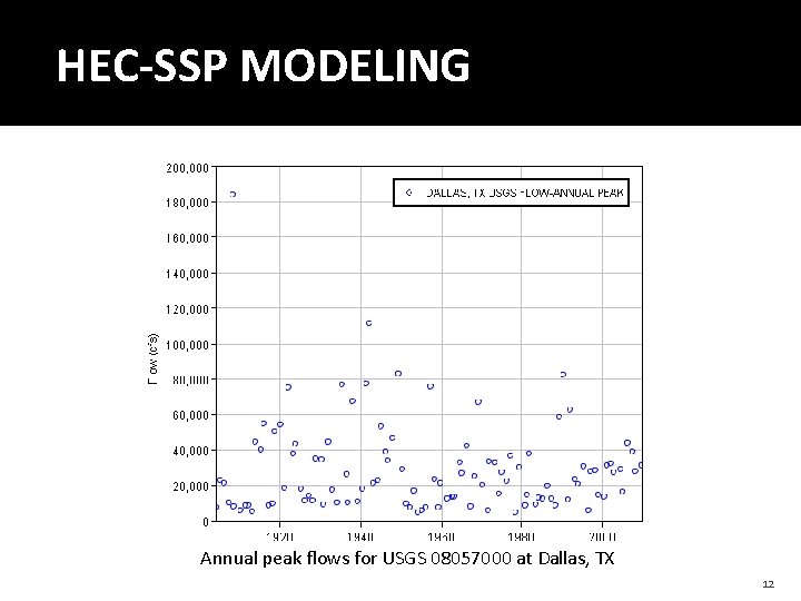
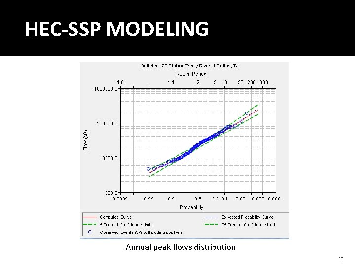
HEC-SSP MODELING Annual peak flows for USGS 08057000 at Dallas, TX 12
HEC-SSP MODELING Annual peak flows distribution 13
FUTURE WORK �HEC-RAS Modeling Model the current levee system against 100 -year flood conditions Determine levee failures from the 100 -year flood Compare 100 -year flood failures to Standard Project Flood failures 14
QUESTIONS? 15