Flash Droughts over the United States Kingtse C

- Slides: 50

Flash Droughts over the United States Kingtse C. Mo Climate Prediction Center & Dennis P. Lettenmaier UCLA 1

What is flash drought? Heat waves meet Lack of soil moisture It occurs in Spring or summer (April-September) It does not last long (flash) 2

Why should we study flash droughts ? • It tends to occur in spring and summer which are the crop growing season • High temperature and sudden drop of soil moisture withered the just panned crops • The economic losses to crops and livestock reported by the USDA are in the billions of $US [Wallander et al. 2012 and USDA Risk Management agency (http: //www. rma. usda. gov/data)]. 3

A story : how did flash drought become a hot topic ? • In 2012 late May, heat waves and low soil moisture wither just planned crops • When reporters knocked on the CPC door, our Anthony Artusa called that Flash Drought • Meanwhile, Jason Otkins and Martha Anderson also detected the 2012 event using the satellite derived Evaporative Stress Index (ESI) • Now, the flash drought had arrived 4

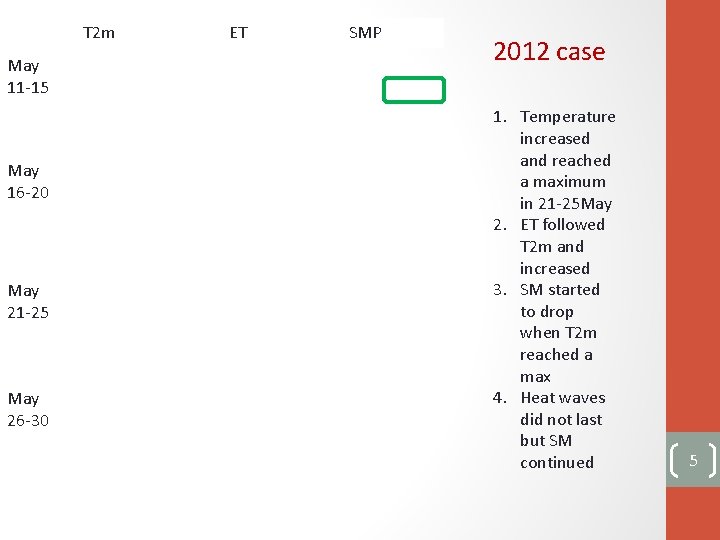
T 2 m ET SMP May 11 -15 May 16 -20 May 21 -25 May 26 -30 2012 case 1. Temperature increased and reached a maximum in 21 -25 May 2. ET followed T 2 m and increased 3. SM started to drop when T 2 m reached a max 4. Heat waves did not last but SM continued 5

Flash drought is---Flash droughts can be defined as • Heat waves -- high temperature Tair>1 SD • ET--- increases so ET anomalies are positive ET anom >0 • SM drops --- SM% is below 30% • Heat wave flash drought 6

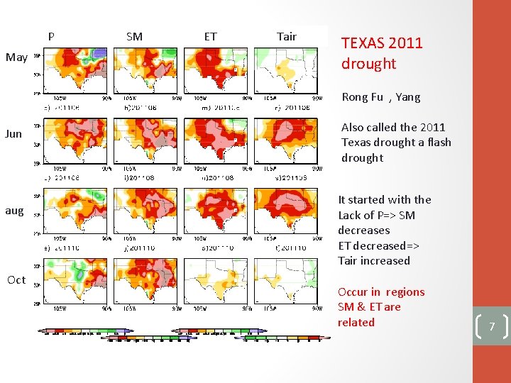
P SM ET Tair May TEXAS 2011 drought Rong Fu , Yang Jun aug Oct Also called the 2011 Texas drought a flash drought It started with the Lack of P=> SM decreases ET decreased=> Tair increased Occur in regions SM & ET are related 7

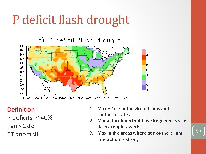
Precipitation Deficit flash drought • T>1 SD • ET anom <0 • P < 40% • Heat waves are the consequence of the lack of Precipitation • 8

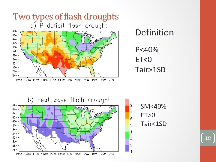
Two types of flash droughts The similarities are ØHigh temperature ØAnd Decrease of SM Differences ØPhysical mechanisms ØOne starts with heat waves--- Heat wave flash drought ØOne starts with P deficits----P deficit flash drought 9

Data sets from UCLA/UW • Data period: 1916 -2013 • Interval: Pentads (5 -day means) • Four variables (Tair, P, ET and SM ): ØTair , P (from observed stations), ØET and total SM (reconstructed from land models: Noah, Catchment, SAC and VIC). we will use ensemble mean of four models for our study 10

variables • • T -- standardized anomalies P --percentiles ET -- anomalies SM –percentiles • We processed for each model and compute frequency of occurrence • All composites are the ensemble means of four models 11

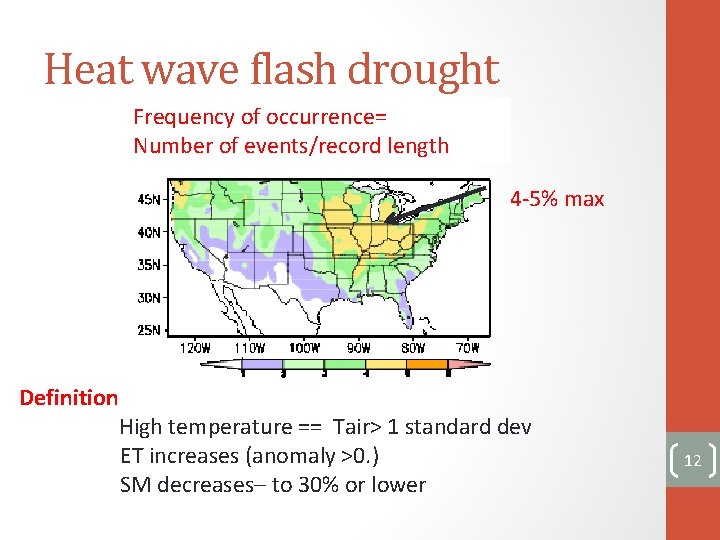
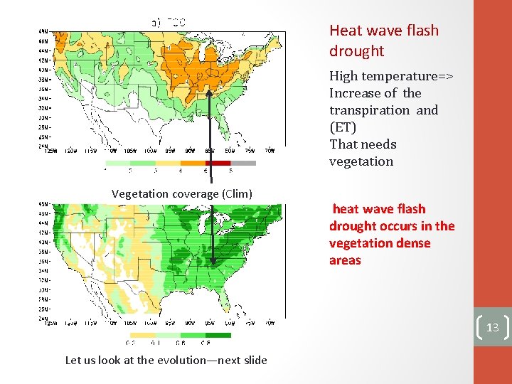
Heat wave flash drought Frequency of occurrence= Number of events/record length 4 -5% max Definition High temperature == Tair> 1 standard dev ET increases (anomaly >0. ) SM decreases– to 30% or lower 12

Heat wave flash drought High temperature=> Increase of the transpiration and (ET) That needs vegetation Vegetation coverage (Clim) heat wave flash drought occurs in the vegetation dense areas 13 Let us look at the evolution—next slide

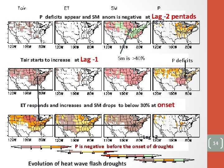
P deficits appear and SM anom is negative at Lag -2 pentads Lag -2 Tair starts to increase at Lag -1 Sm is >40% P deficits ET responds and increases and SM drops to below 30% at onset Lag +2 P is negative before the onset of droughts Evolution of heat wave flash droughts 14

Heat wave flash droughts • Occur over the North Central and the Pacific Northwest over the vegetation dense areas • Start from High temperature=> increase of ET anomalies=> decreases of SM • P deficits start before the occurrence of heat wave flash drought to drive down SM to create favorable conditions for drought to occur • P plays an indirect but important role 15

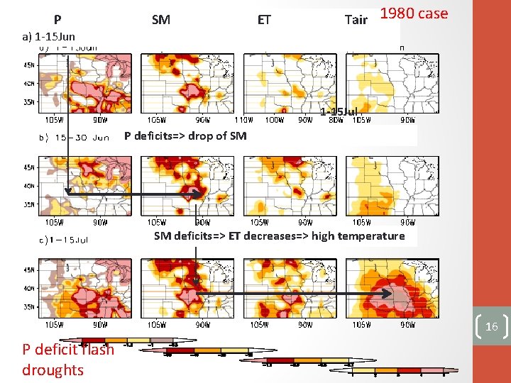
P a) 1 -15 Jun SM ET Tair 1980 case 1 -15 Jul P deficits=> drop of SM SM deficits=> ET decreases=> high temperature 16 P deficit flash droughts

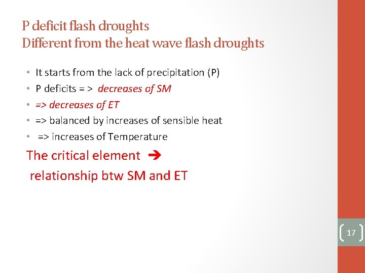
P deficit flash droughts Different from the heat wave flash droughts • • • It starts from the lack of precipitation (P) P deficits = > decreases of SM => decreases of ET => balanced by increases of sensible heat => increases of Temperature The critical element relationship btw SM and ET 17

Two types of flash droughts Definition P<40% ET<0 Tair>1 SD SM<40% ET>0 Tair<1 SD 18

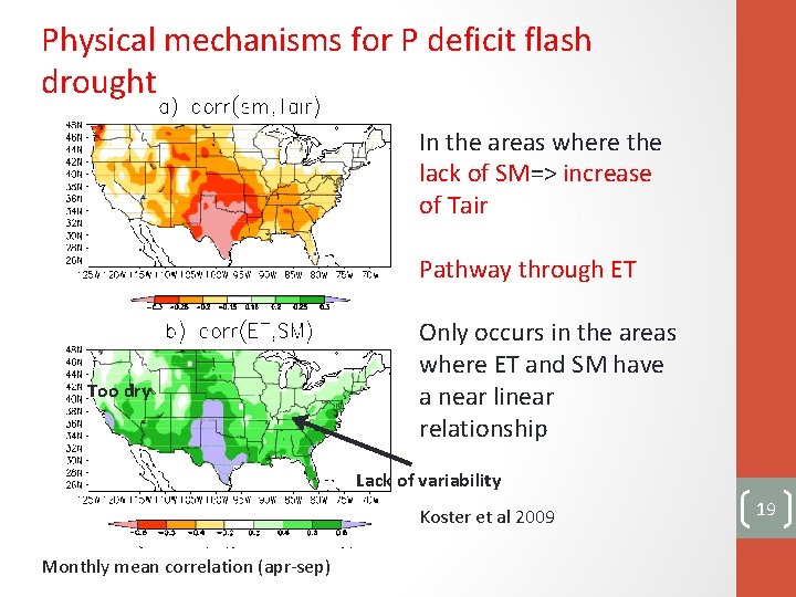
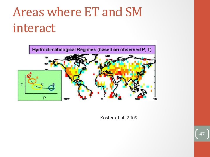
Physical mechanisms for P deficit flash drought In the areas where the lack of SM=> increase of Tair Pathway through ET Too dry Only occurs in the areas where ET and SM have a near linear relationship Lack of variability Koster et al 2009 Monthly mean correlation (apr-sep) 19

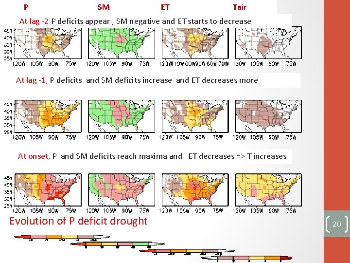
PP SM SM ET ET Tair At lag -2 P deficits appear , SM negative and ET starts to decrease At lag -1, P deficits and SM deficits increase and ET decreases more At onset, P and SM deficits reach maxima and ET decreases => T increases Evolution of P deficit drought 20

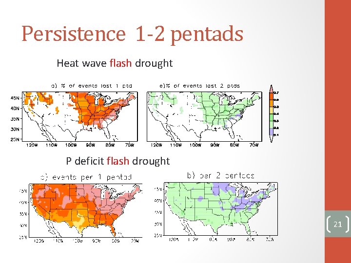
Persistence 1 -2 pentads Heat wave flash drought P deficit flash drought 21

Differences between flash droughts and agricultural droughts 1. Flash droughts do not last. The duration is about few pentads. Agricultural drought lasts longer than 3 months or longer 2. Flash droughts are linked to heat waves, but heat waves do not always develop during agricultural drought. 22

trends • Do heat wave or P deficit flash drought events have trends? • If so, do the trends related to trends of forcing such as P or Tair? • We use the Mann-Kendall test to detect trends and assess the statistical significance. 23

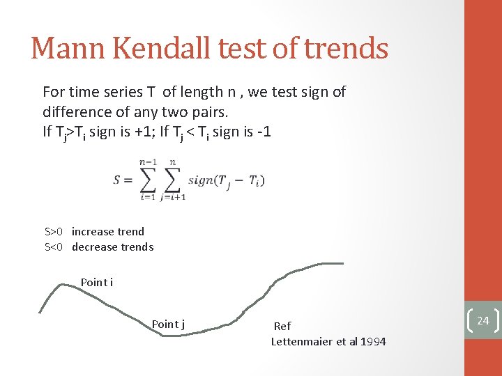
Mann Kendall test of trends For time series T of length n , we test sign of difference of any two pairs. If Tj>Ti sign is +1; If Tj < Ti sign is -1 S>0 increase trend S<0 decrease trends Point i Point j Ref Lettenmaier et al 1994 24

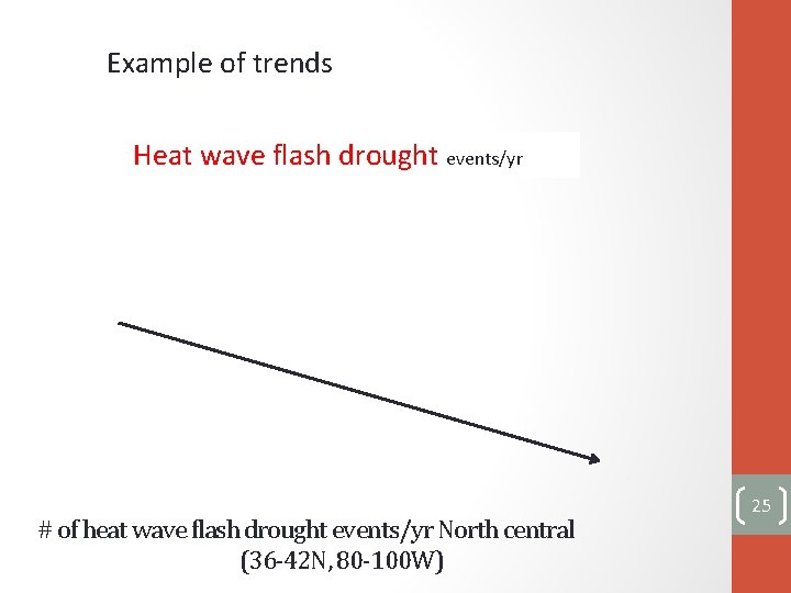
Example of trends Heat wave flash drought events/yr # of heat wave flash drought events/yr North central (36 -42 N, 80 -100 W) 25

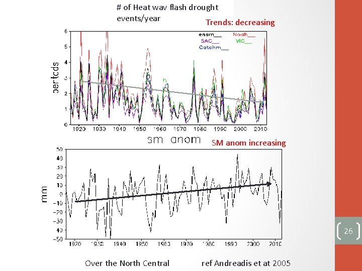
# of Heat wav flash drought events/year Trends: decreasing SM anom increasing 26 Over the North Central ref Andreadis et at 2005

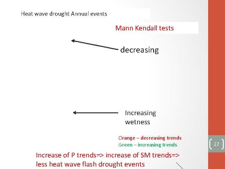
Heat wave drought Annual events Mann Kendall tests decreasing Increasing wetness Orange – decreasing trends Green – increasing trends Increase of P trends=> increase of SM trends=> less heat wave flash drought events 27

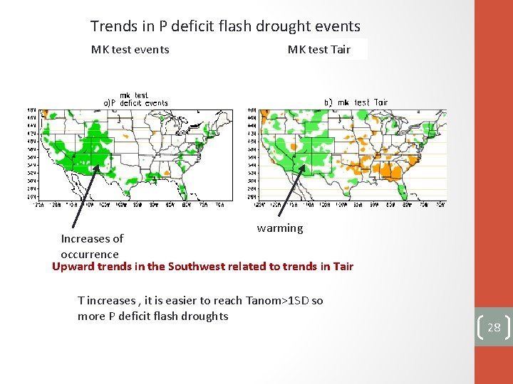
Trends in P deficit flash drought events MK test Tair warming Increases of occurrence Upward trends in the Southwest related to trends in Tair T increases , it is easier to reach Tanom>1 SD so more P deficit flash droughts 28

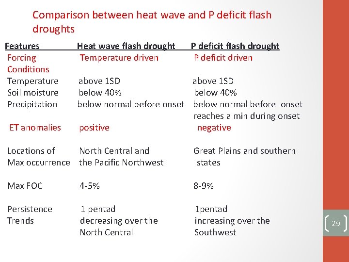
Comparison between heat wave and P deficit flash droughts Features Heat wave flash drought P deficit flash drought Forcing Temperature driven P deficit driven Conditions Temperature above 1 SD above 1 SD Soil moisture below 40% below 40% Precipitation below normal before onset reaches a min during onset ET anomalies positive negative Locations of North Central and Great Plains and southern Max occurrence the Pacific Northwest states Max FOC 4 -5% 8 -9% Persistence 1 pentad 1 pentad Trends decreasing over the increasing over the 29 North Central Southwest

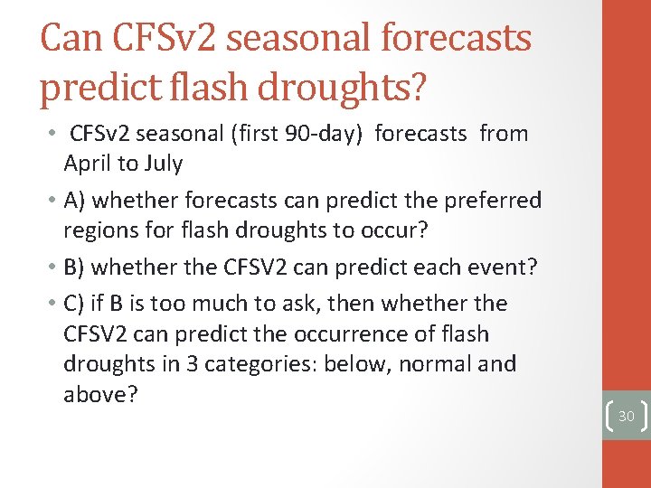
Can CFSv 2 seasonal forecasts predict flash droughts? • CFSv 2 seasonal (first 90 -day) forecasts from April to July • A) whether forecasts can predict the preferred regions for flash droughts to occur? • B) whether the CFSV 2 can predict each event? • C) if B is too much to ask, then whether the CFSV 2 can predict the occurrence of flash droughts in 3 categories: below, normal and above? 30

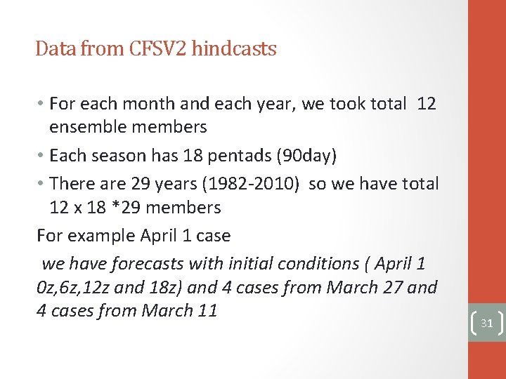
Data from CFSV 2 hindcasts • For each month and each year, we took total 12 ensemble members • Each season has 18 pentads (90 day) • There are 29 years (1982 -2010) so we have total 12 x 18 *29 members For example April 1 case we have forecasts with initial conditions ( April 1 0 z, 6 z, 12 z and 18 z) and 4 cases from March 27 and 4 cases from March 11 31

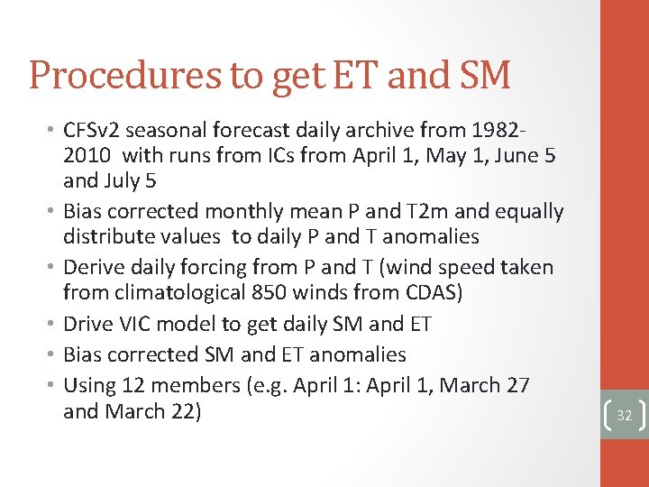
Procedures to get ET and SM • CFSv 2 seasonal forecast daily archive from 19822010 with runs from ICs from April 1, May 1, June 5 and July 5 • Bias corrected monthly mean P and T 2 m and equally distribute values to daily P and T anomalies • Derive daily forcing from P and T (wind speed taken from climatological 850 winds from CDAS) • Drive VIC model to get daily SM and ET • Bias corrected SM and ET anomalies • Using 12 members (e. g. April 1: April 1, March 27 and March 22) 32

Model forecasted flash droughts • We pool all 12 members • Calculate the ET anomalies, T 2 m standardized anomalies, SM and P percentiles in a cross validated way • Use the same criteria as analysis to select heat wave flash drought and P deficit flash drought events • We compare with VIC (SIM) 33

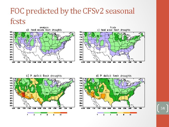
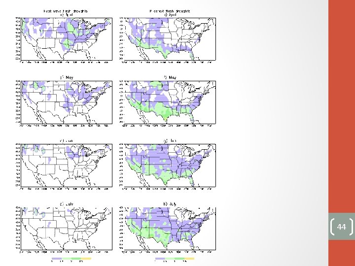
FOC predicted by the CFSv 2 seasonal fcsts 34

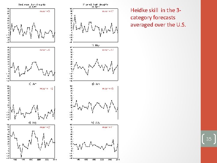
Heidke skill in the 3 category forecasts averaged over the U. S. 35

Can CFSv 2 seasonal forecasts predict flash droughts? • A) whether forecasts can predict the preferred regions for flash droughts to occur? YES • B) whether the CFSV 2 can predict each event? NO • C) if B is too much to ask, then whether the CFSV 2 can predict whethere are flash drought events in the coming season? Skill is similar to the 5 -10 day forecasts of temperature and precipitation 36

Next? ? • 1. Are there flash droughts over South America? Or other places around the globe? • 2. If so, can the same criteria apply? are the physical mechanisms associated with flash droughts still the same? • 3. Can the GEFS (short term forecasts ) predict flash droughts ? So we can issue warning • 4. are flash droughts forced? Sst forcing? (our first look did not find enso connection, but ---- 37

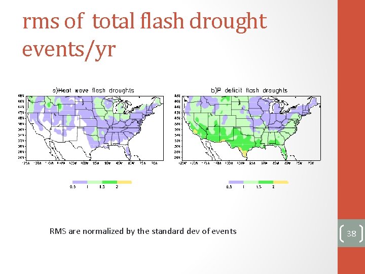
rms of total flash drought events/yr RMS are normalized by the standard dev of events 38

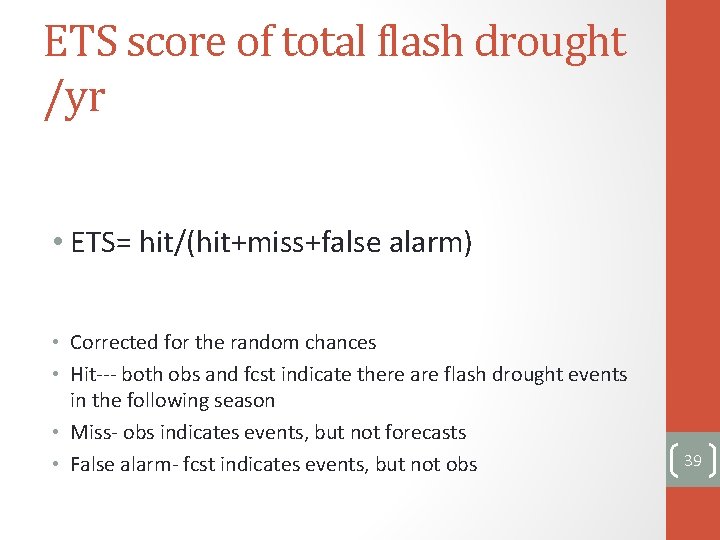
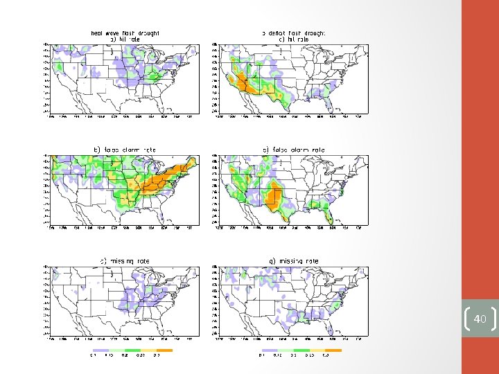
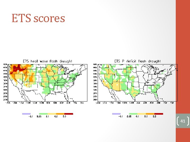
ETS score of total flash drought /yr • ETS= hit/(hit+miss+false alarm) • Corrected for the random chances • Hit--- both obs and fcst indicate there are flash drought events in the following season • Miss- obs indicates events, but not forecasts • False alarm- fcst indicates events, but not obs 39

40

ETS scores 41

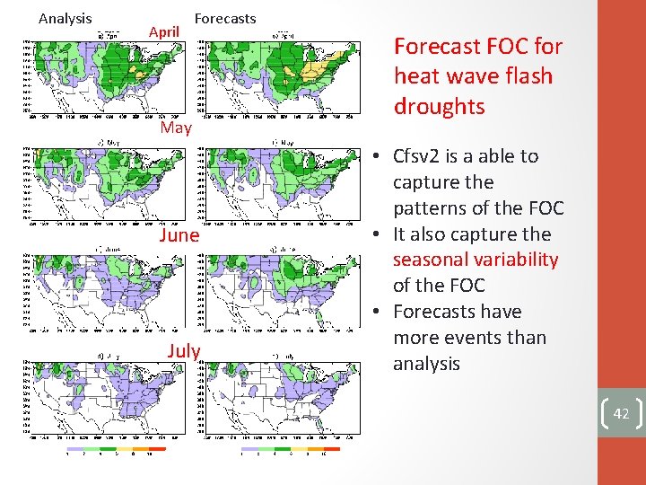
Analysis Forecasts April May June July Forecast FOC for heat wave flash droughts • Cfsv 2 is a able to capture the patterns of the FOC • It also capture the seasonal variability of the FOC • Forecasts have more events than analysis 42

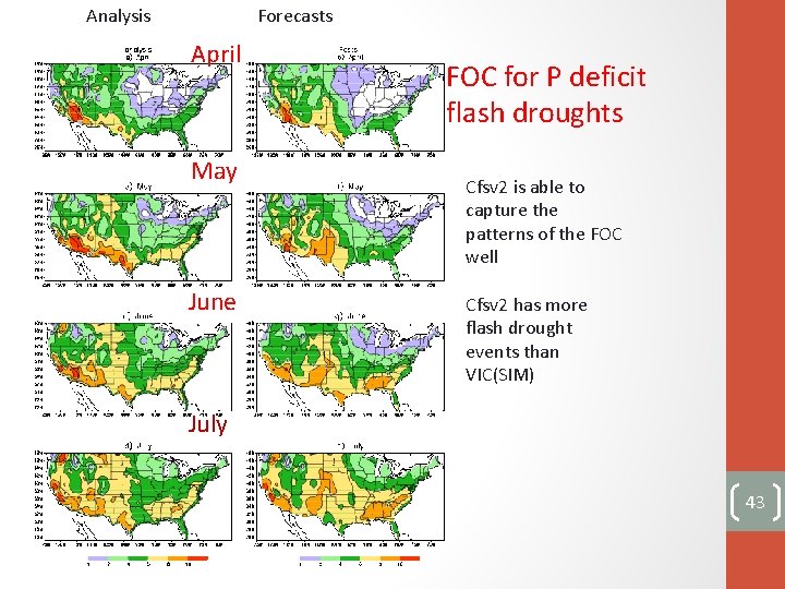
Analysis Forecasts April May June FOC for P deficit flash droughts Cfsv 2 is able to capture the patterns of the FOC well Cfsv 2 has more flash drought events than VIC(SIM) July 43

44

Summary There are two types of flash droughts 1. Heat wave flash drought • Occurs in the North Central and the Pacific Northwest • Max frequency of occurrence is 4 -5% • Temperature driven • High temp=> increasing ET=> decreasing SM 2. P deficit flash drought • Occur over the Great Plains and southern states with a maximum over Texas • Max frequency of occurrence is 8 -10% • Precipitation driven • P deficits=> Decreasing SM=> decreasing ET => Temp increases 45

annual total events • For each year, we have 12 members and 18 pentads (e. g. for 1982 April 1 initial conditions, we have 90 days (seasonal forecasts) so 18 pentads and we have 12 members) • We can compute the flash drought events for each year, each member and each pentad • We took the ensemble mean of 12 members and compute the number of events/per year (add up 18 pentads) • And compare with VIC (SIM) the next slide displays Root mean square difference bwt the number of events(yr) from CFSv 2 and the number of events/yr (vic(sim))

Areas where ET and SM interact Koster et al. 2009 47

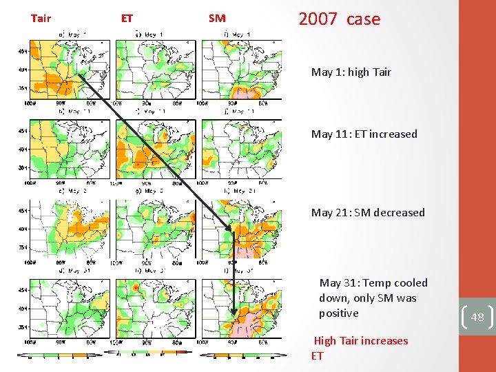
Tair ET SM 2007 case May 1: high Tair May 11: ET increased May 21: SM decreased May 31: Temp cooled down, only SM was positive High Tair increases ET 48

Tair ET SM 2007 case May 1: high Tair May 11: ET increased May 21: SM decreased May 31: Temp cooled down, only SM was positive High Tair increases ET 49

P deficit flash drought Definition P deficits < 40% Tair> 1 std ET anom<0 1. Max 8 -10% in the Great Plains and southern states. 2. Min at locations that have large heat wave flash drought events. 3. Max in the areas where atmosphere-land interaction is strong 50