Finding your way in the world Latitude lines

 around the earth's surface. Think")


 location of a particular place")


- Slides: 12
Finding your way in the world
Latitude lines are imaginary lines that run EAST/WEST (horizontally) around the earth's surface. Think of latitude like the rungs of a ladder (ladder sounds a lot like latitude). Think LATITUDE FATITUDE
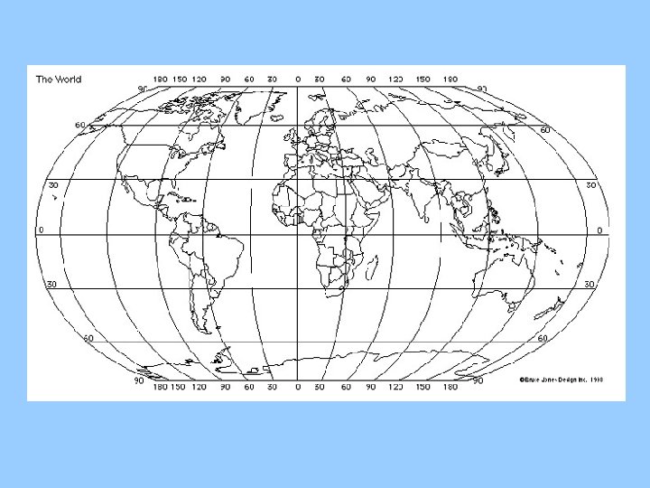
Latitude lines run completely around the earth’s surface in a horizontal direction. Latitude lines measure how far NORTH or SOUTH a place is from the equator. The Equator = 0° Start here E Q U A T O R
Longitude lines run from pole to pole around the globe and tell your distance east or west from the Prime Meridian.
It is approximately 70 miles between two latitude lines. For more accuracy in location, degrees can be divided into smaller parts. One degree = 60 minutes (') and one minute = 60 seconds (").
How do I use latitude and longitude?
To find a latitude line such as 60 degrees north latitude, you must do three things: 1. Go to your starting line (the Equator). 2. Determine which direction (north or south). 3. Determine the distance in degrees you must go (60).
To find a longitude line such as 40 degrees east longitude, you must do three things: 1. Go to your starting line (the Prime Meridian). 2. Determine which direction (east or west). 3. Determine the distance in degrees you must go (40).
The intersection of two lines is the exact (absolute) location of a particular place on the earth's surface (shown by the red "X" on the map found on the next slide.
Your Turn!