Fieldwork in the School Grounds Julia Tanner and


 Geographical skills and fieldwork • use world maps,")
 Geographical skills and fieldwork • use maps, atlases,")


 Teaching Primary Geography, Exeter, Learning Matters Learning")


- Slides: 19
Fieldwork in the School Grounds Julia Tanner and Jane Whittle GA Conference April 2014 juliatanner@live. co. uk jwhittle@isbologna. com
Objectives of the workshop Objectives • To explore strategies for engaging children in rich geographical learning experiences through fieldwork in the school grounds • To demonstrate how to audit your school grounds for geographical learning potential • To undertake some practical fieldwork outside • To provide useful resources and contacts
Why use the school grounds in geography at KS 1 and KS 2?
Why use the school grounds? • Accessibility - they are just outside your classroom door • Builds on children’s existing knowledge and experience of a familiar place • Motivation - children are interested in ‘their place’ • Provides the opportunity to investigate many aspects of physical, human and environmental geography • Provides the context for the development and application of geographical skills - enquiry skills, geographical vocabulary, fieldwork skills, map using and map making skills • School grounds investigations offer the possibility of ‘authentic learning activities’ which have real world outcomes • Required by new NC
NC 2014 - Enquiry Pupils are competent in the geographical skills needed to: • collect, analyse and communicate with a range of data gathered through experiences of fieldwork that deepen their understanding of geographical processes • interpret a range of sources of geographical information, including maps, diagrams, globes, aerial photographs and Geographical Information Systems (GIS) • communicate geographical information in a variety of ways, including through maps, numerical and quantitative skills and writing at length. (From the aims of Geography in NC)
NC 2014 – Skills (KS 1) Geographical skills and fieldwork • use world maps, atlases and globes to identify the United Kingdom and its countries, as well as the countries, continents and oceans studied at this key stage • use simple compass directions (North, South, East and West) and locational and directional language [for example, near and far; left and right], to describe the location of features and routes on a map • use aerial photographs and plan perspectives to recognise landmarks and basic human and physical features; devise a simple map; and use and construct basic symbols in a key • use simple fieldwork and observational skills to study the geography of their school and its grounds and the key human and physical features of its surrounding environment.
NC 2014 – Skills (KS 2) Geographical skills and fieldwork • use maps, atlases, globes and digital/computer mapping to locate countries and describe features studied • use the eight points of a compass, four and six-figure grid references, symbols and key (including the use of Ordnance Survey maps) to build their knowledge of the United Kingdom and the wider world • use fieldwork to observe, measure, record and present the human and physical features in the local area using a range of methods, including sketch maps, plans and graphs, and digital technologies.
Fieldwork in the school grounds At KS 1, pupils should be taught to • use simple fieldwork and observational skills to study the geography of their school and its grounds and the key human and physical features of its surrounding environment. At KS 2, pupils should be taught to • use fieldwork to observe, measure, record and present the human and physical features in the local area using a range of methods, including sketch maps, plans and graphs, and digital technologies.
Enquiry-based Fieldwork Enquiry based fieldwork involves • Asking questions • Working out how to answer them • Planning fieldwork • Collecting field data (observing/measuring, identifying/classifying, recording) • Analysing the data to establish the answers to the questions • Communicating about the enquiry and its outcome to someone.
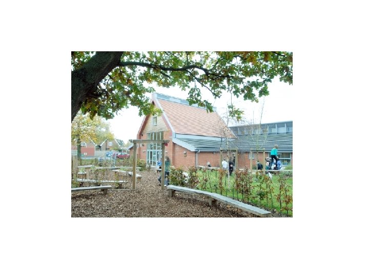
For more information This school grounds development project was inspired by the book ‘Window’ by Jeanne Baker. For more information, visit the school website http: //www. thurton. norfolk. sch. uk/teachinglearning/learning-outside-theclassroom/playground-development
Key data collection techniques • • Close observation Recording sheets Taking photographs Using i. Pads Collecting things Making rubbings Interviewing people
Useful Resources • • • School site maps /plans Large scale OS plan - 1. 1250 scale (available from Digimap) Photographs of the school building and grounds - taken at different times of day/different seasons Photographs of features of the school building and grounds - taken at different times of day/different seasons Aerial photographs of the site ( from Google Earth) Old photographs of the site Compasses Measuring tapes, trundle wheels, rope or string Digital cameras/mini i. Pads Weather-recording instruments
Useful Publications Catling S and Willy (2009) Teaching Primary Geography, Exeter, Learning Matters Learning through Landscapes (2014) Learn and Play Out: How to develop your Primary School’s Outdoor Space London, Routledge May S and Richardson P (2006) Fieldwork File: For the primary years, Sheffield, GA OFSTED (2008) Learning Outside the Classroom London, OFSTED Macintosh M and Kent G (in press) Everyday Guide to Primary Geography: Art Sheffield, GA Scoffham S (ed) (2013) Teaching Geography Creatively London, Routledge Scoffham S (ed) (2013) Primary Geography Handbook, Sheffield, GA Tanner J and Whittle J (2013) Everyday Guide to Primary Geography: Story Sheffield, GA Tanner J and Whittle J (in preparation) Everyday Guide to Primary Geography: School Grounds and Local Area, Sheffield, GA
Useful websites Council for Learning Outside the Classroom – www. lotc. org. uk Groundwork – www. groundwork. org. uk Growing Schools – www. growingschools. org. uk Learning Through Landscapes – www. ltl. org. uk Ordnance Survey - www. ordnancesurvey. co. uk Play England – www. playengland. org. uk The Geographical Association -www. geography. org. uk/ The Royal Horticultural Society – www. rhs. org. uk RSPB – www. rspb. org. uk Sustainable Schools and Sustainability and Environmental Education (SEEd) – www. se-ed. co. uk/sustainable-schools
Next - Practical work outside