Federal Department of Home Affairs FDHA Federal Office

![Hail swath on 18 July 2005 540 km Dailycrop maximum grid-VIL 10 [kg/m 2] Hail swath on 18 July 2005 540 km Dailycrop maximum grid-VIL 10 [kg/m 2]](https://slidetodoc.com/presentation_image/2302dd8a8b3f76eff920cee123ced76a/image-12.jpg)
![Hail swath on 18 July 2005 • Maximum grid-VIL > 5 [kg/m 2] (10: Hail swath on 18 July 2005 • Maximum grid-VIL > 5 [kg/m 2] (10:](https://slidetodoc.com/presentation_image/2302dd8a8b3f76eff920cee123ced76a/image-13.jpg)
![Hail swath on 18 July 2005 • Maximum grid-VIL > 5 [kg/m 2] (10: Hail swath on 18 July 2005 • Maximum grid-VIL > 5 [kg/m 2] (10:](https://slidetodoc.com/presentation_image/2302dd8a8b3f76eff920cee123ced76a/image-14.jpg)
![Hail swath on 18 July 2005 • Maximum grid-VIL > 5 [kg/m 2] (10: Hail swath on 18 July 2005 • Maximum grid-VIL > 5 [kg/m 2] (10:](https://slidetodoc.com/presentation_image/2302dd8a8b3f76eff920cee123ced76a/image-15.jpg)
- Slides: 18

Federal Department of Home Affairs FDHA Federal Office of Meteorology and Climatology Meteo. Swiss Operational thunderstorm nowcasting in the Alpine region using 3 D-radar severe weather parameters and lightning data Alessandro Hering 1, Urs Germann 1, Marco Boscacci 1, Stéphane Sénési 2 Meteo. Swiss, Locarno-Monti, Switzerland 2 Météo-France, Toulouse, France. 1

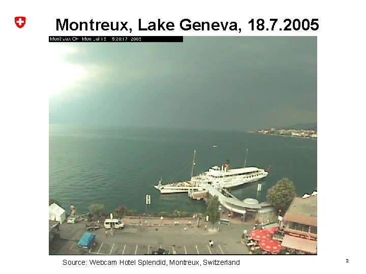
Montreux, Lake Geneva, 18. 7. 2005 Source: Webcam Hotel Splendid, Montreux, Switzerland 2

Montreux, Lake Geneva, 18. 7. 2005 Source: Webcam Hotel Splendid, Montreux, Switzerland 3

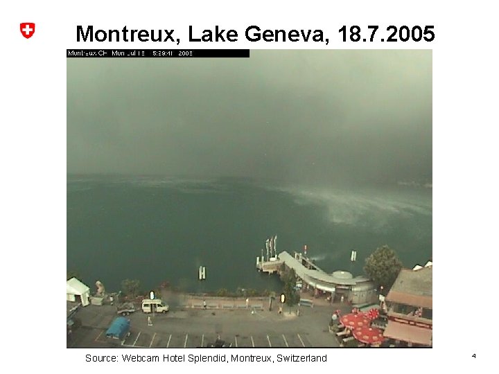
Montreux, Lake Geneva, 18. 7. 2005 Source: Webcam Hotel Splendid, Montreux, Switzerland 4

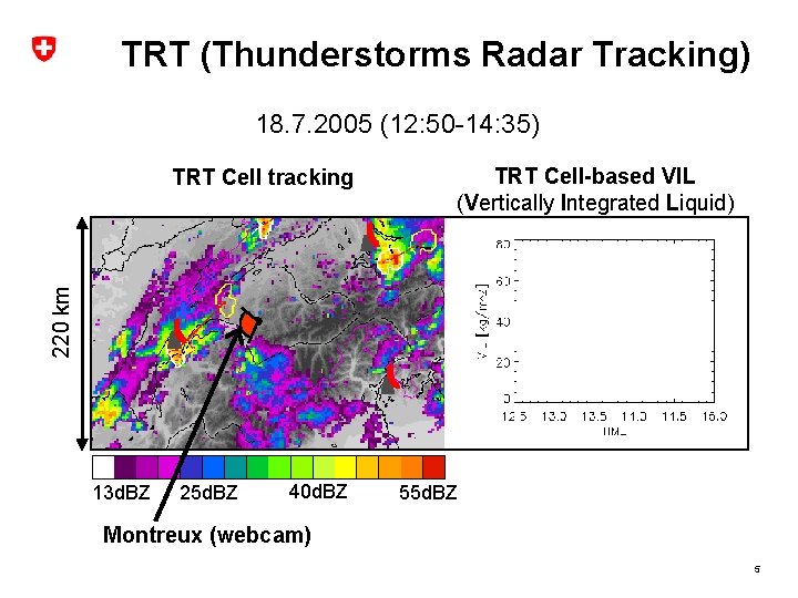
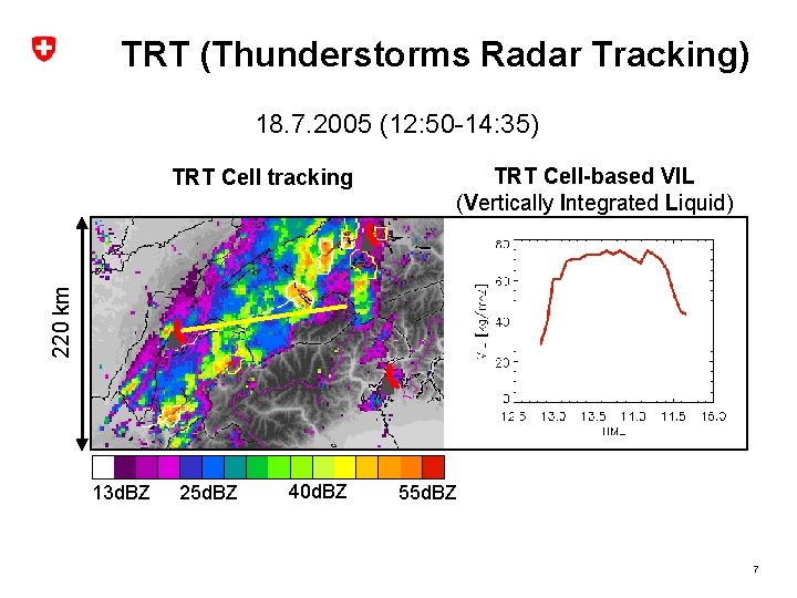
TRT (Thunderstorms Radar Tracking) 18. 7. 2005 (12: 50 -14: 35) TRT Cell-based VIL (Vertically Integrated Liquid) 220 km TRT Cell tracking 13 d. BZ 25 d. BZ 40 d. BZ 55 d. BZ Montreux (webcam) 5

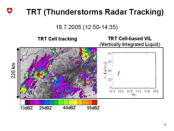
TRT (Thunderstorms Radar Tracking) 18. 7. 2005 (12: 50 -14: 35) TRT Cell-based VIL (Vertically Integrated Liquid) 220 km TRT Cell tracking 13 d. BZ 25 d. BZ 40 d. BZ 55 d. BZ 6

TRT (Thunderstorms Radar Tracking) 18. 7. 2005 (12: 50 -14: 35) TRT Cell-based VIL (Vertically Integrated Liquid) 220 km TRT Cell tracking 13 d. BZ 25 d. BZ 40 d. BZ 55 d. BZ 7

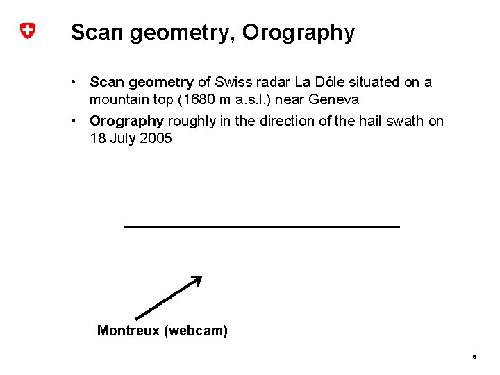
Scan geometry, Orography • Scan geometry of Swiss radar La Dôle situated on a mountain top (1680 m a. s. l. ) near Geneva • Orography roughly in the direction of the hail swath on 18 July 2005 Montreux (webcam) 8

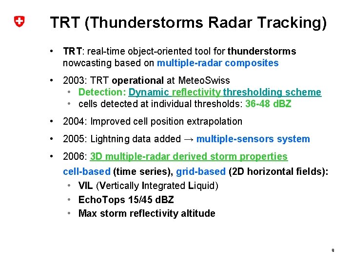
TRT (Thunderstorms Radar Tracking) • TRT: real-time object-oriented tool for thunderstorms nowcasting based on multiple-radar composites • 2003: TRT operational at Meteo. Swiss • Detection: Dynamic reflectivity thresholding scheme • cells detected at individual thresholds: 36 -48 d. BZ • 2004: Improved cell position extrapolation • 2005: Lightning data added → multiple-sensors system • 2006: 3 D multiple-radar derived storm properties cell-based (time series), grid-based (2 D horizontal fields): • VIL (Vertically Integrated Liquid) • Echo. Tops 15/45 d. BZ • Max storm reflectivity altitude 9

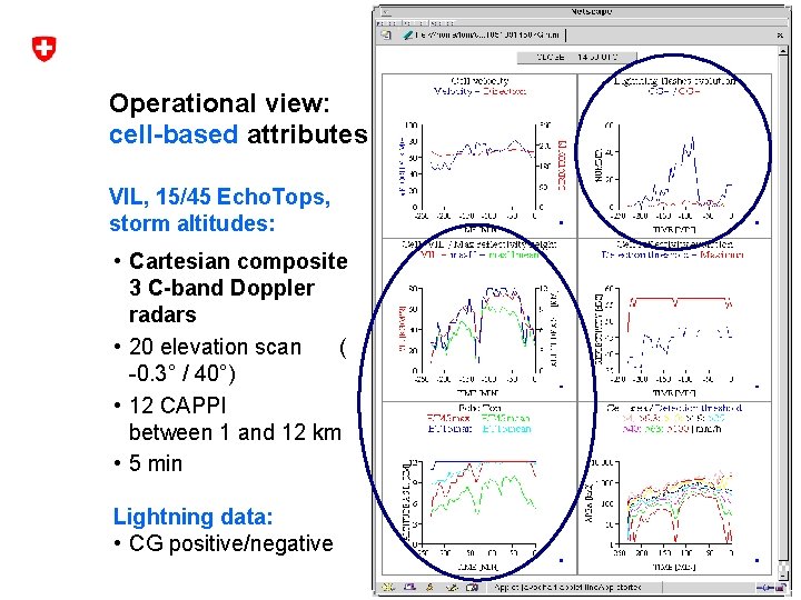
Operational view: cell-based attributes VIL, 15/45 Echo. Tops, storm altitudes: • Cartesian composite 3 C-band Doppler radars • 20 elevation scan ( -0. 3° / 40°) • 12 CAPPI between 1 and 12 km • 5 min Lightning data: • CG positive/negative 10

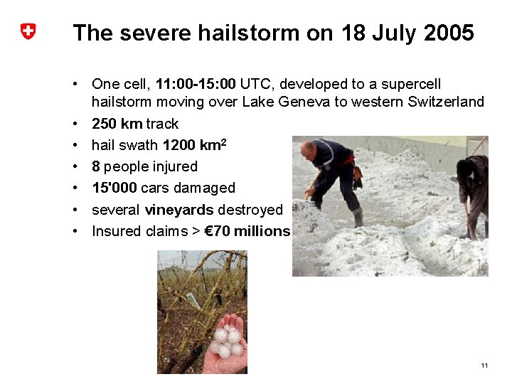
The severe hailstorm on 18 July 2005 • One cell, 11: 00 -15: 00 UTC, developed to a supercell hailstorm moving over Lake Geneva to western Switzerland • 250 km track • hail swath 1200 km 2 • 8 people injured • 15'000 cars damaged • several vineyards destroyed • Insured claims > € 70 millions 11
![Hail swath on 18 July 2005 540 km Dailycrop maximum gridVIL 10 kgm 2 Hail swath on 18 July 2005 540 km Dailycrop maximum grid-VIL 10 [kg/m 2]](https://slidetodoc.com/presentation_image/2302dd8a8b3f76eff920cee123ced76a/image-12.jpg)
Hail swath on 18 July 2005 540 km Dailycrop maximum grid-VIL 10 [kg/m 2] • Hail damage claims>(Swiss Hail Insurance) • Squares: communities where hail reported at least once 0 20 40 60 [kg/m 2] 12
![Hail swath on 18 July 2005 Maximum gridVIL 5 kgm 2 10 Hail swath on 18 July 2005 • Maximum grid-VIL > 5 [kg/m 2] (10:](https://slidetodoc.com/presentation_image/2302dd8a8b3f76eff920cee123ced76a/image-13.jpg)
Hail swath on 18 July 2005 • Maximum grid-VIL > 5 [kg/m 2] (10: 30 -17: 00 UTC) 100 km • Hail crop damage locations (Swiss Hail Insurance) 0 20 40 60 [kg/m 2] 13
![Hail swath on 18 July 2005 Maximum gridVIL 5 kgm 2 10 Hail swath on 18 July 2005 • Maximum grid-VIL > 5 [kg/m 2] (10:](https://slidetodoc.com/presentation_image/2302dd8a8b3f76eff920cee123ced76a/image-14.jpg)
Hail swath on 18 July 2005 • Maximum grid-VIL > 5 [kg/m 2] (10: 30 -17: 00 UTC) • Hail crop damage locations (Swiss Hail Insurance) • POH (Probability of Hail): Waldvogel et al. (1979) 100 km 3850 m Hail: ΔH ≥ 1. 4 km 0 20 40 60 80 100 [%] 14
![Hail swath on 18 July 2005 Maximum gridVIL 5 kgm 2 10 Hail swath on 18 July 2005 • Maximum grid-VIL > 5 [kg/m 2] (10:](https://slidetodoc.com/presentation_image/2302dd8a8b3f76eff920cee123ced76a/image-15.jpg)
Hail swath on 18 July 2005 • Maximum grid-VIL > 5 [kg/m 2] (10: 30 -17: 00 UTC) • Hail crop damage locations (Swiss Hail Insurance) • POH (Probability of Hail): Waldvogel et al. (1979) 3850 m VIL 0 Hail: ΔH ≥ 1. 4 km POH 20 [kg/m 2] 40 60 0 20 40 [%] 60 80 100 15

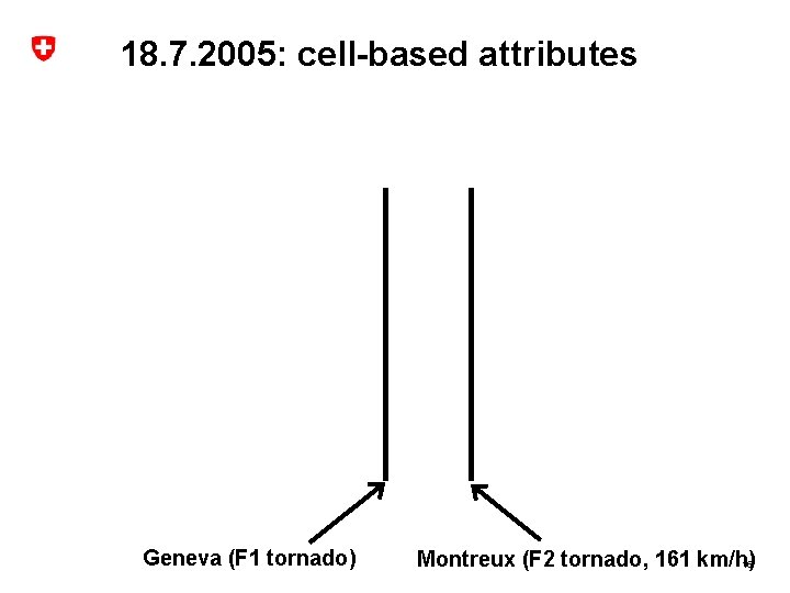
18. 7. 2005: cell-based attributes Geneva (F 1 tornado) Montreux (F 2 tornado, 161 km/h) 16

18. 7. 2005: max cell-VIL distribution 17

Conclusions and outlook • Reliable operational thunderstorms identification, tracking and 3 D characterisation in Alpine area needs: • high resolution in height / time: 20 -elev. (-0. 3° / 40°) in 5 min • dynamic reflectivity thresholding scheme: TRT • multiple-radar composites • Nowcasting in Alpine area: • use 3 D storm attibutes VIL, 15/45 Echo. Tops, max storm refl. altitude, CG for assessing the severe weather potential of thunderstorms • combine grid-based 2 D-animations and cell-based time trends • Outlook Alpine area: • VIL: determine typical values, thresholds for occurrence of hail • explore use of POH!? (Probability of Hail, Waldvogel et al. ) • extend time series analysis to forecast thunderstorm development (stage in its life cycle) 18
 Federal department of home affairs fdha
 Federal department of home affairs fdha
 Federal department of home affairs fdha
 Va form 10-250
 Fdha loan
 Michigan department of licensing and regulation
 Department of commerce and consumer affairs
 Department of local affairs
 Hhs office of population affairs
 Student affairs office
 Hms foundation funds
 Apa arti home care
 Perbedaan home care dan home visit
 Mobile home exchange
 Unit 1 home sweet home
 Softly and tenderly jesus is calling
 Oak springs mobile home park
 Let's go to my house let's go today
 André fougeron

