Features of the Earth Physical Features of the


 5. 98 x 1024 Diameter (km) 12 756 Mean Density")


 – believed that")


- Slides: 38
Features of the Earth
Physical Features of the Earth
Earth’s Statistics Mass (kg) 5. 98 x 1024 Diameter (km) 12 756 Mean Density (kg/m 3 5 520 Average distance from sun 1 AU (149 597 890 km) Rotation Period (length of day in Earth days) 1 (23. 93 hours) Revolution period (length of year in Earth days) 365. 26 Obliquity (tilt of axis degrees) 23. 5 Mean surface Temperature (K) 281 Number of Natural Satellite 1
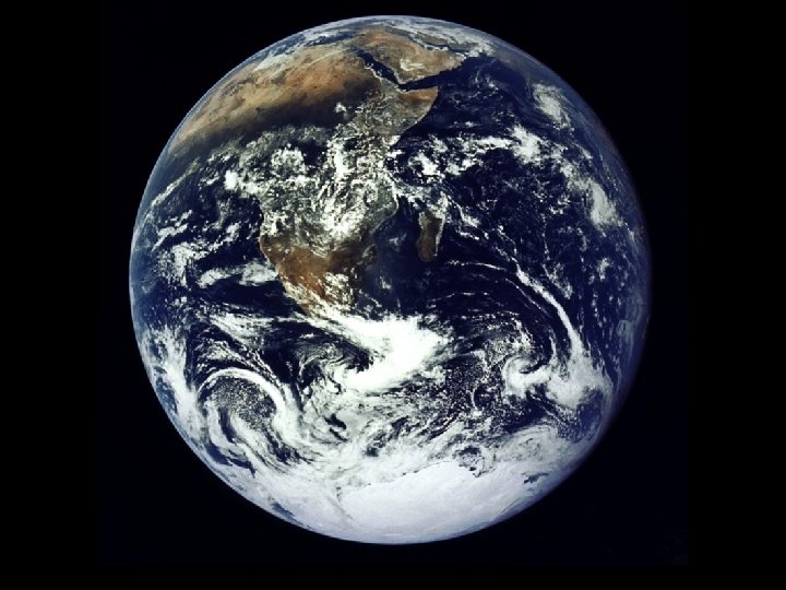
• Earth is the only known planet in the universe that is capable of sustaining life. • Often described as an enormous “ball of rock”. • Composed of the three phases of matter.
Early description of the Physical nature of the Earth • Ancient people described Earth using their senses and reasoning.
The Shape of the Earth • HOMER (8 th century BC) – believed that the Earth was a circular flat disk surrounded by an ocean. • THALES OF MILETUS (624 -546 BC) – believed that the Earth was a flat disk. • ARISTOTLE (384 -322 BC) – believed in a spherical Earth, based on the shadow of the moon during Lunar eclipse. • FERDINAND MAGELLAN (1480 -1521) – made a trip around the world and proved that the Earth was round.
• Some people also believed that Earth has four corners and that beyond the edges of the Earth, you will fall into a deep abyss.
Surface Features of the Earth
• Earth’s surface includes water and solid landforms. • The Earth’s surface is the result of both destructive and constructive processes. weathering volcanic eruption erosion tectonic plate movement deposition • You can identify surface features by their location, shape, and elevation. • Earth is a watery planet. 70% of Earth is covered by water.
Major Landforms Formed either by the movement of tectonic plates or the action of water, wind, or ice.
Mountains and Mountain Chains • Mountains are the highest regions of deformed and disturbed rocks with steep slopes. Mountains are usually more than 600 m elevated from its surroundings as tectonic plates move from each other. • Mountain Ranges are elevated surface features that may be thousands of kilometers long and hundreds of kilometers wide.
MOUNT APO
SIERRA MADRE MOUNTAIN RANGES
Volcanoes • They are also mountains but they are formed by accumulation of the products from their eruption.
MAYON VOLCANO
Hills • It is an elevated landform and is generally somewhat lower and less steep and smaller than a mountain. • Hills may also be volcanic. (cinder cones.
CHOCOLATE HILLS
Plains • Plains are broad, vast flat lands that roll slightly. They are usually grassy areas with a few trees.
NUEVA ECIJA
Valleys • It is a low lying area of land between two mountains or hills.
CAGAYAN VALLEY
Wetlands • It is often wet and low in oxygen because the soil is tightly packed and soaked with water.
SWAMP CANDABA, PAMPANGA
An ERG is a vast area covered with sand dunes. The Erg Chebbi.
Major Water Forms It includes all the water undergrounds, in lakes, rivers, streams, glaciers, as well in the atmosphere.
Oceans • The ocean is the largest body of water and has an average salinity of 35 parts per thousand (ppt). • The ocean contains 98% of the world’s water and drive the water cycle.
Rivers • A narrow body of water that flows. • It may start from a tiny stream that drains surface water or runoff water. • Tributaries – small streams that converge to form a river.
CAGAYAN RIVER
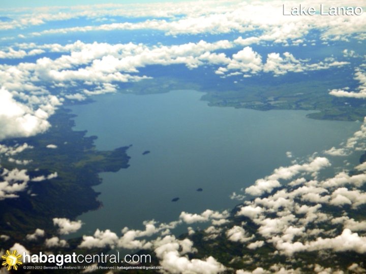
Lakes • A lake is a still body of freshwater completely surrounded by land. • It is formed when runoff streams and rivers fill the depressions in the surface of Earth.
Crater Lake was formed by rain and snow filling a caldera for hundreds of years. It is the deepest lake entirely within the United States.
A FJORD is a long, narrow ocean inlet between steep slopes carved by glaciers. The glacial features of Fjordland National Park on New Zealand's South Island were carved thousands of years ago, in cooler times.
NATURAL RESOURCES
FOSSIL FUELS • It refers to organic materials that have experienced chemical and physical transformations over a very long period of time. These materials originated from the remains that lived and died millions of years ago.