FAO Actions Related to GFOI Components FAO history


- Slides: 8

FAO Actions Related to GFOI Components

FAO history in forest monitoring and assessment • Began in 1946 focused on commercial timber • Activities involving all countries with forest • Work in 1950’s and 1960’s included aerial imagery and starting in the 1970’s expanded to Landsat • Purposes: – Land classification and management – Forest resource change – Climate change mitigation

FAO actions supporting forest monitoring • Including – Needs assessments – Methods and software development – National forest monitoring systems design – Technical assistance in implementation – Remote sensing support – Capacity building – Analysis and reporting • Nearly all of this work is “Country engagement”

Context • About 112 countries representing 80% of the world’s forest is measured by forest inventory • Satellite or aerial imagery is used on about 70% of the inventoried area • Repeated inventories are becoming more common – but still lacking • Most often the most important constraints are not related to a lack of image access

Specific-GFOI related actions • National forest inventory support: – Over 50 countries – Has covered commercial timber, fuelwood, carbon stocks, multi-purpose – Estimated investment: >$100 million • Land classification and mapping – Remote sensing and ground surveys – Estimated investment: >$30 million

Specific-GFOI related actions • Capacity building (2005 -present): – Over 130 countries – Long-term, short-term training plus institutional development – Estimated investment: >$25 million • Software and methods development (2010 present): – Change detection, Open. Foris, SDMS, degradation – Estimated investment: >$15 million

Specific-GFOI related actions • Remote sensing support: – Over 50 countries – Image acquisition, processing, mapping, analysis, interpretation – Wall to wall and sample based – Estimated investment: >$30 million

Future plans • Forest monitoring, assessment and reporting with countries is a permanent FAO mandate • Investments in supporting member countries will continue • REDD+ specific MRV targeted to >50 countries, forest monitoring work covers 234 countries and territories • FAO is committed to communicating activities through GFOI network, participating in GFOI components and to supporting GFOI office
 The integration of eye, hand, and foot movements
 Health vs skill related fitness
 Components of health related fitness
 A set of related components that produces specific results
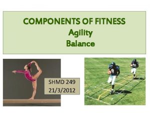
 The 6 components of skill related fitness
 Skills related components of physical fitness
 Skill related fitness coordination
 Flamingo balance test
 Stick drop test component of fitness


