
FAM IT Geospatial Program National Interagency Fire Center
- Slides: 23
FAM IT Geospatial Program National Interagency Fire Center – Boise, ID Fire & Aviation Management Information Technology – FAM IT Sean Triplett –Group Leader Geospatial & BI Brian Collins–Remote Sensing Conultant
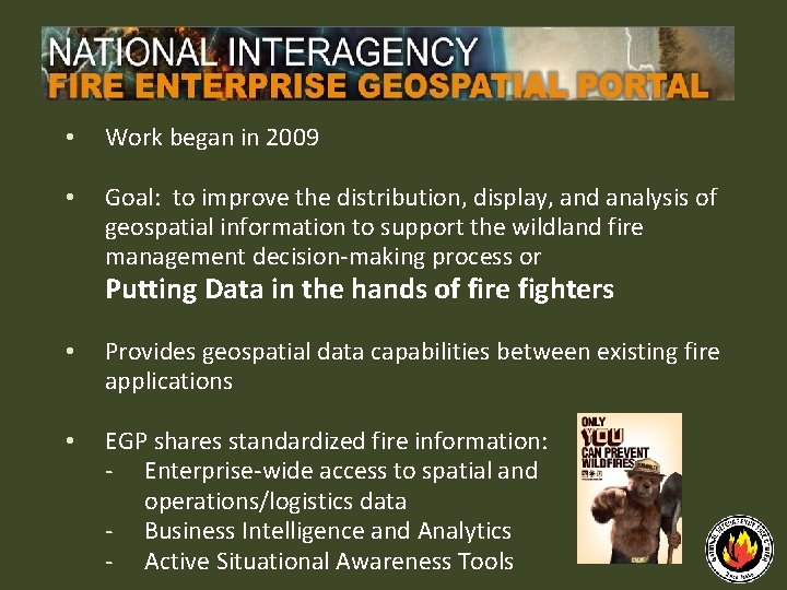
• Work began in 2009 • Goal: to improve the distribution, display, and analysis of geospatial information to support the wildland fire management decision‐making process or Putting Data in the hands of fire fighters • Provides geospatial data capabilities between existing fire applications • EGP shares standardized fire information: ‐ Enterprise‐wide access to spatial and operations/logistics data ‐ Business Intelligence and Analytics ‐ Active Situational Awareness Tools
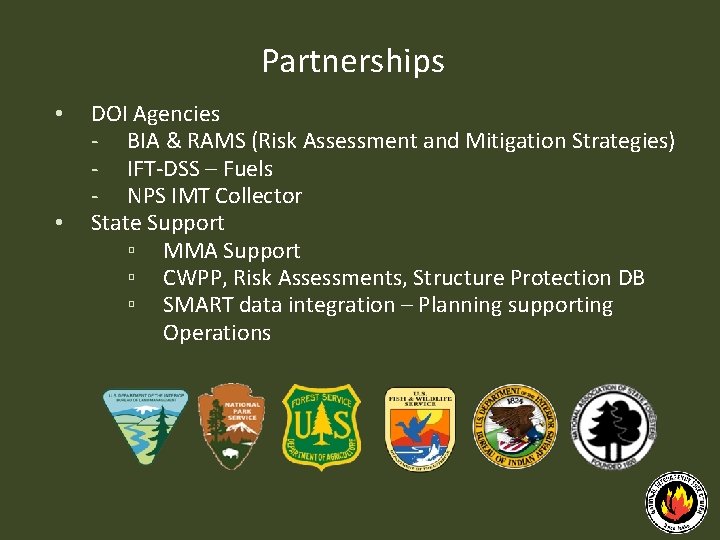
Partnerships • • DOI Agencies ‐ BIA & RAMS (Risk Assessment and Mitigation Strategies) ‐ IFT‐DSS – Fuels ‐ NPS IMT Collector State Support ▫ MMA Support ▫ CWPP, Risk Assessments, Structure Protection DB ▫ SMART data integration – Planning supporting Operations
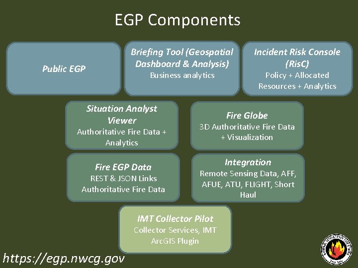
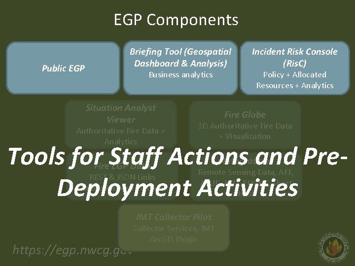
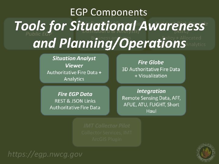
EGP Components Briefing Tool (Geospatial Dashboard & Analysis) Public EGP Business analytics Situation Analyst Viewer Authoritative Fire Data + Analytics Fire EGP Data REST & JSON Links Authoritative Fire Data Policy + Allocated Resources + Analytics Fire Globe 3 D Authoritative Fire Data + Visualization Integration Remote Sensing Data, AFF, AFUE, ATU, FLIGHT, Short Haul IMT Collector Pilot Collector Services, IMT Arc. GIS Plugin https: //egp. nwcg. gov Incident Risk Console (Ris. C)
EGP Components Public EGP Briefing Tool (Geospatial Dashboard & Analysis) Business analytics Situation Analyst Viewer Authoritative Fire Data + Analytics Incident Risk Console (Ris. C) Policy + Allocated Resources + Analytics Fire Globe 3 D Authoritative Fire Data + Visualization Tools for Staff Actions and Pre. Deployment Activities Fire EGP Data REST & JSON Links Authoritative Fire Data Remote Sensing Data, AFF, AFUE, ATU, FLIGHT, Short Haul IMT Collector Pilot Collector Services, IMT Arc. GIS Plugin https: //egp. nwcg. gov Integration
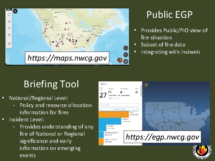
Public EGP https: //maps. nwcg. gov • Provides Public/PIO view of fire situation • Subset of fire data • Integrating with Inciweb Briefing Tool • National/Regional Level: ‐ Policy and resource allocation information for fires • Incident Level: ‐ Provides understanding of any fire of National or Regional significance and early information on emerging events https: //egp. nwcg. gov
EGP Components Tools for Situational Awareness and Planning/Operations https: //egp. nwcg. gov
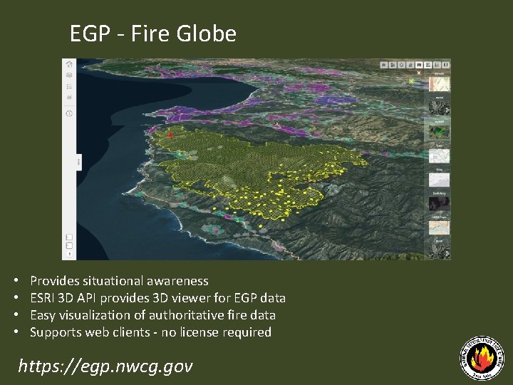
EGP ‐ Fire Globe • • Provides situational awareness ESRI 3 D API provides 3 D viewer for EGP data Easy visualization of authoritative fire data Supports web clients ‐ no license required https: //egp. nwcg. gov
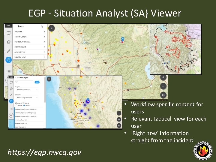
EGP ‐ Situation Analyst (SA) Viewer • Workflow specific content for users • Relevant tactical view for each user • ‘Right now’ information straight from the incident https: //egp. nwcg. gov
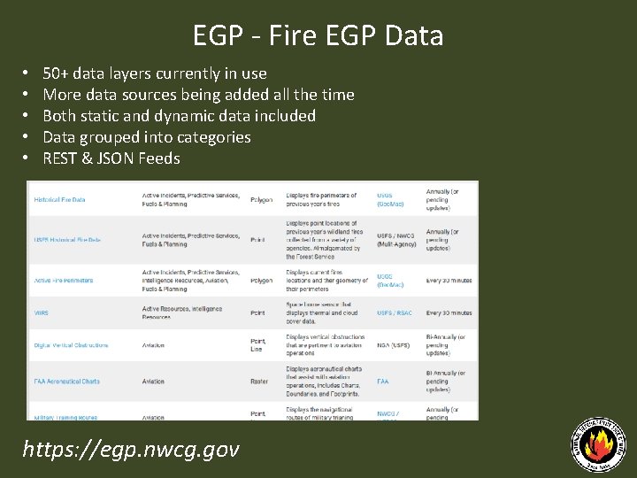
EGP ‐ Fire EGP Data • • • 50+ data layers currently in use More data sources being added all the time Both static and dynamic data included Data grouped into categories REST & JSON Feeds https: //egp. nwcg. gov
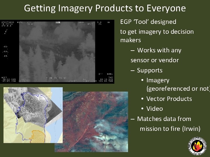
Getting Imagery Products to Everyone EGP ‘Tool’ designed to get imagery to decision makers – Works with any sensor or vendor – Supports • Imagery (georeferenced or not) • Vector Products • Video – Matches data from mission to fire (Irwin)
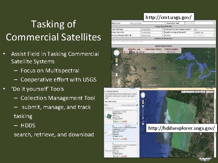
Tasking of Commercial Satellites • Assist Field in Tasking Commercial Satellite Systems – Focus on Multispectral – Cooperative effort with USGS • ‘Do it yourself’ Tools – Collection Management Tool – submit, manage, and track tasking – HDDS search, retrieve, and download http: //cmt. usgs. gov/ http: //hddsexplorer. usgs. gov/
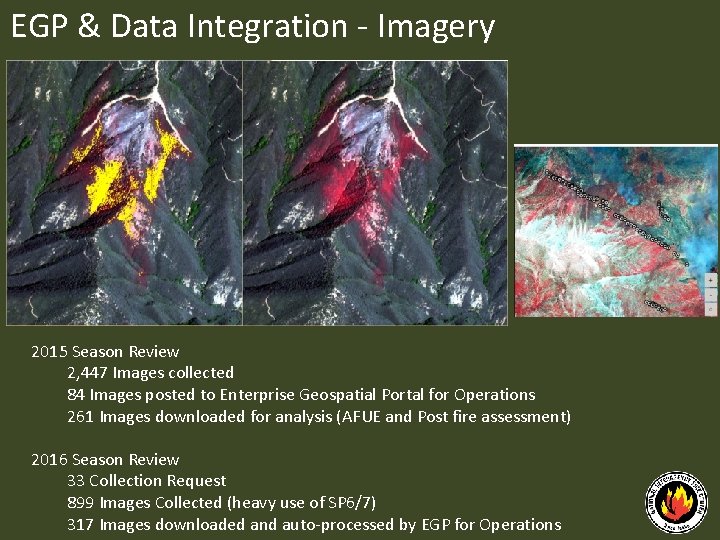
EGP & Data Integration ‐ Imagery 2015 Season Review 2, 447 Images collected 84 Images posted to Enterprise Geospatial Portal for Operations 261 Images downloaded for analysis (AFUE and Post fire assessment) 2016 Season Review 33 Collection Request 899 Images Collected (heavy use of SP 6/7) 317 Images downloaded and auto‐processed by EGP for Operations
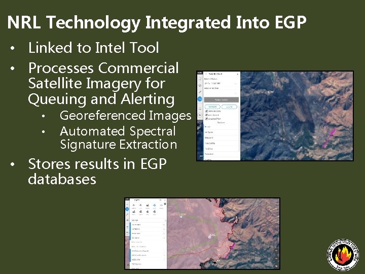
NRL Technology Integrated Into EGP • Linked to Intel Tool • Processes Commercial Satellite Imagery for Queuing and Alerting • • Georeferenced Images Automated Spectral Signature Extraction • Stores results in EGP databases
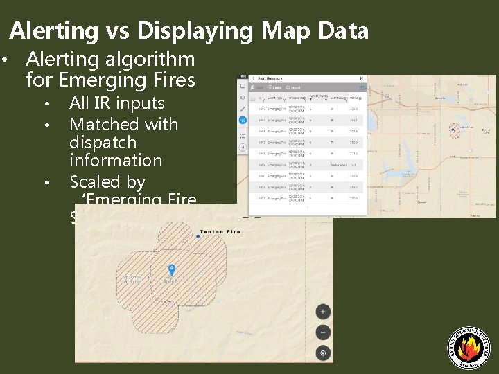
Alerting vs Displaying Map Data • Alerting algorithm for Emerging Fires • • • All IR inputs Matched with dispatch information Scaled by ‘Emerging Fire Severity’
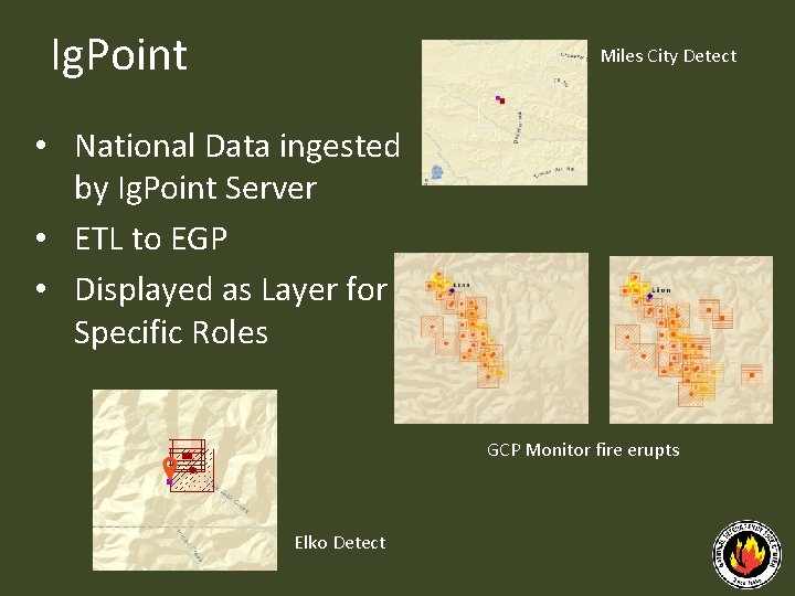
Ig. Point Miles City Detect • National Data ingested by Ig. Point Server • ETL to EGP • Displayed as Layer for Specific Roles GCP Monitor fire erupts Elko Detect
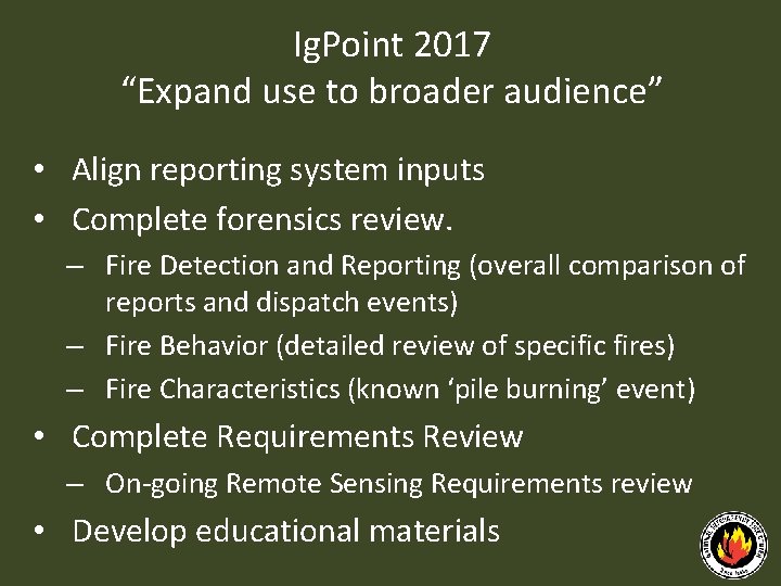
Ig. Point 2017 “Expand use to broader audience” • Align reporting system inputs • Complete forensics review. – Fire Detection and Reporting (overall comparison of reports and dispatch events) – Fire Behavior (detailed review of specific fires) – Fire Characteristics (known ‘pile burning’ event) • Complete Requirements Review – On‐going Remote Sensing Requirements review • Develop educational materials
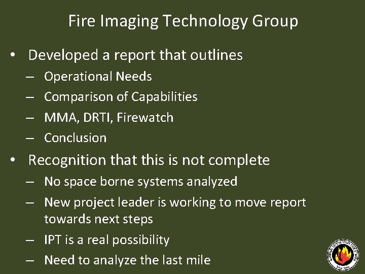
Fire Imaging Technology Group • Developed a report that outlines – – Operational Needs Comparison of Capabilities MMA, DRTI, Firewatch Conclusion • Recognition that this is not complete – No space borne systems analyzed – New project leader is working to move report towards next steps – IPT is a real possibility – Need to analyze the last mile
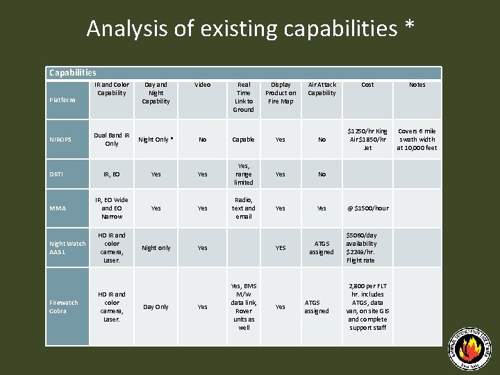
Analysis of existing capabilities * Capabilities Day and Night Capability Video Real Time Link to Ground Display Product on Fire Map Air Attack Capability Dual Band IR Only Night Only * No Capable Yes DRTI IR, EO Yes Yes, range limited MMA IR, EO Wide and EO Narrow Yes Radio, text and email Platform NIROPS IR and Color Capability Night Watch AA 51 HD IR and color camera, Laser. Firewatch Cobra HD IR and color camera, Laser. Night only Day Only Yes Yes, BMS M/W data link, Rover units as well Cost Notes No $1250/hr King Air $1850/hr Jet Covers 6 mile swath width at 10, 000 feet Yes No Yes @ $1500/hour YES ATGS assigned $5060/day availability $2249/hr. Flight rate 2, 800 per FLT hr. includes ATGS, data van, on site GIS and complete support staff Yes ATGS assigned
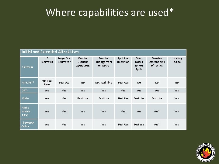
Where capabilities are used* Initial and Extended Attack Uses IA Perimeter Large Fire Perimeter Monitor Burnout Operations Monitor Impingement on MAPs Spot Fire Detection Direct Forces to Hot Spots Monitor Effectiveness of Tactics Locating People Not Real Time Best Use No No No DRTI Yes Yes MMA Yes Best Use Best Use Yes Night Watch AA 51 Yes Yes* Yes Firewatch Cobra Yes Yes Best Use Best use Yes* Yes Platform NIROPS**
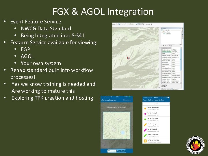
FGX & AGOL Integration • Event Feature Service • NWCG Data Standard • Being Integrated into S‐ 341 • Feature Service available for viewing: • EGP • AGOL • Your own system • Rehab standard built into workflow processes! • Yes we know training is needed and Are working to mature this • Exploring TPK creation and hosting
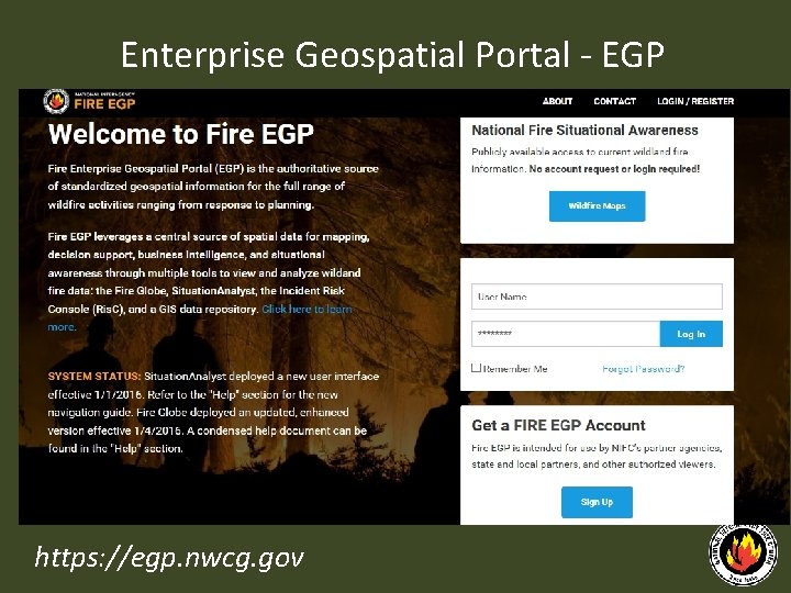
Enterprise Geospatial Portal ‐ EGP https: //egp. nwcg. gov
EGP – Contacts Sean Triplett Jill Kuenzi Geospatial Resource Information Management Group Leader USDA‐Forest Service Fire & Aviation Management National Interagency Fire Center 208‐ 387‐ 5284 (W) 208‐ 9513 (C) Email: setriplett@fs. fed. us Geospatial Coordinator USDA‐Forest Service Fire & Aviation Management National Interagency Fire Center 208‐ 387‐ 5283 (W) Email: jkuenzi@fs. fed. us Cole Belongie Data Integrator USDA‐Forest Service Fire & Aviation Management National Interagency Fire Center 208‐ 387‐ 5169 (W) 208‐ 488‐ 5246 (C) Email: cbelongie@fs. fed. us https: //egp. nwcg. gov