Exploring medieval Britain the Gough Map the map

Exploring medieval Britain: the Gough Map, the map library and the research community Nick Millea Map Librarian Bodleian Library University of Oxford United Kingdom Groupe des Cartothécaires de LIBER 16 th Conference Modern Map Use in Education Vrije Universitiet, Amsterdam 2 July 2008

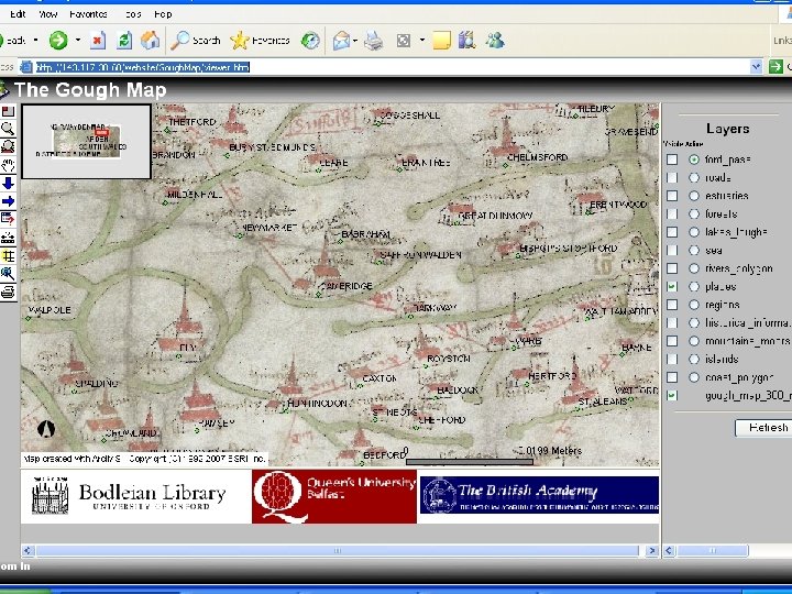
Introduction • The map is housed at the Bodleian Library, University of Oxford, and has recently been scanned • By combining existing research and GIS, the Bodleian is hoping to shed new light on the map’s possible history and function, and to broaden the debate on its significance as an artefact

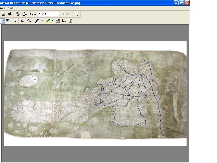
Map history • The Gough Map of Great Britain is the oldest surviving route map of Great Britain, dating from around 1360 • Drawn in pen, ink and coloured washes on two skins of vellum, the map's dimensions measure 553 x 1164 mm • It was donated to the Bodleian Library by Richard Gough in 1809 • Little is known of its provenance - the map was bought by Gough at a sale in 1774 for half a crown (12½ pence or € 0. 16) • The identity of the mapmaker is unknown

“The most remarkable cartographic monument of medieval England” – Paul Harvey

Research triggers • Image capture by Digi. Data Technologies in 2004 • Existing commentary text on the map by E. J. S. Parsons became out of print
 Settlements Over 600 shown on the map London")
What the Gough Map shows (1) Settlements Over 600 shown on the map London and York lettering in gold leaf Six types of “urban” symbol Single buildings with spires Multiple buildings with spires Town walls Castles
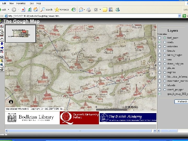
 Routes marked as red lines Distances in roman")
What the Gough Map shows (2) Routes marked as red lines Distances in roman numerals Over 4727 km / 2940 miles of routes Missing routes
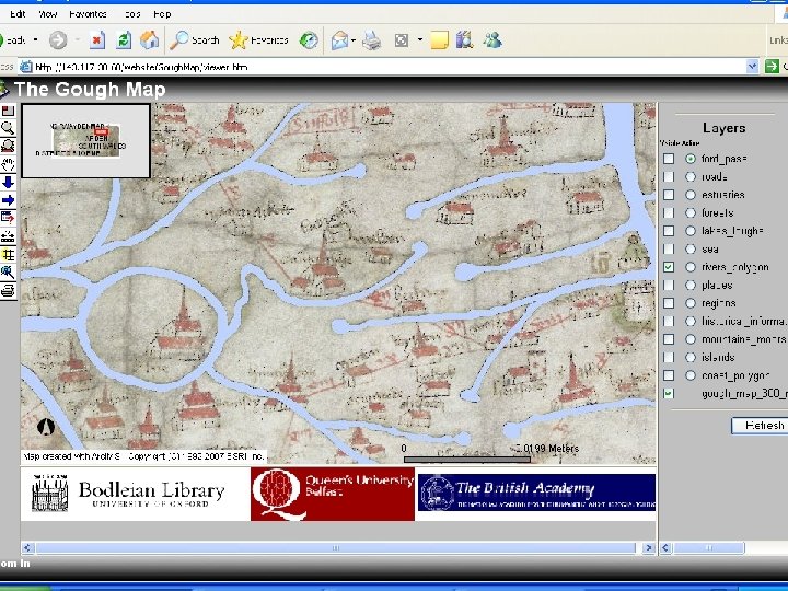
 Rivers Almost 200 rivers shown Consistency of cartographic")
What the Gough Map shows (3) Rivers Almost 200 rivers shown Consistency of cartographic design Dominance reflecting significance?
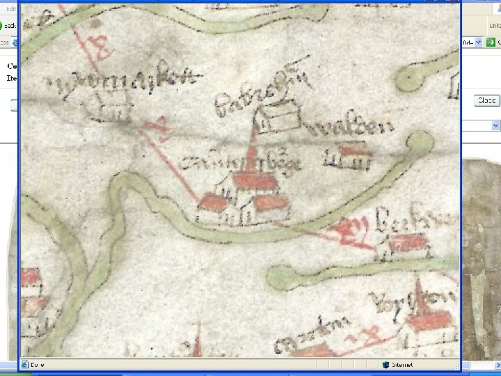
 Place-names Certain names / vignettes make dating possible")
What the Gough Map shows (4) Place-names Certain names / vignettes make dating possible Numerous different hands “Double” naming
 Miscellaneous • • • Forests Lakes Mountains Myths")
What the Gough Map shows (5) Miscellaneous • • • Forests Lakes Mountains Myths Miscellaneous text
 • A statement of geographical (and not theological) fact")
What we already know (1) • A statement of geographical (and not theological) fact • Secular function probable • Prototype map likely to date from ca. 1280 – Bodleian copy a later revision – Possibly for local use in Lincolnshire / south Yorkshire
 • Mapmaker’s knowledge of Scotland was very limited •")
What we already know (2) • Mapmaker’s knowledge of Scotland was very limited • Numerous derivative maps – Muenster (1540) – Lily (1546) – Butler (ca. 1550) – Mercator (1564)
 • What was the map’s function? • Road")
What we want to know (1) • What was the map’s function? • Road map or Route map? • Statement of empire? – Does this signify acquisition of territory? – Why are there no boundaries shown? – Significance of Calais

Calais Vignette for Calais
 • For whom was the map made? •")
What we want to know (2) • For whom was the map made? • From where does its content derive? • Was this particular copy regionally-held and regionally-used?
 • How was it made? • Why are")
What we want to know (3) • How was it made? • Why are certain towns poorly served by routes? – Colchester – King’s Lynn – Plymouth • Was “our” map a palimpsest? – Inked over spires? – Double names?

Work in progress • Mapping the Realm

www. qub. ac. uk/urban_mapping/gough_map/

Mapping the Realm: recent presentations 25 October 2007 The Oxford Seminars in Cartography Cartographic veracity in medieval mapping: new findings from digitizing the Gough Map of Great Britain 1 November 2007 Maps and Society Mapping the Realm: new perspectives on the Gough Map of Great Britain (c. 1280 -c. 1360)

Mapping the Realm – follow-up “Imaging Britain: cartographic imaginaries and the mediation of the nation” – a three-year project • • Conservation history and pigment analysis GIS and spatial analysis Historiography Iconography Linguistic analysis Palaeography Socio-political context Europe-wide context * Conference / Exhibitions / Major publication

Mapping the Realm – follow-up “Imaging Britain: cartographic imaginaries and the mediation of the nation” Potential partner institutions • • Queen’s University Belfast Bodleian Library, University of Oxford The British Library University of Durham University of Aberystwyth University of Texas at Austin National Library of Scotland National Library of Wales

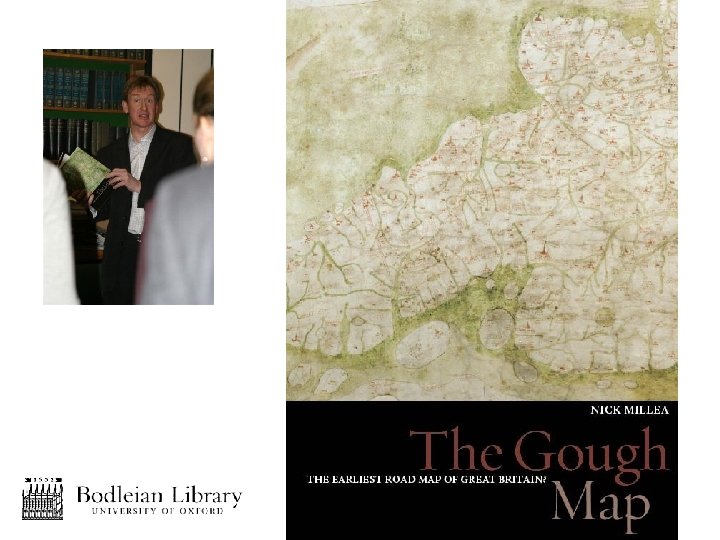
Work in progress • Mapping the Realm • Gough Map book

The role of the map library in promoting the Gough Map • • • Custodian of the resource Identifier of the resource’s potential Facilitator of the resource’s exploitation Networking hub Disseminator of information

The role of education in exploiting the Gough Map • • • Interdisciplinary appeal Springboard for new research Promotion of maps and cartography Insight into medieval society Perception of Britain’s physical extent Promotion of nationhood

Work in progress • Mapping the Realm • Gough Map book • Use of the Gough Map in educational programmes?

Nick Millea Map Librarian Bodleian Library University of Oxford Broad Street Oxford OX 1 3 BG, U. K. Tel: +44 1865 287119 Fax: +44 1865 277139 Email: nick. millea@ouls. ox. ac. uk http: //www. bodley. ox. ac. uk/guides/maps/
- Slides: 34