
Experiences of Mozambique in Flood Management Filipe D
Experiences of Mozambique in Flood Management Filipe D. F. Lúcio National Institute of Meteorology of Mozambique Email: flucio@inam. gov. mz http: //www. inam. gov. mz
Objectives of the Presentation Share Mozambique’s practical experiences in disaster risk reduction n Look at the lessons learned from the major floods in 2000 n Share the challanges the Country faces due to its vulnerability and institutional capacities n
1. Key facts about Mozambique On average the country is affected by: ● 3 to 4 tropical cyclones every year ● droughts every 3 to 4 years ● floods every year in some parts of the country ● Tsunami waves associated with the December 2004 event made an impact in the Mozambican coast
2. Mozambique’s vulnerability to disasters and implications Vulnerability factors n a. Geographical Location of the Country natural vulnerability n b. Historical or induced vulnerability
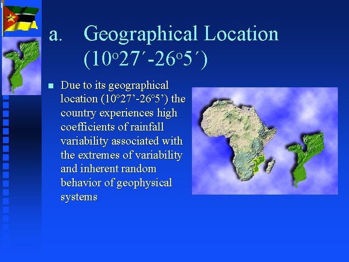
a. Geographical Location (10 o 27´-26 o 5´) n Due to its geographical location (10º 27’-26º 5’) the country experiences high coefficients of rainfall variability associated with the extremes of variability and inherent random behavior of geophysical systems
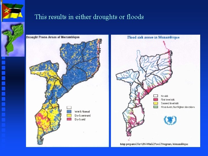
This results in either droughts or floods
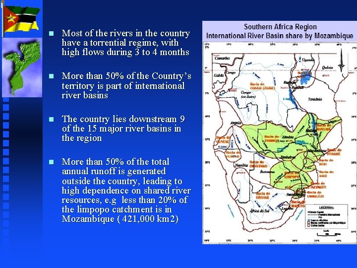
n Most of the rivers in the country have a torrential regime, with high flows during 3 to 4 months n More than 50% of the Country’s territory is part of international river basins n The country lies downstream 9 of the 15 major river basins in the region n More than 50% of the total annual runoff is generated outside the country, leading to high dependence on shared river resources, e. g less than 20% of the limpopo catchment is in Mozambique ( 421, 000 km 2)
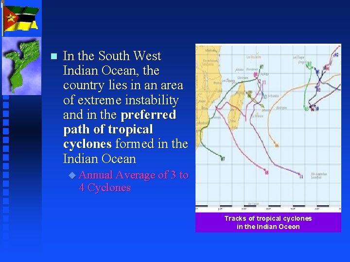
n In the South West Indian Ocean, the country lies in an area of extreme instability and in the preferred path of tropical cyclones formed in the Indian Ocean u Annual Average of 3 to 4 Cyclones Tracks of tropical cyclones in the Indian Oceon
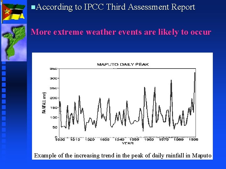
n. According to IPCC Third Assessment Report More extreme weather events are likely to occur Example of the increasing trend in the peak of daily rainfall in Maputo
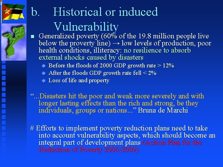
b. n Historical or induced Vulnerability Generalized poverty (60% of the 19. 8 million people live below the proverty line) → low levels of production, poor health conditions, illiteracy: no resilience to absorb external shocks caused by disasters u u u Before the floods of 2000 GDP growth rate > 12% After the floods GDP growth rate fell < 2% Loss of life and property “. . . Disasters hit the poor and weak more severely and with “. . . longer lasting effects than the rich and strong, be they individuals, groups or nations. . . ” Bruna de Marchi # Efforts to implement poverty reduction plans need to take into account vulnerability aspects, which should become an integral part of development plans (Action Plan for the Reduction of Poverty 2006 -2009)
Cont. n Environmental degradation ( land use and land cover changes) e. g: Changes in river flow [from 1966 to 1975 the Limpopo was dry 1 to 2 months in 5 years; from 1990 to 2000 (9/10) it had no flow for more than 6 months] n loss of traditional knowledge on how to mitigate the effects/impacts of natural disasters as a result of people’s displacement and migrations caused by the civil war and (climate change effects? ? )
Cont. n Ability to predict weather related hazards and disseminate warnings and information u Does the available capacity enable accurate prediction of extreme events? u Does the media understand the content of forecasts to communicate the information appropriately? u Do people understand the meaning of warnings? Are they prepared to adopt apropriate measures? “. . . The world of mass communication and the world “. . . of science are two different worlds. Their members have different values, rules and beliefs. This makes interaction between journalists and scientists difficult. . . , the result being poor information flow. . . ” E Quaretelli
3. Institutional frameworks and strategies in place The adoption of the national policy for disaster management in 1999. This provides the strategies and guidelines of what needs to be done to mitigate the impact of disasters; n The formulation of Contingency Plans since 1996 based on climate predictions; n The existence of an interministerial committee for disaster management at the highest political level n
Cont n n The existence of an Institute for Disaster Management; The existence of an Early Warning System in place that includes u Flood Warning System u Cyclone Warning System u n Drought Early Warning System; The adoption of the National Disaster Management Strategic Plan in 2006
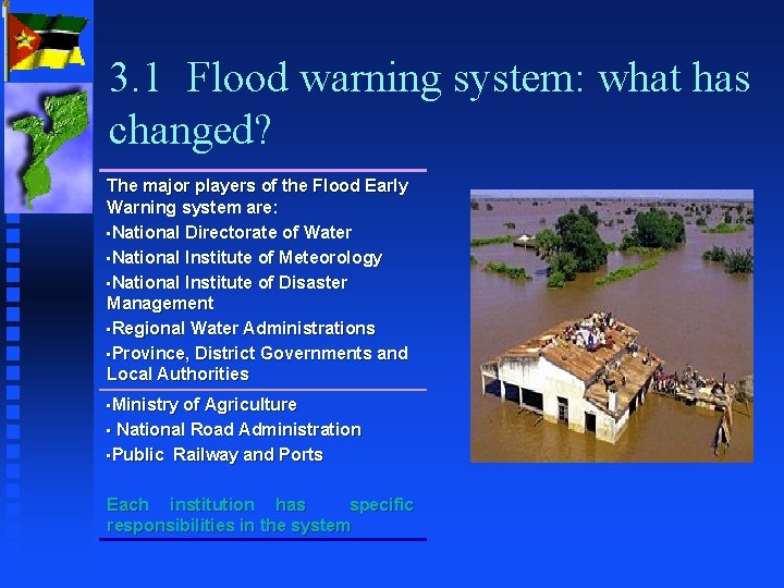
3. 1 Flood warning system: what has changed? The major players of the Flood Early Warning system are: • National Directorate of Water • National Institute of Meteorology • National Institute of Disaster Management • Regional Water Administrations • Province, District Governments and Local Authorities • Ministry of Agriculture • National Road Administration • Public Railway and Ports Each institution has specific responsibilities in the system
Prior to the Rainy Season a meeting is held in October, bringing together water resources officials, meteorologists and disaster managers The meeting aims to assess the preparedness of the water sector for both floods and droughts In case of a predicted flood event a Flood Warning Team is put into operation with the following tasks: • Coordinate and monitor the floods • Identify actions to be taken in collaboration with other entities • Collect rainfall, inflow and outflow data, river flows • Analyse critical information available and recommend measures to be taken
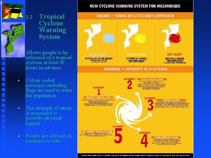
3. 2 Tropical Cyclone Warning System § Allows people to be informed of a tropical cyclone at least 48 hours in advance § Colour coded messages including flags are used to warn the population § The strength of winds is associated to possible physical impact § People are advised on measures to take
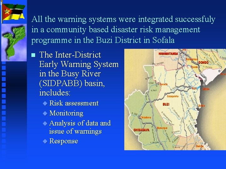
All the warning systems were integrated successfuly in a community based disaster risk management programme in the Buzi District in Sofala n The Inter-District Early Warning System in the Busy River (SIDPABB) basin, includes: u Risk assessment u Monitoring u Analysis of data and issue of warnings u Response
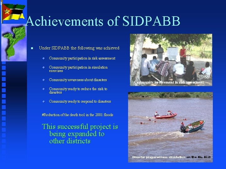
Achievements of SIDPABB n Under SIDPABB the following was achieved u Community participation in risk assessment u Community participation in simulation exercises u Community awareness about diasaters u Community ready to reduce the risk to disasters u Community ready to respond to disasters Community involvement in risk assessment #Reduction of the death tool in the 2001 floods This successful project is being expanded to other districts Disaster preparedness simulation on the Rio Búzi
5. n n n Lessons learned For vulnerable countries to disasters, disaster risk reduction should be part of development policies, strategies and programmes; There is need for political commitment, translated into appropriate institutional structures, institutional support, legislation and policies; Awareness and preparedness are key for appropriate response in cases of disasters; The eixitence of a single and autoritative voice in emergency situations is crucial to avoid confusion and ensure adequate actions Strong coordination at all levels is paramount for the best use of information and available resources
Lessons learned (cont. ) n n n Establishment of a multi-hazard disaster risk reduction framework is essential to ensure appropriate coordination and a common goal; Mozambique needs to take a river basin approach to operate an efficient flood early warning system; Clear and quick communication channels with neighbouring countries in the case of floods is important; The availability of real time data is crucial for monitoring, forecasting and management of emergency situations; The existance of contact points at institutional and regional level has proven to be very efficient during emergencies; Need to understand the different attitudes of different communities to disasters and to warnings. To the extent possible integrate communities experiences, benchmarks, etc
6. Challanges n n n Capacity to provide timely and accurate warnings up to the community level (warnings should to the extent possible be accompanied by measures to be taken); Human resources development, particularly taking into account that the centres of technology and knowledge reside outside the country; Capacity to mainatin and operate adequate observation networks (NMHSs); Capacity to detect the changing patterns of climate and develop appropriate adapatation strategies, including dissemination of information about the changes Capacity to respond in case of disasters (the existance of approriate means for rescue and response); Integration of Prevention in all planning activities (mainstreaming disaster risk reduction on all activities)
- Slides: 22