
Evaluating the National Hydrography Dataset and Stewardship Options
- Slides: 19
Evaluating the National Hydrography Dataset and Stewardship Options for Missouri
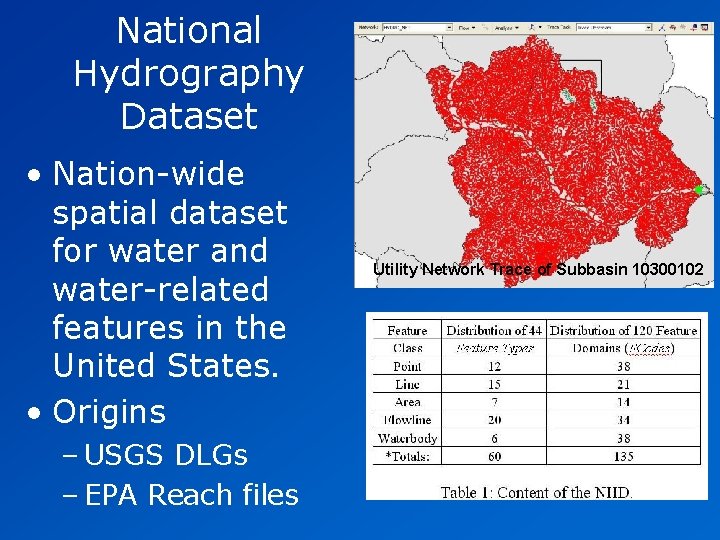
National Hydrography Dataset • Nation-wide spatial dataset for water and water-related features in the United States. • Origins – USGS DLGs – EPA Reach files Utility Network Trace of Subbasin 10300102
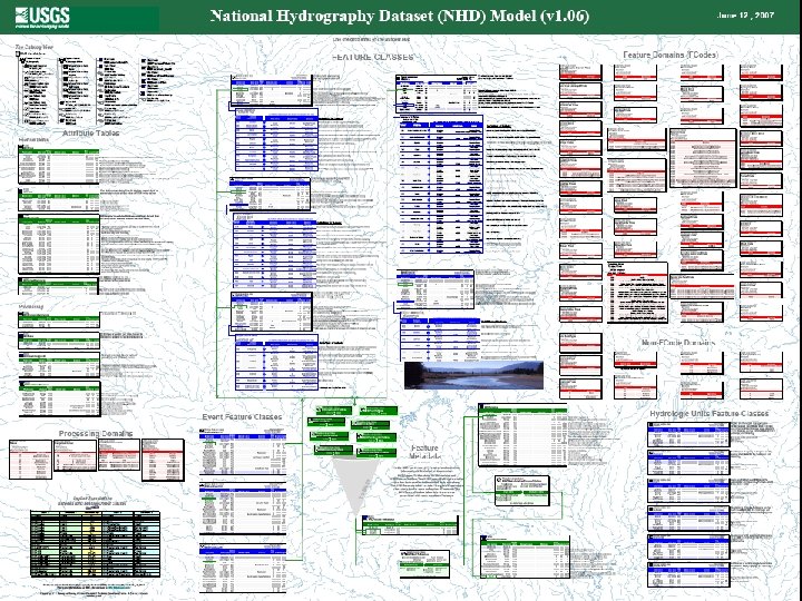
NHD Data Model
National Hydrography Dataset • Developments – Resolutions • Medium Resolution NHD = 1: 100, 000 • High Resolution NHD = 1: 24, 000 • Local Resolution NHD = anything more local than 1: 24, 000 (e. g. , 12, 000; 2, 400; 1, 200) – Water Boundary Dataset • Uses: – Model flow; geocode – MORAP’s Aquatic Gap – Cartography; GRC’s NMSZ project
NHD Stewardship • Partnerships; formal through MOA • USGS – Infrastructure: initial training, software, documentation, quality control, serve data • Stewards (usually at the state level) – Support, develop, and coordinate the use and improvement of NHD for their area – Conduit between USGS & Stewards • Ensure submitted data is accurate, consistent, and current • Without Stewardship, Missouri and users of Missouri data fall behind. – 66 subbasins, only 25 contained in Missouri
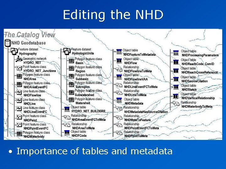
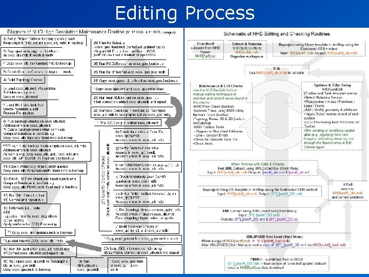
Editing the NHD • Importance of tables and metadata
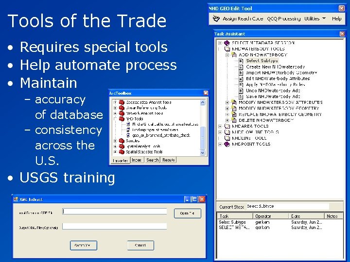
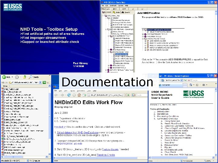
Tools of the Trade • Requires special tools • Help automate process • Maintain – accuracy of database – consistency across the U. S. • USGS training
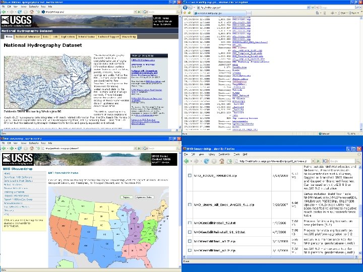
Documentation
Editing Process
Stewardship Options for Missouri • Participation • Action – Requests for corrections or improvements from users – Gradual improvements – Revision of existing NHD resolutions – Creating new local resolution NHD
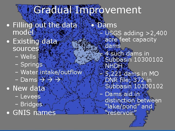
Gradual Improvement • Filling out the data model • Existing data sources – Wells – Springs – Water intake/outflow – Dams • New data – Levees – Bridges • GNIS names • Dams – USGS adding >2, 400 acre feet capacity dams – 4 such dams in Subbasin 10300102 NHDH – 5, 221 dams in MO DNR file; 372 in Subbasin 10300102 – Dams aid in distinction between “lake/pond” and “reservoir”
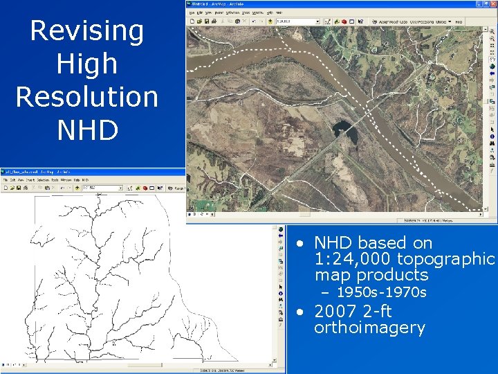
Revising High Resolution NHD • NHD based on 1: 24, 000 topographic map products – 1950 s-1970 s • 2007 2 -ft orthoimagery
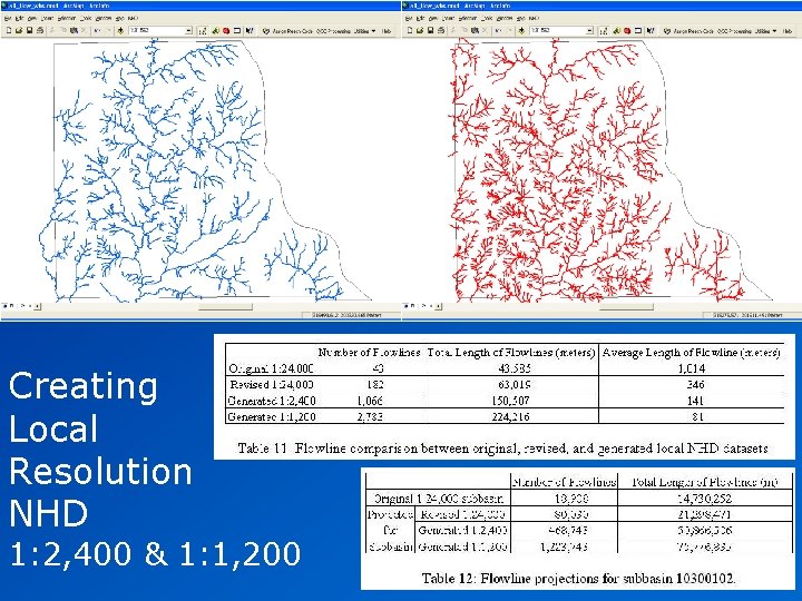
Creating Local Resolution NHD 1: 2, 400 & 1: 1, 200
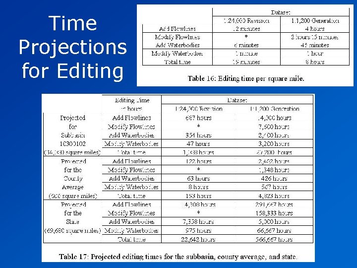
Time Projections for Editing
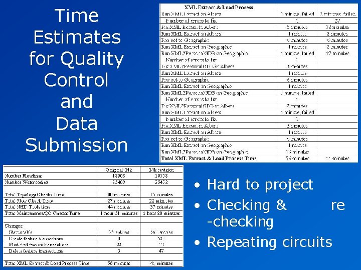
Time Estimates for Quality Control and Data Submission • Hard to project • Checking & re -checking • Repeating circuits
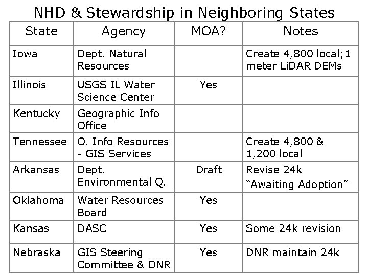
NHD & Stewardship in Neighboring States State Agency Iowa Dept. Natural Resources Illinois USGS IL Water Science Center Kentucky Geographic Info Office MOA? Notes Create 4, 800 local; 1 meter Li. DAR DEMs Yes Tennessee O. Info Resources - GIS Services Create 4, 800 & 1, 200 local Arkansas Dept. Environmental Q. Draft Revise 24 k “Awaiting Adoption” Oklahoma Water Resources Board Yes Kansas DASC Yes Some 24 k revision Nebraska GIS Steering Committee & DNR Yes DNR maintain 24 k
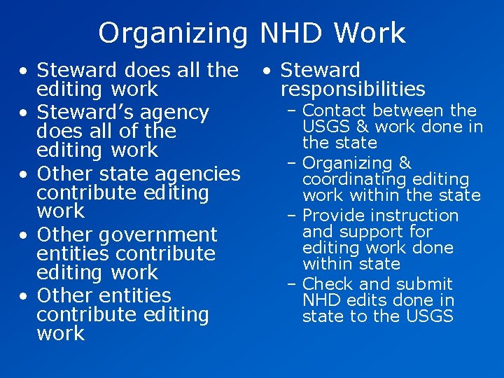
Organizing NHD Work • Steward does all the editing work • Steward’s agency does all of the editing work • Other state agencies contribute editing work • Other government entities contribute editing work • Other entities contribute editing work • Steward responsibilities – Contact between the USGS & work done in the state – Organizing & coordinating editing work within the state – Provide instruction and support for editing work done within state – Check and submit NHD edits done in state to the USGS
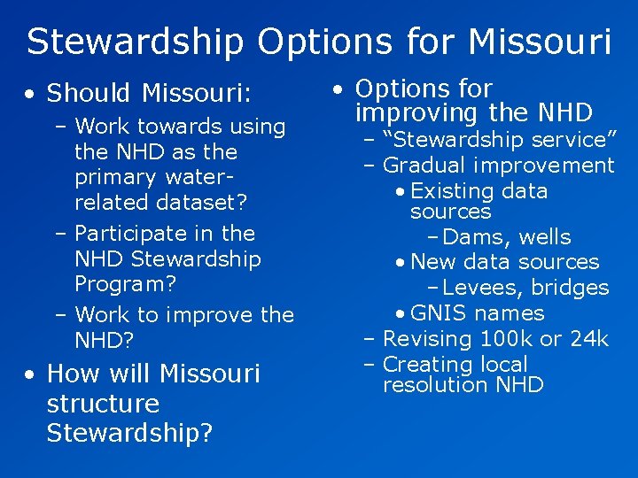
Stewardship Options for Missouri • Should Missouri: – Work towards using the NHD as the primary waterrelated dataset? – Participate in the NHD Stewardship Program? – Work to improve the NHD? • How will Missouri structure Stewardship? • Options for improving the NHD – “Stewardship service” – Gradual improvement • Existing data sources – Dams, wells • New data sources – Levees, bridges • GNIS names – Revising 100 k or 24 k – Creating local resolution NHD