Europe Physical Geography The Land Europe is part


- Slides: 33
Europe Physical Geography
The Land Europe is part of a large landmass called Eurasia; today’s Europe and part of Russia; separated by the Ural Mountains n Longer coastline than Africa, the world’s 2 nd largest continent n Sometimes called a “peninsula of peninsulas” n
Major Landforms Peninsulas n Mountains/Uplands n Rivers/Waterways n Islands n Plains n
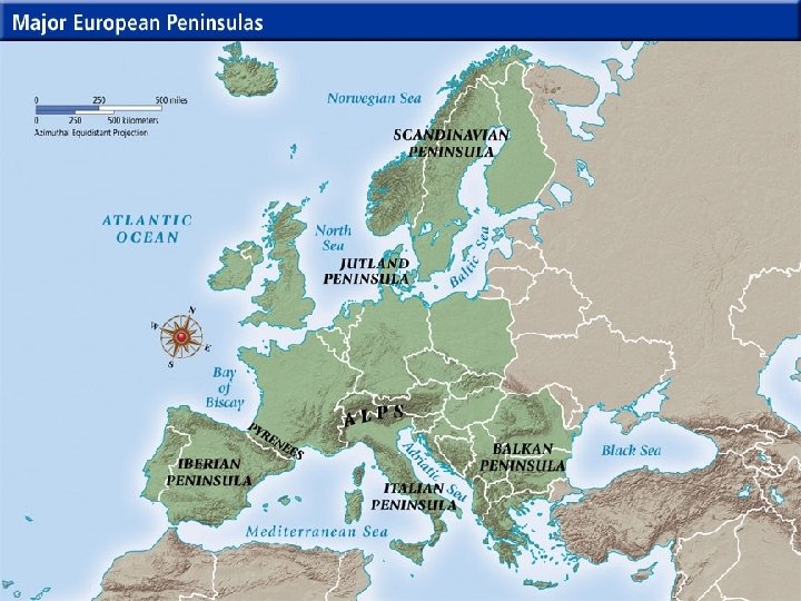
1. Peninsulas n A. B. C. D. E. Europe has five major peninsulas: Scandinavian Peninsula Jutland Iberian Peninsula Italian Peninsula Balkan Peninsula
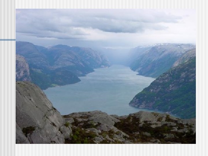
Scandinavian Peninsula n Countries: Sweden, Norway, Finland n Largest peninsula in Europe n Glaciers played an important role in shaping the landscape Only about 3% of land is arable n Glacial rebound causes flooding n Glacial melting created fjords n
Fjords n. A fjord is a steep, narrow, u-shaped valley that is carved out by a glacier.
Jutland n The country of Denmark is on Jutland.
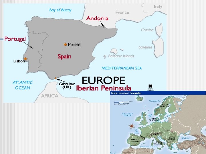
Iberian Peninsula n Countries: Portugal and Spain n Separated from Europe by the Pyrenees Mountains
The Italian Peninsula n The peninsula is comprised of much of Italy and includes the independent republic of San Marino as well as Vatican City. n It is separated from the rest of Europe by the Alps n The Apennine Mountains run down Italy like a spine, dividing East from West
Italian Peninsula
The Balkan Peninsula n Countries: Completely: Albania, Bosnia and Herzegovina, Greece, Bulgaria, Kosovo, Montenegro and Macedonia n Mostly: Croatia, Serbia n Partially: Slovenia, Romania, Turkey n n Separated from rest of Europe by the Balkan Mountains
2. Mountains/Uplands n Mountains vs Uplands n Uplands: hills or very low mountains • may also contain mesas and high plateaus • Some may be eroded remains of ancient mountain ranges n European Uplands (examples): Kjolen Mts. In Scandinavia n Meseta in Spain n Massif Central in France n
Alps, Switzerland
Massif Central, France
3. Rivers/Waterways n Europe’s Rivers = “Watery Highways” n n n Trade, Travel, Ideas Many are large enough for ships to travel 2 Major Rivers: the Danube and the Rhine
Strategic Waterways A strategic waterway is a narrow body of water on an important transportation route or sea lane. Some examples are: A. The English Channel B. The Strait of Gibraltar n
The English Channel n n The English Channel separates the island of Great Britain from France. Strait of Dover = narrowest point (21 miles wide)
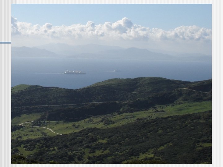
Strait of Gibraltar Connects the Atlantic Ocean and the Mediterranean Sea. n Separates the continents of Europe and Africa. n At the strait’s narrowest point it is 7. 7 miles wide. n
Gibraltar n Gibraltar is an overseas territory of the United Kingdom
4. Islands n A. B. C. D. Some islands in Northern Europe are: Great Britain Ireland Iceland Great Britain and Ireland are the two major islands in an archipelago. Together they are called the British Isles.
Great Britain n A. B. C. D. Great Britain is the name of an island. The United Kingdom refers to a country that is located on Great Britain and Ireland. The United Kingdom is composed of: Wales Scotland England Northern Ireland
5. Fertile Plains n Northern European Plain n n One of the most fertile agricultural regions in the world Wheat, barley, grapes, olives, cork
Climate n A. B. C. D. E. The factors that affect climate are: Topography Wind Currents Ocean Currents Zones of Latitude Elevation
Climate and Vegetation n A. B. C. Europe is in the middle and high latitudes, therefore, Europe has many different types of climates. Northern Europe: Tundra and Sub-arctic climates. Most of Western Europe has a Marine West Coast climate zone. Southern Europe has a Mediterranean climate.
Climate: Ocean and Wind Currents n n The North Atlantic Drift is an ocean current that warms Europe. Winds called westerlies pick up warmth from this current and carry it over Europe
Climate: Special Winds n The Mediterranean coast has hot, dry summers and mild, wet winters, with 2 exceptions: n The Mediterranean coast of France receives the mistral, a cold, dry wind from the north n Most Mediterranean countries also experience a wind called the sirocco, a hot, steady south wind from North Africa
Human-Environment Interaction n Deforestation Acid Rain Pollution
Black Forest, Germany