
EPA REGION 7 LEAD REMEDIATION BYRNES MILL DAM
EPA REGION 7 LEAD REMEDIATION BYRNES MILL DAM AND PARK 255 255 237 237 217 217 200 200 0 163 163 131 132 122 239 65 53 Future Phases Presentation Prepared by: Joseph Asher Leff, PE (USACE) Cody Mc. Larty, PMP (USEPA) Greg Bach (USEPA) 80 119 27 252 174. 59 110 135 120 112 92 56 For the City of Byrnes Mill, Jefferson County, Missouri 26 April 2017 “The views, opinions and findings contained in this report are those of the authors(s) and should not be construed as an official Department of the Army position, policy or decision, unless so designated by other official documentation. ” 62 102 130 102 56 48 130 120 111
CONTENTS § History § Lead Mining § Byrnes Mill Dam § Lead Impacted Sediment § § Project Objectives Conceptual Plan Refined Plan Schedule
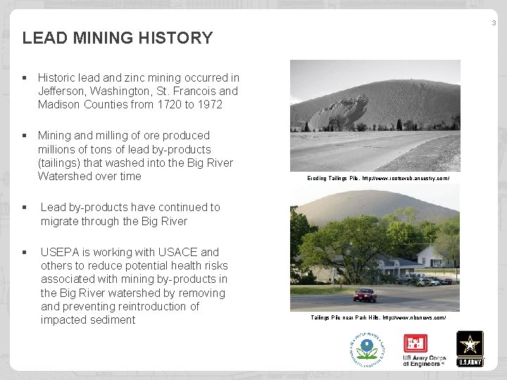
3 LEAD MINING HISTORY § Historic lead and zinc mining occurred in Jefferson, Washington, St. Francois and Madison Counties from 1720 to 1972 § Mining and milling of ore produced millions of tons of lead by-products (tailings) that washed into the Big River Watershed over time § Lead by-products have continued to migrate through the Big River § USEPA is working with USACE and others to reduce potential health risks associated with mining by-products in the Big River watershed by removing and preventing reintroduction of impacted sediment Eroding Tailings Pile, http: //www. rootsweb. ancestry. com/ Tailings Pile near Park Hills, http: //www. nbcnews. com/
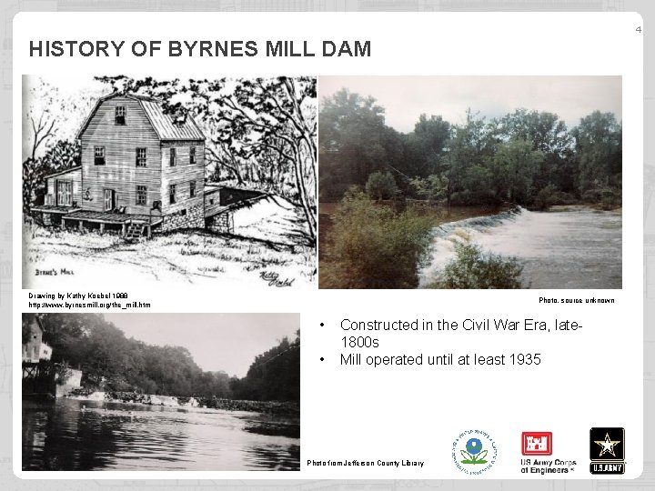
4 HISTORY OF BYRNES MILL DAM Drawing by Kathy Koebel 1988 http: //www. byrnesmill. org/the_mill. htm Photo, source unknown • • Constructed in the Civil War Era, late 1800 s Mill operated until at least 1935 Photo from Jefferson County Library

5 CIVIL WAR ERA MILL DAM CONSTRUCTION § Foundations formed from timber cribbing filled with rough quarry stone. § Exterior constructed of stacked trapezoidal-cut stone. Rockford Beach Dam ca. 1800 s, Source Unknown Typical Foundation Sketch, U. S. War Department 1891 -1895: Plate 53 -3 http: //www. crt. state. la. us/dataprojects/archaeology/virtualbooks/BAILEYS/dam. htm
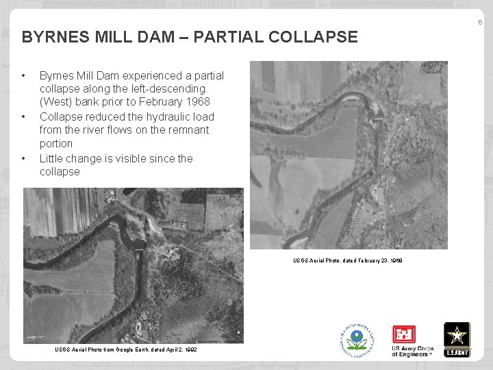
6 BYRNES MILL DAM – PARTIAL COLLAPSE • • • Byrnes Mill Dam experienced a partial collapse along the left-descending (West) bank prior to February 1968 Collapse reduced the hydraulic load from the river flows on the remnant portion Little change is visible since the collapse USGS Aerial Photo, dated February 23, 1968 USGS Aerial Photo from Google Earth, dated April 2, 1992
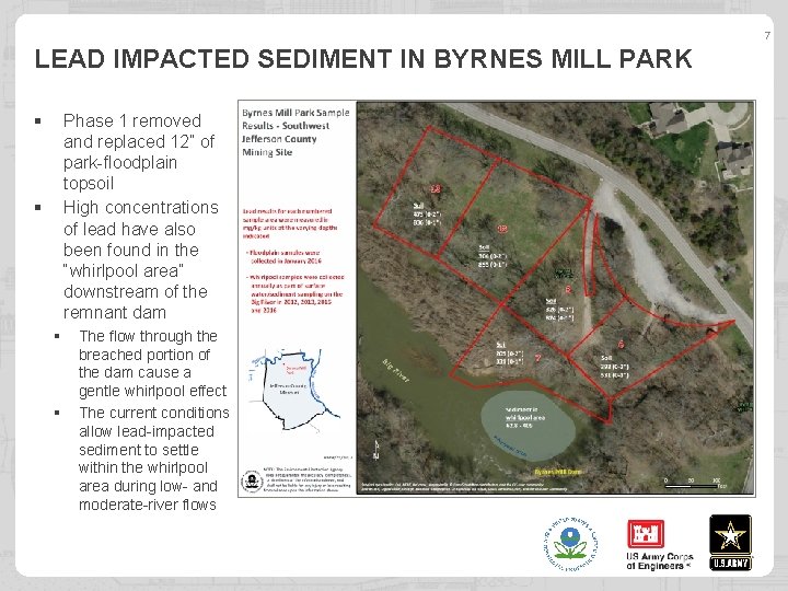
7 LEAD IMPACTED SEDIMENT IN BYRNES MILL PARK § Phase 1 removed and replaced 12” of park-floodplain topsoil High concentrations of lead have also been found in the “whirlpool area” downstream of the remnant dam § § § The flow through the breached portion of the dam cause a gentle whirlpool effect The current conditions allow lead-impacted sediment to settle within the whirlpool area during low- and moderate-river flows
PHASE 2 PROJECT OBJECTIVES § Remove lead-impacted sediment collected below the remnant Byrnes Mill dam (“Whirlpool”) § Determine effectiveness of future removals § Ensure the remnant Byrnes Mill Dam doesn’t collapse further
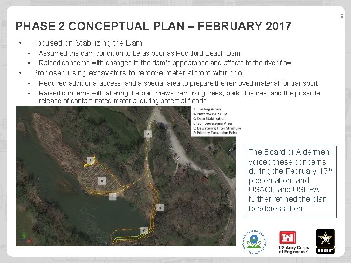
9 PHASE 2 CONCEPTUAL PLAN – FEBRUARY 2017 • Focused on Stabilizing the Dam • • • Assumed the dam condition to be as poor as Rockford Beach Dam Raised concerns with changes to the dam’s appearance and affects to the river flow Proposed using excavators to remove material from whirlpool • • Required additional access, and a special area to prepare the removed material for transport Raised concerns with altering the park views, removing trees, park closures, and the possible release of contaminated material during potential floods The Board of Aldermen voiced these concerns during the February 15 th presentation, and USACE and USEPA further refined the plan to address them
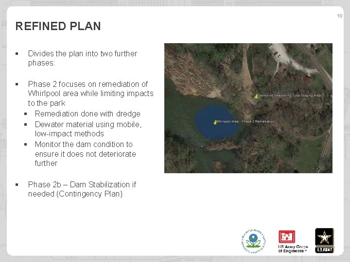
10 REFINED PLAN § § § Divides the plan into two further phases: Phase 2 focuses on remediation of Whirlpool area while limiting impacts to the park § Remediation done with dredge § Dewater material using mobile, low-impact methods § Monitor the dam condition to ensure it does not deteriorate further Phase 2 b – Dam Stabilization if needed (Contingency Plan)
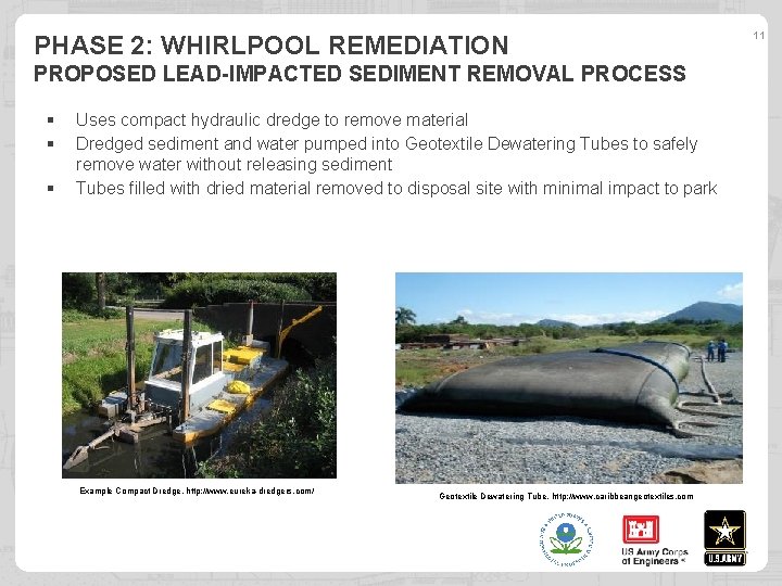
PHASE 2: WHIRLPOOL REMEDIATION PROPOSED LEAD-IMPACTED SEDIMENT REMOVAL PROCESS § § § Uses compact hydraulic dredge to remove material Dredged sediment and water pumped into Geotextile Dewatering Tubes to safely remove water without releasing sediment Tubes filled with dried material removed to disposal site with minimal impact to park Example Compact Dredge, http: //www. eureka-dredgers. com/ Geotextile Dewatering Tube, http: //www. caribbeangeotextiles. com 11
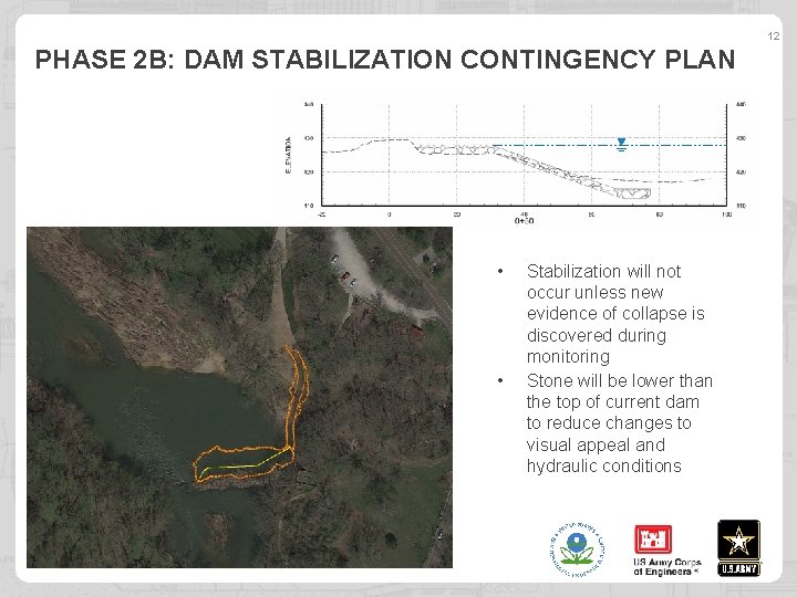
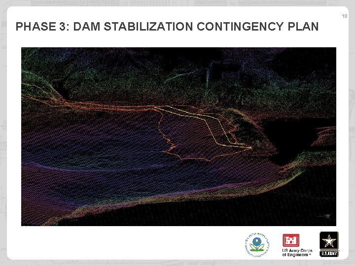
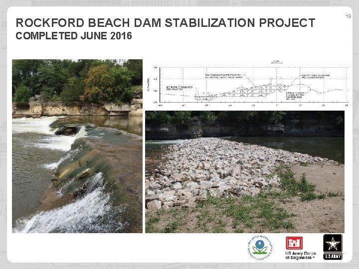
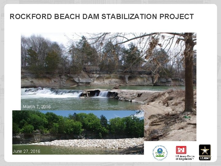
12 PHASE 2 B: DAM STABILIZATION CONTINGENCY PLAN • • Stabilization will not occur unless new evidence of collapse is discovered during monitoring Stone will be lower than the top of current dam to reduce changes to visual appeal and hydraulic conditions
SCHEDULE • Phase 1: Lower Floodplain Bench/Park Remediation – Completed October 2015 • Phase 2: Whirlpool Remediation – Completed by December 2017 • Phase 2 b: Dam Stabilization – Only if needed to prevent collapse
14 BACKUP SLIDES
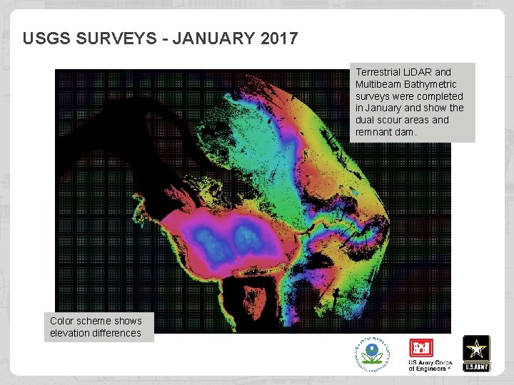
USGS SURVEYS - JANUARY 2017 Terrestrial Li. DAR and Multibeam Bathymetric surveys were completed in January and show the dual scour areas and remnant dam. Color scheme shows elevation differences
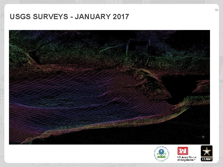
16 USGS SURVEYS - JANUARY 2017
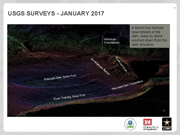
17 USGS SURVEYS - JANUARY 2017 A bench has formed downstream of the dam, likely by stone washed down from the dam structure. Millhouse Foundations wn st am Be nc m Da ol re t an r Po am Scou D t n a n m Re mn Re Do h n nant Rem lweg S River Tha l cour Poo D tio unda o F am
18 PHASE 3: DAM STABILIZATION CONTINGENCY PLAN
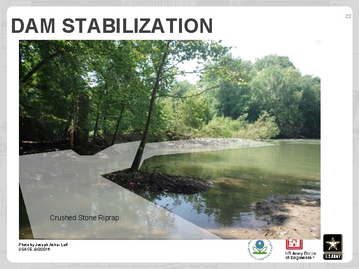
ROCKFORD BEACH DAM STABILIZATION PROJECT COMPLETED JUNE 2016 19
ROCKFORD BEACH DAM STABILIZATION PROJECT March 7, 2016 June 27, 2016
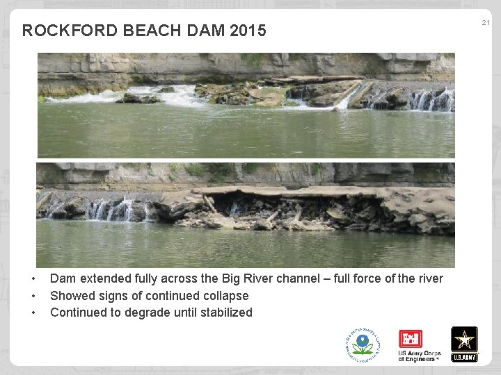
ROCKFORD BEACH DAM 2015 • • • Dam extended fully across the Big River channel – full force of the river Showed signs of continued collapse Continued to degrade until stabilized 21
DAM STABILIZATION Crushed Stone Riprap Photo by Joseph Asher Leff USACE, 9/2/2016 22
APRIL 2016 New Gravel Ramp down Photo by Joseph Asher Leff USACE, 4/25/2016 23
24 NEW RAMP A Excavated Slope, with Grass ge ina Dra h Ditc Photo by Joseph Asher Leff USACE, 4/25/2016 New Gravel Ramp
- Slides: 24