
Emily Guenther Zach Olson Locating Unsafe Areas for
- Slides: 23
Emily Guenther Zach Olson Locating Unsafe Areas for Cyclists and Pedestrians in Monona, Wisconsin Laura Scott Cameron Wein Geography 578 Final Presentation
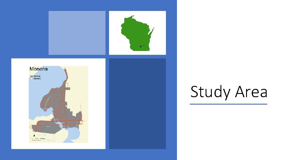
Study Area • Population of approximately 8000 residents • Four square miles of residential homes, commercial properties, and green space surrounded by the City of Madison • Because of its unique geography connecting East Madison to the Isthmus, Monona faces challenges in managing high traffic volume on its three main transportation corridors
Study Area
Background: Univer. City Alliance • The City of Monona has partnered with the University of Wisconsin-Madison to explore sustainable development across four areas: Housing and Development, Community Media, Parks & Recreation, and Transportation • Our role: To assist planners to better understand existing transportation infrastructure, with an emphasis on pedestrian and cyclist safety. • Why is this important? • In 2015, motor- vehicle related crashes claimed the lives of 5376 pedestrians and injured 70, 000. Motor-vehicle-related crashes injured 45, 000 bikers and claimed the lives of 818. (National Highway Traffic Safety Administration, 2017)
Background • “Livable Communities” is a relatively new concept in urban planning that encompasses a wide range of characteristics that describe a general quality of life • Elements: variety of housing types, quality health facilities and schools, reliable public transportation, access to shopping, recreation and culture, physical environment that fosters walking and cycling (AARP Public Policy Institute, 2015) • Benefits of walkable communities: reduced carbon emissions and vehicle related air and noise pollution, physical health and well-being, increased economic activity, higher home values
Question What are the unsafe areas for pedestrians and cyclists while traversing Monona?
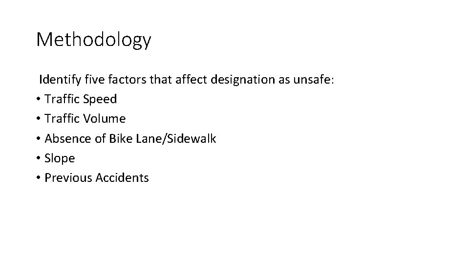
Methodology Identify five factors that affect designation as unsafe: • Traffic Speed • Traffic Volume • Absence of Bike Lane/Sidewalk • Slope • Previous Accidents
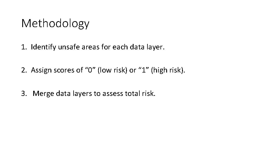
Methodology 1. Identify unsafe areas for each data layer. 2. Assign scores of “ 0” (low risk) or “ 1” (high risk). 3. Merge data layers to assess total risk.
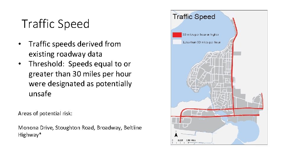
Traffic Speed • Traffic speeds derived from existing roadway data • Threshold: Speeds equal to or greater than 30 miles per hour were designated as potentially unsafe Areas of potential risk: Monona Drive, Stoughton Road, Broadway, Beltline Highway*
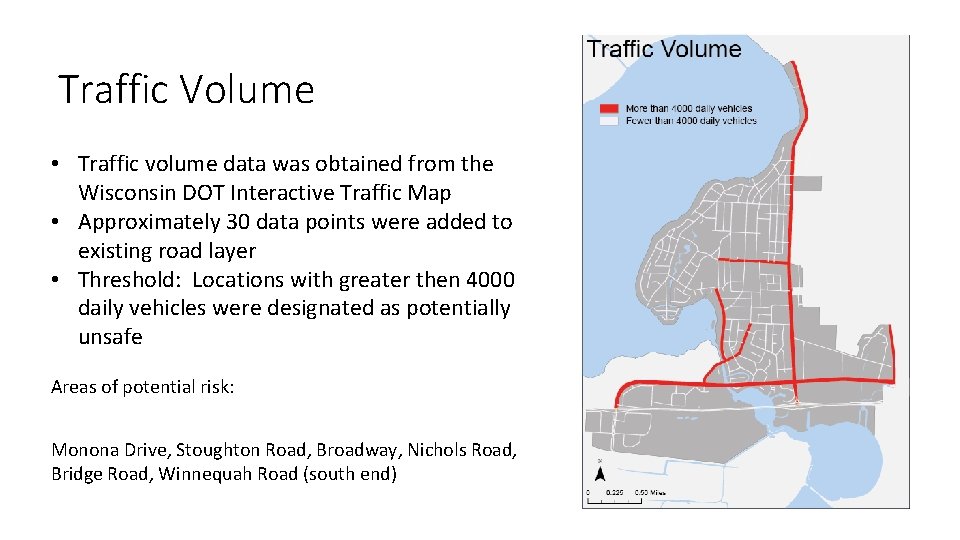
Traffic Volume • Traffic volume data was obtained from the Wisconsin DOT Interactive Traffic Map • Approximately 30 data points were added to existing road layer • Threshold: Locations with greater then 4000 daily vehicles were designated as potentially unsafe • Add map Areas of potential risk: Monona Drive, Stoughton Road, Broadway, Nichols Road, Bridge Road, Winnequah Road (south end)
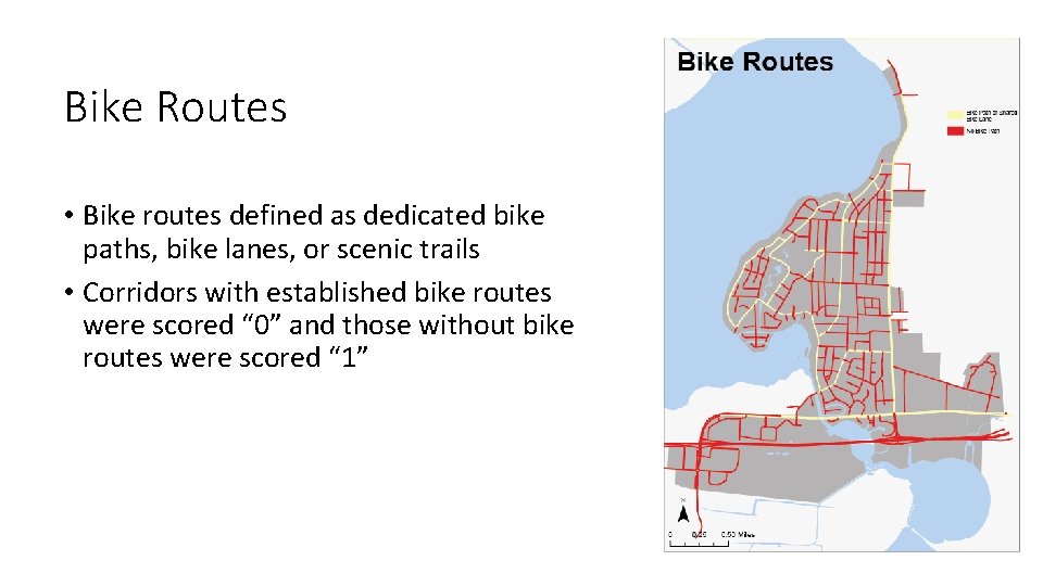
Bike Routes • Bike routes defined as dedicated bike paths, bike lanes, or scenic trails • Corridors with established bike routes were scored “ 0” and those without bike routes were scored “ 1”
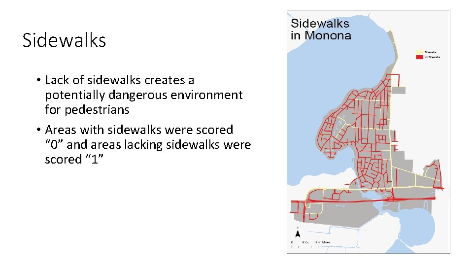
Sidewalks • Lack of sidewalks creates a potentially dangerous environment for pedestrians • Areas with sidewalks were scored “ 0” and areas lacking sidewalks were scored “ 1”
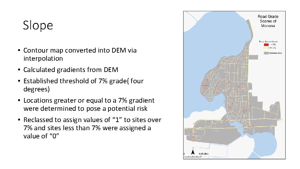
Slope • Contour map converted into DEM via interpolation • Calculated gradients from DEM • Established threshold of 7% grade( four degrees) • Locations greater or equal to a 7% gradient were determined to pose a potential risk • Reclassed to assign values of “ 1” to sites over 7% and sites less than 7% were assigned a value of “ 0”
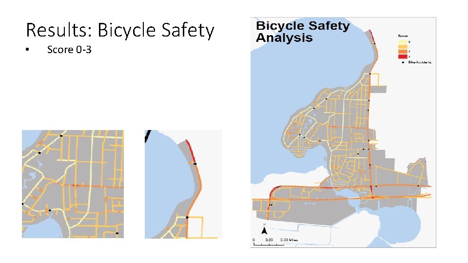
Previous Accidents • 22 vehicle vs. bike accidents • 10 vehicle vs. pedestrian accidents • Accidents were officially recorded from 2010 -2016
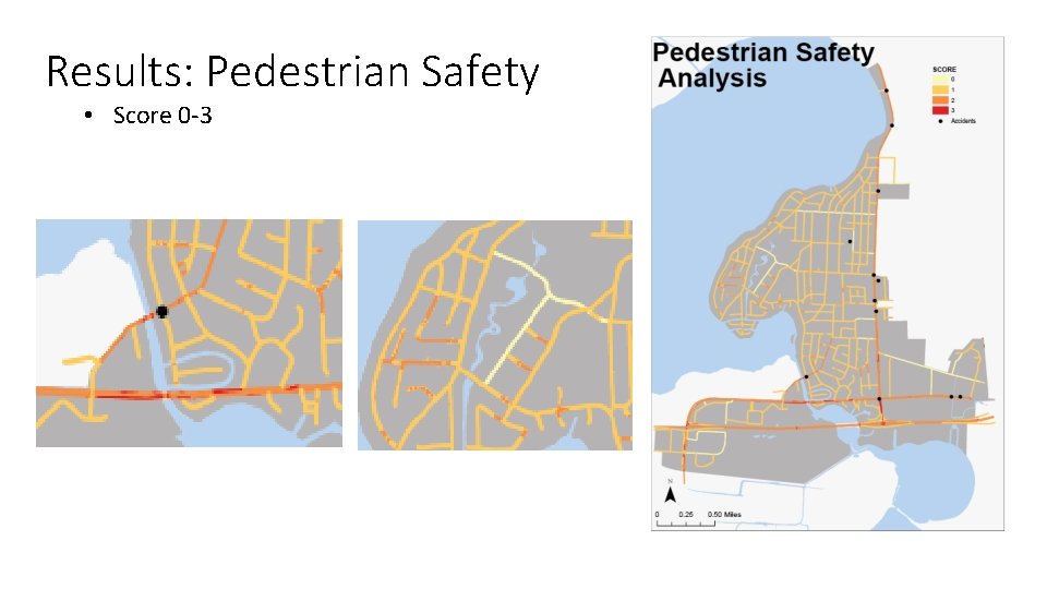
Results: Pedestrian Safety • Score 0 -3
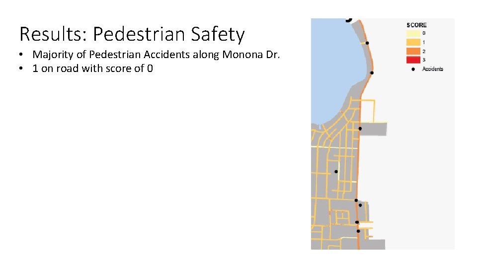
Results: Pedestrian Safety • Majority of Pedestrian Accidents along Monona Dr. • 1 on road with score of 0
Results: Bicycle Safety • Score 0 -3
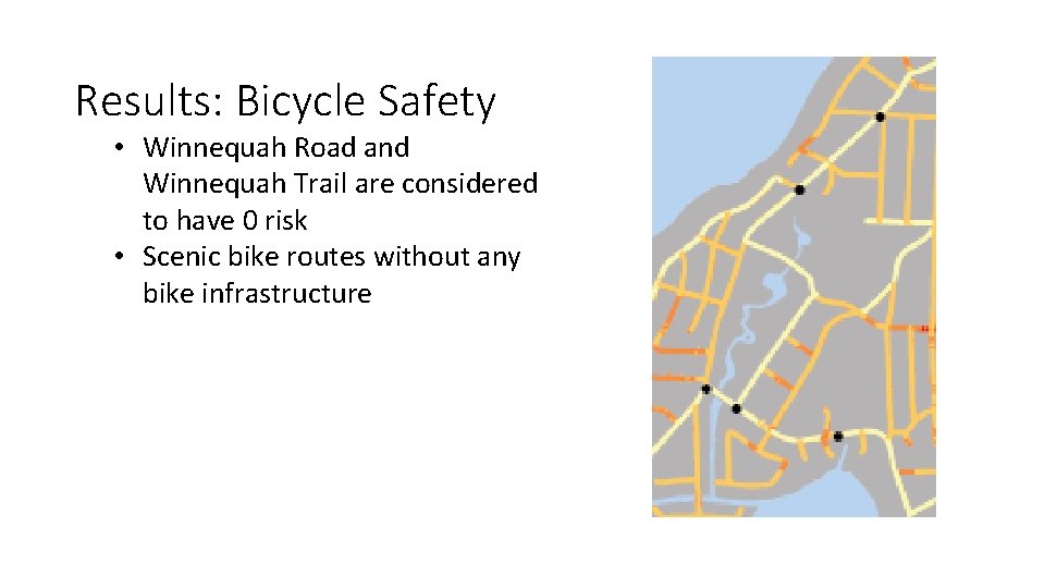
Results: Bicycle Safety • Winnequah Road and Winnequah Trail are considered to have 0 risk • Scenic bike routes without any bike infrastructure
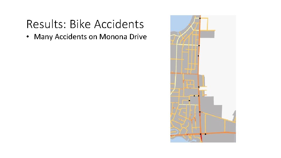
Results: Bike Accidents • Many Accidents on Monona Drive
Key Conclusions • Speed and Volume are the most dangerous factors for both Pedestrians and Bicyclists • Bike Infrastructure need to be added to shared bike path
Future Considerations • Affect of signage on pedestrian safety • Obstructions and condition of pavement • Crosswalks • Analysis using a more nuanced scoring system
References • AARP Public Policy Institute. Livable Communities: An Evaluation Guide. 2005. Accessed online 4/26/2017 • City of Monona. Official Website. Accessed online 4/30/2017 • National Highway Traffic Safety Administration. Accessed online 4/24/2017. • State of Florida Department of Transportation. Manual of Uniform Minimum Standards for Design Construction and Maintenance for Streets and Highways. May 2013. Accessed online 4/6/2017. • State of Virginia Department of Transportation. Traffic Calming Guide for Local Residential Streets. October 2002. Accessed online 3/30/2017. State of Wisconsin • State of Wisconsin Department of Transportation: Interactive Traffic Count Map. Accessed online 4/4/2017.
Acknowledgements • Special thanks to Brad Bruun and the City of Monona