Efficient Assimilation of Radar Data at High Resolution
- Slides: 18

Efficient Assimilation of Radar Data at High Resolution for Short. Range Numerical Weather Prediction Keith Brewster, Ming Hu, Ming Xue and Jidong Gao Center for Analysis and Prediction of Storms University of Oklahoma USA WSN 05 6 Sep 2005 Toulouse, France

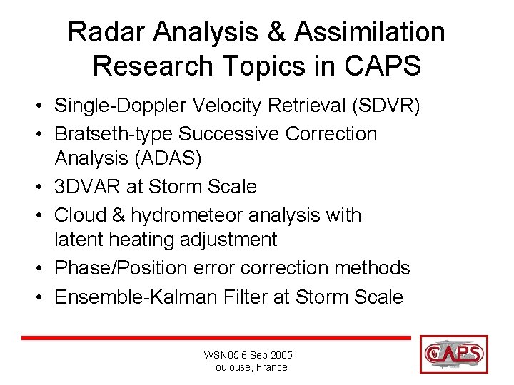
Radar Analysis & Assimilation Research Topics in CAPS • Single-Doppler Velocity Retrieval (SDVR) • Bratseth-type Successive Correction Analysis (ADAS) • 3 DVAR at Storm Scale • Cloud & hydrometeor analysis with latent heating adjustment • Phase/Position error correction methods • Ensemble-Kalman Filter at Storm Scale WSN 05 6 Sep 2005 Toulouse, France

Radar Analysis & Assimilation Research Topics in CAPS • Single-Doppler Velocity Retrieval (SDVR) • Bratseth-type Successive Correction Analysis (ADAS) • 3 DVAR at Storm Scale • Cloud & hydrometeor analysis with latent heating adjustment • Phase/Position error correction methods • Ensemble-Kalman Filter at Storm Scale WSN 05 6 Sep 2005 Toulouse, France

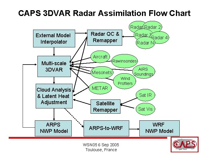
CAPS 3 DVAR Radar Assimilation Flow Chart Radar 1 Radar 2 External Model Interpolator Radar QC & Remapper Aircraft Multi-scale 3 DVAR Cloud Analysis & Latent Heat Adjustment ARPS NWP Model Radar 3 Radar 4 Radar N Rawinsondes AIRS Soundings Mesonets METAR Wind Profilers Sat IR Satellite Remapper ARPS-to-WRF WSN 05 6 Sep 2005 Toulouse, France Sat Vis WRF NWP Model

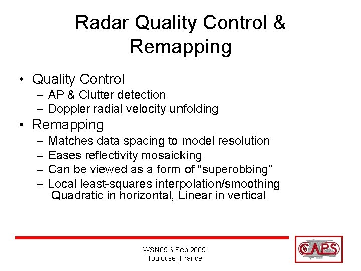
Radar Quality Control & Remapping • Quality Control – AP & Clutter detection – Doppler radial velocity unfolding • Remapping – – Matches data spacing to model resolution Eases reflectivity mosaicking Can be viewed as a form of “superobbing” Local least-squares interpolation/smoothing Quadratic in horizontal, Linear in vertical WSN 05 6 Sep 2005 Toulouse, France

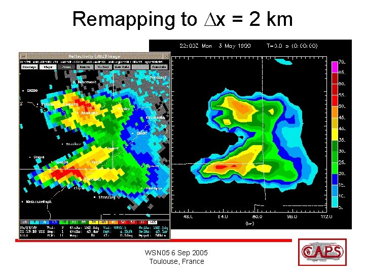
Remapping to Dx = 2 km WSN 05 6 Sep 2005 Toulouse, France

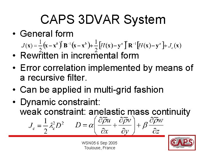
CAPS 3 DVAR System • General form • Rewritten in incremental form • Error correlation implemented by means of a recursive filter. • Can be applied in multi-grid fashion • Dynamic constraint: weak constraint: anelastic mass continuity WSN 05 6 Sep 2005 Toulouse, France

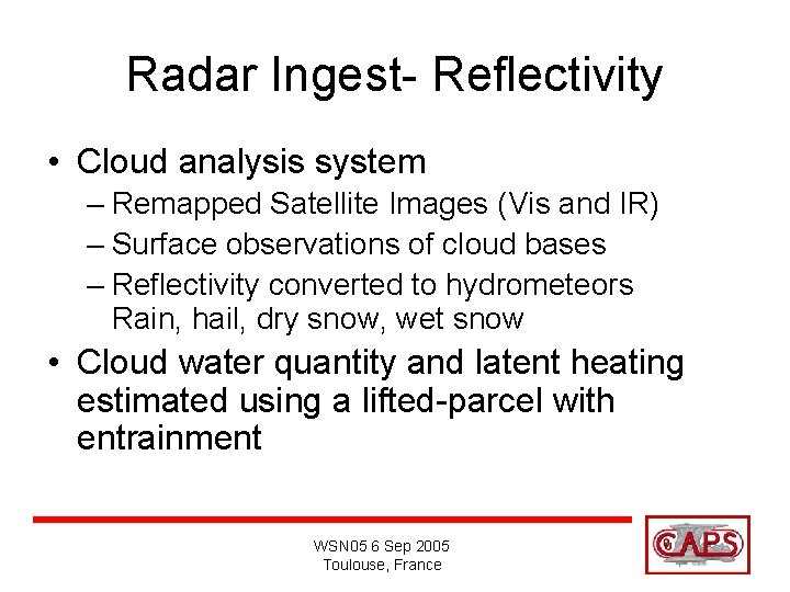
Radar Ingest- Reflectivity • Cloud analysis system – Remapped Satellite Images (Vis and IR) – Surface observations of cloud bases – Reflectivity converted to hydrometeors Rain, hail, dry snow, wet snow • Cloud water quantity and latent heating estimated using a lifted-parcel with entrainment WSN 05 6 Sep 2005 Toulouse, France

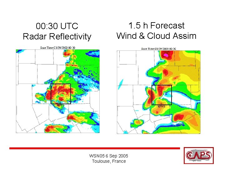
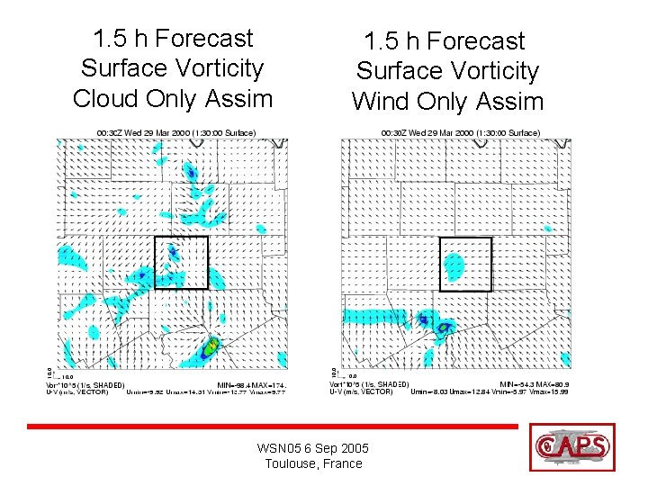
3 DVAR Applied to Fort Worth Tornadic Storm • Fort Worth, Texas area tornadoes of 28 Mar 2000 • 3 -km ARPS Forecast 23 UTC-06 UTC nested in 9 -km forecast 18 UTC – 06 UTC • Six 10 -min analysis cycles (1 hour) using NEXRAD data 22 UTC-23 UTC. • Experiments: – Wind and Cloud Assimilated – Wind Alone – Cloud Alone Ming Hu et al. papers submitted to MWR WSN 05 6 Sep 2005 Toulouse, France

00: 30 UTC Radar Reflectivity 1. 5 h Forecast Wind & Cloud Assim WSN 05 6 Sep 2005 Toulouse, France

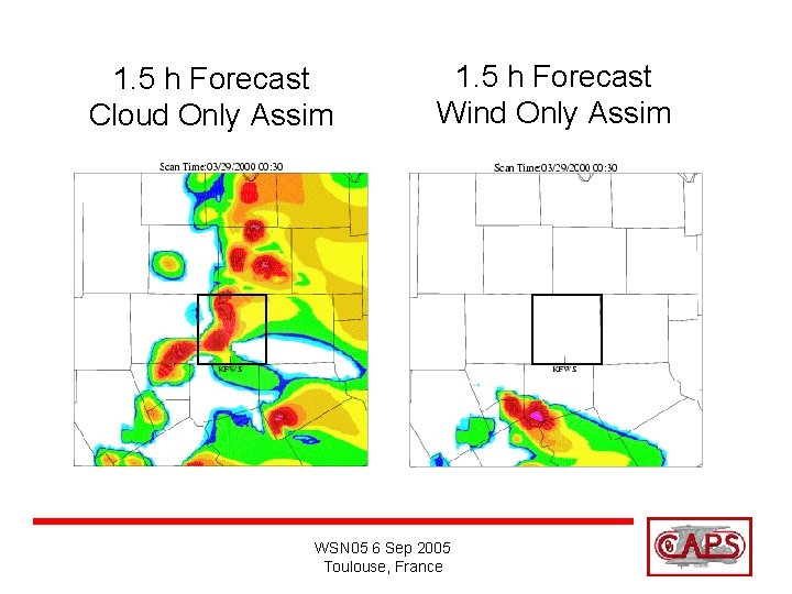
1. 5 h Forecast Cloud Only Assim 1. 5 h Forecast Wind Only Assim WSN 05 6 Sep 2005 Toulouse, France

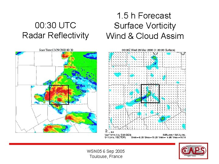
00: 30 UTC Radar Reflectivity 1. 5 h Forecast Surface Vorticity Wind & Cloud Assim WSN 05 6 Sep 2005 Toulouse, France

1. 5 h Forecast Surface Vorticity Cloud Only Assim 1. 5 h Forecast Surface Vorticity Wind Only Assim WSN 05 6 Sep 2005 Toulouse, France

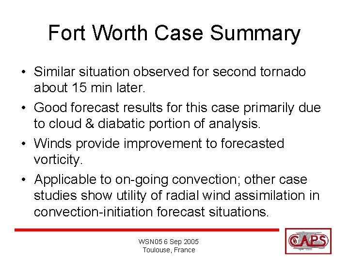
Fort Worth Case Summary • Similar situation observed for second tornado about 15 min later. • Good forecast results for this case primarily due to cloud & diabatic portion of analysis. • Winds provide improvement to forecasted vorticity. • Applicable to on-going convection; other case studies show utility of radial wind assimilation in convection-initiation forecast situations. WSN 05 6 Sep 2005 Toulouse, France

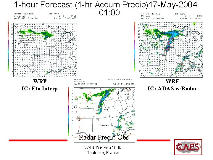
1 -hour Forecast (1 -hr Accum Precip)17 -May-2004 01: 00 WRF IC: Eta Interp WRF IC: ADAS w/Radar Precip Obs WSN 05 6 Sep 2005 Toulouse, France

2004 Real-time Use Summary • Spin-up at 4 -km is largely eliminated using radar and satellite data. • Good results even with a static analysisinitialization. WSN 05 6 Sep 2005 Toulouse, France

Sample of Ongoing & Future Work with These Tools • Testing different lengths of assimilation cycle and total assimilation window length • Will also test using 3 DVAR output in Incremental Analysis Updating • More real-time high-resolution test periods in collaboration with SPC/NSSL • Smaller-domain real-time system run daily http: //www. caps. ou. edu/wx WSN 05 6 Sep 2005 Toulouse, France

Credits • CAPS Research Scientists – Ming Xue, Jidong Gao, Dan Weber, Kelvin Droegemeier • CAPS Model and Real Time System Support – Kevin Thomas and Yunheng Wang • CAPS Students – Ming Hu, Dan Dawson • WSN 05 Conference Travel Support OU School of Meteorology Weather. News Chair funds WSN 05 6 Sep 2005 Toulouse, France