Eastern and Southern Asia Physical Geography Eastern Asia


- Slides: 19

Eastern and Southern Asia Physical Geography

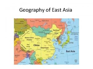
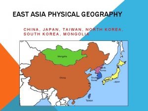
Eastern Asia Countries in Eastern Asia • North and South Korea (Korean Peninsula) • • China Japan Mongolia Taiwan

Japan Archipelago • Japan is an archipelago. Archipelago—a chain of islands

Koreas (North and South) Peninsula • North and South Korea are located on the Korean Peninsula—a body of land surrounded on three sides by water

Major Deserts in East Asia Gobi Desert • This desert is located on the border of Mongolia and China. • It is one of the largest deserts in the world. • Population densities are very low in these desert areas due to the harsh conditions. Taklimakan Desert • This desert is located in western China. Traders on the historic Silk Road traveled on foot around this deadly desert.

Gobi Desert Taklimakan

Major Rivers in East Asia Rivers are important for farming, transportation, and trade. Huang He (Yellow River) • This river is located near the North China Plain near the Yellow Sea. • The North China Plain has one of the highest population densities in China. • The climate is a little cooler there. A lot of wheat is grown in this region because the soil is so fertile. Loess--A yellowish brown, fertile soil or silt. The river’s name comes because it blows into the river.

Major Rivers in East Asia Yangtze River (Chang Jiang) • This river flow from the Plateau of Tibet to the East China Sea. It’s China’s longest river and very important for the irrigation of crops. • It is located more to the south in China. The climate is much warmer there. Huge amounts of rice are grown in this region.

Major Rivers in East Asia Mekong River • This river begins near the Plateau of Tibet and winds south on the border of Thailand, Laos, and Vietnam where it empties into the South China Sea. • Warm temperatures and heavy rains make the Mekong region a fertile rice-growing region. This regions has a very large population.

The Importance of the Sea • Many of the countries in Asia rely on the oceans and seas for food and trade. • Japan, China, and South Korea have the world’s biggest deepsea fishing industries. • They eat plenty of seafood and export (sell) TONS of it to other countries.

Ring of Fire • There is a lot of tectonic plate movement in and around Asia and the Pacific Ocean. • Plates colliding create strong effects in Asia: 1. Mountains 2. Volcanoes 3. Earthquakes/Tsunamis

Plateau of Tibet • This plateau is high, cool, and dry. • For this reason, very few people live there. • People who live there are subsistence farmers, those who raise herd animals, or are nomadic. Nomads—people who move from place to place.

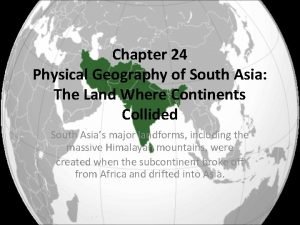
Southern Asia and Southeastern Asia • Some major countries of Southern and Southeastern Asia are: • India and Pakistan • • • Vietnam Thailand Cambodia Myanmar Indonesia Philippines

Himalayan Mountain Range • Mt. Everest, the tallest mountain in the world, is found in this mountain range. • It is still growing—about 3 millimeters each year. • Because it is so high, cold, and rugged, it created a natural barrier of trade between India and other parts of East Asia.

Rivers in Southern Asia • There a few major rivers in this region: Indus, Ganges and Brahmaputra Rivers. • All of these rivers begin because of snow melting high in the Himalayan Mountains. • The Ganges River is considered very holy to those who practice the religion of Hinduism.

Climate in Southern and Southeast Asia Many areas in the southern areas have a hot, tropical climate. This is because they are near the equator. Areas of higher elevations, near mountainous areas or plateaus tend to be cooler. In other areas, rain and winds can be blocked by mountains. This is called the rain shadow effect.

Monsoons • Monsoons—seasonal winds • Sometimes monsoons are cooler and drier. This causes dry winters. • Sometimes monsoons are moist and wet. In this case, they can bring strong tropical storms called typhoons. This causes wet summers.

Cyclones • A cyclone or typhoon is a strong storm that forms in the Pacific Ocean. • It is similar to a hurricane, which forms in the Atlantic Ocean.

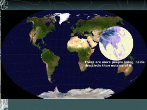
Population Densities: Where do people live in Asia and why? • China—Most people live in the eastern, river and coastal plains. • Observe how much darker the areas are near coasts or along the banks of major rivers as they near the coasts. • Why do you think they prefer to live in these areas?
 Southern and eastern asia physical features answer key
 Physical features of southern and eastern asia
 Physical features of southern and eastern asia
 Southern and eastern asia physical features answer key
 Sw asia geography cloze notes 1
 Label the following
 Brain wrinkles southern and eastern asia
 Brain wrinkles southern and eastern asia
 Se asia's belief systems cloze notes 1 answer key
 Lesson 1 physical geography of eastern europe
 Kums definition geography
 Geography of asia
 Taiwan physical geography
 China population density
 Lesson 1 physical geography of southeast asia
 Physical geography of east asia
 South asia physical geography
 Chapter 21 physical geography of southwest asia
 Peninsulas and waterways in southwest asia
 Southern colonies geography
