Earths Water The Hydrosphere and the Water Cycle



- Slides: 79

Earth’s Water

The Hydrosphere and the Water Cycle

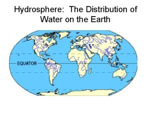
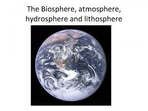
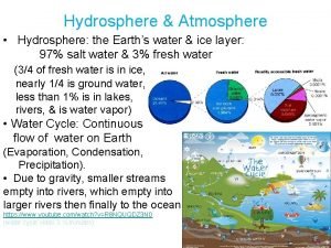
The Hydrosphere: An Overview… The hydrosphere is… • the water on and in Earth’s crust The percentage of water found in the oceans… • 97% The percentage of water contained by the landmasses… • 3 http: //www. earthview. pair. com/earth 300 color. jpg

Of the Freshwater on Earth… 90% is in the form of… • polar ice caps and glaciers Most of the remaining water is… • groundwater Only a small fraction is in… • rivers, streams, and lakes Snow pack on Mt. Shucksan, Washington

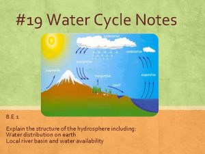
http: //www. euwfd. com/html/hydrological_cycle. html The Water Cycle… Infiltration http: //www. youtube. com/watch? v =o 3 BVa 7 PH_JE

Runoff… Runoff is… • water flowing down slope along Earth’s surface http: //myecoproject. org/wp-content/uploads/2009/02/stormwater. jpg

Five Factors that Increase Runoff… Little to No Vegetation… • B/C topsoil is easily eroded so that water runs off easier

Five Factors that Increase Runoff… Heavy rain… B/C rain falls too quickly to soak into the ground http: //luirig. altervista. org/cpm/albums/nrcs 3/normal_1389 -Runoff-from-a-heavy-rain-carries-topsoil-from-a-cr. jpg

Five Factors that Increase Runoff… Soil with a lot of clay… B/C clay has small air spaces that prevents water from soaking in

Five Factors that Increase Runoff… Steep Slope… • B/C gravity causes the water to flow off faster http: //secretagentworms. org/images/runoff 2 nrcs. jpg

Five Factors that Increase Runoff… High ground- water levels… • B/C there is no space left for the water to soak in underground. http: //secretagentworms. org/images/runoff 2 nrcs. jpg

Watersheds and Stream Systems… A stream is runoff water that begins to flow more permanently in a channel. A large stream is called a river. The smaller streams that feed into it are called tributaries Zip-lining across a stream in Loon Mtn. , New Hampshire

The Rivers of North Carolina…

Watersheds and Divides… A watershed is all of the land area whose water drains into a stream system. http: //dutchesswam. files. wordpress. com/2010/05/watershed-image-small. png

Watersheds and Divides… A divide is a high land area that separates one watershed from another. • The Eastern Continental Divide is located in the Blue Ridge Mountains. Highway 421 N, Jefferson, NC

Divides of North America… http: //en. wikipedia. org/wiki/Eastern_Continental_Divide

Watersheds and Divides… The watershed of the Mississippi River is the largest watershed in North America! http: //www. epa. gov/gmpo/lmrsbc/index. html

Surface Water: Rivers

http: //media-3. web. britannica. com/eb-media/78/3078 -004 -9 B 8860 F 2. jpg Stream Systems: Beginning… Headwaters are… the beginning of a stream Found in mountains Water is cold, oxygenated, clear V-shaped channels i. have steep sides. ii. The Grand Canyon is a Vshaped valley. The Grand Canyon

Stream Systems: Middle… What is a floodplain? … a broad, flat, fertile area next to a stream that floods periodically … It is not wise to build on a floodplain b/c it is prone to flooding!

Stream Systems: Middle… A meander is a… • bend or curve in a stream channel The Cape Fear River The Yadkin River http: //www. wfae. org/wfae/images/Yadkin. jpg http: //www. wilmingtonbeachrentals. com/2010/02/cape-fear-river-facts-pictures. html

Erosion & Deposition in Stream Systems Water (in a stream) flows fastest on outside of a meander & erodes a cut bank. Water (in a stream) flows slowest on inside of a meander & deposits a sandbar.

Stream Systems: The End!… The end of a stream is called the mouth … and is usually located at the ocean or another large body of water http: //carolinagreensense. com/uploaded_images/NIWB-731140. jpeg

A Stream’s End: Deposition of Sediment… Streams lose their ability to carry sediment …b/c they slow down & lose energy A delta is a triangular deposit that forms at the mouth of a river. Pollution at the end of a river comes from upstream. The end is almost always more polluted! The Mississippi River Delta – picture taken by Landsat 7 http: //earthasart. gsfc. nasa. gov/mississippi. html

Floods… When do floods occur? • when water overflows a stream’s banks (Soccer fields were built on the flood plain of the Yadkin River in Davie County. Why? ) http: //www. nowpublic. com/world/floodplain

Floods… How are floods related to groundwater levels? … It is more likely to flood when groundwater levels are high … b/c the aquifer is already full and can only hold so much water. … the dotted line on the diagram represents the groundwater level. http: //www. sciencedirect. com/science/article/pii/S 004896970800380 X

North Carolina Watersheds… http: //www. learnnc. org/lp/media/maps/nc/Watersheds-NC-map. jpg

The Rivers of North Carolina…

Lakes

What are lakes often associated with? Lakes … http: //en. wikipedia. org/wiki/High_Rock_Lake o River basins (watersheds) Why are lakes important? control flooding, recreation, drinking water, habitats What human activities pollute lakes? Coal-fired power plants, agriculture (crops & animals), stormwater runoff http: //www. city-data. com/picfilesv/picv 23839. php High Rock Lake

Dams are built to store & manage water. The water of a reservoir is used for… drinking & hydropower. The negative consequences of building a dam include… destruction of habitats (around the dam) & water quality changes downstream (colder and clearer). Dams… trap sediments which prevent sandbars from forming downstream. Dams are removed… if they’re no longer useful or are causing damage.

Lakes Undergo Change… How do lakes get polluted? o When water runs off polluted surfaces into the lake o Sources of pollution – sediments, agriculture, industry Agriculture affects lakes by… o Adding pesticides, fertilizers, & animal wastes

Lakes Undergo Change… Eutrophication is… o excess nutrients “fertilize” algae which use up O 2 in the lake as they decay Eutrophication in Australia Fish kill in the Salton Sea, CA http: //www. eoearth. org/article/Eutrophication

Eutrophication… Algae – producers for aquatic environments. Oxygen – used up (as algae decays) Critters need oxygen for – cellular respiration (breaking down food in presence of oxygen to get energy) If fish don’t get oxygen – they die! Human activities that speed up eutrophication – fertilizing, dumping (raw or treated) sewage into a waterway

Eutrophication Sources … http: //library. thinkquest. org/04 oct/01590/pollution/culturaleutroph. jpg

Lakes Undergo Change… Four things that can cause eutropication o animal wastes & fertilizer from farms o phosphate detergents o industrial toxins o untreated sewage

Freshwater Wetlands

http: //www. tommangan. net/twoheeldrive/index. php/2009/11/29/easy-hike-at-historic-bethabara-park/ Freshwater Wetlands… A wetland is… o land that is soaked with water Three examples of wetlands are… a. bogs b. marshes c. swamps Boardwalk at Bethabara Park Our very own wetlands!

http: //water. epa. gov/type/wetlands/bog. cfm Bogs… A bog is a water-soaked area with poor drainage. Water in a bog comes from… http: //here 4 now. typepad. com/here 4 now/2011/05/weeks-bay-reserve. html o Precipitation (rain) The soil in a bog is acidic because… o of decaying moss o slows bacterial growth & prevents nitrogen (N) recycling. A bog in Alabama

Marshes … A marsh is a watersoaked area at the mouth of streams. An estuary is a marsh on the coast where fresh and salt water mix. Fresh water marshes and estuaries often form… o Where a river enters a lake or sea Marsh grasses have shallow roots that … o anchor silt and mud deposits in a delta. (Builds land!) Brackish marsh near Wanchese, NC http: //www. duke. edu/~jspippen/vistas/outerbanks. htm

Swamps… A swamp is… o a low-lying area near a stream Swamps may develop from marshes that have filled in to support the growth of shrubs and trees. Congaree National Park, SC http: //vogeltalksrving. com/wp-content/uploads/2011/12/Mosquito-meter. jpg

Environmental Issues: A Loss of Habitat… Two valuable functions of wetlands … o the filtering of water o providing a habitat for migrating birds and fish fry (fish babies!) What % of our wetlands were lost from the late 1700 s to mid-1980 s? o 50 % o Why? Snow Geese in Prince William Sound http: //www. pwconserve. org/wildlife/birds/snowgoose. htm

Environmental Issues: Upstream Drought… A drought upstream … o … will lead to less fresh water entering the estuary and… o … saltier water

Environmental Issues: Saltwater Intrusion… Overused wells in coastal areas … o … may draw up salt water from the ocean and … o … cause the water to become undrinkable.

Three Ways to Preserve Wetlands… • Education • Conservation • Regulation

The Movement and Storage of Groundwater

Precipitation and Groundwater… Remember the water cycle? Most water in the atmosphere comes from oceans! Most precipitation that falls on land becomes groundwater. Eventually groundwater will… … return to the ocean to complete the water cycle.

Groundwater Storage… Porosity is… …the percentage of pore space in a material The types of soil that have a. highest porosity well- sorted b. lowest porosity – poorly- sorted http: //core. ecu. edu/geology/woods/GWANSW 2008_files/image 002. jpg

Groundwater Storage… Groundwater is stored… • in the pore spaces of rocks & sediments • …and can be compared to a hard sponge http: //core. ecu. edu/geology/woods/GWANSW 2008_files/image 002. jpg

Groundwater Storage… The zone of saturation is the… … depth below surface where groundwater completely fills all the pores The water table is the … … upper boundary of the zone of saturation

e. Figure 10 -2: Groundwater Storage (p. 421) soil Zone of aeration Water table Zone of saturation

Groundwater Storage… If the water table is v high, it is more likely to flood. v low, it is less likely to flood. The water table fluctuates with the seasons and weather conditions because… • it depends on rain to recharge it http: //www. tulane. edu/~sanelson/images/chwattab. gif

Groundwater Movement: Permeability… What is permeability? • ability of a material to let water pass through a. What subsurface materials are permeable? • sand, sandstone, & gravel (good for parking lots so water can infiltrate) b. What subsurface materials are impermeable? • clay, silt, shale, & pavement (bad for infiltration!) c. Why is clay used to line ponds & landfills?

Groundwater Movement: Aquifers… An aquifer Ø … underground storage area for water (permeable rock layers) An aquiclude Ø … impermeable layer above or below an aquifer.

Groundwater Systems, Use, and Threats!

Springs… Ground water discharges (comes out) at… • Earth’s surface • These natural discharges of water are called…springs Water may flow out of a rock when… • an aquifer meets an aquiclude at Earth’s surface (a spring!)

Springs and Geysers… Most hot springs in our country are found in the… • western states A geyser is an … • explosive hot spring that erupts at regular intervals Old Faithful Geyser Yellowstone NP

Wells… A well is… • a hole dug to reach groundwater A cone of depression is produced by… • over pumping wells Drawdown is… • the difference b/tw the original water table level and that of a pumped well • Water is drawn! Water table goes down! Draw down… • • • Wells can run dry or pull up salt Streams can run dry Coastal aquifers - saltwater intrusion

Wells… Recharge is… • water from rain or runoff is added to an aquifer • Aquifers are recharged by rain.

http: //pubs. usgs. gov/gip/gw_ruralhomeowner_new. html Wells: Figure 10 -15, p. 252 http: //ga. water. usgs. gov/edu/earthgwlandsubside. html

Wells… The entire water table can be lowered due to… …overuse of wells Ground above an overused well can… v …sink! v This is called subsidence

Groundwater Use In the USA, 23% of all freshwater is obtained from… … aquifers (groundwater) … Florida, Hawaii, and Nebraska depend almost entirely on groundwater.

Environmental Issues: Saltwater Intrusion… Saltwater intrusion… o … saltwater intruding into coastal wells… o … Outer Banks (on coast) o … too many wells

Threats to Our Groundwater Supply… a. Overuse b. Subsidence c. Pollution (sewage, industrial waste, landfills, agriculture) d. Chemicals (not filtered out by sediments; hard to remove from groundwater) e. Salt (esp. coastal areas) f. Radon (radioactive decay of uranium in

Protection of Groundwater… 1. Identify and eliminate pollution sources. 2. Monitor pollution. 3. Pump groundwater to surface and treat it.

Groundwater Erosion

http: //www. virginiacaves. org/lok/ccvup 56. htm Karst Topography Karst topography are limestone regions that have sinkholes, sinks, and sinking streams – named for an area in Croatia. A aerial photograph of a classic Karst terrain north of Lewisburg, WV

Karst Topography…

Hard Water… Hard water is water that contains high concentrations of calcium, magnesiun, or iron. • • • Common in limestone areas Causes deposits of calcium bicarbonate and can clog water pipes. (p. 247) More soap must be used

Erosional Stream Load… All the materials that the water in a stream carries is known as the stream’s load. http: //upload. wikimedia. org/wikipedia/commons/9/9 c/Stream_Load. gif

Erosional Stream Load… Three ways in which a stream carries its load. . . a. Material is carried in solution after it becomes dissolved in a stream’s water. b. All particles small enough to be held up by the turbulence of a stream’s moving water are carried in suspension. c. Sediments that are too large or heavy to be held up by turbulent water are transported as a stream’s bed load.

Erosional Stream Load… Carrying capacity is the ability of a stream to… • transport material http: //water. weather. gov/ahps 2/images/hydrograph_photos/muri 2_2. jpg

Use, Abuse, and Conservation of Water Resources

The Importance of Water… Eastern states get the most precipitation. Eastern states - cooling, energy production, and manufacturing. Western states - irrigation Withdrawal rates of freshwater are increasing each year because… …our population is growing!

Western states, such as California, use more water for growing their crops…

Use of Water in the USA… http: //fracfocus. org/sites/default/files/water-use-pie-chart. jpg

Water Pollution: Types of Pollution Point sources … …have a single point of origin (often through a pipe) …Three examples include (but aren’t limited to)… 1. sewage 2. spills 3. Industry Drainage into the Ohio River http: //www. lakescientist. com/learn-about-lakes/water-quality/pollution. html http: //www. waterencyclopedia. com/Po-Re/Pollution-Sources-Point-and-Nonpoint. html

http: //oceanservice. noaa. gov/education/kits/pollution/media/pol 04 a_460. jpg Water Pollution: Types of Pollution… Nonpoint sources … … come from widely spread areas & can’t be identified & cleaned up easily. … Two examples include (but aren’t limited to)… Sedimentation is caused by runoff from a deforested area. It “muddies” the water & requires more energy to filter out of drinking water. Stormwater runoff pollutes water with bacteria from sewage & chemicals from parking lots, roads, & development.

Clean up… • Surface water is more easily polluted than groundwater but easier to clean up. http: //www 2. epa. gov/cleanups
 Water and water and water water
 How is water distributed in the hydrosphere
 Hydrosphere includes *
 Geosphere
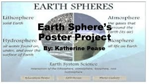
 Images of lithosphere hydrosphere atmosphere biosphere
 Earth's 5 spheres
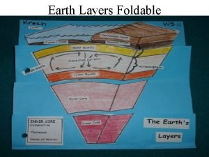
 Earth layers foldable
 Earths roation
 Whats a natural satellite
 Home sweet biome crossword
 Pnitogens
 Basalt
 Whats earths moon called
 Earth's thickest layer
 Earths early atmosphere contained
 Lithosphere is made up of
 Earths major crustal plates
 Earths orbit seasons
 Brown earths
 Study of earth's physical features
 Earth's honey
 Whats the name of earths moon
 Continental drift theory notes
 Earths crust
 Where
Where Spring earth tilt
 Atmospheric definition
 What is the true shape of earth
 Arch of constantine frieze
 What does earths tilt do
 Earths boundaries
 Earths 4 spheres
 Water cycle brainpop
 Water cycle the hydrologic cycle
 Ten uses of water
 Structure of hydrosphere
 Hydrosphere images
 Geosphere defintion
 Lithosphere
 How does biosphere interact with hydrosphere
 Hydrosphere includes all the
 Hydrology unit study guide
 Hydrosphere layers
 Hydrosphere concept map
 Characteristics of hydrosphere
 Whats hydrosphere
 Ocean zones graphic organizer
 What is biosphere and geosphere
 Stream load
 Groundwater
 The hydrosphere includes
 Hydrosphere layer
 4 spheres of the earth poster
 Hydrosphere pictures
 Hydrosphere
 Hydrosphere
 Hydrosphere
 Denitrification definition
 Difference between phosphorus cycle and carbon cycle
 Difference between open cycle and closed cycle gas turbine
 Forbidden latency
 Chapter 5 principles of engine operation
 Disadvantages of mhd generator
 Water cycle and transpiration
 Hát kết hợp bộ gõ cơ thể
 Bổ thể
 Tỉ lệ cơ thể trẻ em
 Gấu đi như thế nào
 Glasgow thang điểm
 Chúa yêu trần thế alleluia
 Môn thể thao bắt đầu bằng chữ đua
 Thế nào là hệ số cao nhất
 Các châu lục và đại dương trên thế giới
 Công của trọng lực
 Trời xanh đây là của chúng ta thể thơ
 Mật thư anh em như thể tay chân
 Phép trừ bù
 độ dài liên kết
 Các châu lục và đại dương trên thế giới
