Earths surface and maps Maps Cartographic projections Map


 => it´s needed to")


- Slides: 21
Earth´s surface and maps Maps Cartographic projections Map content Mgr. Matúš Dobeš, 2006
Maps
Maps n n Cartography = science studying possibilities how to display globular shape of the Earth to the flat drawing area Map = cartographic work and together with the globe represents the world around us
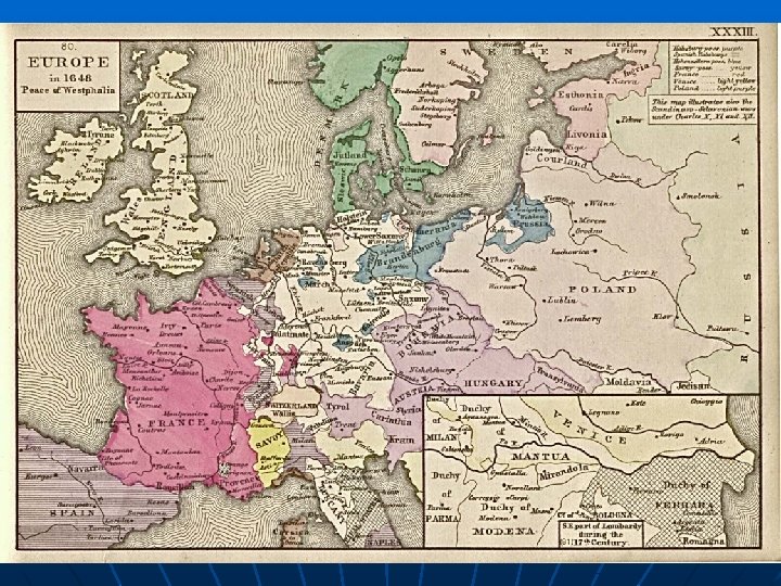
Historical maps
Maps n A map provides graphic, transparent, distorted miniature of the Earth´s surface by using captions (marks), symbols and colours. Maps are used by geographers, geologists, foresters, constructers, tourists, navigators, fliers, etc.
Various maps
Maps n n n Earth´s surface is very complex (complicated) => it´s needed to simplify it => generalization. Air and satellite survey are the most basic ways how to obtain pictures of the Earth. Basic field data important for cartographers = Location Altitude Dimensions
Map generalization
Maps n n n Map types according to theme: map plans topographic maps geographic maps Every map includes also geographic grid (geographic coordinates) created by latitude (parallels) and longitude (meridians)
Map scale n the relation between the map distance and reality => 1 : m 1 : 50, 000 means that 1 cm on the map represents 50, 000 cm in reality, in other words 500 m or 0, 5 km
Map scale n n Map types according to map scale large-scale maps (great focus representing small area with many details) n n medium-scale maps n n e. g. 1 : 50 000 (tourist map) e. g. 1 : 500 000 (autoroute map) small-scale maps (small focus representing large area with few details), n e. g. 1 : 10 000 (world map)
Cartographic projections
Cartographic projections n n = methods of displaying the Earth´s surface = projections i. e. transferring 3 D (world) to 2 D (map) => distortions
Cartographic projections n n n conform projections = angles are the same => appropriate for navigation, flights, etc. equivalent projections = areas are the same equidistant projections = distances are the same => the larger the area, the greater the distortion
Map content
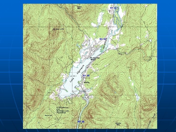
Map content n n n = all the objects shown on the map by signs and symbols => physical and political maps Topographic content Vertical segmentation = altitude (hypsometry) => contours – lines joining points with the same altitude => positive altitude (above sea level) and negative altitude (below sea level)
Map content n Horizontal segmentation = planimetry = all points, lines and symbols representing vegetation, settlements, etc. using different colours
Map content n n Thematic content = points, lines and areas using special symbols and colours for special purposes => thematic maps, e. g. ecological, climatic, urban, population, etc. legend (description) – inseparable part of all maps
Thank You for Your attention