Earth Structure Earth Structure CONTINENTAL CRUST OCEANIC CRUST

 MANTLE Continental crust -“Granitic”")
 CRUST LITHOSPHERE partially molten (only 1 -5%")


 3. 0 Basaltic 45")

 Geotherm (°C) Melting point of Peridotite (°C)")
 Asthenosphere (semi-solid) Depth (km) Mesosphere (solid) Outer")
 Lithosphere (solid) Asthenosphere (semi-solid) Geotherm Depth (km)")
 –")

. L-Waves (long waves) 2. Body Waves i). P-Waves")


 (weak / 150 km Asthenosphere ductile) 250 km")


- Slides: 34
Earth Structure
Earth Structure CONTINENTAL CRUST OCEANIC CRUST MANTLE Mohorovivic Discontinuity (Moho) MANTLE Continental crust -“Granitic” Oceanic crust - “Basaltic” Peridotite (olivine & augite) Gutenberg Discontinuity CORE Iron & Nickel This is a compositional layering of the Earth i. e. by what material the layers are made of.
Earth Structure solid (cool, brittle & rocky) CRUST LITHOSPHERE partially molten (only 1 -5% molten) ASTHENOSPHERE MANTLE CORE MESOSPHERE OUTER CORE INNER CORE solid (solid-state convection) liquid solid This is a mechanical layering of the Earth i. e. by what properties the layers have.
Earth Structure Crust Mantle Core Compositional
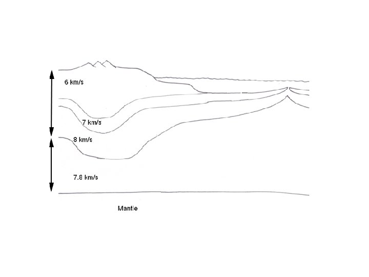
Earth Structure Crust Seismic wave velocities Lithosphere Asthenosphere Mantle Core Compositional 6 km/s Continental crust 7 km/s 8 km/s 7. 8 km/s Oceanic crust Upper mantle Mesosphere 13 km/s Outer Core 8 km/s Outer core Inner Core 11 km/s Inner core Mechanical Mantle
Continental crust Lithosphere 2. 7 Granitic >65% Oceanic crust (solid/brittle) 3. 0 Basaltic 45 -52% (weak / 150 km Asthenosphere ductile) 250 km 3. 3 Mesosphere Mantle (solid) 5. 5 Peridotite <45% [solid-state convection due to high pressures & temperatures over long periods of time] 2, 900 km Outer core Core 8. 0 10 (liquid) Metallic 0% (Fe , Ni , S) 5, 100 km Inner core (solid) 14 6, 300 km Metallic (Fe & Ni) 0%
Mid-oceanic ridge Lithosphere Continental crust MOHO Granitic Basaltic Peridotite Asthenosphere Upper mantle Oceanic crust
Temperature Variation within Earth’s Interior Depth (km) Geotherm (°C) Melting point of Peridotite (°C) 0 50 200 500 1000 2000 3000 4000 5000 6000 15 1250 1450 1900 2500 3250 4000 4250 1200 1350 1600 2100 3000 3600 3850 4050 4200 4500 1. 2. 3. 4. 5. 6. Plot the data onto graph paper, with depth on the vertical axis. Describe how the geotherm varies with depth. Define the geotherm. Locate the Earth’s internal layers on the graph. Describe the physical state of the Earth’s interior in relation to the melting point curve. Calculate the average geothermal gradient for the first 50 km into the Earth.
Temperature Variation within Earth’s Interior Temperature (°C) Asthenosphere (semi-solid) Depth (km) Mesosphere (solid) Outer Core (liquid) Inner Core (solid)
Temperature Variation within Earth’s Interior Temperature (°C) Lithosphere (solid) Asthenosphere (semi-solid) Geotherm Depth (km) Melting curve Mesosphere (solid) Outer Core (liquid) Where does this heat come from? • Radiogenic heat Inner Core (solid) • Primordial heat
Age Oceanic Continental <200 million years <4000 million years 35 km (rift valleys) – 70 km (mountains) Thickness 6 -10 km Density 3. 0 g/cm 3 2. 6 – 2. 7 g/cm 3 Composition Basaltic Granitic Structure Sediments, Pillow lavas, Sheeted dykes, Gabbro Upper crust, lower crust Formation Sea-floor spreading Subduction Continental collision
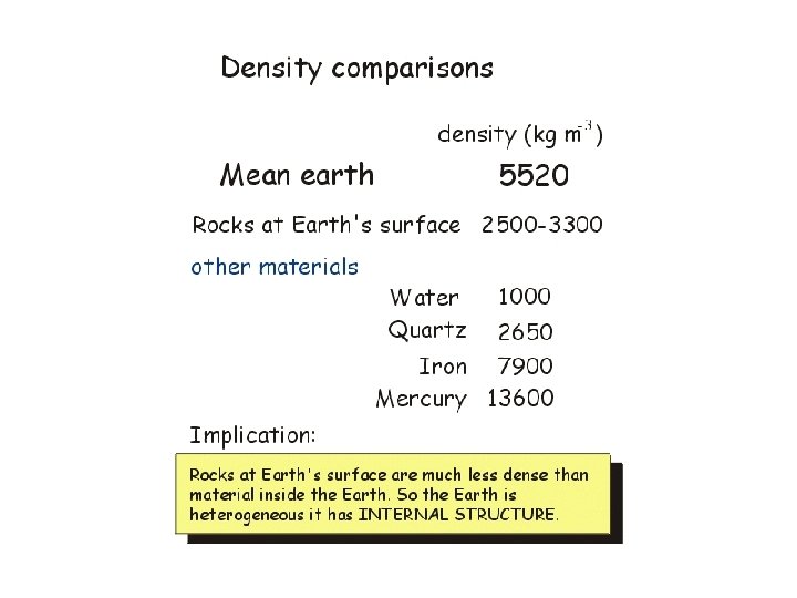
Evidence for Earth Structure • Seismic Waves • Density of Earth • Earth’s Magnetic Field • Meteorites
Seismic Waves 1. Surface Waves i). L-Waves (long waves) 2. Body Waves i). P-Waves (push waves) • travel through liquids & solids • fastest waves (4 – 7 km/s) ii). S-waves (shake waves) • travel through solids only • slower than P-waves (2 - 5 km/s) both travel faster as material gets more rigid & less compressible
Seismic Waves Velocity 3 2 4 Inner Core Mesosphere Outer Core 5 1 Lithosphere Asthenosphere 6 7
Mid-oceanic ridge Lithosphere Continental crust MOHO Granitic Basaltic Peridotite Asthenosphere Upper mantle Oceanic crust
Continental crust Lithosphere Oceanic crust (solid/brittle) (weak / 150 km Asthenosphere ductile) 250 km 6 2. 7 Granitic >65% 7 8 7. 8 3. 0 Basaltic 45 -52% 3. 3 Mesosphere Mantle (solid) 5. 5 [solid-state convection due to high pressures & temperatures over long periods of time] <45% 13 8. 0 2, 900 km Outer core Core Peridotite 8 10 (liquid) Metallic 0% (Fe , Ni , S) 5, 100 km Inner core (solid) 11 6, 300 km 14 Metallic (Fe & Ni) 0%
Seismic Waves Refraction Seismograph Station 2 • Direct • Reflected • Refracted Focus Boundary between layer 1 & 2 (Moho) Epicentre Seismograph Station Layer 1 (Crust) Layer 2 (Mantle) h = depth Хd = distance from epicentre where all seismic waves arrive at same time V 1 = velocity of P waves in layer 1 V 2 = velocity of P waves in layer 2
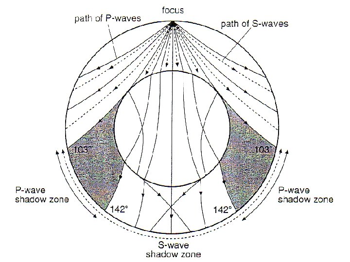
Suppose the shadow zone for P waves was located between 120 and 160º rather than 103 and 142º. What would this indicate about the size of the core?
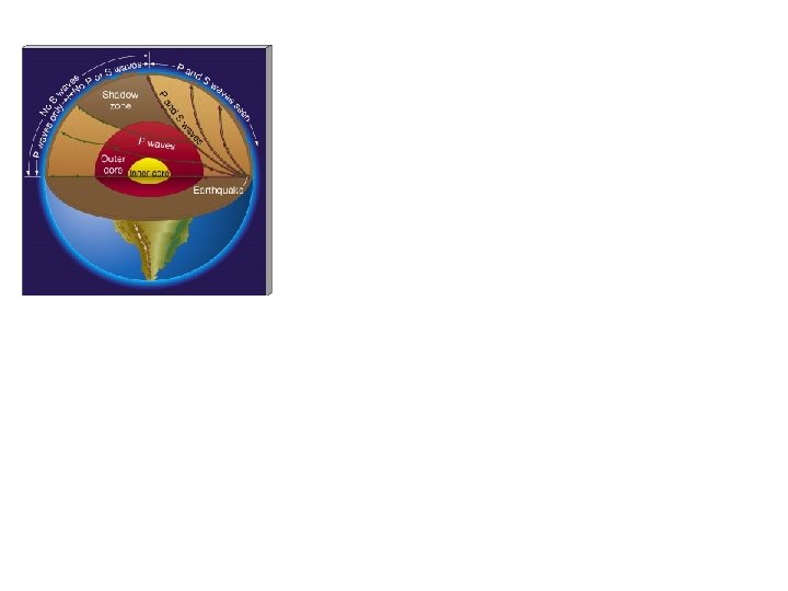
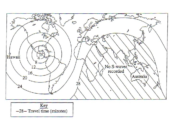
Why is there a S-wave shadow zone? There is a S-wave shadow zone from where the Swaves cannot reach the other side of the Earth as they are stopped by the liquid outer core. Liquids cannot transmit shear waves due to the weak bonding between particles.
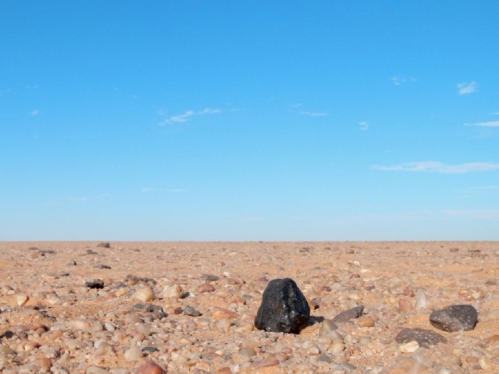
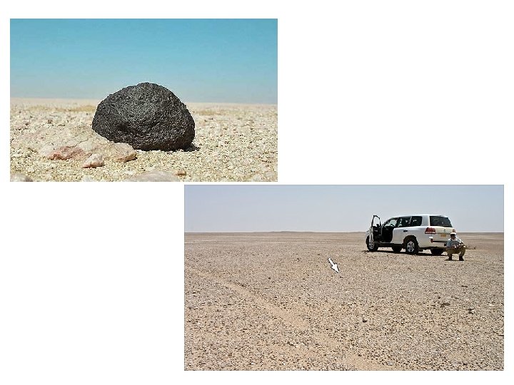
Meteorites
Meteorites Stony Meteorites
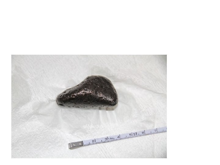
Iron Meteorites
Density
Earth’s Magnetic Field