
Earth observation data for everyone the CBERS experience
Earth observation data for everyone: the CBERS experience Gilberto Câmara Director, National Institute for Space Research
The need for global land observation n The world is changing rapidly ¨ Climate n Change is here to stay Global land observation is a crucial need for the world, but its future is uncertain ¨ MODIS is very useful, but has no future ¨ What will happen to LANDSAT? n Global land observation systems are a public good
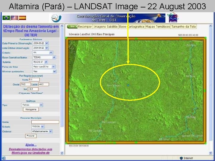
Altamira (Pará) – LANDSAT Image – 22 August 2003
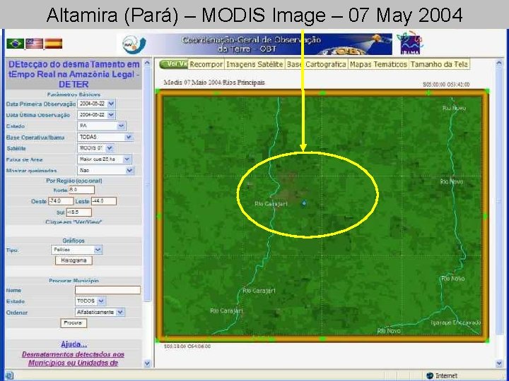
Altamira (Pará) – MODIS Image – 07 May 2004
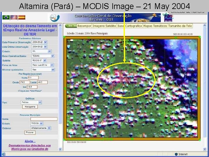
Imagem Modis de 2004 -05 -21, com excesso de nuvens Altamira (Pará) – MODIS Image – 21 May 2004
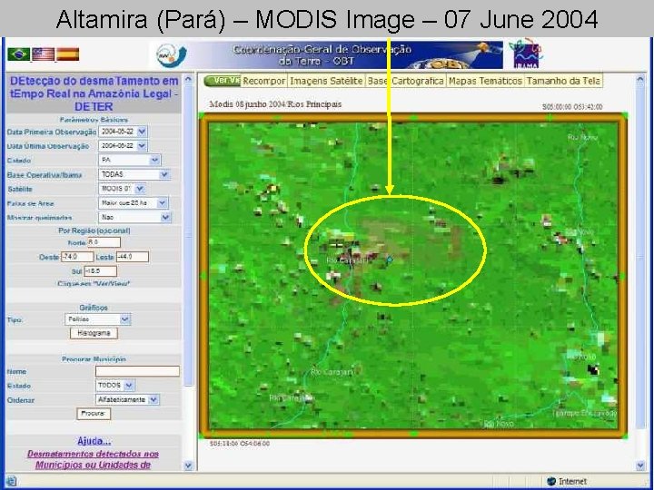
Altamira (Pará) – MODIS Image – 07 June 2004
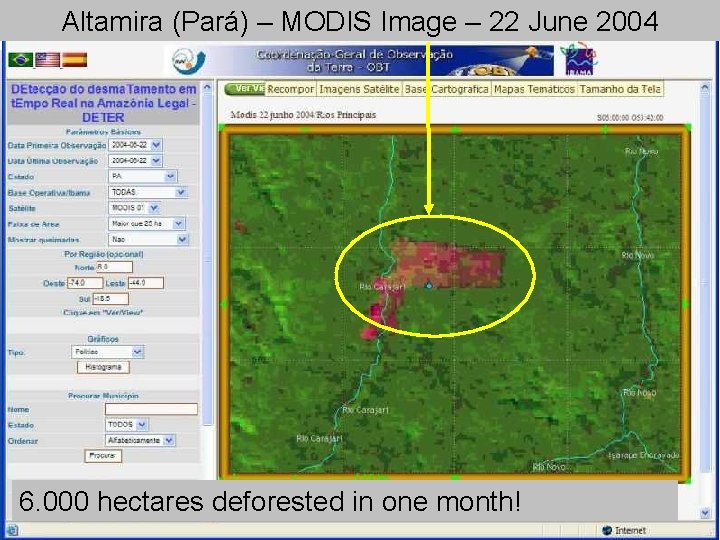
Altamira (Pará) – MODIS Image – 22 June 2004 6. 000 hectares deforested in one month!
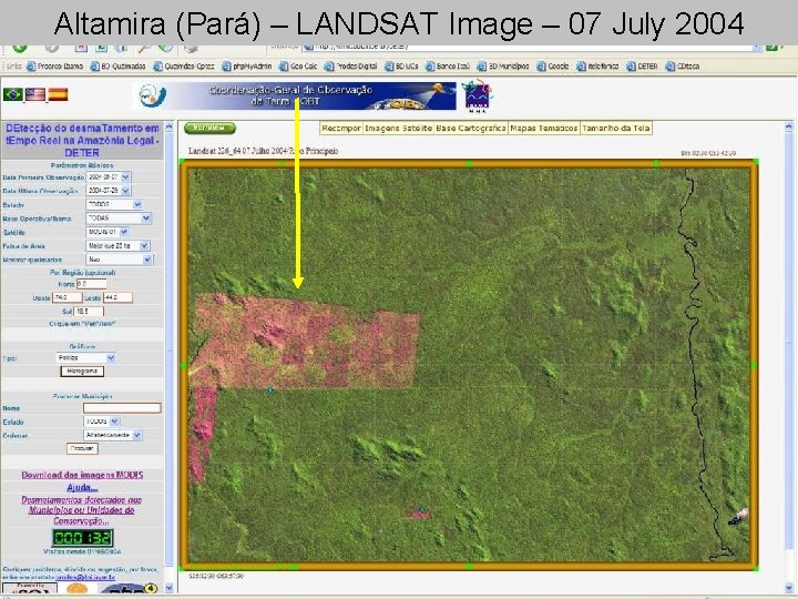
Altamira (Pará) – LANDSAT Image – 07 July 2004
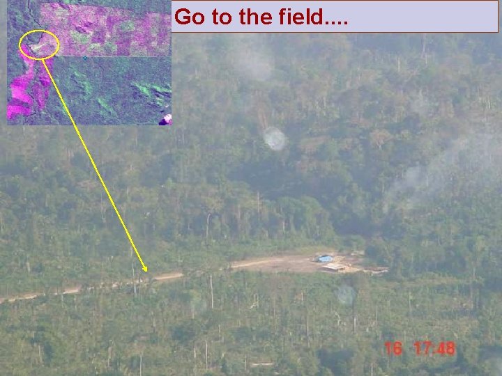
Go to the field. .
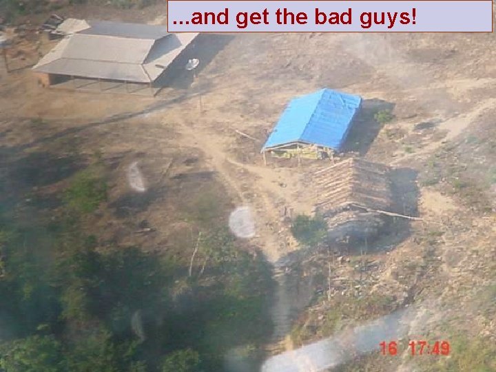
. . . and get the bad guys!
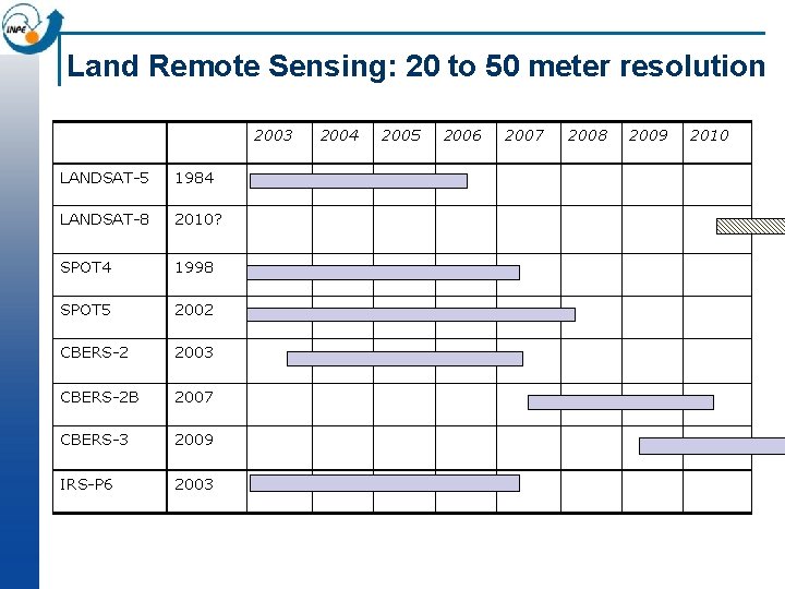
Land Remote Sensing: 20 to 50 meter resolution 2003 LANDSAT-5 1984 LANDSAT-8 2010? SPOT 4 1998 SPOT 5 2002 CBERS-2 2003 CBERS-2 B 2007 CBERS-3 2009 IRS-P 6 2003 2004 2005 2006 2007 2008 2009 2010
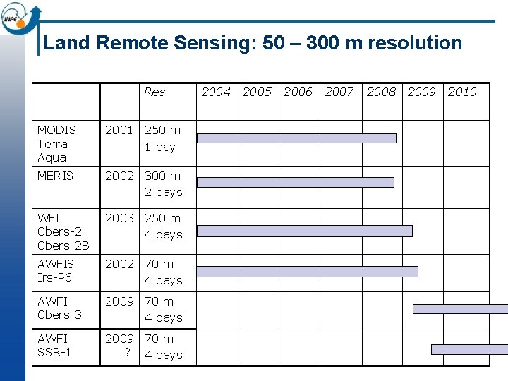
Land Remote Sensing: 50 – 300 m resolution Res MODIS Terra Aqua 2001 250 m 1 day MERIS 2002 300 m 2 days WFI Cbers-2 B 2003 250 m 4 days AWFIS Irs-P 6 2002 70 m 4 days AWFI Cbers-3 2009 70 m 4 days AWFI SSR-1 2009 70 m ? 4 days 2004 2005 2006 2007 2008 2009 2010
The 300+ million dollar question How do we obtain support for funding Earth Observation Missions? n Our answer: Make all sectors of society use publically funded EO data. . . n . . . by providing EO data for free!
Uncle Scrooge and the Internet n Uncle Scrooge: “A penny saved is a penny earned” n The anti-Uncle Scrooge principle: “A pixel saved is a penny wasted” n Why is that so?
The Internet paradox n The Internet has reduced the cost of data distribution to very close to zero n Society responds very quickly to open availability of free data and good on the Web
Brazilian and Chinese Strategy for CBERS n CBERS images received in Brasil are freely available on the Internet for Brazilian and Latin American users n CBERS images received in China are freely available on the Internet for Chinese users n A high-quality image processing software (SPRING) is also available free on the Internet in Brazil
CBERS: China-Brazil Earth Resources Satellite n Brief History ¨ Initial agreement signed in July 6 th, 1988, covering CBERS-1 and 2. ¨ In 2002, both governments decided to expand the initial agreement by including CBERS-3 and 4. n Program objectives ¨ Build a family of remote sensing satellites to support the needs of users in earth resources applications ¨ Improve the industrial capabilities of space technology in Brazil and China
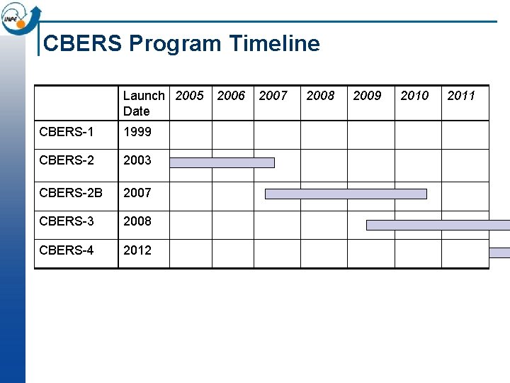
CBERS Program Timeline Launch 2005 Date CBERS-1 1999 CBERS-2 2003 CBERS-2 B 2007 CBERS-3 2008 CBERS-4 2012 2006 2007 2008 2009 2010 2011
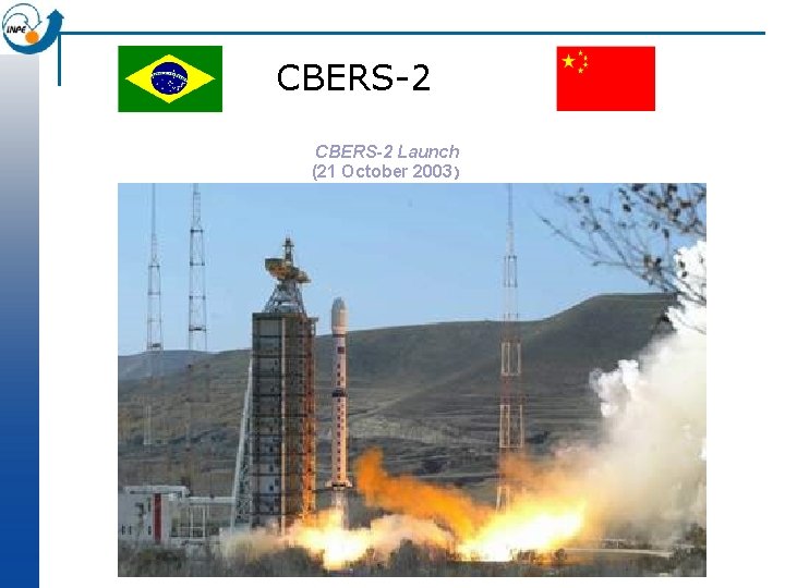
CBERS-2 Launch (21 October 2003)
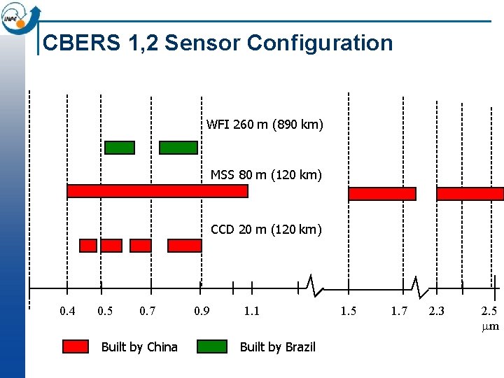
CBERS 1, 2 Sensor Configuration WFI 260 m (890 km) MSS 80 m (120 km) CCD 20 m (120 km) 0. 4 0. 5 0. 7 Built by China 0. 9 1. 1 Built by Brazil 1. 5 1. 7 2. 3 2. 5 mm
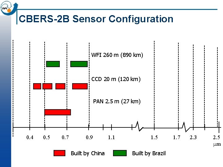
CBERS-2 B Sensor Configuration WFI 260 m (890 km) CCD 20 m (120 km) PAN 2. 5 m (27 km) 0. 4 0. 5 0. 7 0. 9 Built by China 1. 1 1. 5 Built by Brazil 1. 7 2. 3 2. 5 mm
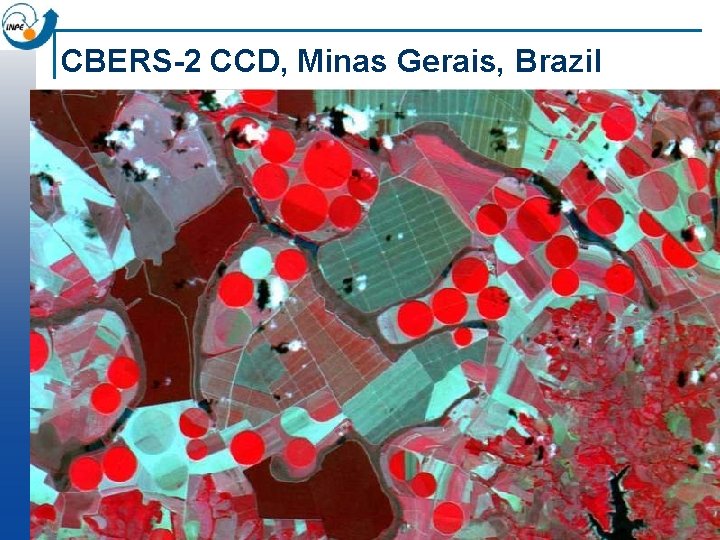
CBERS-2 CCD, Minas Gerais, Brazil
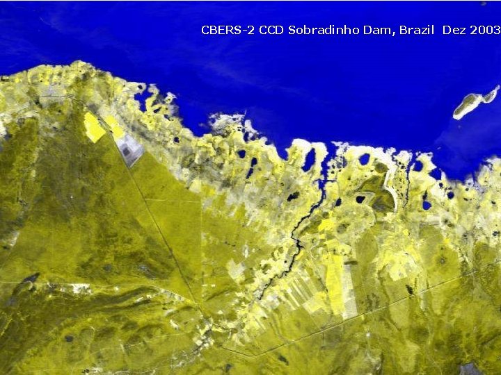
CBERS-2 CCD Sobradinho Dam, Brazil Dez 2003
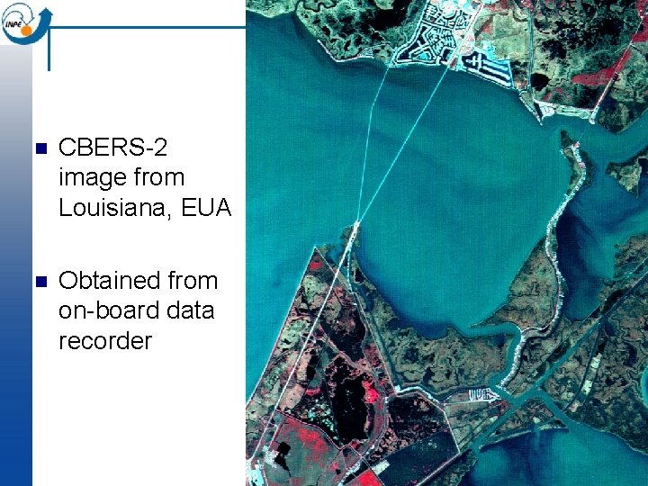
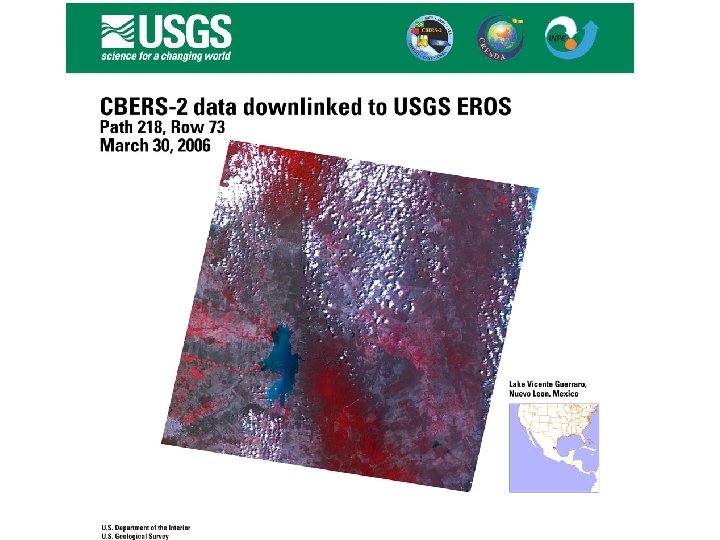
n CBERS-2 image from Louisiana, EUA n Obtained from on-board data recorder
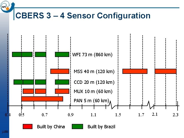
CBERS 3 – 4 Sensor Configuration WFI 73 m (860 km) MSS 40 m (120 km) CCD 20 m (120 km) MUX 10 m (60 km) PAN 5 m (60 km) 0. 4 mm 0. 5 0. 7 Built by China 0. 9 1. 1 Built by Brazil 1. 5 1. 7 2. 1 2. 3
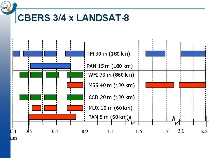
CBERS 3/4 x LANDSAT-8 TM 30 m (180 km) PAN 15 m (180 km) WFI 73 m (860 km) MSS 40 m (120 km) CCD 20 m (120 km) MUX 10 m (60 km) PAN 5 m (60 km) 0. 4 mm 0. 5 0. 7 0. 9 1. 1 1. 5 1. 7 2. 1 2. 3
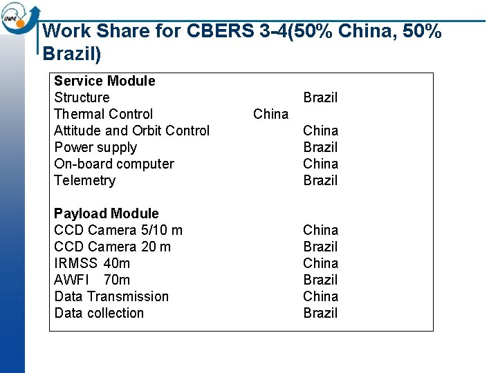
Work Share for CBERS 3 -4(50% China, 50% Brazil) Service Module Structure Thermal Control Attitude and Orbit Control Power supply On-board computer Telemetry Payload Module CCD Camera 5/10 m CCD Camera 20 m IRMSS 40 m AWFI 70 m Data Transmission Data collection Brazil China Brazil China Brazil
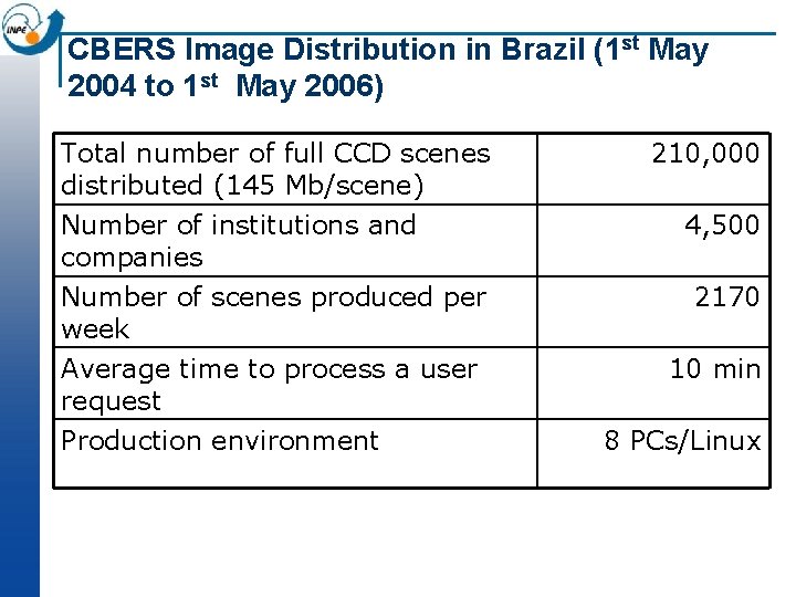
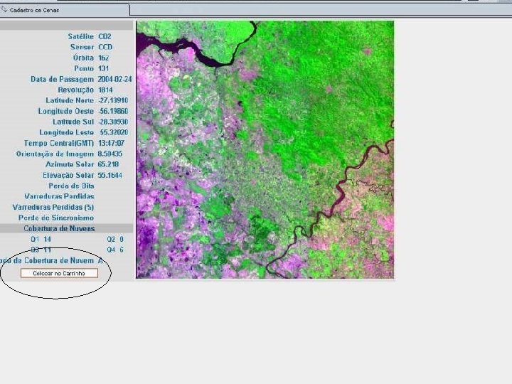
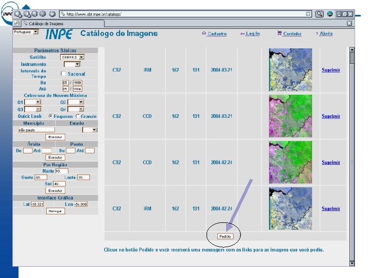
CBERS Image Distribution in Brazil (1 st May 2004 to 1 st May 2006) Total number of full CCD scenes distributed (145 Mb/scene) Number of institutions and companies 210, 000 Number of scenes produced per week 2170 Average time to process a user request Production environment 4, 500 10 min 8 PCs/Linux
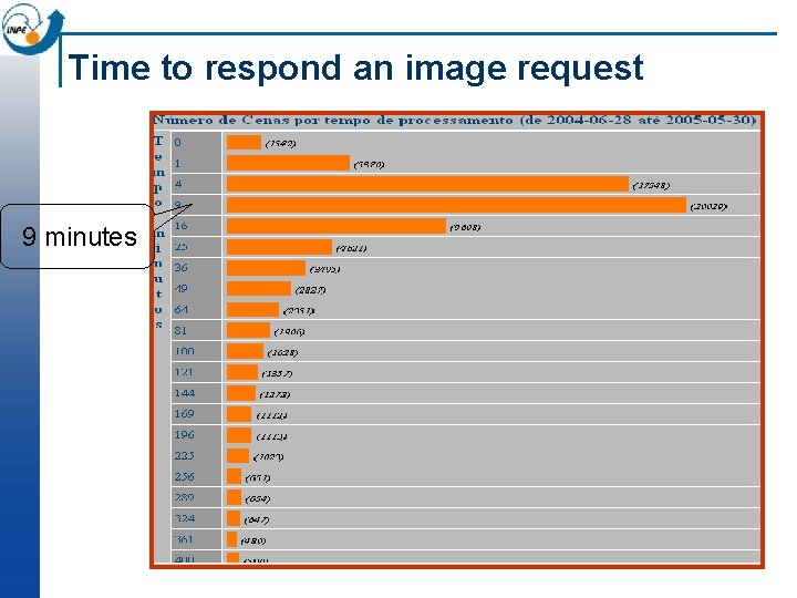
Time to respond an image request 9 minutes
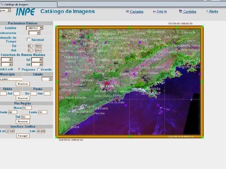
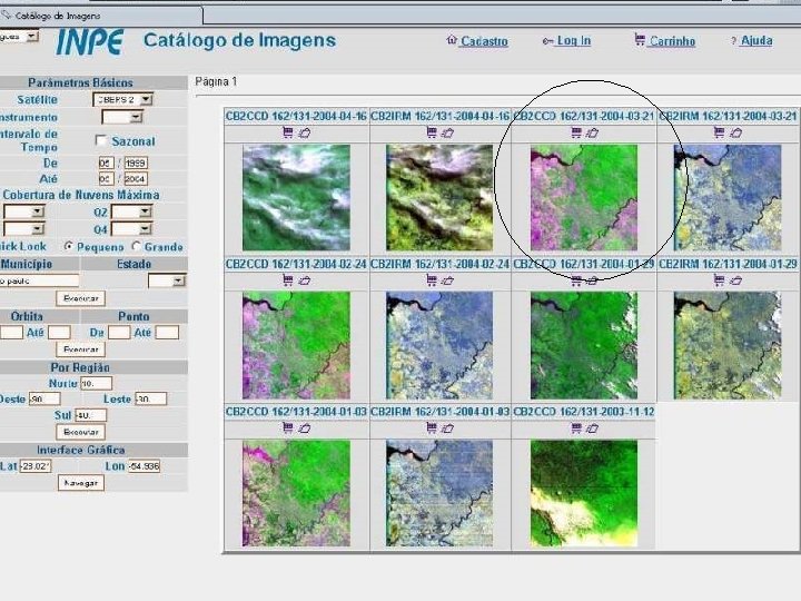
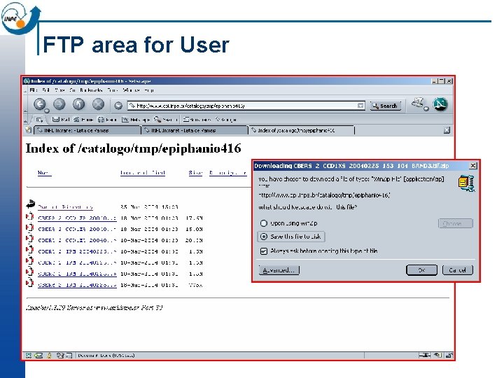
FTP area for User
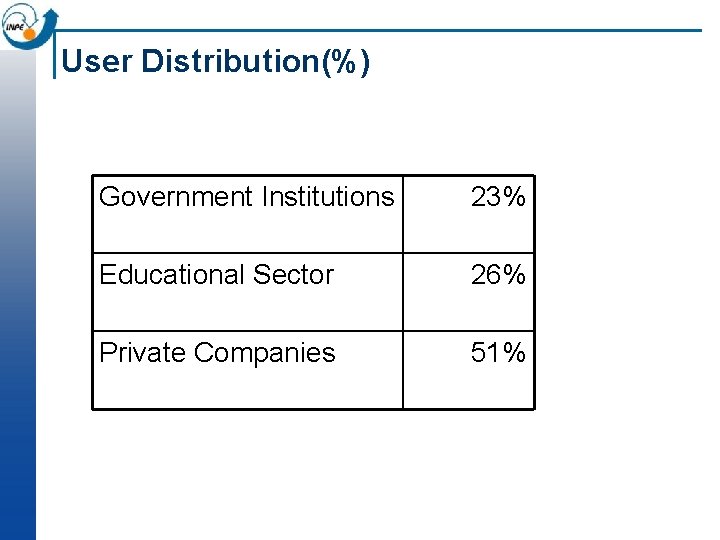
User Distribution(%) Government Institutions 23% Educational Sector 26% Private Companies 51%
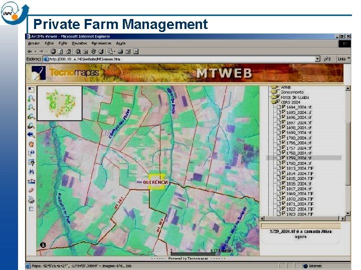
Private Farm Management
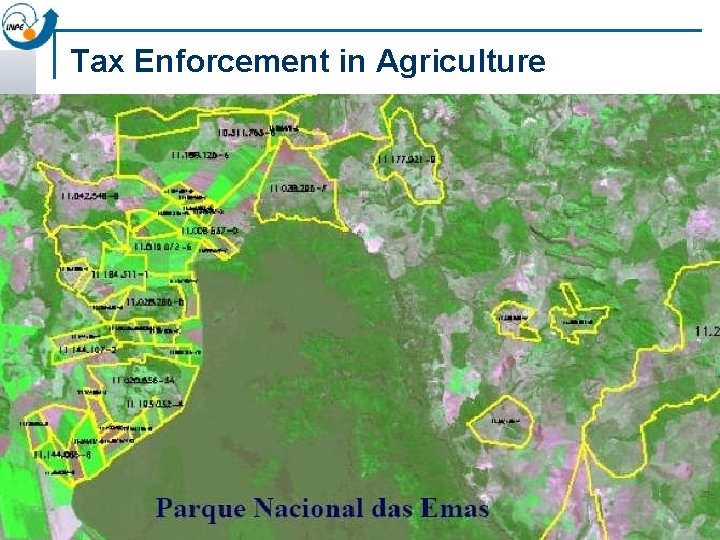
Tax Enforcement in Agriculture
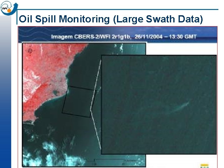
Oil Spill Monitoring (Large Swath Data)

Propaganda and Marketing
What do we get from free data? n n “With zero cost data access, technology dissemination has a much greater impact. ” “CBERS brought the freedom to have data immediately available when you need it. ” Free EO data and free EO technology create new users and new applications Increases the need for other types of EO data
What do the private companies say about free CBERS data? n Enables new business development n Facilitates trial uses for new clients n Planning new applications becomes easier n Creates jobs by reducing cost of data buys n Increases work quality by adding data previously unavailable
What have we learned? n There is an enormous demand for remote sensing data in developing countries n Free on-line data access can significantly increase the number of users of earth observation data n The CBERS data policy has been extremely well -received by government and society in Brazil
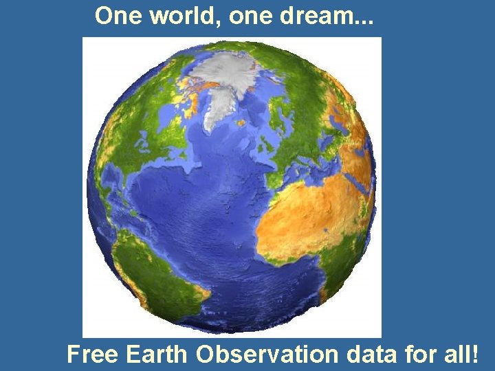
One world, one dream. . . Free Earth Observation data for all!
One world, one dream. . . n A consortium of Earth Observation satellites for global land observation (5 m+) n A network of cooperating ground stations n EO data free on the Internet, with global weekly coverage
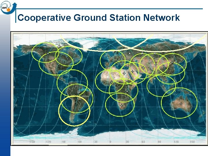
Cooperative Ground Station Network
Key questions (Donna Coutts and Achache) n n How do we develop services from Earth Observation data? How does the system change when everyone has ready access to space-based Earth observation?
Key questions (Donna Coutts and Achache) n n How do we develop services from Earth Observation data? How does the system change when everyone has ready access to space-based Earth observation? Create a market for services and high-resolution data by providing EO data at a massive scale!
- Slides: 49