Drought identification and prediction Kostas Andreadis Dennis Lettenmaier


- Slides: 17

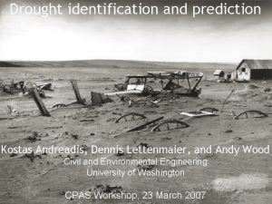
Drought identification and prediction Kostas Andreadis, Dennis Lettenmaier, and Andy Wood Civil and Environmental Engineering University of Washington CPAS Workshop, 23 March 2007

Motivation Drought one of the most costly natural disasters Annual costs estimated at $6 -8 B (FEMA, 1995), with recent western US drought (2002) cost over $10 B (NCDC, 2003) Drought monitoring and prediction Important to assess drought characteristics: severity, duration, frequency and areal extent PDSI most widely used Offers simplicity and standardization Not appropriate for high latitudes and during cold seasons

Motivation (cont'd) Alternative approach is to use hydrologic models to produce a spatially and temporally continuous dataset of more “direct” variables (soil moisture for agricultural and runoff for hydrological drought) Long-term and consistent precipitation and air temperature dataset from NCDC (1915 -now) Need method for objective identification and estimation of drought characteristics Near real-time implementation and drought recovery prediction using hydrologic forecasting

Hydrologic model Variable Infiltration Capacity (VIC) model Solves energy and water balance over gridded domain Accounts for subgrid variability in topography, land cover, soil moisture, and precipitation Streamflow estimated by routing runoff and baseflow through stream network Precipitation, air temperature and wind speed as input

Model validation VIC successfully applied in variety of climates and basins Good agreement for monthly streamflow compared with USGS observations Seasonal variability and temporal persistence of soil moisture flux well simulated when compared with point measurements Streamflow Comparisons Soil Moisture Comparisons

Drought identification Express soil moisture and runoff as percentiles relative to 1915 -2003 climatology Threshold approach to identify drought at different levels (20 th percentile here) Spatial contiguity constraint for initial drought segmentation Drought classification using constraints on Minimum area Minimum distance between clusters Neighborhood correlations Temporal continuity constraints “Drought tracking” in retrospective analysis Drought transition probability estimated from climatology

Drought identification maps

Spatial maps of drought Jul 1934 Nov 1952 Jun 1988 Jun 2002

Severity-Area-Duration analysis At each time step Identify drought events Keep track of their duration, severity and areal extent Adapted Depth-Area-Duration analysis replacing rainfall depth with drought severity For different predefined areas and durations calculates average severity of each identified event Essentially a way to compare droughts in terms of severity, duration and areal extent

Severity-Area-Duration curves Agricultural Drought (soil moisture) Envelope Curves

Potential drought products Take advantage of UW Surface Water Monitor and West-wide forecasting system Drought severity map (directly derived from drought identification algorithm) Drought duration and frequency (temporally continuous dataset allows direct definition) Maps of trends in drought characteristics S-A-D curves for comparisons of current with historical droughts Maps of probabilities of recovery from drought at different lead times

Drought severity product Week 1, 12/2005 Week 4, 3/2006 Week 4, 1/2006 Week 1, 4/2006 Week 1, 2/2006 Week 4, 5/2006

Drought recovery prediction methodology Use observed forcings to drive the model and produce “best knowledge” initial conditions forecast Drive the model with precipitation and temperature forcings unconditionally sampled from climatology creating an ensemble of model trajectories At different lead times, estimate probability of soil moisture/runoff percentile exceeding threshold from ensemble = probability of recovery

California-Arizona drought Drought severity ESP forecast Texas drought Ensemble “Observed”

Probability of drought recovery Initial Conditions (2/2006) 3 -month lead forecast (5/2006) 1 -month lead forecast (3/2006) 6 -month lead forecast (8/2006)

Summary Algorithm for objective identification and delineation of drought Combination with hydrologic forecasting to estimate probability of drought recovery Importance of initial hydrologic state – Potential for merging of satellite and ground observations (data assimilation) Replace current ESP approach with ensemble version of CPC “official” forecast, perhaps others included in westwide system Provide suite of drought products through UW Surface Water Monitor, and add GIS functionality to the webinterface

Questions?
 Kostas andreadis
 Dennis p. lettenmaier
 Kostas ostrauskas
 Kostas glampedakis
 Kostas ostrauskas
 Drought and desertification
 Positive identification example
 Dazzling in a sentence
 Hong kong drought
 Bibliography of drought in south africa
 Drought usaco
 Drought presentation
 Anasazi drought
 Conclusion on drought
 Vermont drought monitor
 Utah drought map
 Drought stopper system
 World, drought monitor
