Dr Hurm 2006 2007 Winter Forecast Official Farmers
- Slides: 62

Dr. Hurm 2006 -2007 Winter Forecast Official Farmers “Hurmanac” 2006 -2007 Winter Forecast My Entry for Winter Forecast Challenge

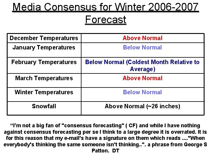
Media Consensus for Winter 2006 -2007 Forecast December Temperatures Above Normal January Temperatures Below Normal February Temperatures Below Normal (Coldest Month Relative to Average) March Temperatures Above Normal Winter Temperatures Below Normal Snowfall Above Normal (~26 inches) “I’m not a big fan of "consensus forecasting" ( CF) and while I have nothing against consensus forecasting per se I think to a large degree it is overrated. It is for this reason that my e-mail's have a signature on them which reads. . "When everybody's thinking the same someone isn't thinking. . ". a phrase from George S Patton. DT

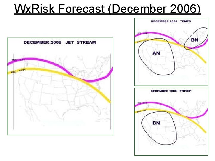
Wx. Risk Forecast (December 2006)

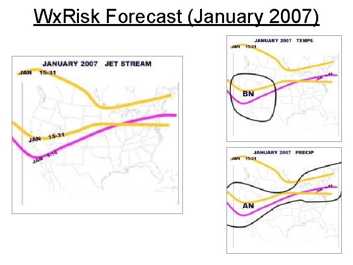
Wx. Risk Forecast (January 2007)

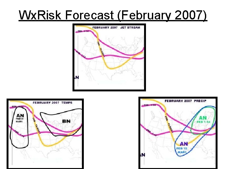
Wx. Risk Forecast (February 2007)

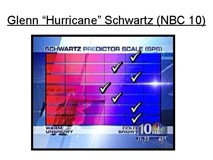
Glenn “Hurricane” Schwartz (NBC 10)

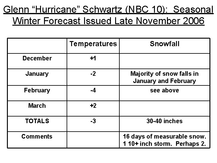
Glenn “Hurricane” Schwartz (NBC 10): Seasonal Winter Forecast Issued Late November 2006 Temperatures Snowfall December +1 January -2 Majority of snow falls in January and February -4 see above March +2 TOTALS -3 Comments 30 -40 inches 16 days of measurable snow. 1 10+ inch storm. Perhaps 2.

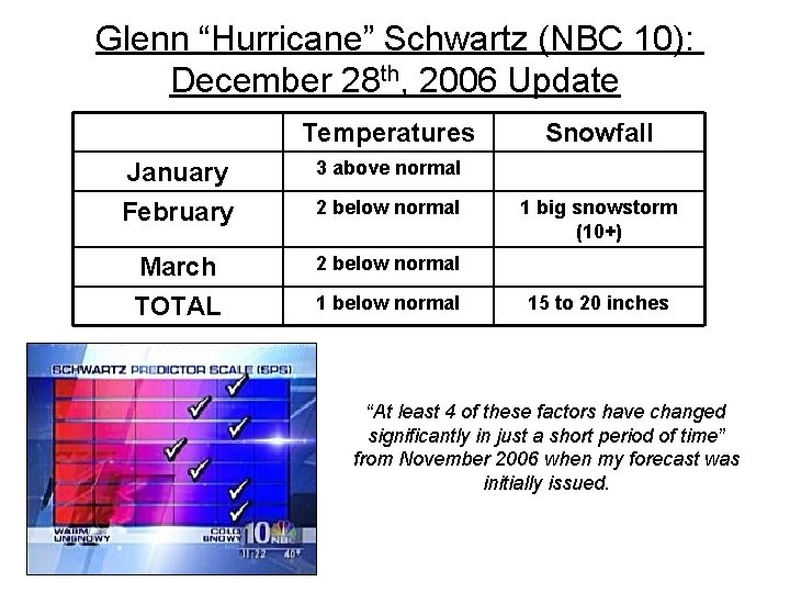
Glenn “Hurricane” Schwartz (NBC 10): December 28 th, 2006 Update Temperatures January 3 above normal February 2 below normal March TOTAL 2 below normal 1 below normal Snowfall 1 big snowstorm (10+) 15 to 20 inches “At least 4 of these factors have changed significantly in just a short period of time” from November 2006 when my forecast was initially issued.

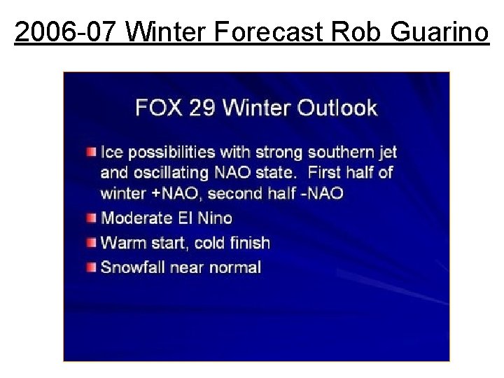
2006 -07 Winter Forecast Rob Guarino

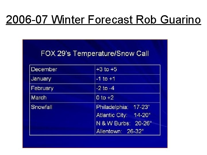
2006 -07 Winter Forecast Rob Guarino

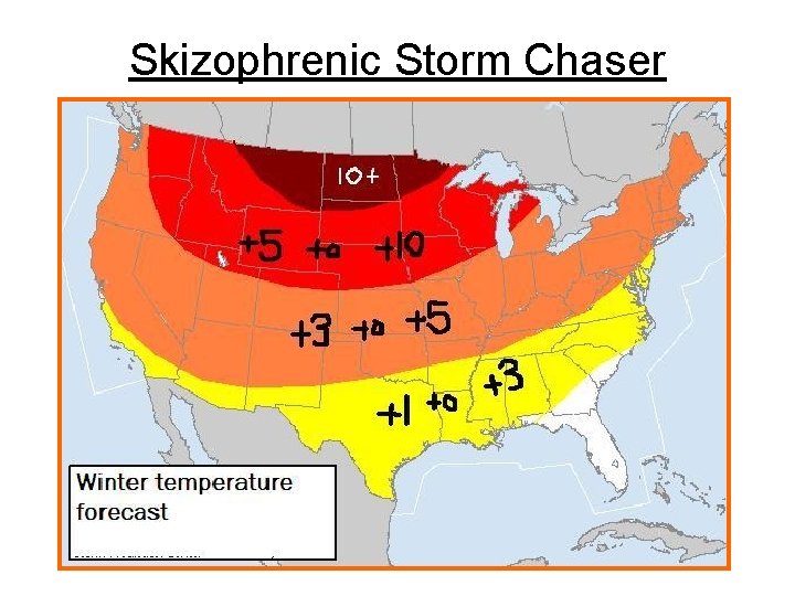
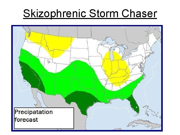
Skizophrenic Storm Chaser

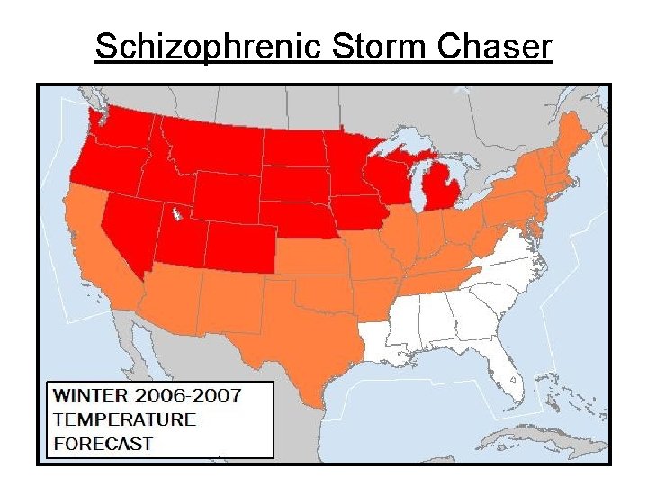
Schizophrenic Storm Chaser

Skizophrenic Storm Chaser

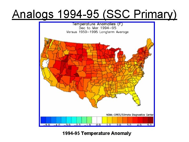
Analogs 1994 -95 (SSC Primary) 1994 -95 Temperature Anomaly

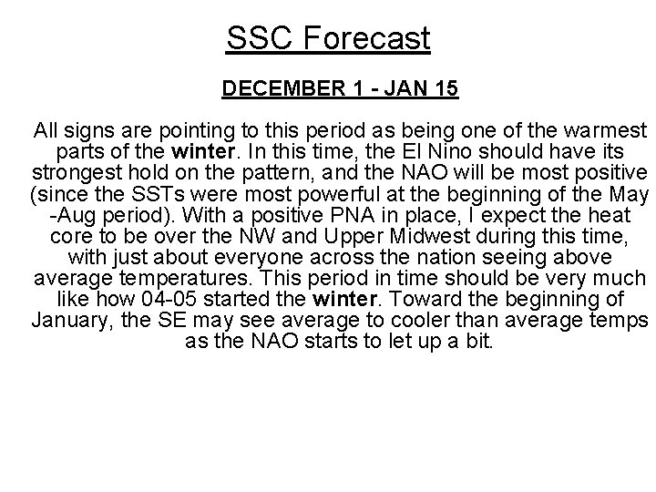
SSC Forecast DECEMBER 1 - JAN 15 All signs are pointing to this period as being one of the warmest parts of the winter. In this time, the El Nino should have its strongest hold on the pattern, and the NAO will be most positive (since the SSTs were most powerful at the beginning of the May -Aug period). With a positive PNA in place, I expect the heat core to be over the NW and Upper Midwest during this time, with just about everyone across the nation seeing above average temperatures. This period in time should be very much like how 04 -05 started the winter. Toward the beginning of January, the SE may see average to cooler than average temps as the NAO starts to let up a bit.

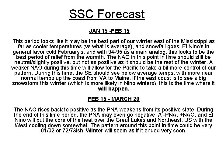
SSC Forecast JAN 15 -FEB 15 This period looks like it may be the best part of our winter east of the Mississippi as far as cooler temperatures (vs what is average), and snowfall goes. El Nino's in general favor cold February's, and with 94 -95 as a main analog, this looks to be the best period of relief from the warmth. The NAO in this point in time should still be neutral/slightly positive, but not as positive as it should be the rest of the winter. A weaker NAO during this time will allow for the Pacific to take a bit more control of our pattern. During this time, the SE should see below average temps, with more near normal temps up the coast from VA to Maine. If the east coast is to see a big snowstorm this winter (which is more likely in Nino winters), this is the time where it will happen. FEB 15 - MARCH 20 The NAO rises back to positive as the PNA weakens from its positive state. During the end of this time period, the PNA may even go negative. A -PNA, +NAO, and El Nino will put the core of the heat over the Great Lakes and Northeast, US with the West cooling down somewhat. The pattern around this point in time could be very 01/02 or 72/73 ish. Winter will seem as if it ended very soon.

SSC Forecast MARCH 20 -MAY 1 I know that this is beyond the "winter", but I just thought that I would mention this point in time since I am starting to see a very strong signal for a rapid change to a negative NAO during this time. A negative NAO along with a declining weak-Nino could make for some very strong cold weather across the nation. This is all preliminary, as it is very far out, but right now I would say that 1997 is the best analog for the start of Spring. The change in SSTs over the North Atlantic in the past 5 -6 weeks has been amazing. Unfortunately, that shouldnt impact our pattern until early Spring. Everything mentioned above is more of an educated guess than anything else, and I will grade my forecast only on the overall temperature and precip maps posted, so take the month-by-month breakdown for what its worth. IN CONCLUSION One other note. . A very warm gulf stream coupled with an El Nino means that we will see several storms bombing off the coast this winter. Even in Strong-Nino winters, there is the threat that one of the bombing lows could impact the Atlantic corridor at just the right time (82 -83), so although I'm predicting a warm winter, I think that the odds of us seeing a 1/50 year type storm are 1/5 this winter.

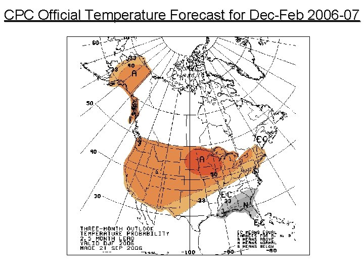
CPC Official Temperature Forecast for Dec-Feb 2006 -07

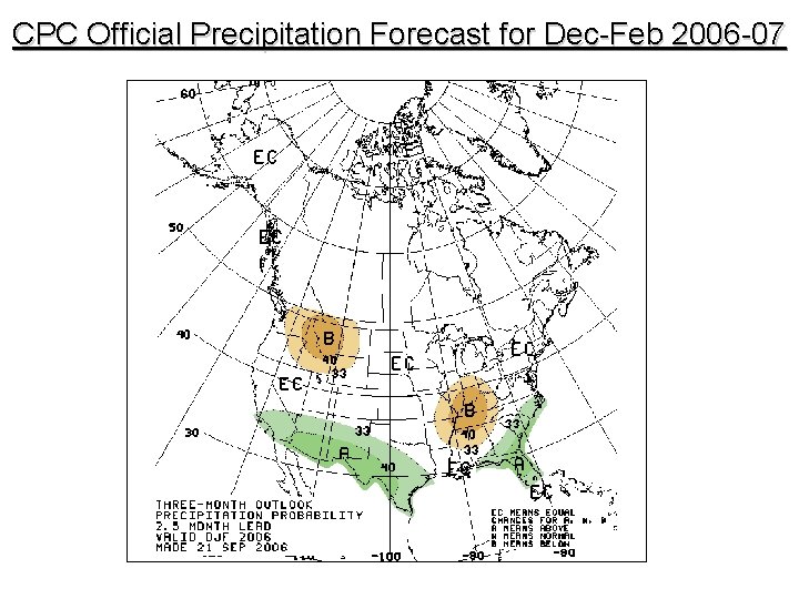
CPC Official Precipitation Forecast for Dec-Feb 2006 -07

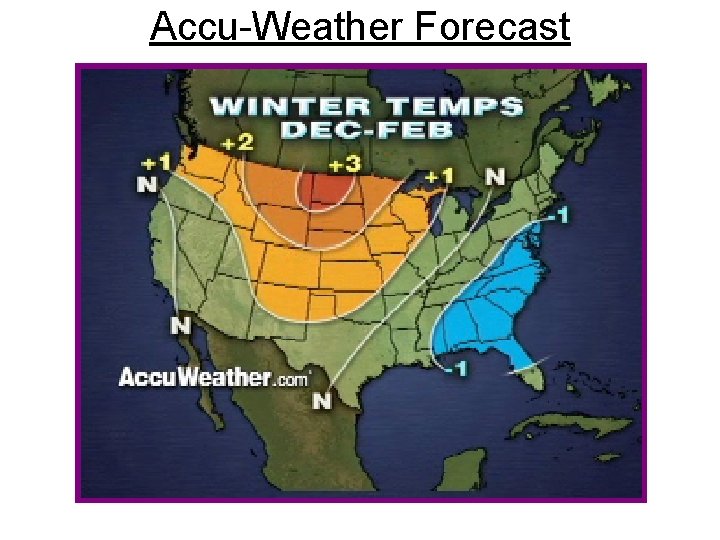
Accu-Weather Forecast

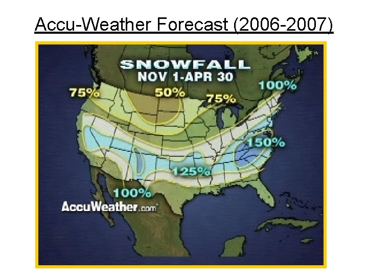
Accu-Weather Forecast (2006 -2007)

Accu-Weather (Comments Made Sept. 2006) El Niño's Influence Points to Milder Start, Colder End Than Normal for Heating Oil-Dependent Northeast Chief Long-Range Forecaster Joe Bastardi predicts that the coming winter is shaping up to be quite different than last year's. The El Niño pattern that has noticeably impacted the 2006 hurricane season will lead to colder temperatures for the northeastern U. S. and Midwest, and a milder winter for the West Coast.

Accu-Weather (Sept. 2006) The winter in the Northeast and Midwest is expected to begin mild before turning significantly colder in January and February as cold air pours down from Canada. Overall, New York City and Boston are expected to average slightly below normal for the three-month winter period of December through February. The winter along the East Coast and Gulf Coast will be marked by stormy weather, because of the pattern created by the El Niño that formed this summer and was identified by Bastardi in the late spring.

Accu-Weather (Sept. 2006) El Niño and the East Coast Winter An El Niño - a cyclical warming of Pacific Ocean waters - directs strong wind currents that tend to hinder hurricane development in the Atlantic Basin during the summer, and lead to a more active southern jet stream in the winter, which creates a wetterthan-normal pattern for the South and Southeast U. S. This precipitation works its way up the East Coast, bringing more storms to the region. "While the East Coast will most likely experience more precipitation, it is too early to tell whether the majority of this precipitation will be in the form of rain or snow, " said Bastardi. "Timing will be the key in the major cities of the East Coast. Cold air from the north arriving too early or too late would lead to more rain and less snow. " Added Bastardi, "Given the overall pattern and the water temperature profile we expect, the region will likely see one or two major Nor'easters. "

Accu-Weather (Sept. 2006) Winter in the Rockies and the West Coast As with previous El Niño years, a large high-pressure system will likely sit over the Rockies this winter, which will keep conditions relatively drier and warmer than normal. "Skiers and ski resort operators in the Rockies may not be pleased by the prospect of less snow this winter, " said Reeves. "Of potentially greater impact, though, will be the effects that a drier winter will have on areas in the region that rely on waters that come from the melting snow pack. With the possibility of less snow this winter, there could be less water available next year. " As for the West Coast, Bastardi forecasts that temperatures will be above average across much of the region.

Accu-Weather (Sept. 2006) Winter's Effect on Energy Prices "While temperatures in the Northeast will start out warmer than normal, a shift to colder weather during the final two months of winter will result in slightly below normal temperatures for the three-month period. This will lead to consumers needing more heating oil or natural gas than they did during last year's exceptionally mild winter, " said Accu. Weather. com Director of Forecast Operations Ken Reeves. "Chicago, which is dependent on natural gas heat, experienced relatively warm winters the past few years, and we expect this pattern to change this year. The last time we had an El Niño - the winter of 2002 -2003 - Chicago had to contend with slightly colder-than-average temperatures. " "That said, " added Reeves, "in most areas, we do not expect sustained exceptionally extreme temperatures, so energy prices will likely react more to economic and political conditions than to meteorological ones this winter. "

JB 2006 -2007 Winter Forecast MAJOR COASTAL STORMS In other winters, the stormy, wet fall we are having in the south and east may take the energy out of the dead of winter, however we are in the warm cycle of the Atlantic Multidecadal Oscillation and the only close El Nino we have in that cycle is 57 -58. The moral, for snow lovers from Texas to the Northeast and even back into the Midwest, its a winter of storms and rumors of storms. I think there is a lot of snow this winter relative to normal from the South right up the East Coast with the threat of a couple of severe Nor’easters. Not as cold as 77 -78, but perhaps as stormy. Perhaps another way to say it not as warm as 92 -93 but as stormy. Both had severe late (Feb on) winter events to go along with a spraying of major events that seemed to get wilder with each month.

JB 2006 -2007 Winter Forecast SEVERE COLD SHOTS I do think the pattern of the 3 winters before last, a 10 15 day period of major cold in the areas that demand the most energy, returns. If we look at NYC/ORD couplet in 02 -03, 03 -04, and 04 -05, each had outstanding cold periods. I think these certainly return this winter and unlike last January's vacation, the tale may be very different then.

JB 2006 -2007 Winter Forecast MODELS This is going to be an ugly winter for model accuracy and I think you are seeing this already. It does not help that with each model run, the lemmings run for what ever is in front of them. It is interesting to note that in a couple of recent visits with other clients, I demonstrated to them the idea I did not have to look at a computer run from NCEP to tell if the run was colder, all I did was go to the price of natural gas as the run came out and one could predict whether the run was colder or warmer in the major areas than the run before. I do not know what to do about this except to make sure the steady drumbeat of reality works enough to offset this and lead to opportunity. In any case with the tendency toward blocking, the enhanced southern branch and the fact that all the winters recently have had large areas of extreme cold (last year it happened to be in Asia in the dead of winter), it would appear that more than the usual model mayhem will reign.

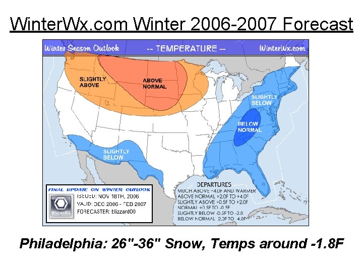
Winter. Wx. com Winter 2006 -2007 Forecast Philadelphia: 26"-36" Snow, Temps around -1. 8 F

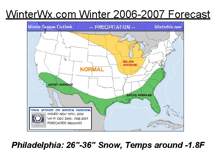
Winter. Wx. com Winter 2006 -2007 Forecast Philadelphia: 26"-36" Snow, Temps around -1. 8 F

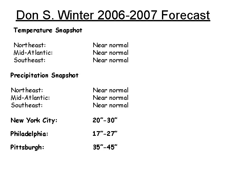
Don S. Winter 2006 -2007 Forecast Temperature Snapshot Northeast: Mid-Atlantic: Southeast: Near normal Precipitation Snapshot Northeast: Mid-Atlantic: Southeast: Near normal New York City: 20”-30” Philadelphia: 17”-27” Pittsburgh: 35”-45”

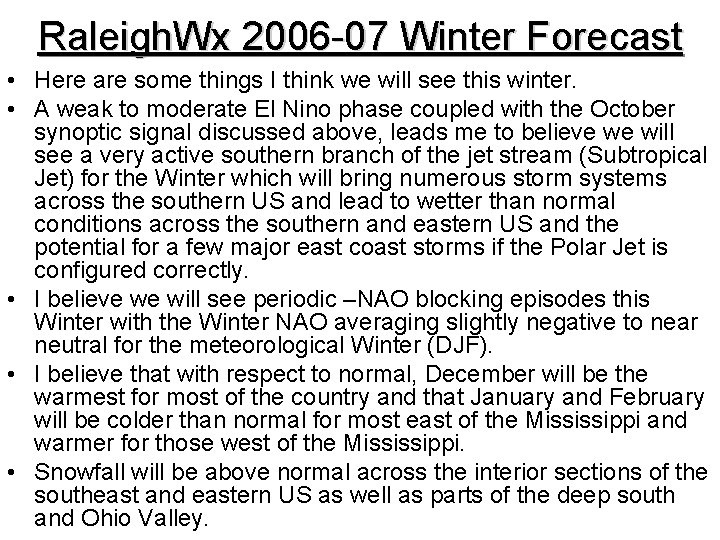
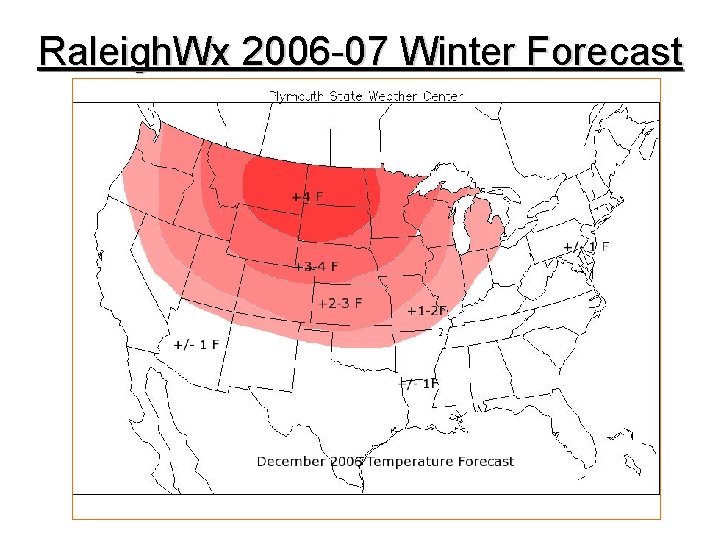
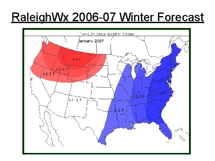
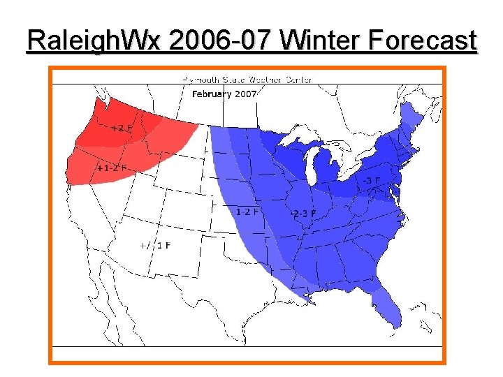
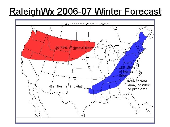
Raleigh. Wx 2006 -07 Winter Forecast • Here are some things I think we will see this winter. • A weak to moderate El Nino phase coupled with the October synoptic signal discussed above, leads me to believe we will see a very active southern branch of the jet stream (Subtropical Jet) for the Winter which will bring numerous storm systems across the southern US and lead to wetter than normal conditions across the southern and eastern US and the potential for a few major east coast storms if the Polar Jet is configured correctly. • I believe we will see periodic –NAO blocking episodes this Winter with the Winter NAO averaging slightly negative to near neutral for the meteorological Winter (DJF). • I believe that with respect to normal, December will be the warmest for most of the country and that January and February will be colder than normal for most east of the Mississippi and warmer for those west of the Mississippi. • Snowfall will be above normal across the interior sections of the southeast and eastern US as well as parts of the deep south and Ohio Valley.

Raleigh. Wx 2006 -07 Winter Forecast

Raleigh. Wx 2006 -07 Winter Forecast

Raleigh. Wx 2006 -07 Winter Forecast

Raleigh. Wx 2006 -07 Winter Forecast

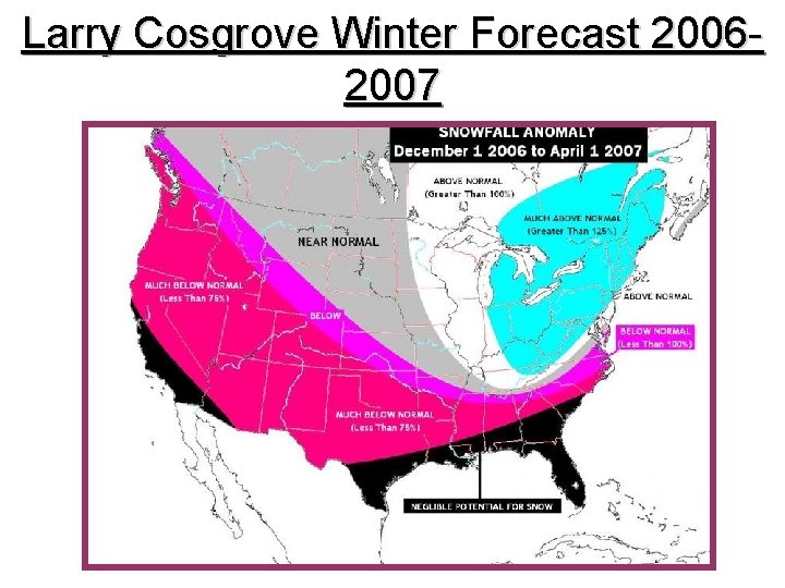
Larry Cosgrove Winter Forecast 20062007

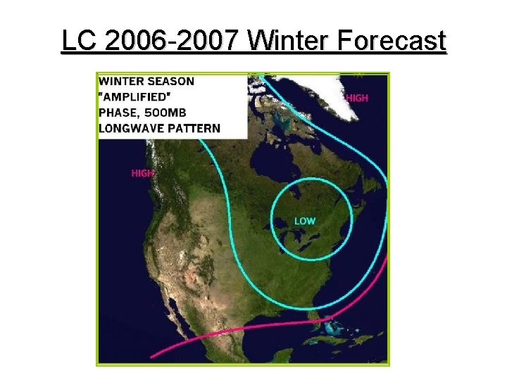
LC 2006 -2007 Winter Forecast

LC 2006 -2007 Winter Forecast

LC 2006 -2007 Winter Forecast

LC 2006 -2007 Winter Forecast

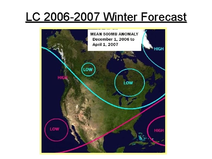
LC 2006 -2007 Winter Forecast

LC 2006 -2007 Winter Forecast Importance Of El Nino Event While essentially best termed a weak, basin-wide +ENSO episode over the equatorial Pacific Ocean, there are some defining tendencies of the oceanic temperature field. The western sector has cooled somewhat, while upward spikes are noted in the central and eastern domains of the oscillation character. With cool anomalies very noticeable west of California and Mexico, it is highly probable that a recurrent moist and energetic subtropical jet stream will be noted from the Baja California Peninsula into the lower Mississippi Valley. When this flow pattern phases with the northern branch, as has been seen four times this autumn, heavy precipitation events will be noted from eastern Texas all the way into New Brunswick and southern Quebec. A persistent subtropical high, often seen in El Nino years, has been observed in the vicinity of the Bahamas and western Sargasso Sea, and occasionally may retrogress to near Florida. This anticyclone may strengthen the moisture fetch while also bringing bouts of warm to the Deep South.

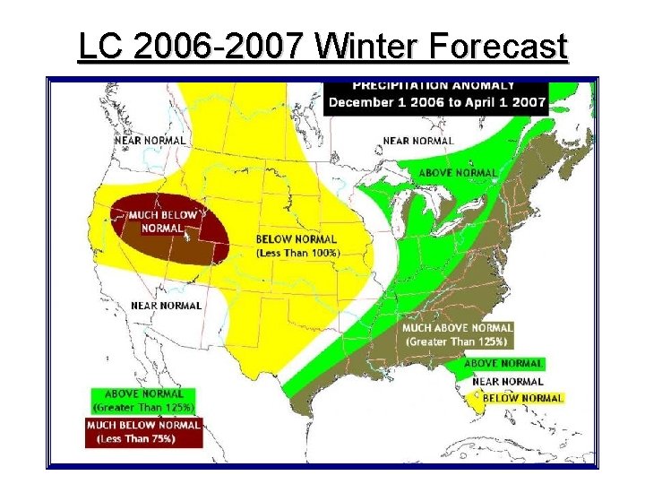
LC 2006 -2007 Winter Forecast First Key Element Of The Forecast: Southern Branch Phases With Polar Jet Stream While the often-observed "El Nino Cutoff Low" has been an erratic presence off of the coastline of California, the subtropical jet stream has found a home from near the Equator into northern Mexico and eventually Texas. Several times in this energetic flow has phased with the northern branch, bringing widespread severe weather, heavy rain and powerful straightline, gradient derived winds to parts of the Midwest, Northeast, and eastern Canada. In October, two such storms actually pulled in enough cold air for heavy snows in lake-related events. So with the coming of winter and a lower sun angle against a growing snow field, frozen precipitation could be a major threat to those regions which recently have had excessive rains.

LC 2006 -2007 Winter Forecast Second Key Element Of The Forecast: Never-Ending Supply Of Moisture The astounding pattern seen all across the Northern Hemisphere has been the relative ease with which midlatitude cyclones have been able to tap deep tropical (i. e. equatorial) moisture. While the aforementioned +ENSO association helps this condition in the U. S. , notice that the intake of higher dew-points continues even as the deep storms move north and east. Unless this moist advection occurrence eases or ends during the winter, there will be cases of high precipitable water with colder air, a sure formula for snow and ice within cold and overrunning sectors of cyclones.

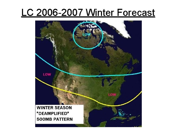
LC 2006 -2007 Winter Forecast Third Key Element Of The Forecast: The Tendency For NAO-Styled Blocking We are only now coming out of a long-duration example of NAO -styled blocking. A few times during the fall PNA-styled thumb projection ridges have built into BC and AK, but the two and a half week show of a positive height anomaly building over Iceland before retrogressing to NU has been noteworthy. With very strong closed low still taking shape west of the British isles, and Atlantic Ocean SST anomalies favoring a warm "trap" east of NL, the stage is set for at least a few more displays of Rex signatures in the NAO positions. The formation of such anticyclones can only mean colder thermal profiles across the eastern half of Canada and a good chunk of the U. S. to the right of the Rocky Mountains.

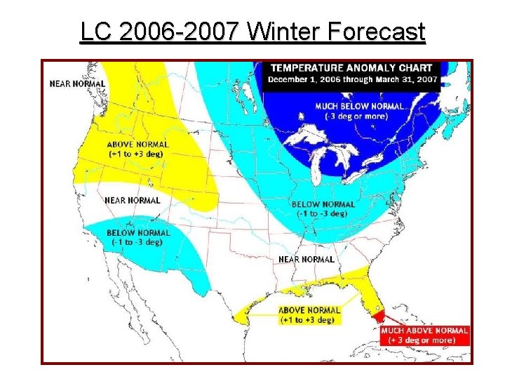
LC 2006 -2007 Winter Forecast Temperature In a "worst-case" scenario, where +PNA and -NAO derived ridges create deep troughs across eastern North America, c. Ak regimes will occupy a good portion of the U. S. to the right of the Rocky Mountains. Another example of cooler air impacts may be in the Southwest, where El Nino derived closed lows work inland from offshore of California and Baja California. The ongoing strength of subtropical jet stream flow and a heat ridge (near the Bahamas) will act to keep the immediate Gulf Coast and Florida warm for most of this winter, while a tendency for thumb-projection ridging along the western rim of the continent should bring a milder and drier than normal tendency to weather in the Pacific Northwest. Breakdowns in the amplified jet stream tendency (with importation of m. P and Im. P regimes) should keep seasonal averages tolerable in the Great Plains and Tennessee Valley.

LC 2006 -2007 Winter Forecast Precipitation The storm track patterns during the autumn have been refreshingly simple: digging shortwaves from Alberta; occasional inputs from the Southwest resulting in Colorado/Trinidad cyclones; and southern branch systems that move through the Old South before turning northward along the Atlantic Coastal Plain. In about half of all storms this fall, there has been a phasing of the northern and southern jet streams resulting in high volume of precipitation, severe weather and even bombogenesis. With ongoing overall SST anomalies, and a weak El Nino still present through the winter, we can probably expect some shift of storm tracks to the south. That would mean any phased systems might redevelop in classic cases of secondary cyclogenesis off of the shoreline of the Carolinas, and c. Pk or c. A input into the northwest quadrant of the lows. In the cases of the deepest storms, lake-related and lake-effect squalls may develop. The best potential for excessive precipitation will be along the subtropical jet stream and its phased presence with the polar westerlies, roughly along and 300 miles either side of an axis from Houston TX to Rimouski QC.

LC 2006 -2007 Winter Forecast Snow And Ice Were this a strong or a truly moderate El Nino, with resultant warmer temperature profiles along apparent storm tracks, frozen precipitation types would be much less likely. But this particular +ENSO episode falls within the weak category, and is already showing erosion on its western flank. With warmer subsurface readings about to "max out" and blending into the top oceanic layer, the stage will be set for an active southern stream interlocking with and often phasing with northern branch flow over the Midwest and Eastern Seaboard. This set-up allows for cold air infiltration, hence offering the potential for snow and ice production in the cold and overrunning sectors of storms. Because the lower latitude flow may have periods of particular strength, warm advection may keep frozen types out of the Deep South entirely while bringing about change or mixing to the Mid-Atlantic region and New England shoreline. I suspect there may be a passing resemblance to the events of 1993 -94 (although that season is not a particularly good match in terms of ENSO or other climatic indices) from lower Appalachia into the Northeast. But where cold advection is prevalent (which should be fairly often if thermal trends seen this fall continue), the Great Lakes snow belts, the middle and upper Appalachian Mountains and a good portion of the Interstate 95 and 81 corridors could be hit with several high-impact snow events.

LC 2006 -2007 Winter Forecast SUMMARY Combined a weak El Nino episode that may decay in late winter, thus shutting down or diminishing the vaunted southern branch moisture feed, and recurrent strong NAO-styled blocking in locations stretching from Nunavut AR to Iceland (which should suppress the polar or Arctic jet streams in latitude), and the stage is set for a colder than normal, fairly snowy winter season across the Midwest and Northeast. With occasional +PNA positive height anomalies in place over the West and a subtropical high likely to be centered near or just east of the Bahamas, then it becomes evident that temperatures will stay moderate or warm across the Intermountain Region and along the immediate Gulf Coast, including Florida. Precipitation may be sparse in these same vicinities, owing to the strength of the anticyclones. However, with the pulsations of the El Nino energizing the lower latitude jet stream, precipitation can expected to be well above normal from parts of Texas into the upper St. Lawrence Valley. Where moisture intersects the incoming cold air, such as in the Ohio Valley, Appalachia, and the Northeast, snowfall can be expected to run above average. In some cases, icing may be an issue with the very warm m. T fetch overrunning the cold dome (in a manner similar to 1993 -94).

2006 -2007 Winter Forecast (OSU 2) • THE CALL: PHL NUMBERS: PHL Ave: 19. 6 Inches PHL Snow Total: 21 -26 Inches. (Favoring Slightly Above Normal Snowfall. ) I am going below the analog average but above the PHL yearly snowfall average. There is a history of overrunning precipitation situations in many of the analog years. With the NAO averaging negative over the last few months, I do think we see a flip to a more positive phase for parts of the winter. However given the warm pool in the Northern Atlantic, I do not think a positive NAO can be sustained over a long period of time. The NAO winter average overall should be negative. The Southern Jet will supply the moisture like a typical El Nino year, which will aid in making the pattern stormy. Any overrunning situation will need to be monitored for the potential of icing as southern moisture rides over the more dense cold air at the surface. Temps: Normal To -0. 5 F (Could be a period of extreme swings (+/-) given the Southern Jet and the amount of blocking). ERIC

HM 2006 -2007 Winter Forecast General Pattern Discussion and Storm Threats: The El Nino development is not like that of 02 -03 and 04 -05 where the center of the strongest warmth was focused in NINO region 3. 4 and slowly the anomalies dropped towards South America. This year, the entire basin is warm right to the S. American coast. The 850 mb winds have had a westerly anomaly across the Central American waters/eastern tropical pacific and the waters are all above normal here, Gulf of Mexico and western Atlantic. The Latent Heat Flux should be above normal for the rest of the Autumn and into the early winter. On some global seasonal models that predict LHF, and interesting thing can be noted: That we can assume that when the NAO is not helping, the CONUS will be blazing! There will be a tremendous heat pump. IT will supply tons of moisture / instability, which can already be seen this autumn w/ the consistent storminess.

HM 2006 -2007 Winter Forecast THE IOD phase affected the STJ ridge in the west pacific, displacing it south. With the SSTA like they are in the north pacific (warm couplet in NE PAC), displaced STJ ridge and the "pump setup" in the eastern pacific, we can get a general pattern that can be described w/ frequent split flow w/ low anomaly 25 N / 140 E and high anomaly around 50 N and 140 E. This pattern will continue to repeat setting up a very typical el Nino picture in the seasonal means. If the NAO / AO are positive, expect very warm conditions for much of the CONUS, even more so than in a neutral winter. Expect very warm DJF temp anomalies in the NW USA / n-c states potentially exceeding +4!

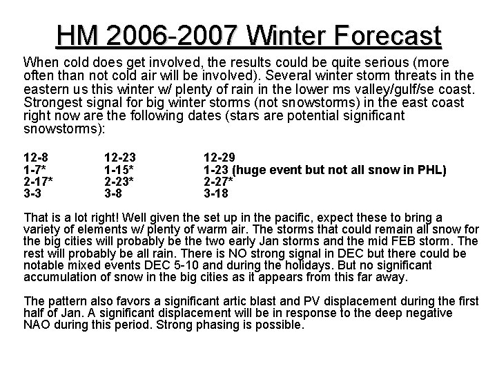
HM 2006 -2007 Winter Forecast When cold does get involved, the results could be quite serious (more often than not cold air will be involved). Several winter storm threats in the eastern us this winter w/ plenty of rain in the lower ms valley/gulf/se coast. Strongest signal for big winter storms (not snowstorms) in the east coast right now are the following dates (stars are potential significant snowstorms): 12 -8 1 -7* 2 -17* 3 -3 12 -23 1 -15* 2 -23* 3 -8 12 -29 1 -23 (huge event but not all snow in PHL) 2 -27* 3 -18 That is a lot right! Well given the set up in the pacific, expect these to bring a variety of elements w/ plenty of warm air. The storms that could remain all snow for the big cities will probably be the two early Jan storms and the mid FEB storm. The rest will probably be all rain. There is NO strong signal in DEC but there could be notable mixed events DEC 5 -10 and during the holidays. But no significant accumulation of snow in the big cities as it appears from this far away. The pattern also favors a significant artic blast and PV displacement during the first half of Jan. A significant displacement will be in response to the deep negative NAO during this period. Strong phasing is possible.

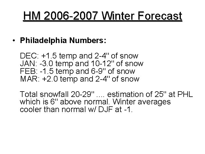
HM 2006 -2007 Winter Forecast • Philadelphia Numbers: DEC: +1. 5 temp and 2 -4" of snow JAN: -3. 0 temp and 10 -12" of snow FEB: -1. 5 temp and 6 -9" of snow MAR: +2. 0 temp and 2 -4" of snow Total snowfall 20 -29". . estimation of 25" at PHL which is 6" above normal. Winter averages cooler than normal w/ DJF at -1.

HM 2006 -2007 Winter Forecast Ok so. . I used the tropical tropospheric/stratospheric pacific, general SSTA, autumn patterns and latent heat flux to make my forecast and used them along w/ analogs to make storm threat calls and NAO forecasts. Everything is very experimental, and like previous years, is subject to hard criticism and bust potential! To close out this outlook: When the NAO is NOT negative. . . the warmth will be more intense than normal given the setup in the tropical east pacific/gom. However, it should be noted that the STJ will be nothing but constant for us and bring plenty of activity. There will plenty of rain/snow mix, snow to rain and improper tracks this winter that should remind us I-95 ers of the good old days. The right combination of cold should bring a few great winter storms w/ a memorable JAN storm of historic proportions. I am predicting a KU.

HM 2006 -2007 Winter Forecast Wildcards: -DEC analog list was 1957, 1963, 1969, 1977, 1987, 1992, 1994 and 2004. . . These analogs in a composite make a cold picture. I chose 1987, 1994 and 2004 b/c I felt they closely resemble the current picture. Also, they seem to make more sense w/ the current 2006 tropical pacific forecast I have. So therefore, I went warm. It is possible that the current negative NAO / cool trend persists and I bust and the other analogs were correct. If that happens I will take it like a man. -FEB global indices paint a blocky picture and the analogs also indicate a negative NAO period. However the composites do not exactly paint a very cold look. FEB should look very el Nino on the monthly departures when all done with. It is possible this month is even colder/snowier than indicated.

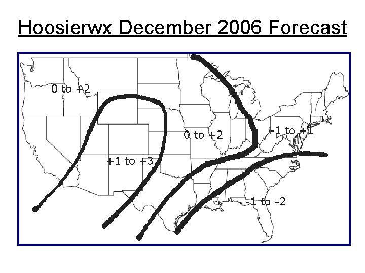
Hoosierwx December 2006 Forecast

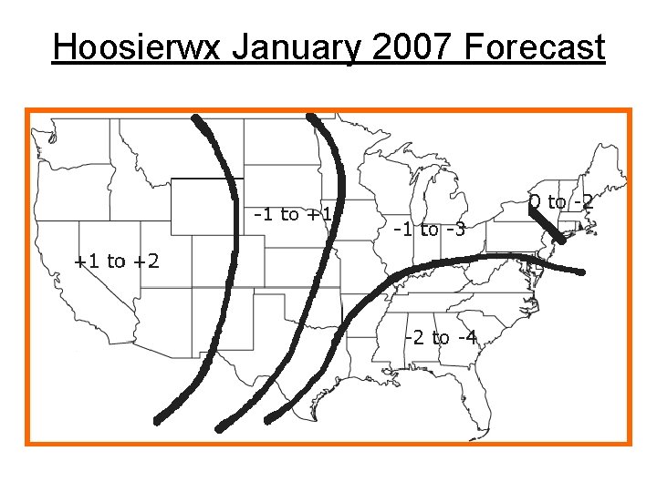
Hoosierwx January 2007 Forecast

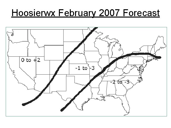
Hoosierwx February 2007 Forecast

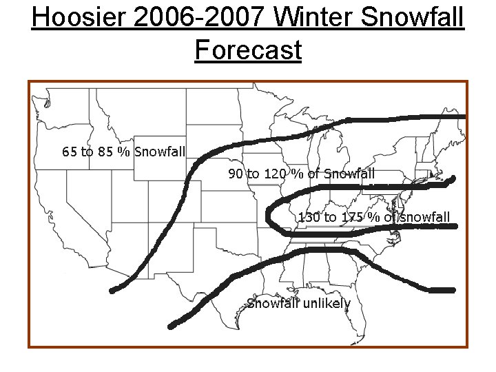
Hoosier 2006 -2007 Winter Snowfall Forecast