Documenting Sites in Rhode Island Presentation by James

Documenting Sites in Rhode Island Presentation by James Gage given at the NEARA Spring 2014 Meeting held in Warwick RI. © 2014

Site Documentation Step 1 – Photographs Step 2 – GPS Step 3 – Measurements Step 4 – Maps Step 5 – Site Report Step 6 – File Your Report

Research Ethics Please … • Do not dig • Do not move any stones • Do not add any stones • Do not climb on top of the structures • Do not remove any artifacts It is okay to … • Take photographs and measurements • Brush the leaves away

Number the Structures Stone Cairn, Boxley, Arkansas

Step 1 - Photographs Front Top Down Back Side View

Photo Scales

IPAD Handheld GPS Unit Smart Phone with External Bluetooth GPS Receiver

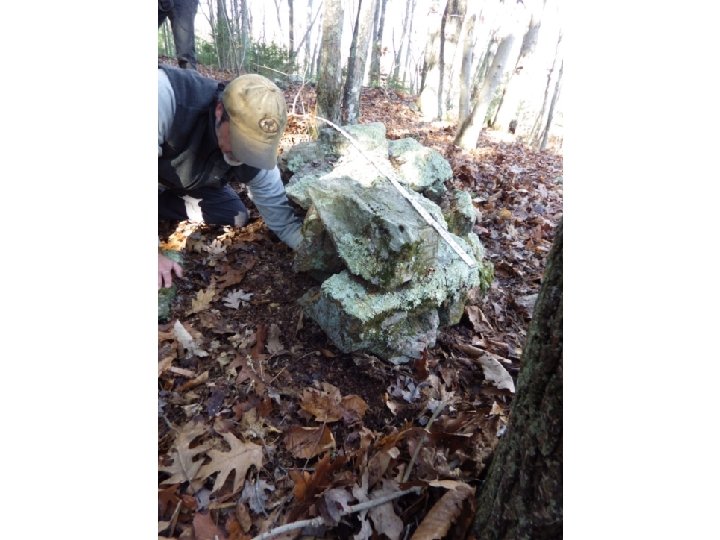
Step 3 - Take Measurements

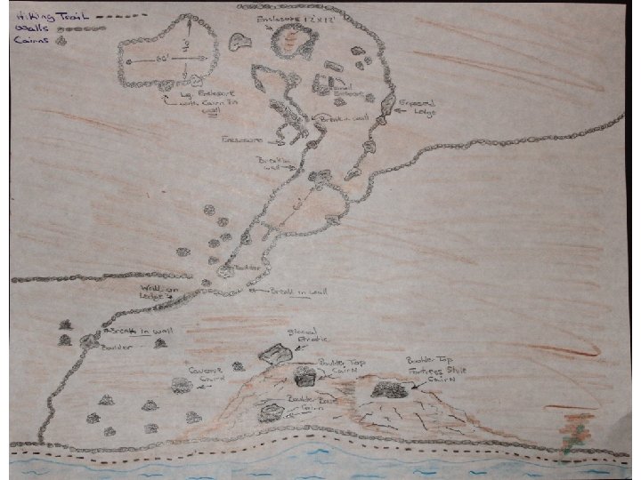
Step 4 - Maps

Step 5 - Paperwork

Sample Stone Structure Entry #7 – On ground cairn with depression Cairn is a mound on the ground with a wide, deep depression. It was built on level ground. Cairn 7’ Dia. Stone sizes: large, medium, small N 39° 15’ 18. 6481” W 72° 26’ 21. 0297”

Step 6 – File Your Report RI State Archaeologist Office Charlotte Taylor Senior Archaeologist RI Historical Preservation & Heritage Commission 150 Benefit Street Providence, RI 02903 NEARA Site Files Anne Wikkala NHTI Library 31 College Dr. Concord, NH 03301

New Discoveries

Miniature Chambers Voluntown, CT

Niche-Shaft Niche opening in front Vertical shaft opening on top

This presentation is posted online at www. stonestructures. org/html/document-it. html
- Slides: 18