
Diurnal Cycle over the Great Plains in NCEPGFS


- Slides: 34
Diurnal Cycle over the Great Plains in NCEP/GFS Myong-In Lee NASA/GSFC Global Modeling and Assimilation Office Coauthors: Siegfried Schubert, Max Suarez (NASA/GSFC) Jae Schemm, Soo-Hyun Yoo (NOAA/NCEP/CPC) Hua-Lu Pan, Jongil Han (NOAA/NCEP/EMC) Climate Diagnostics and Prediction Workshop, 23 -27 October 2006, Boulder, CO
Contents 1. Compare Diurnal cycle in three global models (NCEP/GFS, GFDL, NASA) 2. Impact of model resolution 3. Local versus large-scale forcing 4. Focus on GFS and Great Plains Ø Convection trigger functions Ø Sensitivity to the convection scheme 5. The global diurnal cycle 6. Summary
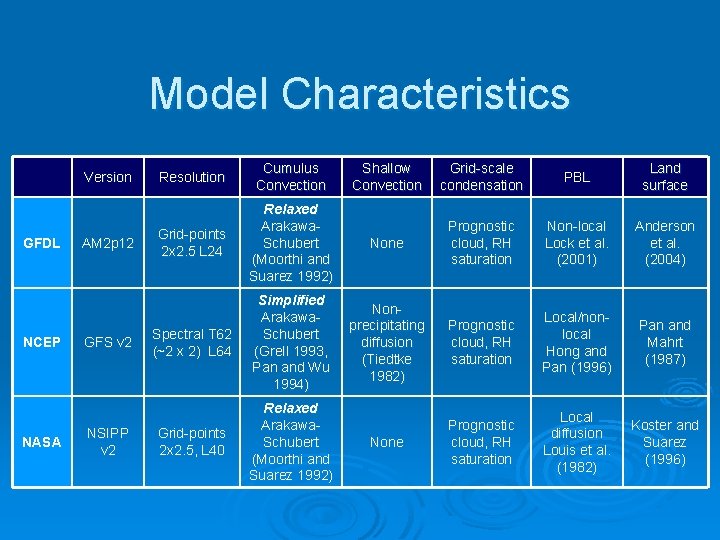
Model Characteristics Version GFDL NCEP NASA AM 2 p 12 GFS v 2 NSIPP v 2 Resolution Cumulus Convection Shallow Convection Grid-scale condensation PBL Land surface Grid-points 2 x 2. 5 L 24 Relaxed Arakawa. Schubert (Moorthi and Suarez 1992) None Prognostic cloud, RH saturation Non-local Lock et al. (2001) Anderson et al. (2004) Spectral T 62 (~2 x 2) L 64 Simplified Arakawa. Schubert (Grell 1993, Pan and Wu 1994) Nonprecipitating diffusion (Tiedtke 1982) Prognostic cloud, RH saturation Local/nonlocal Hong and Pan (1996) Pan and Mahrt (1987) Grid-points 2 x 2. 5, L 40 Relaxed Arakawa. Schubert (Moorthi and Suarez 1992) None Prognostic cloud, RH saturation Local diffusion Louis et al. (1982) Koster and Suarez (1996)
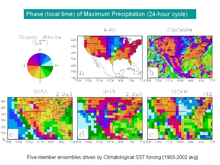
Phase (local time) of Maximum Precipitation (24 -hour cycle) Five-member ensembles driven by Climatological SST forcing (1983 -2002 avg)
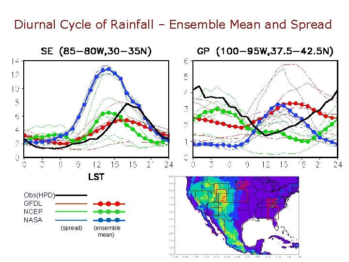
Diurnal Cycle of Rainfall – Ensemble Mean and Spread GP Obs(HPD) GFDL NCEP NASA SE (spread) (ensemble mean)
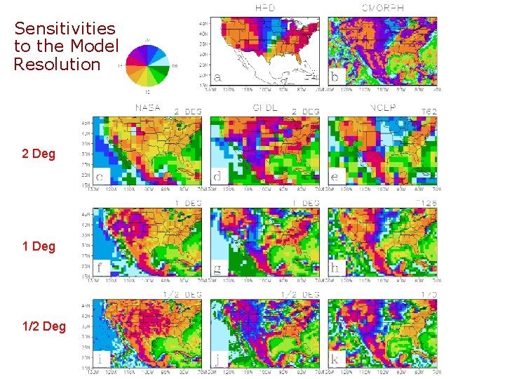
Sensitivities to the Model Resolution 2 Deg 1/2 Deg (Lee et al. 2006, JC)
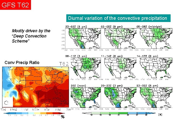
GFS T 62 Diurnal variation of the convective precipitation Mostly driven by the “Deep Convection Scheme” Conv Precip Ratio %
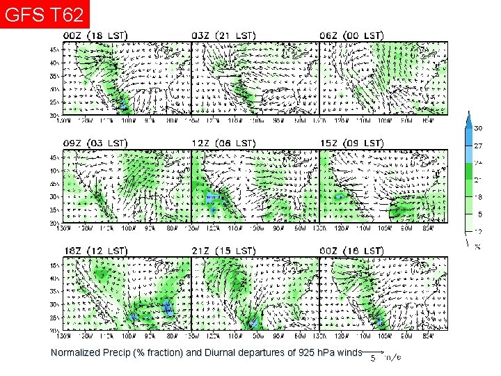
GFS T 62 Normalized Precip (% fraction) and Diurnal departures of 925 h. Pa winds
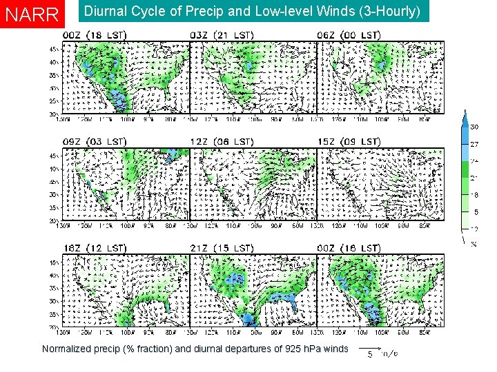
NARR Diurnal Cycle of Precip and Low-level Winds (3 -Hourly) Normalized precip (% fraction) and diurnal departures of 925 h. Pa winds
Local versus Large-scale forcing to the diurnal convection • Diurnal variations of local convective instability - measured by CAPE (convective available potential energy) • Large-scale moisture flux associated with GPLLJ
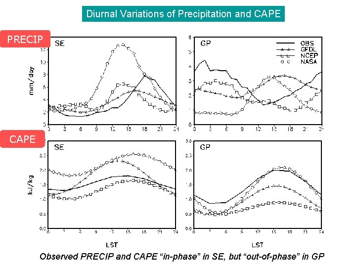
Diurnal Variations of Precipitation and CAPE PRECIP CAPE Observed PRECIP and CAPE “in-phase” in SE, but “out-of-phase” in GP
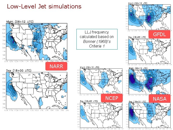
Low-Level Jet simulations LLJ frequency calculated based on Bonner (1968)’s Criteria 1 GFDL NARR NCEP NASA
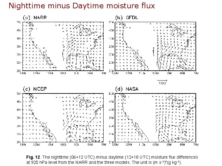
Nighttime minus Daytime moisture flux Fig. 12. The nighttime (06+12 UTC) minus daytime (12+18 UTC) moisture flux differences at 925 h. Pa level from the NARR and the three models. The unit is (m s-1)*(g kg-1).
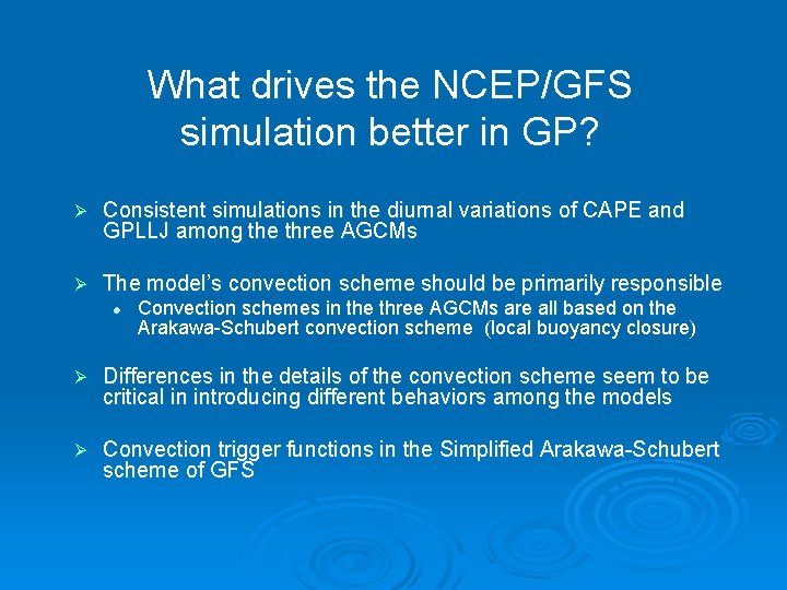
What drives the NCEP/GFS simulation better in GP? Ø Consistent simulations in the diurnal variations of CAPE and GPLLJ among the three AGCMs Ø The model’s convection scheme should be primarily responsible l Convection schemes in the three AGCMs are all based on the Arakawa-Schubert convection scheme (local buoyancy closure) Ø Differences in the details of the convection scheme seem to be critical in introducing different behaviors among the models Ø Convection trigger functions in the Simplified Arakawa-Schubert scheme of GFS
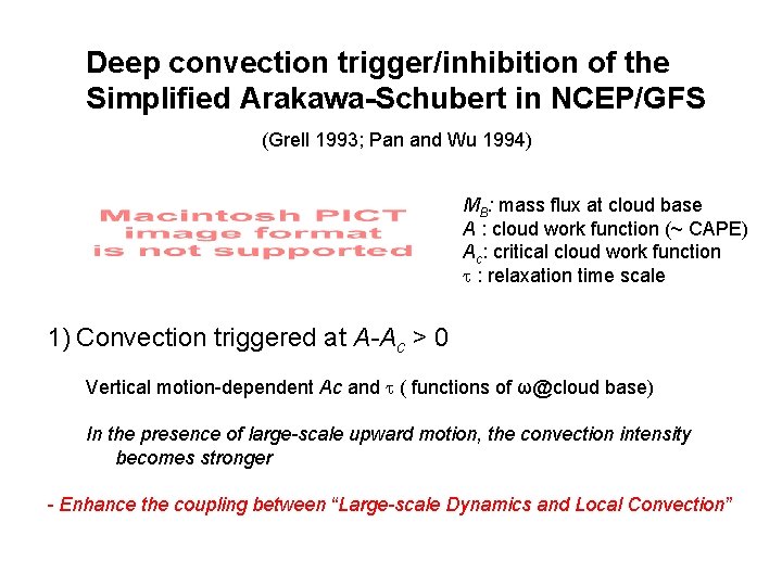
Deep convection trigger/inhibition of the Simplified Arakawa-Schubert in NCEP/GFS (Grell 1993; Pan and Wu 1994) MB: mass flux at cloud base A : cloud work function (~ CAPE) Ac: critical cloud work function : relaxation time scale 1) Convection triggered at A-Ac > 0 Vertical motion-dependent Ac and ( functions of ω@cloud base) In the presence of large-scale upward motion, the convection intensity becomes stronger - Enhance the coupling between “Large-scale Dynamics and Local Convection”
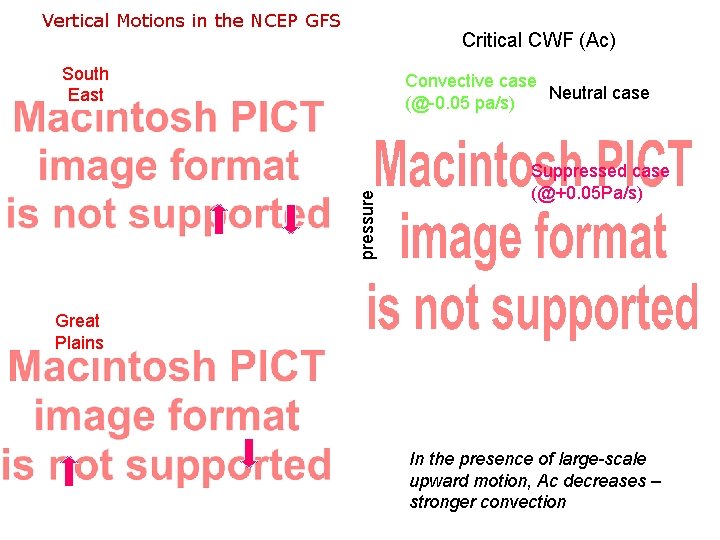
Vertical Motions in the NCEP GFS Critical CWF (Ac) South East pressure Convective case Neutral case (@-0. 05 pa/s) Suppressed case (@+0. 05 Pa/s) Great Plains In the presence of large-scale upward motion, J/kg Ac decreases – stronger convection
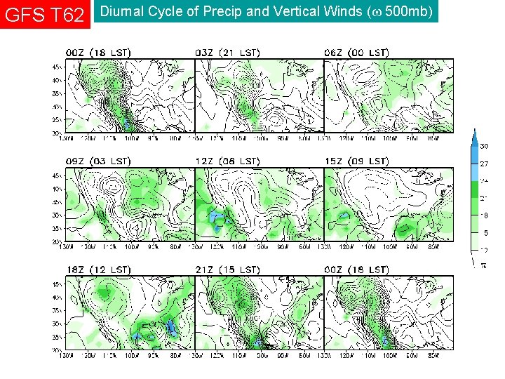
GFS T 62 Diurnal Cycle of Precip and Vertical Winds ( 500 mb) (Pa/sec, negative upward)
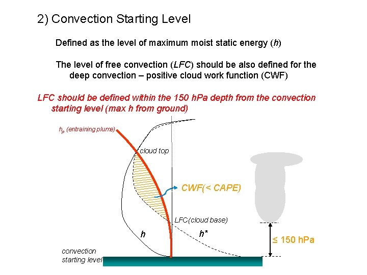
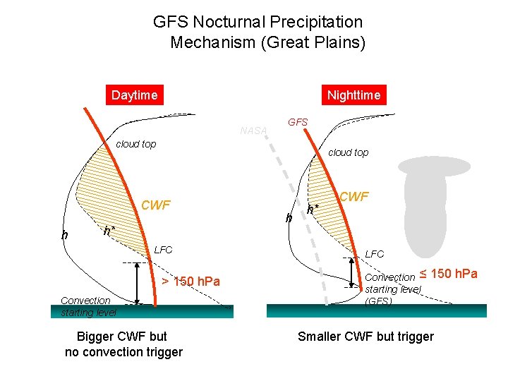
2) Convection Starting Level Defined as the level of maximum moist static energy (h) The level of free convection (LFC) should be also defined for the deep convection – positive cloud work function (CWF) LFC should be defined within the 150 h. Pa depth from the convection starting level (max h from ground) hp (entraining plume) cloud top CWF(< CAPE) LFC (cloud base) h convection starting level h* ≤ 150 h. Pa
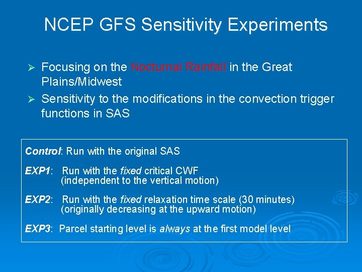
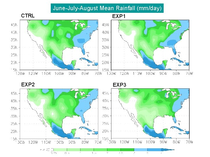
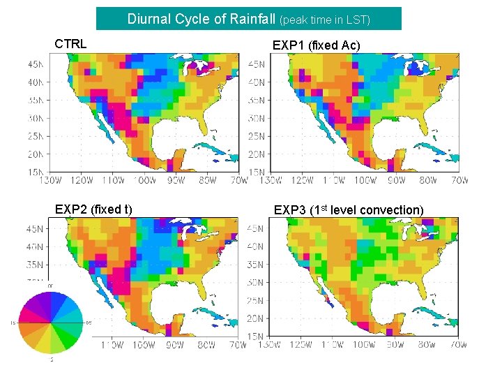
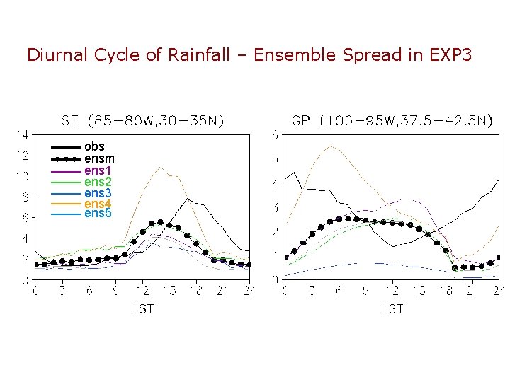
NCEP GFS Sensitivity Experiments Focusing on the Nocturnal Rainfall in the Great Plains/Midwest Ø Sensitivity to the modifications in the convection trigger functions in SAS Ø Control: Run with the original SAS EXP 1: Run with the fixed critical CWF (independent to the vertical motion) EXP 2: Run with the fixed relaxation time scale (30 minutes) (originally decreasing at the upward motion) EXP 3: Parcel starting level is always at the first model level
June-July-August Mean Rainfall (mm/day) CTRL EXP 1 EXP 2 EXP 3
Diurnal Cycle of Rainfall (peak time in LST) CTRL EXP 1 (fixed Ac) EXP 2 (fixed t) EXP 3 (1 st level convection)
Diurnal Cycle of Rainfall – Ensemble Spread in EXP 3 obs ensm ens 1 ens 2 ens 3 ens 4 ens 5
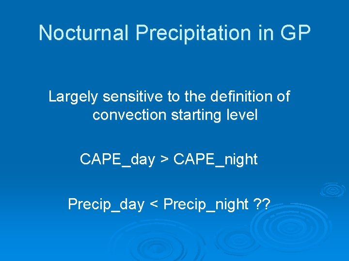
Nocturnal Precipitation in GP Largely sensitive to the definition of convection starting level CAPE_day > CAPE_night Precip_day < Precip_night ? ?
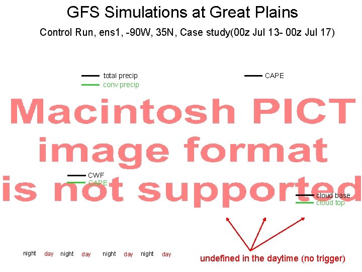
GFS Simulations at Great Plains Control Run, ens 1, -90 W, 35 N, Case study(00 z Jul 13 - 00 z Jul 17) total precip conv precip CAPE CWF CAPE cloud base cloud top night day undefined in the daytime (no trigger)
Moist Static Energy (h) GFS @ Great Plains (-90 W, 35 N) h (ground) h (850 mb) precipitation total precip conv precip
GFS Nocturnal Precipitation Mechanism (Great Plains) Daytime Nighttime NASA GFS cloud top CWF h h* LFC > 150 h. Pa Convection starting level Bigger CWF but no convection trigger h h* CWF LFC Convection ≤ 150 h. Pa starting level (GFS) Smaller CWF but trigger
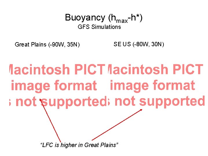
Buoyancy (hmax-h*) GFS Simulations Great Plains (-90 W, 35 N) SE US (-80 W, 30 N) “LFC is higher in Great Plains”
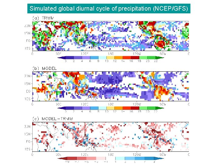
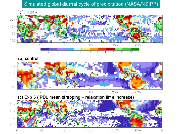
Global Diurnal Cycle Simulations (compared with TRMM) l l Six years (1998– 2003) of TRMM Microwave Instrument (TMI) rain retrievals at 2. 5°x 2. 5° grid box (Tom Bell 2004) NCEP/GFS T 62 5 member ensemble runs with climatological SSTs Seasonal statistics (e. g. , JJA) Rainfall (R) in each grid point is fit to sinusoidal harmonics
Simulated global diurnal cycle of precipitation (NCEP/GFS)
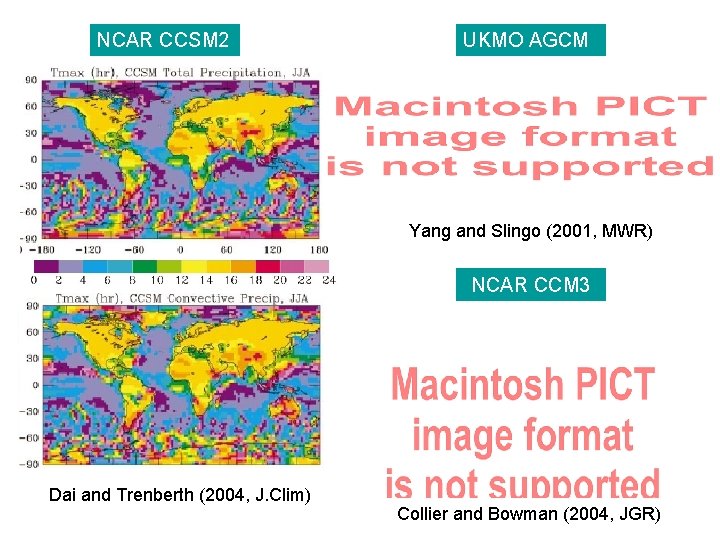
NCAR CCSM 2 UKMO AGCM Yang and Slingo (2001, MWR) NCAR CCM 3 Dai and Trenberth (2004, J. Clim) Collier and Bowman (2004, JGR)
Simulated global diurnal cycle of precipitation (NASA/NSIPP) (b) control (c) Exp 3 ( PBL mean strapping + relaxation time increase) (Lee et al. 2006, in preparation
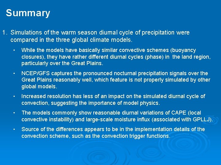
Summary 1. Simulations of the warm season diurnal cycle of precipitation were compared in the three global climate models. • While the models have basically similar convective schemes (buoyancy closures), they have rather different diurnal cycles (phase) in the land region, particularly over the Great Plains. • NCEP/GFS captures the pronounced nocturnal precipitation signals over the Great Plains reasonably well, which feature is not properly simulated by other global models. • Increased resolution has less of an impact on the simulated diurnal cycle of convection, suggesting the importance of model physics. • The models commonly show reasonable diurnal variations of CAPE (local convective instability) and large-scale moisture influx (associated with GPLLJ). • Source of the differences appears to be in the implementation details of the convection scheme, such as the convection trigger functions.
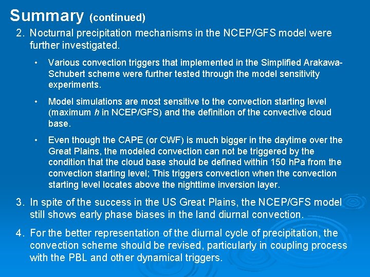
Summary (continued) 2. Nocturnal precipitation mechanisms in the NCEP/GFS model were further investigated. • Various convection triggers that implemented in the Simplified Arakawa. Schubert scheme were further tested through the model sensitivity experiments. • Model simulations are most sensitive to the convection starting level (maximum h in NCEP/GFS) and the definition of the convective cloud base. • Even though the CAPE (or CWF) is much bigger in the daytime over the Great Plains, the modeled convection can not be triggered by the condition that the cloud base should be defined within 150 h. Pa from the convection starting level; This triggers convection when the convection starting level locates above the nighttime inversion layer. 3. In spite of the success in the US Great Plains, the NCEP/GFS model still shows early phase biases in the land diurnal convection. 4. For the better representation of the diurnal cycle of precipitation, the convection scheme should be revised, particularly in coupling process with the PBL and other dynamical triggers.
Ø Thank you very much !!