Distortion All maps have distortion What type of


 n Equal Area")


- Slides: 18
Distortion • All maps have distortion • What type of distortion do each of these maps have? • Compare and contrast – What is the purpose (how is it used) – How is it distorted? • • Robinson Mercator Azimuthal Equal Area
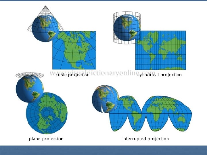
Map projection is the way we fit earth’s three-dimensional surface onto flat paper or a screen
n The Most Common: Conformal (i. e. , angles are preserved) n Equal Area (i. e. , areas are in constant proportion) n Equidistant (i. e. , distances are in constant proportion) n n An Important Mathematical Result: n A single projection can not be both conformal and equal area
Azimuthal n n A map projection in which a globe, as of the Earth, is assumed to rest on a flat surface onto which its features are projected. An azimuthal projection produces a circular map with a chosen point the point on the globe that is tangent to the flat surface at its center. When the central point is either of Earth's poles, parallels appear as concentric circles on the map and meridians as straight lines radiating from the center. Directions from the central point to any other point on the map are accurate, although distances and shapes in some azimuthal projections are distorted away from the center.
Azimuthal Projection
Mercator Projection n n rectangular map, direction consistent, shape slightly distorted, poles are grossly distorted A true conformal cylindrical map projection, the Mercator projection is particularly useful for navigation because it maintains accurate direction
Mercator Projection
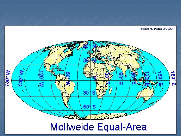
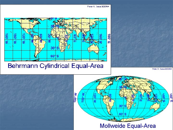
Equal Area Projection
Robinson Projection n n Frequently used. Distorts both size and shape, but not too much. The major benefit of the Robinson projection is that oceans are uninterrupted. This projection is useful in depicting patterns of global interaction. Considered a compromise projection
Robinson Projection n The Robinson projection is a map projection of a world map, which shows the entire world at once. It was specifically created in an attempt to find a good compromise to the problem of readily showing the whole globe as a flat image.
Robinson Projection
n n Goode’s projection interrupts the oceans and tucks Australia and New Zealand farther west than in reality. Therefore, land masses appear relatively large compared to the oceans. Minimized distortion in the shape of the various land masses and the size of one land mass compared to other land masses.
Goode’s Projection
n n The Peters Projection World Map is one of the most stimulating, and controversial, images of the world. When this map was first introduced by historian and cartographer Dr. Arno Peters at a Press Conference in Germany in 1974 it generated a firestorm of debate. The first English-version of the map was published in 1983, and it continues to have passionate fans as well as staunch detractors. The earth is round. The challenge of any world map is to represent a round earth on a flat surface. There are literally thousands of map projections. Each has certain strengths and corresponding weaknesses. Choosing among them is an exercise in values clarification: you have to decide what's important to you. That is generally determined by the way you intend to use the map. The Peters Projection is an area accurate map. http: //www. petersmap. com/page 2. html
Peter’s Projection