Digital Leveling Section Nine Bluebooking Purpose To insure

Digital Leveling Section Nine Bluebooking

Purpose • To insure leveling observations meet FGCS specifications and procedures • To reduce raw leveling data into standard. lvl format and finally to. hgz format for submission to NGS

History • • • Hand recording observations VERREC for field recording observations VFPROC (newrec, editor, abstra, etc. ) for DOS The digital level-Whalen software Translev – Windows based program

Translev Program Overview • • Program installation and configuration File naming conventions Processing leveling data Tools Web tools Locus Project submission

Program Installation • Windows. NT, Windows 2000, Windows. XP Professional – Must have administrative privileges • Version numbering-current 4. 14. xx • Remove old version before installing the new • After installing, change permissions to read/write for all users • Intermediate updates – all users
 Raw (. lev, .")
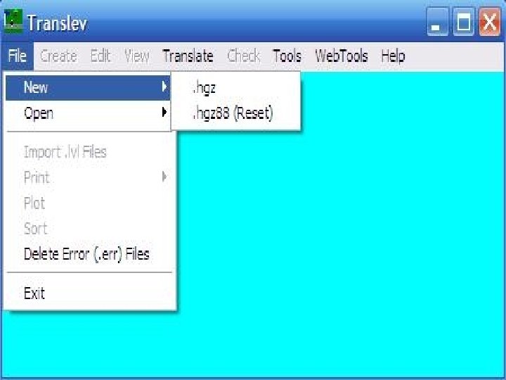
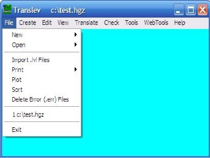
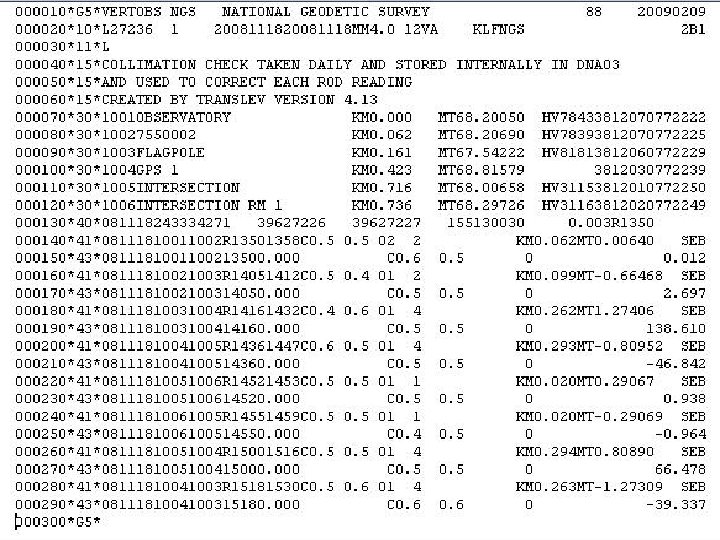
File Naming Conventions • • • Blue Book (. hgz) Raw (. lev, . raw, . dat, . gsi) Error Files (. err) Abstracts (. abs) Report (. rpt) Lvl/Bok (. lvl, . bok) New-minus-old (. nmo) Statistics (. stt) Running List (. rlst) RI Load (_RI. txt)

FLOW CHART Flow Chart

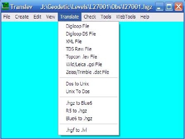
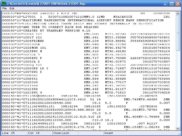
Translating Raw Files • Raw digital level formats -. gsi, . dat, . lev • Other formats-TDS, Digiloop, xml • Must have description file containing names, PIDs, elevations and geographic positions • Entering defaults • Rod/Instrument supporting files

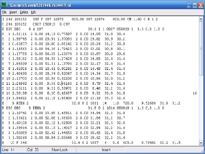
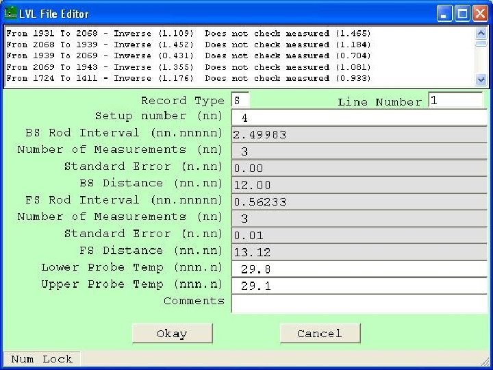
The. lvl File • • Editing the. lvl file Checking the. lvl file Fixing errors in the. lvl file Importing the. lvl file to create the *40* series records in the. hgz file

Importing. lvl Files

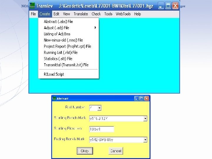
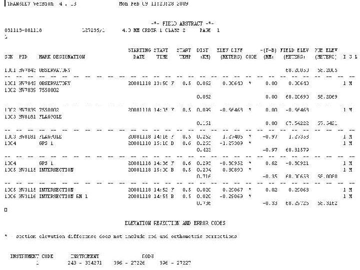
Creating Abstracts • Date discontinuity errors • • • Rejections Rod/Instrument data Inverse-running length differences Refraction corrections The Neighbor File The Segment File

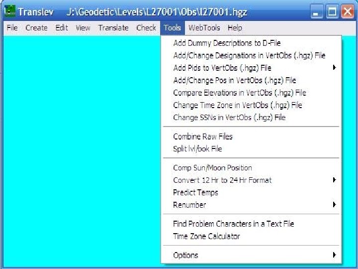
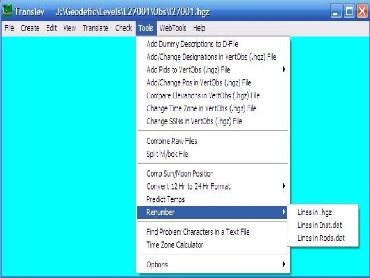
Tools • • • Plotting Creating statistical reports Creating new-minus-old reports The RI editor Astronomic positions Temperature profile prediction Renumbering Finding problems in ASCII files Time zone calculator

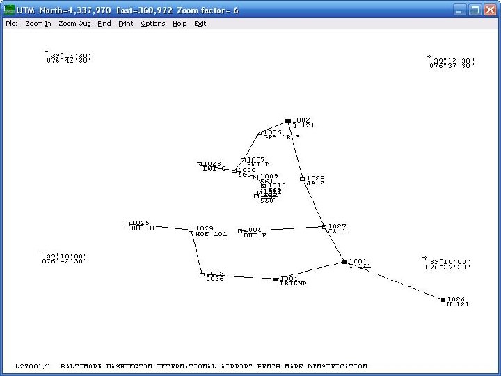
Creating a Plot

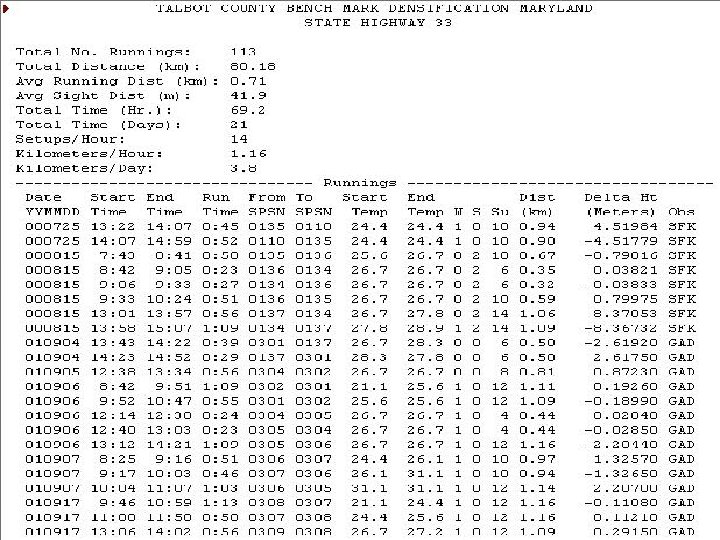
Creating a Statistical File

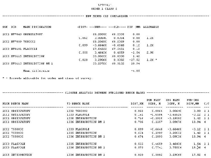
Creating the New-minus-old File

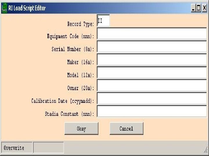
Creating a RI Load File

Position of the Sun and Moon

Diagnosing Problems With ASCII Files

The Time Zone Calculator
 • Level projects • LOCUS • Updating")
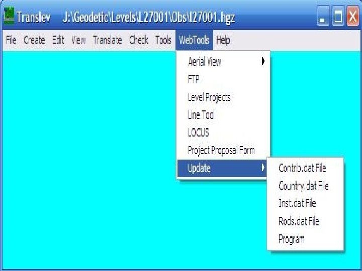
Web Tools • Aerial view (Google Earth) • Level projects • LOCUS • Updating files
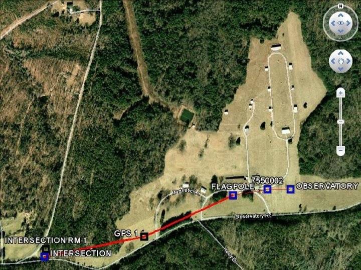

Level Projects for Marks
 created,")
Project Checklist • • • . hgz file created and checked. lvl file(s) created, checked, combined Abstract file created & checked New-minus-old file created Ties checked Project report created
 file Combined raw (. gsi, .")
Files for Submittal • • Description (. dsc) file Combined raw (. gsi, . lev, or. dat) file Combined (. bok) file VERTOBS (. hgz) file Abstract (. abs) file Project report (. rpt) file CD of photos
- Slides: 40