
Digital AIM DAIM Sam Van der Stricht EUROCONTROL
- Slides: 22
Digital AIM “D-AIM” Sam Van der Stricht EUROCONTROL
Content l l Digital AIM Introduction & Concepts Digital AIM Trial Project
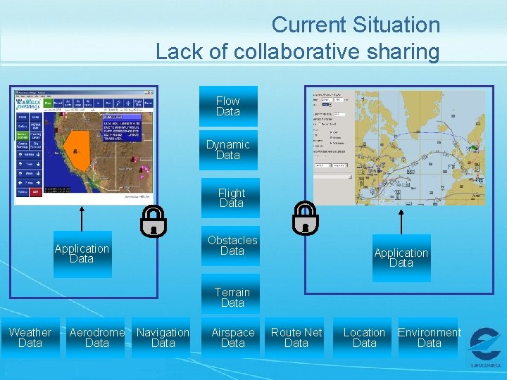
Current Situation Lack of collaborative sharing Flow Data Dynamic Data Flight Data Obstacles Data Application Data Terrain Data Weather Data Aerodrome Data Navigation Data Airspace Data Route Net Data Location Data Environment Data
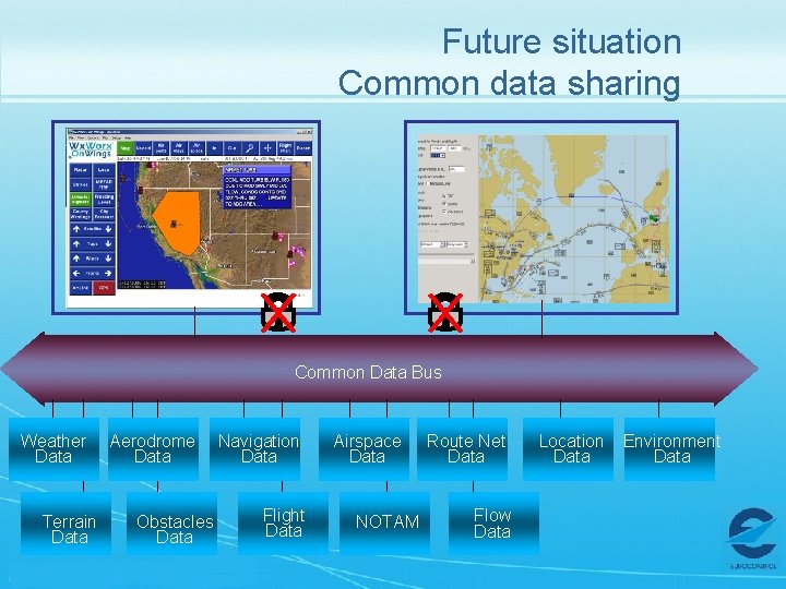
Future situation Common data sharing Common Data Bus Weather Data Terrain Data Aerodrome Data Obstacles Data Navigation Data Flight Data Airspace Data NOTAM Route Net Data Flow Data Location Data Environment Data
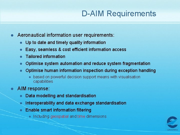
D-AIM Requirements l Aeronautical information user requirements: l Up to date and timely quality information l Easy, seamless & cost efficient information access l Tailored information l Optimise system automation and reduce system fragmentation l Optimise human information inspection during exception handling l l based on powerful decision support means with visualisation capabilities AIM response: l Data modelling and standardisation l Interoperability and data exchange standardisation l Enable smart information filtering l Including geospatial and time dimensions
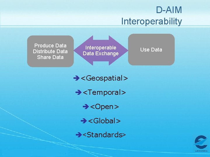
D-AIM Interoperability Produce Data Distribute Data Share Data Interoperable Data Exchange è<Geospatial> è<Temporal> è<Open> è<Global> è<Standards> Use Data
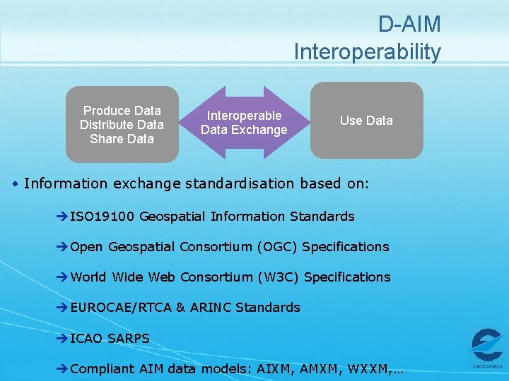
D-AIM Interoperability Produce Data Distribute Data Share Data Interoperable Data Exchange Use Data • Information exchange standardisation based on: èISO 19100 Geospatial Information Standards èOpen Geospatial Consortium (OGC) Specifications èWorld Wide Web Consortium (W 3 C) Specifications èEUROCAE/RTCA & ARINC Standards èICAO SARPS èCompliant AIM data models: AIXM, AMXM, WXXM, …
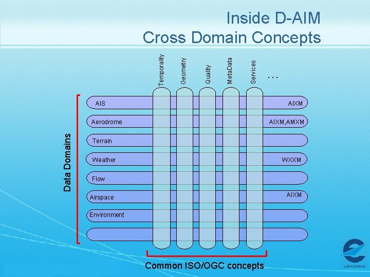
Services Meta. Data Quality Geometry Temporality Inside D-AIM Cross Domain Concepts AIS AIXM Aerodrome Data Domains … AIXM, AMXM Terrain Weather WXXM Flow AIXM Airspace Environment Common ISO/OGC concepts
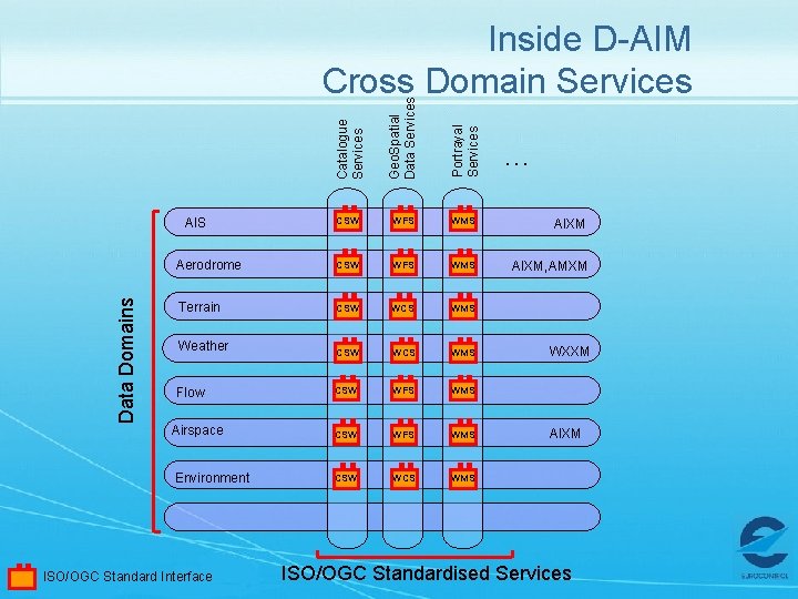
Catalogue Services Geo. Spatial Data Services Portrayal Services Inside D-AIM Cross Domain Services CSW WFS WMS AIXM Aerodrome CSW WFS WMS AIXM, AMXM Terrain CSW WCS WMS CSW WFS WMS CSW WCS WMS Data Domains AIS Weather Flow Airspace Environment ISO/OGC Standard Interface … WXXM AIXM ISO/OGC Standardised Services
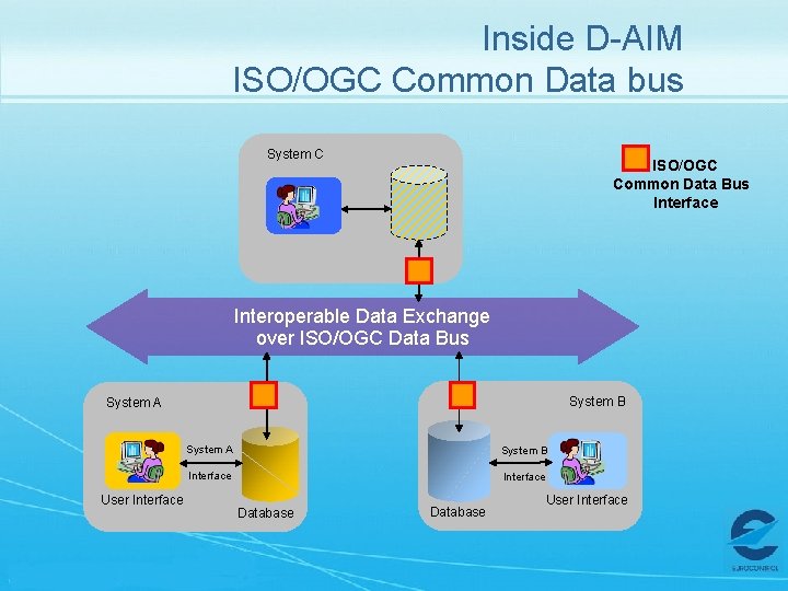
Inside D-AIM ISO/OGC Common Data bus System C ISO/OGC Common Data Bus Interface Interoperable Data Exchange over ISO/OGC Data Bus System B System A User Interface System A System B Interface Database User Interface
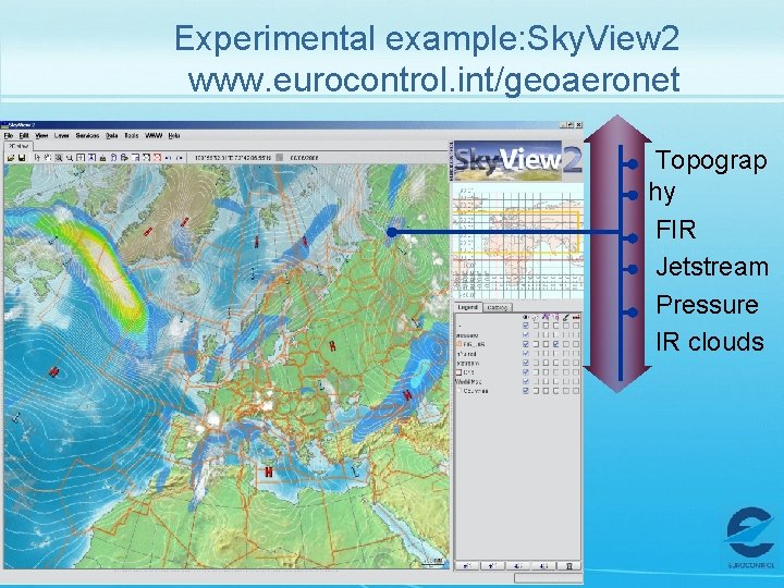
Experimental example: Sky. View 2 www. eurocontrol. int/geoaeronet Topograp hy FIR Jetstream Pressure IR clouds
Content l l Digital AIM (D-AIM) Introduction Digital AIM Project
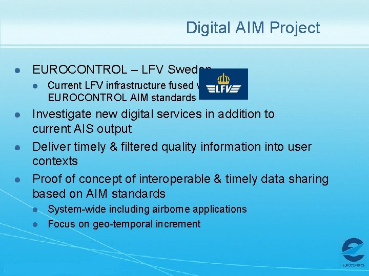
Digital AIM Project l EUROCONTROL – LFV Sweden l l Current LFV infrastructure fused with EUROCONTROL AIM standards Investigate new digital services in addition to current AIS output Deliver timely & filtered quality information into user contexts Proof of concept of interoperable & timely data sharing based on AIM standards l l System-wide including airborne applications Focus on geo-temporal increment
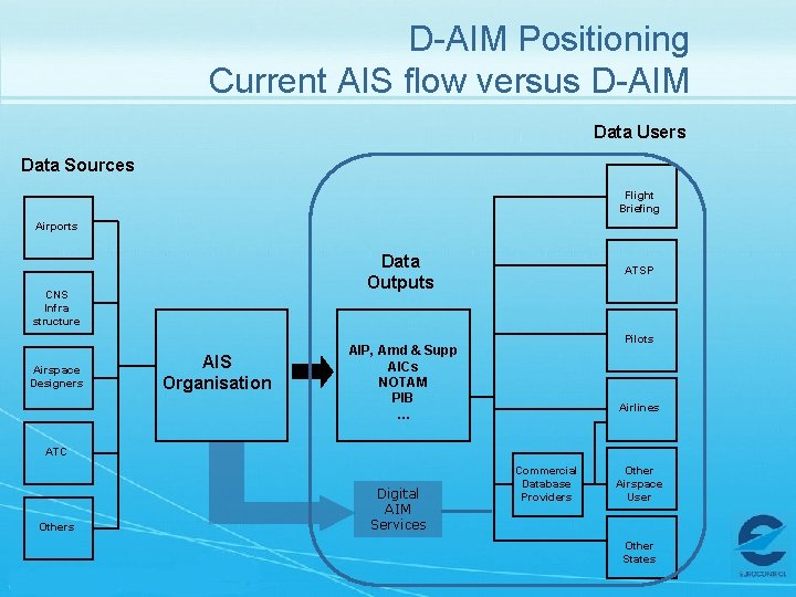
D-AIM Positioning Current AIS flow versus D-AIM Data Users Data Sources Flight Briefing Airports Data Outputs CNS Infra structure Airspace Designers AIS Organisation ATSP Pilots AIP, Amd & Supp AICs NOTAM PIB … Airlines ATC Others Digital AIM Services Commercial Database Providers Other Airspace User Other States
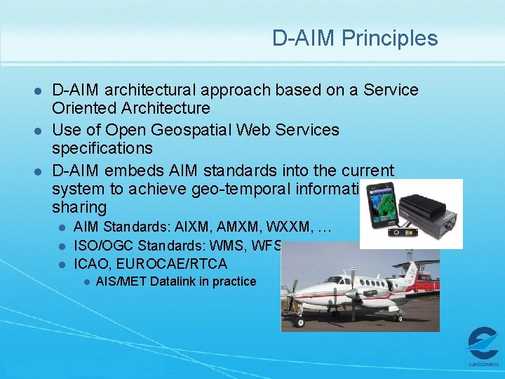
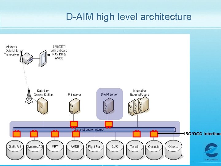
D-AIM Principles l l l D-AIM architectural approach based on a Service Oriented Architecture Use of Open Geospatial Web Services specifications D-AIM embeds AIM standards into the current system to achieve geo-temporal information sharing l l l AIM Standards: AIXM, AMXM, WXXM, … ISO/OGC Standards: WMS, WFS, … ICAO, EUROCAE/RTCA l AIS/MET Datalink in practice
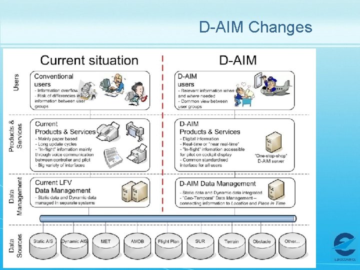
D-AIM Changes
D-AIM high level architecture ISO/OGC Interface
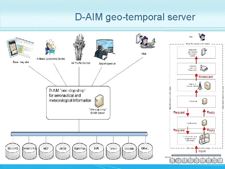
D-AIM geo-temporal server
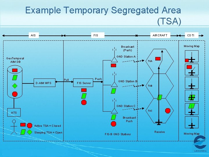
Example Temporary Segregated Area (TSA) AIS FIS AIRCRAFT CDTI Moving Map Broadcast (Push) GND Station A Geo. Temporal AIM DB TVA Push Pull D-AIM WFS FIS Server GND Station B TVB GND Station C TVC ATS Broadcast Push Active TSA = Closed Sleeping TSA = Open FIS-B GND Stations Receive Moving Map
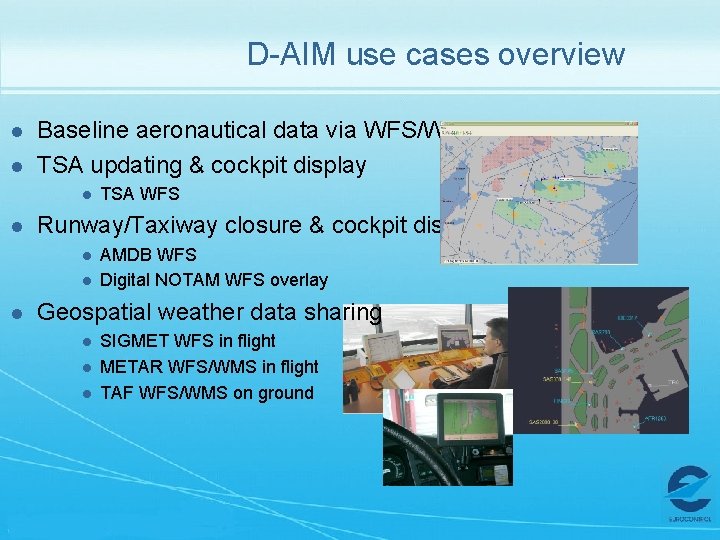
D-AIM use cases overview l l Baseline aeronautical data via WFS/WMS TSA updating & cockpit display l l Runway/Taxiway closure & cockpit display l l l TSA WFS AMDB WFS Digital NOTAM WFS overlay Geospatial weather data sharing l l l SIGMET WFS in flight METAR WFS/WMS in flight TAF WFS/WMS on ground
D-AIM Conclusion l l l D-AIM puts AIM into practice D-AIM builds future digital AIM services D-AIM benefits: l l l Provides a “one-stop shop” to geo-temporal aeronautical information Geo-enable content provider output to enable downstream location based information filtering and decision making support Increase safety by making information available WHEN and WHERE needed l l l Based on Service Oriented Architecture & ISO/OGC Based on existing global AIM data models: AIXM, AMXM, WXXM Increase situational awareness through geospatial approach l Common timely & geospatial information (en-route/aerodrome)
Thank you!