Different ViewsSame World A Whats different B C

Different Views/Same World A What’s different? B C

Map Projections

A map projection is defined as a way of drawing a map to represent the rounded earth on a flat surface.

• All maps distort the Earth’s representation • The only true representation of the Earth’s surface is a globe. • Different map projections are developed for specific purposes.

The Earth’s image will be distorted in one or more of the following ways. • Area-is the size accurate? • Shapes-is the shape accurate? • Distance-is the scale accurate? • Directions-can directions be accurately shown?

Students must be able to identify and understand the following projections. • Mercator • Polar • Robinson

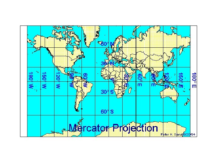
Mercator Projection Most Accurate in the tropics from Cancer to Capricorn Most Distortion at the North and South Poles

Mercator Projection Used for: • Locating Latitude and Longitude • Sea Captains use it for navigation at sea

Mercator Projection Characteristics: • All lines are at 90 degree angles • Simplest to read • Accurate direction • Distorted size, distance, shape


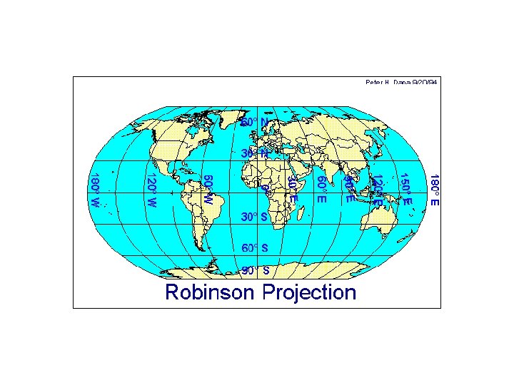
Robinson Projection Most Accurate at the equator Most Distortion around the outer edges

Robinson Projection Same characteristics as the Mercator except: • lines of longitude are curved • shapes at the poles are flat and not as distorted • used mostly in classrooms--one of the most accurate maps

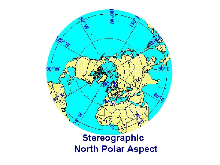
Polar Projection Most Accurate at the poles Most Distortion around the outer edges

Polar Projection Used for navigation of air planes

Polar Projection Characteristics: • Distances and direction are accurate from the center along the longitude lines. • Size and shape are accurate at the center of the map


- Slides: 20