Describing Climates many different ways exist Climate Zones

Describing Climates- many different ways exist!

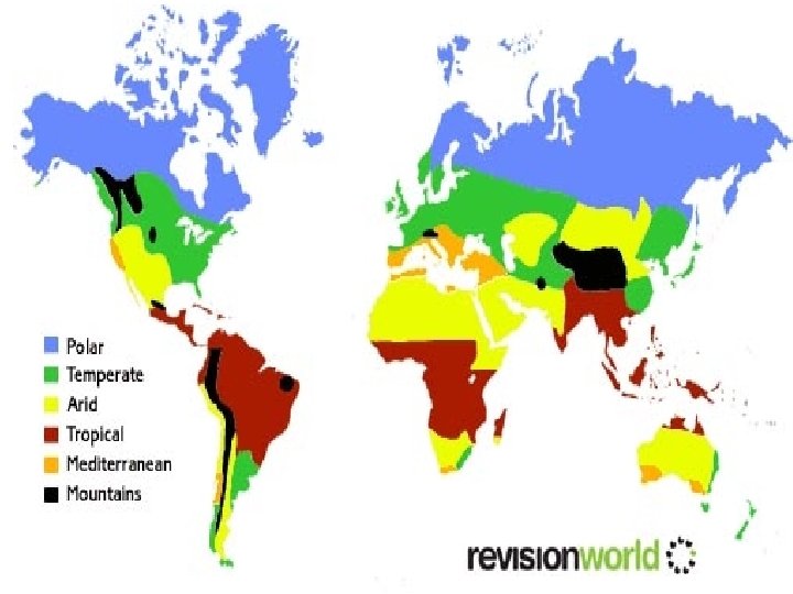
Climate Zones The planet can be divided into several regions of similar weather conditions called climate zones. l Polar regions are colder than equatorial regions as they receive less direct sunlight. More sun rays bounce/reflect off. - above at below the 60 th parallel l Temperate regions- between the 30 th and 60 th parallel on both sides of earth l Tropical regions- between the two 30 th parallel lines and including the equator- get the most direct sunlight- rays enter and do not bounce or reflect l

Climatographs l Climatographs are graphs of average climate data for a specific region, usually obtained over 30 years from observations made at local weather stations. ¡ Useful because they allow scientists to view how temperate and precipitation change throughout the year.

Climatographs have 2 Y axes- a line graph for temperature and a bar graph for precipitation, one bar for every month

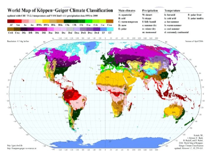
Classifying Climates Köppen Climate Classification System: l Method of identifying and describing climates based on observable features such as temperature ranges and rates of precipitation l Divides the world into 5 regions based on ¡ Average monthly temperature ¡ Average monthly precipitation ¡ Average annual precipitation

Köppen Climate Classification System l A - Tropical Moist Climates: ¡ l B - Dry Climates: ¡ l warm to hot summers, low of -3°C. D - Moist Mid-Latitude Climates with Cold Winters: ¡ l with deficient precipitation during most of the year and temperatures ranging from -40°C in winter to 40°C in summer. C - Moist Mid-latitude Climates with Mild Winters: ¡ l all months have average temperatures above 18°C, with annual precipitation greater than 1500 mm. warm to cool summers, low of -3°C. E - Polar Climates: ¡ extremely cold winters and summers, warmest month is below 10°C.

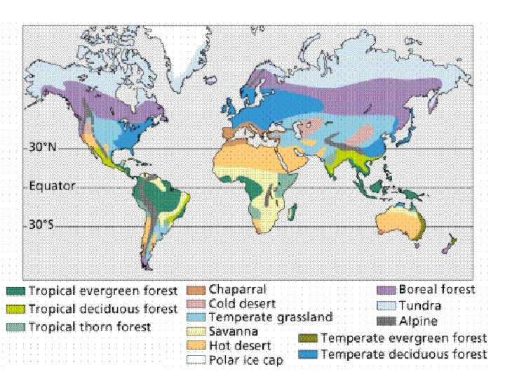
Biomes l A biome is the largest division of the biosphere, and includes regions with similar biotic components (plants, animals) and abiotic components (temperature, rain). ¡ Biomes in Canada: 6 kinds in Canada l l l l Permanent Ice Tundra Boreal Forest Temperate Deciduous Forest Temperate Rainforest Grassland Rainforest

Temperate rainforest of BC Grasslands of the prairies Desert of BC Tundra

Deciduous forest Boreal Forest

Bioclimate Profiles l Graphs of climatic conditions include: ¡ Minimum, maximum, and mean temperature ¡ Probability of frost ¡ Monthly total precipitation ¡ Number of days with rain and days with snow ¡ Water surplus and deficit

Bioclimatic charts have a lot of detailed information- Milwaukee vs Washington DC

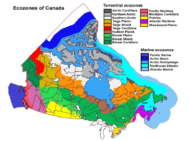
Ecozones and Ecoregions l Ecozone – division of Earth’s surface that has developed over a long period of time and is separated from other ecozones by geological features (ocean, desert, mountains) l Ecoregion – subdivision of an ecozone characterized by local landforms such as plains, lakes, mountains, rivers
 l")
Work: l Page 283 #1 -4 l Review pages 284 -285 (7 biomes) l Page 289 #1 -8
- Slides: 17