Deep Mapping Federated Data Crowd Sourcing and Digital


: Links time and space (chronotope) Operates")


 Neogeography Participatory GIS Volunteered Geographic Information (VGI) Google Earth, virtual")


 Wearable technology,")


 as a")


- Slides: 34
Deep Mapping, Federated Data, Crowd Sourcing, and Digital Encyclopedias David Bodenhamer The Polis Center at IUPUI International Symposium on Grids & Clouds Academia Sinica, Taipei April 2019
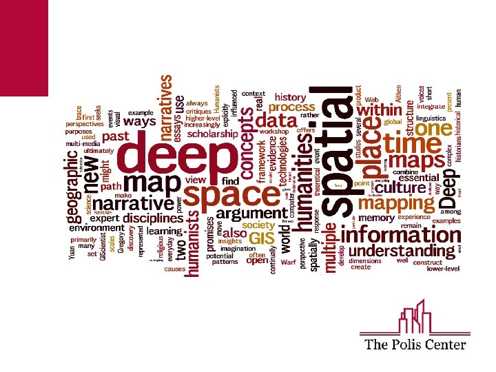
Spatial Humanities An explicit recognition of the reciprocal influence of geographic and constructed/symbolic space on culture and society. Fuses traditional focus on nuance, voice, experience, text, and image with the systematic approaches of spatial science, computer modeling, and virtual reality. Links time, space, and culture dynamically (deep mapping).
Deep Mapping Deep maps (platform, process, and product): Links time and space (chronotope) Operates across multiple scales (time and space) Embodies multiple agents, multiple perspectives Open to new information and non-expert contributions Fosters dynamic context (movement, linkage) Evokes emotional and experiential (visual and immersive; an affective geography)
Design Requirements Deep maps are: Flexible, inviting exploration User-centric, supporting differing views Path-traceable, supporting narration Open, admitting new material Immersive, evoking experience
Technical Schema
New Approaches (alt. GIS) Neogeography Participatory GIS Volunteered Geographic Information (VGI) Google Earth, virtual globes APIs, mash-ups Story maps Gazetteers, spatial semantics, text-to-GIS
Deep Maps Typology Five categories 1. Archival: spatially and temporally enabled open repository that allows map-based access to quantitative, qualitative, and image data (World. Map, Valley of Shadow) 2. Descriptive: densely layered map of a place with information drawn from multiple sources; designed to describe context or theme (Salem Witch Trials, Literary Atlas of Europe) 3. Exploratory: dynamically constructed, path-traceable maps of places and placebased themes (Pelagios Commons, Republic of Letters) 4. Narrative: structured view of spatially and temporally located data; designed to facilitate or make a scholarly argument within a rich spatio-temporal (mapped) environment (Enchanting the Desert) 5. Immersive/Experiential: focus on presence, a sense of reality, with its contextual awareness of past actions and embedded contingencies; seeks to place user within a spatially and temporally sensitive environment as a way of reifying context; fosters an aesthetic and emotional experience with place (Virtual Wheeling, Virtual Plasencia)
Visible Past: A Participatory GIS
Augmented Reality Synthesis of real and digital space (e. g. , Architip) Wearable technology, e. g. , Google Glass
Virtual Place-Making
Spatial VR
Temporal Ubiquity
Faceted Browsing
Enhanced e-Books
Immersive VR
Gaming Engines
Soundscapes
Print Encyclopedias Strengths: Compendium of existing knowledge Useful for quick reference Weaknesses: Static Dated How do we transform a centuries-old tool into a sustainable modern resource?
Challenges New models, e. g. , wikipedia Emergence of digital repositories Shift to mobile platforms Demand for citizen engagement Skepticism of experts Rapid changes in technology Limited funding/sustainability
Digital Encyclopedia of Indianapolis Goals 1. Update the Encyclopedia of Indianapolis (1994) as a knowledge platform to serve as a sustainable, dynamic, and reliable source of information about the metropolitan area. 2. Develop a collaborative framework among the city’s major heritage and culture institutions to support the continued growth of the DEOI. 3. Involve residents in creating information for the DEOI. 4. Make the DEOI an innovative technical product, with deep mapping capabilities.
Federated Data Collaborating partners include state and local libraries and archives, centers, universities, historical societies. All have active programs to create digital resources. Key aim is to federate these resources, allowing the DEOI to serve as a hub for their exchange.
DEOI as Knowledge Platform Discover • Data catalog • Search feature: find data and content by geo x time x topic Visualize • Timelines: animated and basic • Basic maps • Faceted browsing (multiple views of data) • Experimental Areas: • Augmented reality • Virtual Reality, Immersive Environments Explore • Simple simulations (user adjusts parameters to view scenarios) • Exploratory Spatial Data Analysis Learn • Spatial narratives, cultural narratives • Story telling – includes narrative • Online exhibits (e. g. , photos, art) Contribute • Citizen science • Perceptions, memories, unstructured observations
Design Principles 1. Flexible Data preparation, ingestion, transformation, and delivery is continuous Accommodates changes in technology 2. Scalable Both horizontally and vertically in response to demands and complexities of data 3. Performance Technology choice is made to reach/optimize highest performance 4. Distributed Bridges and integrates distributed data 5. Sustainable Supportable as a distributed system
Structural Design Principles 1. Mobile first 2. Location aware 3. Voice assistive 4. Deep both temporally and spatially 5. Connectivity based on friend of a friend (FOAF) that can be associated with relevant objects 6. SEO Rich 7. Accessible
Interface Design Principles 1. Focus on clarity and readability. 2. Create connections internally and to partner sites. 3. Optimize for causal users and researchers. 4. Encourage user contributions/volunteered content. 5. Differentiate between authoritative and nonauthoritative content. 6. Aim for simplicity and currency.
System Architecture
Technology Stack Servers Programming 1. Multimodal database such as Mongo. DB 2. My. SQL, SQL Server, Hadoop, Polybase, and file systems 3. Web server Windows IIS and Nginx 4. Windows and Linux Operating Systems 1. . net core and Go 2. Java. Script Libraries (j. Query, Vue. js, d 3. js, leaflet. js etc. ) 3. CSS 3 or CSS 4, bootstrap 4. HTML 5 5. Excel, Word 6. Arc. GIS Online, Carto. DB 7. Python and R 8. Drupal CMS Geospatial Platform 1. ESRI Arc. GIS Enterprise Cached service Feature service Geocoding service Geodata service Geometry service Geoprocessing service Image service 2. Geo. Node and Geo. Server for geo-spatial Content Management Module
Editorial Modules and Work Flow
DEOI Modules and Content Flow
User-Driven Change • Responsive to the needs of existing and potential users • Work with the user community regularly • Continual user feedback ID Needs Develop Requirements Final Build User Testing www. sav Build prototype
Conceptual Design: Homepage
Linked Data
Mutimodal Format