CZECH OFFICE FOR SURVEYING MAPPING AND CADASTRE Ing


- Slides: 49

CZECH OFFICE FOR SURVEYING, MAPPING AND CADASTRE Ing. Svatava Dokoupilová Prague, 29. 2. 2008


CONTENT • • Basic data on the Czech Republic Structure of the COSMC branch Role and position of COSMC Tasks and duties of the branch bodies Surveying and mapping Cadastre of Real Estates Cooperation with private sector Current tasks of the branch

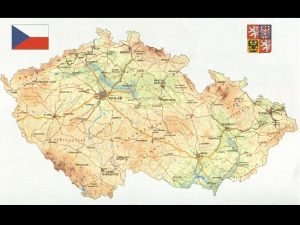
BASIC DATA ON THE CZECH REPUBLIC Area Population Administrative division 78 866 km² 10 million 14 regions 76 districts 6 250 municipalities 13 079 cadastral districts – technical territorial units

COSMC STRUCTURE

ROLE AND POSITION OF THE COSMC • COSMC is central administrative body both for surveying and cadastre • Established by the Act No. 359/1992 on Land Surveying and Cadastral Bodies • President is appointed by Government and closely cooperates with the Ministry of Agriculture • Independent chapter in state budget

BASIC DATA ON EMPLOYEES (by 31. 12. 2007) Total number of employees 5 546 • • 166 423 4 863 94 COSMC Land Survey Office 14 Cadastral Offices in regions 7 Survey and Cadastral inspectorates • Research Institute of Geodesy, Topography and Cartography (public research institute since 1. 1. 2007) 69

COMPETENCIES AND DUTIES OF COSMC Is responsible for administration and maintenance of: • Cadastre of Real Estates • Geodetic control • State map series • Information system of cadastre and surveying • Standardization of geographic names Coordinates research and international activities

COMPETENCIES AND DUTIES OF COSMC Controls • Land Survey Office (LSO) • Cadastral Offices (CO) • Survey and Cadastral Inspectorates (SCI) Gives Special licences for surveyors • based on examinations • organized 3 -4 times a year • usually 26 applicants

LAND SURVEY OFFICE • Focuses on land survey activities provided in the public interest • Administrates – Geodetic control – Fundamental base of geographic data (ZABAGED®) – State boundaries – Basic and thematic maps • Maintains Central Archives of Surveying, Mapping and Cadastre

SURVEY AND CADASTRAL INSPECTORATES (7) • Supervise authorization of results of surveys for cadastre - private sphere • Inspect activities of Cadastral Offices • Decide about some appeals against decisions of CO • Deal with violation in the field of surveying and mapping • Submit proposals for withdrawing of survey licences

CADASTRAL OFFICES (14) • Administrate Cadastre of Real Estates !No separated Land Book and Cadastre! • Every cadastral office has several workplaces in larger towns (except for Prague-city) - together 107 – Legal relations and materially rights - former Land Book – Updating of cadastral database - maps – Documentation, maintenance and administration

SURVEYING AND MAPPING - LSO • Fully in responsibility of LSO • Results accessible via e-service – GEOPORTAL - launched in 2005 – http: //geoportal. cuzk. cz/ – Geodetic points – free of charge – CZEPOS – paid service – Map services – GEOVIEWER – Business module – offer of data and printed maps – Archival maps

GEOPORTAL OF LSO

DATAZ – TRIGONOMETRIC POINTS

LEVELLING POINTS

CZEPOS - CZECH NETWORK OF PERMANENT GPS STATIONS • • • Built in 2005, 2006 27 stations Real time services Since 1. 1. 2007 - in full operation Paid service • http: //czepos. cuzk. cz/

CZEPOS

FUNDAMENTAL BASE OF GEOGRAPHICAL DATA (ZABAGED®) • Digital topographic model of the Czech Republic • Level of details matches the scale 1: 10 000 • Geodetic reference S-JTSK • Baltic vertical system after adjustment • Organized in 3 levels – Planimetry – Altimetry – Geonames

PLANIMETRY - 2 D

ALTIMETRY – 3 D

STATE MAP SERIES • Based on ZABAGED® and cadastral maps • Basic map of CR – 1: 10 000 – 1: 25 000 – 1: 50 000 – 1: 100 000 – 1: 200 000 • Thematic maps (f. i. Road map) • Map of administrative division • Sheet index

BASIC MAPS DERIVED FROM ZABAGED – ZM 10, ZM 25, ZM 50, ZM 100, ZM 200

THEMATIC MAPS - 1: 50 000 (road, trigonometric points, levelling network)

CENTRAL ARCHIVES OF SURVEYING, MAPPING AND CADASTRE • Collection of results of geodetic and cartographic activities on the territory of Czech, Moravia and Silesia • Half of million records • In 2006 the application Archive maps was launched – on-line viewing of hand coloured maps • Scanning of historical maps is still running – at present territory of Bohemia is covered and Moravia and Silesia starts • GEOPORTAL– http: //geoportal. cuzk. cz/ISAR

HISTORICAL MAPS

CADASTRE OF REAL ESTATES • Set of data on real estates including their – Inventory and description (geometric specification and position) – Records of property and other material rights (+other legally stipulated rights) • Long tradition of land registration • Current cadastre of real estates is integrated in the Information System of the Cadastre of Real Estates (ISKN) – One of basic registers of the state administration

BRIEF HISTORY OF THE CZECH CADASTRE • Land records -14 th century - nobility secured rights • 1817 - foundations of modern cadastre supreme patent on land tax and land surveying - Stable cadastre • 1927 - Cadastral act-foundation Cadastre of Land - precise and reliable until 1938 • Socialist era - only use of land • 1993 - integration of former Land Registry Book and Cadastre of Land into one register

LAND BOOKS

MAP OF STABLE CADASTRE – PRAGUE CASTLE

INFORMATION SYSTEM OF CADASTRE OF REAL ESTATES – ISKN • Integrated information system of CRE – Support of state administration – Ensures user services – Implemented in 2001 – Data in local databases – 2 hours updating • On-line access - two services – Consultation of CRE – Remote access to the CRE

CONSULTATION OF THE CRE • • • http: //nahlizenidokn. cuzk. cz Free of charge Selected data on ownership of parcels, buildings and flats • Information on proceedings concerning applications for registration of right into the CRE • Growing number of users – More than 7 million in 2007

INFORMATION ON BUILDING

INFORMATION ON PARCEL

INFORMATION ON PROCEEDING

REMOTE ACCESS TO THE CRE • https: //katastr. cuzk. cz/ • On-line data from the whole territory of the Czech Republic • Paid service for registered customers - exception state administration and self-government - since 2004 - free of charge • Outputs are the same as from cadastral offices • Cadastral maps - only 1/3 of the territory digitized • Rest is covered by raster maps - updated once a yearfor information • Number of users in 2007 - over 10 000 (1/3 free of charge) • Since 1. 7. 2006 - electronic mark based on certificateauthenticity of the output - public document

EXTRACT FROM THE CADASTRE

EXTRACT FROM THE CRE - COMPLETE

DIGITIZED CADASTRAL MAP

OVERVIEW MAP – FAST SEARCH

ORTHOPHOTO MAP

CADASTRAL AND ORIENTATION PARCEL MAP

ENTRIES AND RECORDS • Main agenda - most time demanding • Entry - registering of property rights to real estate (ownership, r. of lien, easement, pre-emptive r. , mortgage) based on a deed • Record - other registrations – based on decision of other state bodies - courts, given by law, deletion of right of lien and easement, dispositional rights to real estates, inheritance and others – informative notations – executions, technical information-f. i. type of land parcel, newly built buildings • Survey sketches - private surveyors

NUMBER OF REGISTRATIONS IN 2007 • Number of proposals for registration to the Cadastre is still growing – Entries - over 700 000 – Other records – over 1 million

SURVEY SKETCHES • Made solely by private geodetic companies • Depict land parcel division, position of building and change of boundaries in cadastre • Part of application for entry of any right into the CRE in case of changes of boundaries • Important documents for maintaining of cadastral maps • Number of survey sketches is around 130 000 a year, because of many transformation processes still being in run in CR

AUTHORIZATION OF SURVEY SKETCHES • Number of authorized surveyors is 2 377 • • 254 400 360 765 Licence only for survey sketches Combination with geodetic control Combination with building surveying Combination – SS, GC, BS • Combinations GC, BS

COOPERATION – CO x PRIVATE SURVEYORS (PS) • PS get from the CO – necessary documentation (geodetic points, old survey sketches, cadastral map, extract from the CRE) – new parcel numbers • PS – create and verify survey sketch – send it in exchange format to the CO – bring original and 6 -8 copies to the CO • CO – certify survey sketch – usually in 10 days – save it

CURRENT TASKS OF THE BRANCH • Main task is digitalization of cadastral maps on the rest of the territory of the Czech Republic – 9000 cadastral districts has to be digitized by the end of 2015 • Development and improving of e-services – Czech point • LSO – prepares a brand new DTM and land cover based on laser scanning • Implementation of INSPIRE – Everything is ready - services, metadata - except for digitized cadastral maps

THANK YOU FOR YOUR ATTENTION. svatava. dokoupilova@cuzk. cz
 Cadastre czech republic
 Plan cadastral cadgis
 Mining cadastre kenya
 Hellenic cadastre
 Cadastre 2034
 Memory parameters
 Forward mapping vs backward mapping
 Transform mapping dan transaction mapping
 Crm mind map
 Office in factory
 Fspos
Fspos Typiska novell drag
 Tack för att ni lyssnade bild
 Vad står k.r.å.k.a.n för
 Shingelfrisyren
 En lathund för arbete med kontinuitetshantering
 Kassaregister ideell förening
 Vilotidsbok
 A gastrica
 Vad är densitet
 Datorkunskap för nybörjare
 Stig kerman
 Debattinlägg mall
 Delegerande ledarstil
 Nyckelkompetenser för livslångt lärande
 Påbyggnader för flakfordon
 Formel för lufttryck
 Publik sektor
 Jag har nigit för nymånens skära text
 Presentera för publik crossboss
 Jiddisch
 Plats för toran ark
 Klassificeringsstruktur för kommunala verksamheter
 Luftstrupen för medicinare
 Claes martinsson
 Centrum för kunskap och säkerhet
 Verifikationsplan
 Mat för unga idrottare
 Verktyg för automatisering av utbetalningar
 Rutin för avvikelsehantering
 Smärtskolan kunskap för livet
 Ministerstyre för och nackdelar
 Tack för att ni har lyssnat
 Referatmarkeringar
 Redogör för vad psykologi är
 Stål för stötfångarsystem
 Tack för att ni har lyssnat
 Borra hål för knoppar
 Vilken grundregel finns det för tronföljden i sverige?
 Varians

