Cyclone Phase Classification Worksheet Moisture Structure TPW signature




- Slides: 21


Cyclone Phase Classification Worksheet

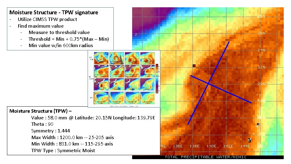
Moisture Structure - TPW signature - Utilize CIMSS TPW product Find maximum value - Measure to threshold value - Threshold = Min + 0. 75*(Max – Min) - Min value w/in 600 km radius Moisture Structure (TPW) – Value : 58. 0 mm @ Latitude: 20. 15 N Longitude: 139. 79 E Theta : 90 Symmetry : 1. 444 Max Width : 1200. 0 km -- 25 -205 axis Min Width : 831. 0 km -- 115 -295 axis TPW Type : Symmetric Moist

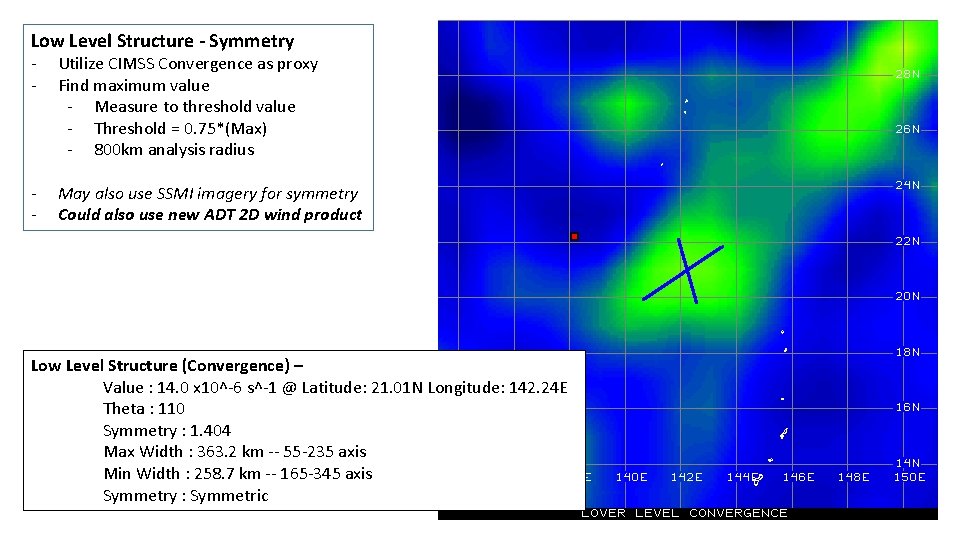
Surface Wind Field – Symmetry of Wind Field - Utilize CIMSS Convergence as proxy Find maximum value - Measure to threshold value - Threshold = 0. 75*(Max) - 800 km analysis radius - May also use SSMI imagery for symmetry Could also use new ADT 2 D wind product Low Level Structure (Convergence) – Value : 14. 0 x 10^-6 s^-1 @ Latitude: 21. 01 N Longitude: 142. 24 E Theta : 110 Symmetry : 1. 404 Max Width : 363. 2 km -- 55 -235 axis Min Width : 258. 7 km -- 165 -345 axis Symmetry : Symmetric

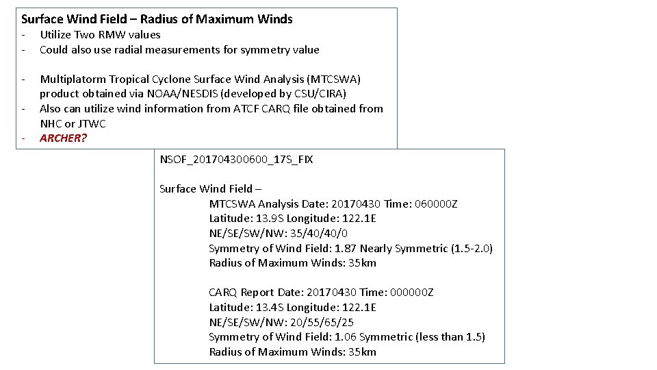
Surface Wind Field – Radius of Maximum Winds - Utilize Two RMW values Could also use radial measurements for symmetry value - Multiplatorm Tropical Cyclone Surface Wind Analysis (MTCSWA) product obtained via NOAA/NESDIS (developed by CSU/CIRA) Also can utilize wind information from ATCF CARQ file obtained from NHC or JTWC ARCHER? - NSOF_201704300600_17 S_FIX Surface Wind Field – MTCSWA Analysis Date: 20170430 Time: 060000 Z Latitude: 13. 9 S Longitude: 122. 1 E NE/SE/SW/NW: 35/40/40/0 Symmetry of Wind Field: 1. 87 Nearly Symmetric (1. 5 -2. 0) Radius of Maximum Winds: 35 km CARQ Report Date: 20170430 Time: 000000 Z Latitude: 13. 4 S Longitude: 122. 1 E NE/SE/SW/NW: 20/55/65/25 Symmetry of Wind Field: 1. 06 Symmetric (less than 1. 5) Radius of Maximum Winds: 35 km

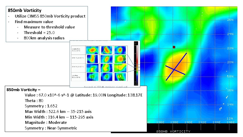
850 mb Vorticity - Utilize CIMSS 850 mb Vorticity product Find maximum value - Measure to threshold value - Threshold = 25. 0 - 800 km analysis radius 850 mb Vorticity – Value : 67. 0 x 10^-6 s^-1 @ Latitude: 19. 00 N Longitude: 138. 17 E Theta : 80 Symmetry : 1. 652 Max Width : 522. 6 km -- 35 -215 axis Min Width : 316. 4 km -- 115 -295 axis Magnitude : Moderate Symmetry : Near-Symmetric

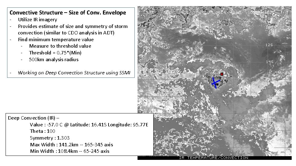
Convective Structure – Size of Conv. Envelope - Utilize IR imagery Provides estimate of size and symmetry of storm convection (similar to CDO analysis in ADT) Find minimum temperature value - Measure to threshold value - Threshold = 0. 75*(Min) - 500 km analysis radius - Working on Deep Convection Structure using SSMI Deep Convection (IR) – Value : -57. 0 C @ Latitude: 16. 41 S Longitude: 95. 77 E Theta : 100 Symmetry : 1. 303 Max Width : 141. 2 km -- 165 -345 axis Min Width : 108. 4 km -- 65 -245 axis

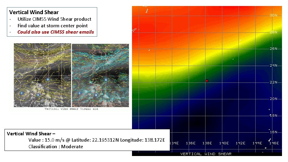
Vertical Wind Shear - Utilize CIMSS Wind Shear product Find value at storm center point Could also use CIMSS shear emails Vertical Wind Shear – Value : 15. 0 m/s @ Latitude: 22. 195312 N Longitude: 138. 172 E Classification : Moderate

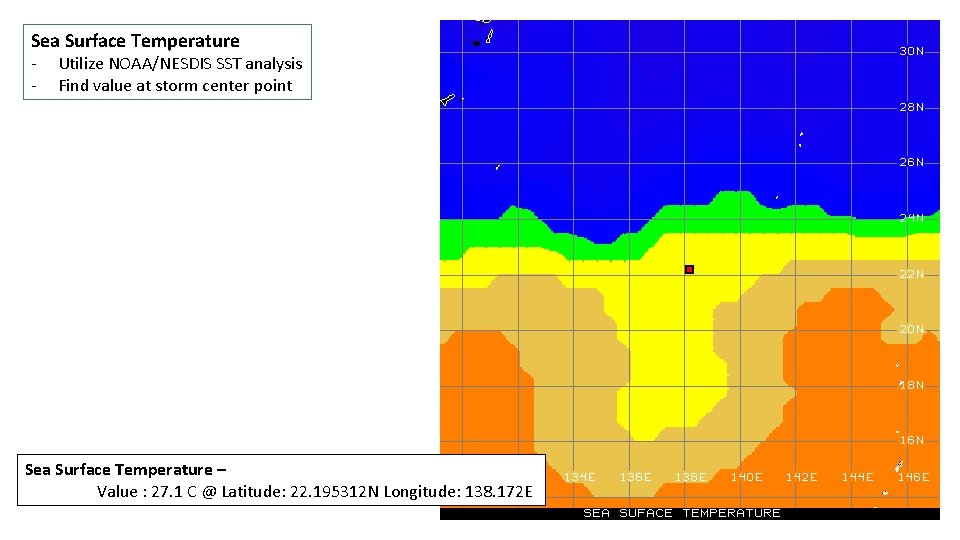
Sea Surface Temperature - Utilize NOAA/NESDIS SST analysis Find value at storm center point Sea Surface Temperature – Value : 27. 1 C @ Latitude: 22. 195312 N Longitude: 138. 172 E

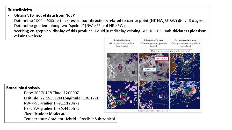
Baroclinicity - Obtain GFS model data from NCEP Determine 1000— 500 mb thickness in four directions related to center point (NE, NW, SE, SW) @ +/- 3 degrees Determine gradient along two “spokes” (NW->SE and NE->SW) Working on graphical display of this product. Could just display existing GFS 1000 -500 mb thickness plot from existing website. Baroclinic Analysis – Date: 20170428 Time: 120000 Z Latitude: 22. 195312 N Longitude: 138. 172 E NW-->SE gradient: -91. 5120 h. Pa NE-->SW gradient: -35. 4400 h. Pa Classification: Moderate Temperature Gradient Hybrid - Possible Subtropical

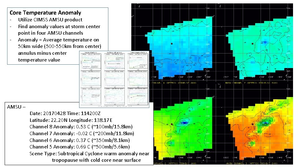
Core Temperature Anomaly - Utilize CIMSS AMSU product Find anomaly values at storm center point in four AMSU channels Anomaly = Average temperature on 50 km wide (500 -550 km from center) annulus minus center temperature value AMSU – Date: 20170428 Time: 114200 Z Latitude: 22. 20 N Longitude: 138. 17 E Channel 8 Anomaly: 0. 53 C (~100 mb/15. 8 km) Channel 7 Anomaly: -0. 02 C (~200 mb/11. 8 km) Channel 6 Anomaly: 0. 37 C (~350 mb/8. 1 km) Channel 5 Anomaly: 0. 69 C (~500 mb/5. 6 km) Scene Type: Subtropical Cyclone warm anomaly near tropopause with cold core near surface

JTWC Low-Medium-High Worksheet

Low Level Structure - Symmetry - Utilize CIMSS Convergence as proxy Find maximum value - Measure to threshold value - Threshold = 0. 75*(Max) - 800 km analysis radius - May also use SSMI imagery for symmetry Could also use new ADT 2 D wind product Low Level Structure (Convergence) – Value : 14. 0 x 10^-6 s^-1 @ Latitude: 21. 01 N Longitude: 142. 24 E Theta : 110 Symmetry : 1. 404 Max Width : 363. 2 km -- 55 -235 axis Min Width : 258. 7 km -- 165 -345 axis Symmetry : Symmetric

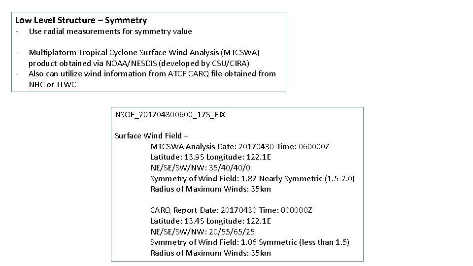
Low Level Structure – Symmetry - Use radial measurements for symmetry value - Multiplatorm Tropical Cyclone Surface Wind Analysis (MTCSWA) product obtained via NOAA/NESDIS (developed by CSU/CIRA) Also can utilize wind information from ATCF CARQ file obtained from NHC or JTWC - NSOF_201704300600_17 S_FIX Surface Wind Field – MTCSWA Analysis Date: 20170430 Time: 060000 Z Latitude: 13. 9 S Longitude: 122. 1 E NE/SE/SW/NW: 35/40/40/0 Symmetry of Wind Field: 1. 87 Nearly Symmetric (1. 5 -2. 0) Radius of Maximum Winds: 35 km CARQ Report Date: 20170430 Time: 000000 Z Latitude: 13. 4 S Longitude: 122. 1 E NE/SE/SW/NW: 20/55/65/25 Symmetry of Wind Field: 1. 06 Symmetric (less than 1. 5) Radius of Maximum Winds: 35 km

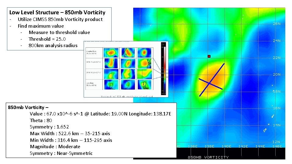
Low Level Structure – 850 mb Vorticity - Utilize CIMSS 850 mb Vorticity product Find maximum value - Measure to threshold value - Threshold = 25. 0 - 800 km analysis radius 850 mb Vorticity – Value : 67. 0 x 10^-6 s^-1 @ Latitude: 19. 00 N Longitude: 138. 17 E Theta : 80 Symmetry : 1. 652 Max Width : 522. 6 km -- 35 -215 axis Min Width : 316. 4 km -- 115 -295 axis Magnitude : Moderate Symmetry : Near-Symmetric

Dvorak Fix Values - Utilize TAFB and SAB Dvorak Analysis Add ADT and SATCON in near future? Dvorak – PGTW: T 1. 0 (T 1. 5/2. 0/W 2. 0/24 HRS/S 0. 0/03 HRS) 30/0850 Z @ Latitude: 13. 31 S Longitude: 121. 82 E KNES: T 1. 0 (T 1. 0/2. 0/W 2. 0/24 HRS) 30/0530 Z @ Latitude: 13. 4 S Longitude: 121. 9 E

Model Development not examined yet

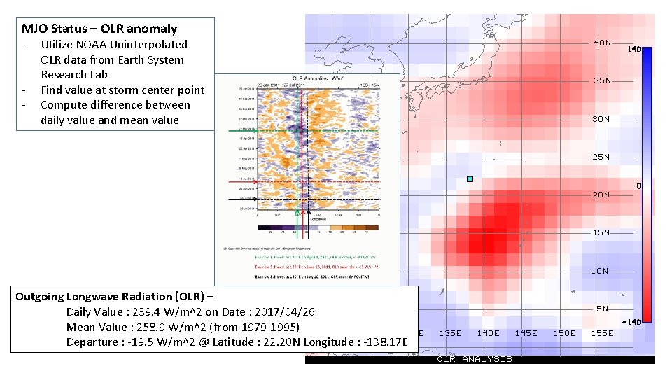
MJO Status – OLR anomaly - Utilize NOAA Uninterpolated OLR data from Earth System Research Lab Find value at storm center point Compute difference between daily value and mean value Outgoing Longwave Radiation (OLR) – Daily Value : 239. 4 W/m^2 on Date : 2017/04/26 Mean Value : 258. 9 W/m^2 (from 1979 -1995) Departure : -19. 5 W/m^2 @ Latitude : 22. 20 N Longitude : -138. 17 E

Vertical Wind Shear - Utilize CIMSS Wind Shear product Find value at storm center point Use CIMSS shear email info? Vertical Wind Shear – Value : 15. 0 m/s @ Latitude: 22. 195312 N Longitude: 138. 172 E Classification : Moderate

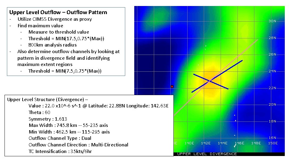
Upper Level Outflow – Outflow Pattern - - Utilize CIMSS Divergence as proxy Find maximum value - Measure to threshold value - Threshold = MIN(17. 5, 0. 75*(Max)) - 800 km analysis radius Also determine outflow channels by looking at pattern in divergence field and identifying maximum extent regions - Threshold = MIN(7. 5, 0. 75*(Max)) Upper Level Structure (Divergence) – Value : 22. 0 x 10^-6 s^-1 @ Latitude: 22. 88 N Longitude: 142. 63 E Theta : 60 Symmetry : 1. 613 Max Width : 745. 8 km -- 55 -235 axis Min Width : 462. 5 km -- 115 -295 axis Outflow Channel Type : Dual Outflow Channel Direction : Multi-Directional TC Intensification : 35 kts/6 hr

Where things currently stand - Currently have several products to examine in development suite - Need to fine tune current suite to mimic JTWC analysis for each individual product - Also need to further investigate additional products (e. g. ADT 2 D wind field) for use with current product suite or to replace products that are not sufficient (e. g. Convergence analysis for surface wind fields) Next Steps - Must determine if other products currently missing (e. g. Model Development and other model based products) can be automated - Once all products are automated and working correctly (mimicking JTWC analysis), the final combined assessment of Phase or Low-Medium-High using all related products must be performed.