CUSTOMIZING GR 2 ANALYST SOFTWARE 11 th Annual


 provides a")


 of the 3 D")


- Slides: 50
CUSTOMIZING GR 2 ANALYST SOFTWARE 11 th Annual High Plains Conference Hastings, NE August 16 th/17 th by Van De. Wald van. dewald@noaa. gov Lead Meteorologist National Weather Service Omaha/Valley
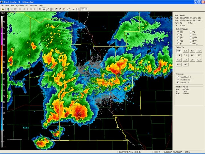
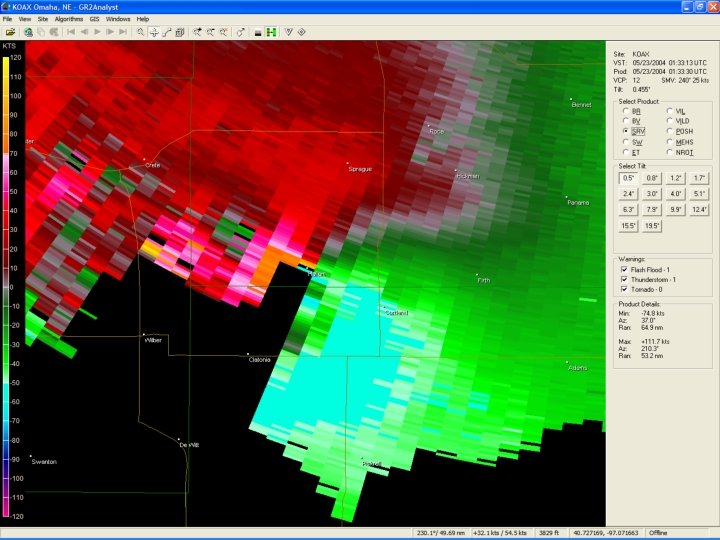
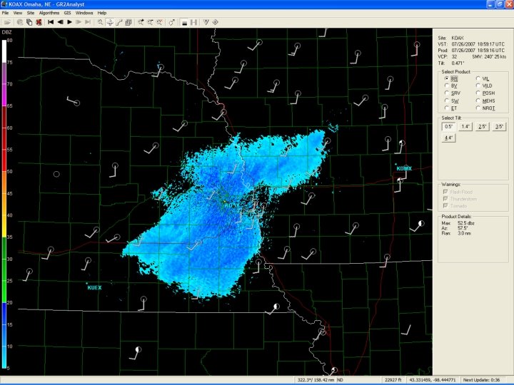
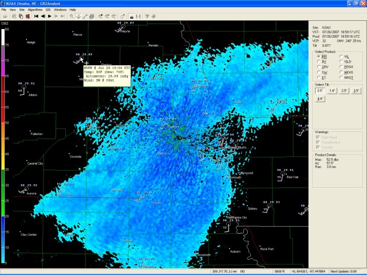
GR 2 Analyst �A PC based radar viewing and analysis software package developed by Gibson Ridge Software. The software displays base WSR 88 D Level II and computed data. �Implements 2 D traditional plan views, pseudo 3 D cross sections, and true 3 D volumetric displays, the precursor to FSI software being developed for AWIPS OB 8. 3. �A very useful and powerful program by itself, but can be highly customized with supplementary data. �Does have specific hardware requirements (graphics and memory) to run. �http: //www. grlevelx. com/
How to Obtain Real-Time Data � The Iowa State Environmental Mesonet (IEM) provides a 24 -hour archive of WSR 88 D Level II data for all sites nationwide. � http: //mesonet. agron. iastate. edu/data/nexrd 2/raw � This is the only free site that currently exists that can be used for live polling of Level II data. �Data mostly on time, but occasionally lags behind due to network design. � A paid data subscription can be purchased through a couple of private vendors.
Level II Data Flow WSR 88 D NWS Radar Server / ht tp : / LDM BD DS Computer with GR 2 AE ORPG Iowa State Web Server
Archived Level II Data � Previous 30 Days – Texas Mesonet � http: //mesonet. tamu. edu/products/RADAR/nexrad/CRAFT � Beginning of the WSR 88 D Network � http: //hurricane. ncdc. noaa. gov/pls/plhas/has. dsselect � Neither of the above sites can be used for live polling!
Custom Background Images
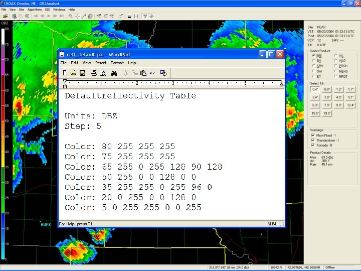
Custom Color Curves
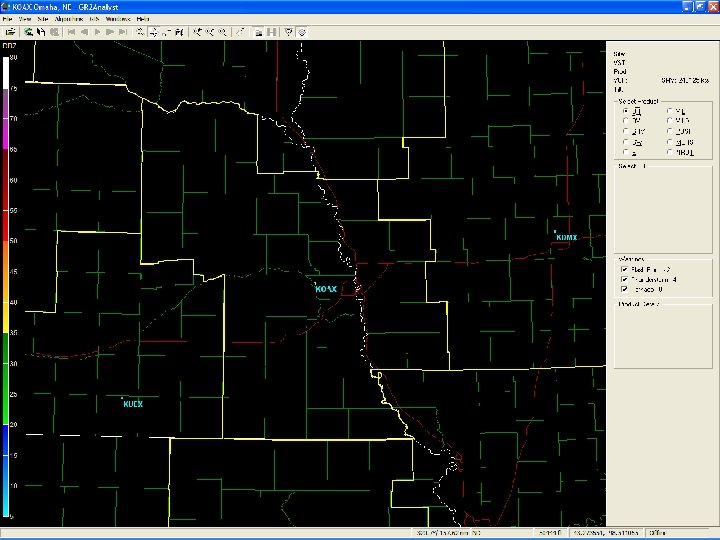
Custom Place Files � Places files are standard text files that display icons, polygons, line segments, text, etc. � Can have up to 128 place files per radar site. � Place files can be static (loaded once) or dynamic (loaded with a specific refresh interval). � Not supplied with the program, but obtained from other sources. � Mostly used during real-time polling of data.
NWS County Warning Outlines � Useful to track storms from one NWS area of responsibility to another. � Example of a static place file.
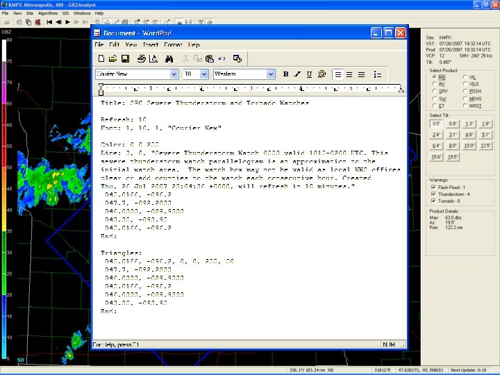
Severe Weather Boxes � Example of a dynamic place file, with new data loaded based on the refresh interval.
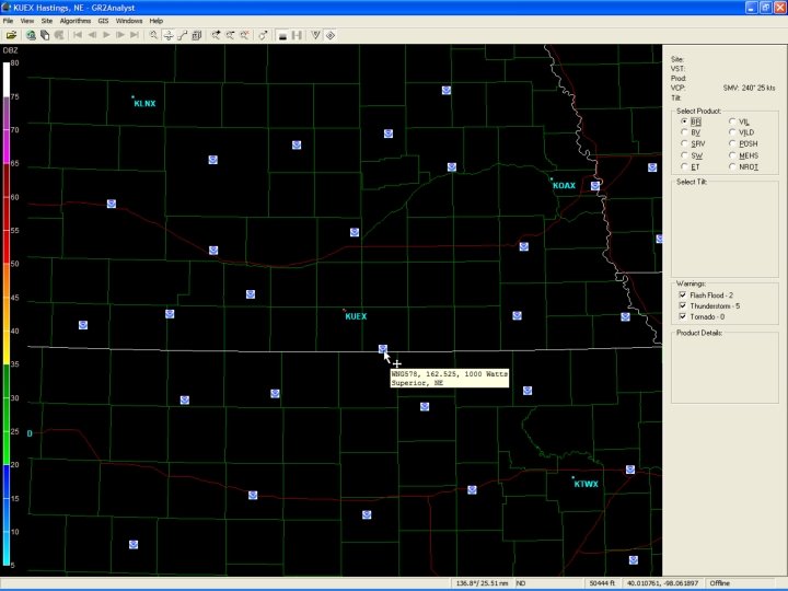
NOAA Weather Radio Icons � Another example of a static place file.
Local Storm Reports � A dynamic place file.
METAR Data
Spotter Network Icons � A voluntary program where spotters and storm chasers transmit their GPS coordinates every few minutes. � The next big thing? �http: //www. spotternetwork. org/
An estimated 200 spotters converged on this storm, about 18 icons were noted here.
Day 1 Severe Weather Outlook
Mesoscale Convective Discussions � Contours with MCD text.
Shape Files GIS � Standard GIS shape files can be loaded. � Useful to load additional mapping features that may be of interest. � Street-level roads and highways, streams, rivers, lakes, other transportation conduits, airports, etc. � Basically, anything GIS related that can be loaded in AWIPS can be used in the program.
County-Level Roads
Street-level roads display when zooming in. When holding your cursor over a road, the name of the street or road will be displayed in the bottom left corner of the window.
Hydrography
Pierce County
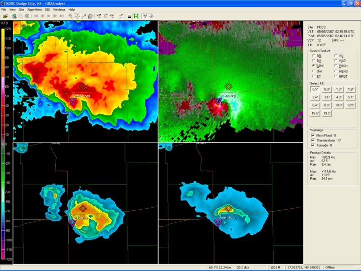
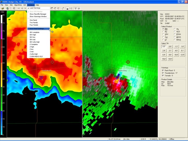
2/4 -Panel Displays � Useful for loading multiple panes of data simultaneously, just like AWIPS. � Does not support linked cursors, but you can place a marker on the screen which will be visible on all panes.
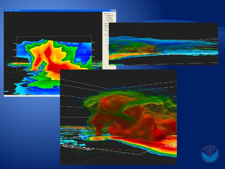
3 -Dimensional Displays � Perhaps one of the most useful features of the software. � Allows meteorologists and weather enthusiasts to view storms as never seen before. � Pseudo 3 D cross sections can be generated, along with true 3 D volumetric displays. � Can see suspended hail cores, descending reflectivity cores, rotational couplets, etc.
Understanding Alpha Curves � Alpha curves control the opacity (transparency) of the 3 D display. � Can be tricky to comprehend at first. � Once you understand knobology, one can easily peel away layers of reflectivity to show the most important portion of the storm, or you can use pre-defined color curves to highlight various storm-scale features.
Transparency The Volume Alpha Window 10 20 30 40 50 60 70 80 90 100 Huh, what the heck is this?
Transparency 10 20 30 40 50 60 70 80 90 100
Transparency 10 20 30 40 50 60 70 80 90 100
Saving Alpha Curves
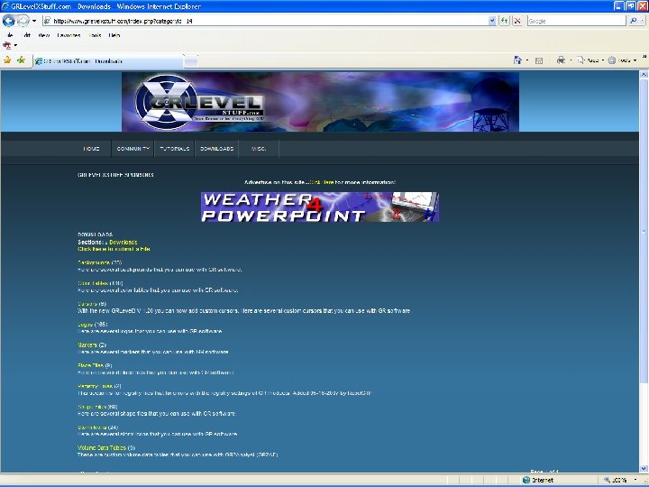
Gibson Ridge Software User-Submitted Repository � For custom background images, color curves, shape files, logos, place files and more… �http: //www. grlevelxstuff. com/ � You do have to register at this site to gain access, but it’s free!
Where to Download More Free Data � For METAR data, Day 1 Convective Outlooks, and more… � http: //grlevel 3. tornadocentral. com/ � For Storm Reports, SPC Watch Boxes, Mesoscale Convective Discussions, NWS CWA boundaries, Shape Files, and more… � http: //vansvault. org/weather/grlevelx/ �. . /resources
Additional Resources � The GRLevel. X http: //www. grlevelx. com/owners/ Bulletin Board, but must be a registered owner to access. � Moderated by the software author. � Can get results near instantaneously from a huge network.
In Summary � GR 2 Analylst is a very powerful radar display program on its own merit. � However there are several customizations that you can perform to take it to the “next” level which will enhance your experience. � This has/will revolutionize the way we interpret the radar data, and is the natural stepping stone to real-time 3 D data in AWIPS via FSI. van. dewald@noaa. gov 402 -359 -5166 x 614