Current Satellite Observing Network and its Future Evolution

Current Satellite Observing Network and its Future Evolution Stephen English Stephen. English@ecmwf. int 1. A brief introduction to the Satellite GOS 2. OSCAR – WMO’s database for information on observations, user requirements and gap-analysis 3. EPS Second Generation / Meteosat Third Generation 4. ESA Earth Explorer missions: Earth. CARE and Aeolus 5. Quick summary of other missions 6. WMO Vision 2040 for the WIGOS © ECMWF 18 th March 2016

What types of satellites are used in NWP? Advantages GEO - Regional coverage Disadvantages No global coverage by single satellite - Temporal coverage LEO - Global coverage with single satellite EUROPEAN CENTRE FOR MEDIUM-RANGE WEATHER FORECASTS

Example of 6 -hourly satellite data coverage LEO Sounders LEO Imagers Scatterometers GEO imagers GPS Radio Occultation Satellite Winds (AMVs) 30 March 2012 00 UTC

Satellite orbits Mid AM Europe Early AM China India Met. Op-B, A FY-3 A T i m e DMSP F 17, F 18 NOAA-15 PM NOAA-19, S-NPP, Aqua, Terra, Aura, FY-3 B Adapted from EUROPEAN CENTRE FOR MEDIUM-RANGE WEATHER FORECASTS US China

OSCAR • Observation Systems Capability Analysis and Review – A tool developed by WMO to assist with the “Rolling Requirements Review” and the development of “WMO Integrated Global Observing System” WIGOS • What do we need? • What is there? • Where are the gaps? • But OSCAR is more than this. It provides valuable and usually very up to date information both to satellite data specialists and the wider interested meteorological community. http: //www. wmo-sat. info/oscar/ EUROPEAN CENTRE FOR MEDIUM-RANGE WEATHER FORECASTS

Types of sensor • • Orbit View geometry Wavelength Passive or Active Issues • • Calibration accuracy Signal to noise ratio Complexity of interpretation 3 D spatial and temporal resolution EUROPEAN CENTRE FOR MEDIUM-RANGE WEATHER FORECASTS

EPS Second Generation A little of the history that led to EPS-SG… • • • 1970 s : Research sounders with a few channels = SCAMS, VTPR+ 1979 : TOVS (NOAA) = HIRS/2→/3, MSU, SSU, AVHRR 1999 : ATOVS (NOAA) = HIRS/3→/4, AMSU-A, AMSU-B→MHS, AVHRR 2002 : A-train: AIRS, MODIS, Cloud. Sat, Calipso+ 2007 : EPS First Generation (Metop) = ATOVS + IASI, ASCAT, GRAS, GOME-2 2011 : S-NPP = ATMS, Cr. IS, VIIRS, OMPS • ~2021: • • EPS-SG-A (3 sats) 2021 -2042 = mostly EPS follow on instruments EPS-SG-B (3 sats) 2022 -2043 = mostly new instruments EUROPEAN CENTRE FOR MEDIUM-RANGE WEATHER FORECASTS

EPS Second Generation ~2021 EPS-SG will have updated counterparts to Metop 2 nd generation instruments on EPS-SG-A: • ATOVS + AVHRR/MODIS → MWS + Met. Image • IASI → IASI-NG • ASCAT → SCA (on EPS-SG-B) • GOME-2 → Sentinel-5 UVNS • GRAS → RO Plus some instruments new compared to Metop, on EPS-SG-A • MWI: based on SSM/I • 3 MI: based on POLDER and PARASOL (VIS/NIR/SWIR) • ICI: completely new! Sub-mm imager for cloud ice EUROPEAN CENTRE FOR MEDIUM-RANGE WEATHER FORECASTS
 From Cloud. Ice")
EPS-SG: Ice Cloud Imager - ICI From John and Soden (2006) From Cloud. Ice proposal (Buehler et al. ) EUROPEAN CENTRE FOR MEDIUM-RANGE WEATHER FORECASTS

EPS-SG: Multi-Viewing Multi-Channel Multi-Polarisation Imaging Mission - 3 MI = POLDER + MODIS heritage • Multi-directional : 10 -14 views for one pixel Exploits bi-directional reflectivity • Multi-polarization : ± 60, 0 o • Multi-spectral : 12 channels 388 to 2130 nm (close to MODIS specification) EUROPEAN CENTRE FOR MEDIUM-RANGE WEATHER FORECASTS

What can be obtained depends on avoiding sun-glint GLINT West Case 1 Optical depth + some size and refractive index information Optical depth + size and refractive index information for coarse and fine particles EUROPEAN CENTRE FOR MEDIUM-RANGE WEATHER FORECASTS

Meteosat Third Generation A little of the history that led to MTG-IRS • • • 1977 1989 1995 2002 2005 : Meteosat-1: 3 channel MVIRI instrument (by ESA) : Meteosat-4: first operational Meteosat : EUMETSAT takes over Meteosat operations : 2 nd generational Meteosat: 12 channel SEVIRI on Meteosat-8 : NASA aspiring to launch first Geo interferometer ~ 2019 Meteosat Third Generation • MTG-I 2019 (4 sats) 2019 -2039 • MTG-S 2021 (2 sats) 2021 -2037 EUROPEAN CENTRE FOR MEDIUM-RANGE WEATHER FORECASTS

Meteosat Third Generation ~2018 MTG-I will have updated counterpart to SEVIRI on MSG: • SEVIRI → FCI 16 channel imager • European rapid scan 2. 5 minutes, full disk 10 minutes. Plus new instruments on MTG-I and MTG-S (from ~2020): • IRS: IR interferometer (never previously launched in Geo orbit) • LI: Lightning imager (777. 4 nm) • UVN: Ultraviolet, Visible and Near IR imager EUROPEAN CENTRE FOR MEDIUM-RANGE WEATHER FORECASTS

MTG: Infrared Sounder - IRS • An imaging Fourier-interferometer with a hyperspectral resolution of 0. 625 cm-1 wave-number • Two bands, the 700– 1210 cm-1 Long-Wave Infra. Red (LWIR) and the 1600– 2175 cm-1 Mid-Wave Infra. Red (MWIR) • Spatial resolution of 4 km. • Full Disk basic repeat cycle of 60 min. • Moisture flux convergence from combination of humidity and wind (through feature tracking) • High potential for nowcasting and NWP. • ECMWF workshop in January 2017 dedicated to exploitation of high temporal Advanced IR Sounder information. EUROPEAN CENTRE FOR MEDIUM-RANGE WEATHER FORECASTS

MTG: Infrared Sounder - IRS LW CO 2 MW H 2 O

Aeolus: doppler wind lidar – Active measurement of Doppler shift in backscattered laser – Direct information on horizontal line of sight wind mostly in the zonal direction – Provides a “curtain” of observations along orbit (2 D cross section) • Vertical resolution 250 m (PBL) to 2 km (Stratosphere) • Horizontal resolution ~90 km – Winds are derived from molecular (Rayleigh) or particulate (Mie) backscattering – Technologically challenging and launch date has changed many times. Now expected ~2017. EUROPEAN CENTRE FOR MEDIUM-RANGE WEATHER FORECASTS

Aeolus: doppler wind lidar Continuous mode 1 basic repeat cycle 30 x 2. 85 km each 6 hr coverage km 86 sec) (12 EUROPEAN CENTRE FOR MEDIUM-RANGE WEATHER FORECASTS

Simulated Aeolus wind observations EUROPEAN CENTRE FOR MEDIUM-RANGE WEATHER FORECASTS

Earth. CARE: cloud radar and lidar Earth. Care Earth. CARE Th. A-Train – – – Launched 2006 NASA 700 -km orbit Cloud. Sat 94 -GHz radar CALIPSO 532/1064 -nm lidar MODIS, CERES and AMSR-E radiometers § Expected launch c. 2018 § ESA+JAXA § 400 -km orbit (more sensitive) § CPR: 94 -GHz Doppler radar § ATLID: 355 -nm lidar § MSI and BBR radiometers EUROPEAN CENTRE FOR MEDIUM-RANGE WEATHER FORECASTS

Earth. CARE: cloud radar and lidar O B A δq δT Radar Lidar (S Di Michele and M Janisková)

GPM Feb 2014 Some other key missions • JAXA/JMA • • FY 3 C Sept 2013 Sentinel series (1, 2, 3 up, 4, 5 p, 5, 6 to come) NSPO • • Meghatropiques SAPHIR sounder ESA / EUMETSAT / European Commission • • Feng Yun satellite series • FY-3 C similar to Metop • FY-4 similar to MTG ISRO / CNES • • Himawari-8 – “MODIS on GEO!” (as GOES-R) GCOM-W 1: AMSR 2 GPM: GMI and DPR CMA • • Meghatropiques Oct 2011 COSMIC-2 (RO) Do. D, CSA, Ros. Hydro. Met, KMA, NSAOS, UCAR, DLR, CONAE, IMD EUROPEAN CENTRE FOR MEDIUM-RANGE WEATHER FORECASTS Sentinel-1 April 2014

Full operational system. GOS + forecast changes with time ERA-Interim skill shows little change 1980 -2000 when there was little change in the GOS. The ATOVS era shows a gain of around 6 -18 hours in predictable skill compared to the TOVS era. Re-analysis system. Only GOS changes with time ERA-Interim excludes more recent data e. g. IASI and ASCAT so the impact of newer data is hard to judge. This compares to overall ECMWF gain in skill of about 2 -3 hours per year. TOVS ATOVS + Hyperspectral IR
 design Examples questions we use Data Assimilation techniques")
WMO Integrated Global Observing System (WIGOS) design Examples questions we use Data Assimilation techniques to study: • Very specific questions e. g. Would it be beneficial for the Chinese FY 3 program to move to the “early morning orbit” with the Europeans occupying the “mid morning orbit” and the Americans the “afternoon orbit”? • Preparation for future instruments such as lidar and radar (Earth. CARE) – will these observations make a difference? • Which observations are most critical to forecast skill? • Monitoring the quality of observations – protecting the operational system e. g. HCN event. • Protecting our needs e. g. Radiofrequency interference.

Developing WIGOS • Vision for WIGOS in 2025 adopted June 2009 • Vision for WIGOS in 2040 currently under development - Goal of new WIGOS vision by 2018 or 2019 - Sets goals for the Space Agencies and attempts to coordinate • Understanding WIGOS - WMO Space provide detailed support for satellite data from www. wmo-sat. info: - OSCAR lists what exists, what is planned, what it can do, how this compares to requirements: http: //www. wmo-sat. info/oscar/ - SATURN provides detailed information to prepare forthcoming launches: data availability, formats, meta data, test data, points of contact: https: //www. wmo-sat. info/satellite-user-readiness/ - The Product Access Guide provides information on existing datasets and how to obtain them: https: //www. wmo-sat. info/product-access-guide/ EUROPEAN CENTRE FOR MEDIUM-RANGE WEATHER FORECASTS October 29, 2014 26

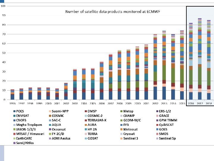
Summary • WMO trying to coordinate Global Observing System, with some success • We have a core component of WIGOS for meteorology with: – Microwave, IR and Radio Occultation sounders for temperature and humidity – Atmospheric Motion winds and Scatterometer winds – Microwave imagers and cloud + precipitation radar for clouds/precipitation • OSCAR database allows easy examination of what exists, and to what purpose. • New and exciting developments – Lidar: for wind, clouds and aerosol; Cloud radar (ESA Earth Explorer) – Visible for aerosol, sub-mm for ice cloud (EPS-SG) – Hyperspectral IR on Geo (MTG, FY 4) • Needs advances in models, data assimilation, observation operators and data handling, quality control and characterisation. Also preparing for future Earth System rather than pure NWP approaches, with coupled models and data assimilation EUROPEAN CENTRE FOR MEDIUM-RANGE WEATHER FORECASTS October 29, 2014 27

Sun-Synchronous Polar Satellites Instrument Early morning orbit High spectral resolution IR sounder Morning orbit Afternoon orbit IASI Aqua AIRS NPP Cr. IS Microwave T sounder F 16, 17 SSMIS Metop AMSU-A FY 3 A MWTS DMSP F 18 SSMIS Meteor-M N 1 MTVZA NOAA-15, 18, 19 AMSU-A Aqua AMSU-A FY 3 B MWTS, NPP ATMS Microwave Q sounder + imagers F 16, 17 SSMIS Metop MHS DMSP F 18 SSMIS FY 3 A MWHS NOAA-18, 19 MHS FY 3 B MWHS, NPP ATMS Broadband IR sounder Metop HIRS FY 3 A IRAS NOAA-19 HIRS FY 3 B IRAS IR Imagers Metop AVHRR Meteor-M N 1 MSU-MR Aqua+Terra MODIS NOAA-15, 16, 18, 19 AVHRR Composition (ozone etc). NOAA-17 SBUV NOAA-18, 19 SBUV ENVISAT GOMOS AURA OMI, MLS ENVISAT SCIAMACHY GOSAT
 Instrument Early morning orbit Scatterometer Morning orbit Afternoon orbit Metop")
Sun-Synchronous Polar Satellites (2) Instrument Early morning orbit Scatterometer Morning orbit Afternoon orbit Metop ASCAT Coriolis Windsat Oceansat OSCAT Radar Cloud. Sat Lidar Calipso Visible reflectance Parasol L-band imagery SMOS SAC-D/Aquarius Non Sun-Synchronous Observations Instrument Radio occultation High inclination (> 60°) GRAS, GRACE-A, COSMIC, Terra. Sar. X C-NOFS, (SAC-C), ROSA MW Imagers Radar Altimeter Low inclination (<60°) TRMM TMI Meghatropics SAFIRE MADRAS ENVISAT RA JASON Cryosat

Data sources: Geostationary Satellites Product Status SEVIRI Clear sky radiance Assimilated SEVIRI All sky radiance Being tested for overcast radiances, and cloud-free radiances in the ASR dataset SEVIRI total column ozone Monitored SEVIRI AMVs IR, Vis, WV-cloudy AMVs assimilated GOES AMVs MTSAT AMVs
- Slides: 29