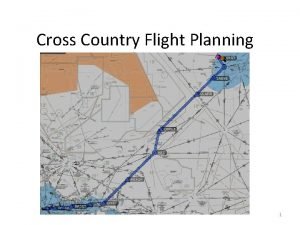
CROSS COUNTRY PLANNING DEFINITION n Point to point


- Slides: 26

CROSS COUNTRY PLANNING

DEFINITION n Point to point flight measured in a straight line that is > 50 nm

CROSS COUNTRY PLANING n This process involves many steps, TAKE THEM ONE AT A TIME n n Many of the steps can be determined well in advanced n DO THIS n You will become more familiar with your route and what to expect Slides with a advanced * can be done in

ITEMS YOU WILL NEED* n Appropriate & CURRENT Charts n n n n SEC, AFD, Airport directory, TAC Pilot Information Manual Navigation Log (s) Flight Computer Plotter Pencils (Mechanical) Complete Weather Briefing (Standard) NOTAMS (FDC, L, D)

First you need to know where you are and where you are going* n Determine that your charts are current n Very Important n Do not fly with out of date charts n n Find your departure airport on the chart n n Surprise……. 2000 ft T. V. TOWER WWW. AIRNAV. COM Find your destination on the chart n DOES IT MEET YOUR REQUIREMENTS n Distance-----50 NM

Look at what is in between* n You are planning for your preferred route n n n This may be a straight line VOR –VOR OR IFR (I Follow Roads) n n Plot your preferred route in pencil n n Or anything else for that matter (VFR HERE FOLKS) You can Highlight the route later THIS ROUTE MAY CHANGE!!!!!

CHECK NOTAMS* n As a preliminary step, check NOTAMS & T. V forecast (long range) to find out early about anything out of the ordinary n n Airport closures, Navaids down, changed frequencies etc. These are things that may change your routing Adjust as necessary NOW YOU CAN HIGHLIGHT!

FREQUENCY INFO* n Now that you have checked the NOTAMS n n Fill in the frequency boxes Use the A/FD n AOPA guides and others

Measure True Course* n Determine each leg n n n It may be 1 or it may be more Determine Magnetic Variation for each leg Determine Magnetic Course for First Leg n Initial cruising Altitude

Determine the Checkpoints for your Route n n Mark the check points on your Sectional Label them on your Navigation log. n n 1 st check point is always your departure point Measure the distance between them and put on Navigation log n Keep total n Is the total the same as the Straight out Measurement

What makes a good checkpoint? n n About every 10 -15 miles MUST be able to see it (VFR DUH!!) n n Should be identifiable by at least 3 different descriptors n n n Private airfields are lousy Lake with a power line is lousy Lake West of Jamestown with a power line in the West side is EXCELLENT Some other examples

What Altitude are we going to Fly? n n n Determine altitude (s) that could be flown MEF’s Magnetic Course, Winds, MSA FAR 91. 119…. WHICH SAYS………

FAR 91. 119 MSA’s* n ANYWHERE- if a power unit fails, an emergency landing can be made without undue hazards to persons or property on the surface. n OVER CONGESTED AREAS-… Open air assembly of persons, an altitude of 1000 feet above the highest obstacle within a horizontal radius of 2000 feet of the aircraft

FAR 91. 119 MSA’s* WHAT ELSE DOES 91. 119 SAY? n Over Other Than Congested… n n An altitude of 500 ft above the surface, except over open water or sparsely populated areas. In those cases, the aircraft may not be operated closer than 500 ft to any person, vessel, vehicle, or structure

Then What…. . * n n Now that the FAA is happy, what altitude should we use? MEF’S, Magnetic Course, Winds MEF’s ‘……. we talked about those Magnetic course n When do we HAVE to follow this rule n What are the stipulations

Pre FAA Flight Plan n Fill out these items Now n n n n n Type of flight Aircraft Type & Equipment Departure Point Route of Flight Destination Remarks Pilot’s Name Souls on Board Color of the Aircraft

Preliminary Weight & Balance n n Probably can determine Weight & Balance up through Zero Fuel Weight Possibly up to GTOW n Including Takeoff C. G

Time to give the Weather Folks a call n 1 -800 -WX-BRIEF n STANDARD WX BRIEF n n Ask for winds at 3, 6, 9 or Higher!? n n REFER TO FAA FLIGHT PLAN Winds aloft are forecast and true NOW IT’S TIME TO DO SOME PLANNING…. . ALRIGHT!!!!!

AIRCRAFT PERFORMANCE n n Weight & Balance----Takeoff Determine Pressure and Density Alt. n Departure Airport, Cruise, & Destination Airport n n Some Aircraft Manuals use DA READ THE CHARTS…. n WHERE DO THEY COME FROM!

PILOTS OPERATING HANDBOOK (POH) n n Pilot Information Manuals Determine n n n Takeoff Performance Climb Performance Cruise Performance [be sure of leaning procedures] Endurance Landing Performance [Decent if possible]

WHAT HEADING n n n Complete the compass heading planning Remember winds aloft forecast are true Determine Compass heading for the different legs n You may want to substitute the MH if you properly set the Directional Gyro n That means taking into account Magnetic Deviation

NAV LOG n n n Complete the Navigation log portion Fill in the items needed for quick reference--fuel, winds aloft, cruise settings Fill in checkpoints as appropriate n n n Include NAV Frequencies & Idents Fill in Compass Headings Estimated times Estimated Fuel Burns Add totals

Side Note on 1 st Checkpoint n ADD your Time & Fuel to climb to you first checkpoint n Why n That time & fuel will be used in maneuvering out of the traffic pattern & getting established on course

FINISHING UP n Complete the navigation log n Complete weight & balance n n Landing can be done now that approximate fuel burn is known Other notes as needed n n FSS frequencies Alternate & route of flight to the Alternate How to open & close your flight plan ETC. . ETC

FAA FLIGHT PLAN n n COMPLETE THE FAA FLIGHT PLAN & FILE NOW WE MUST ORGANIZE

ORGANIZTION n ORGANIZTION YOURSELF & THE AIRCRAFT n n n n Set Charts were they can be reached Set timer in Conspicuous place Charts folded appropriate Kneeboard or Lap Desk Flashlights, etc Flight Computer & Plotter $$$ for Food & Fuel
 How to fill out a nav log
 Host country and home country
 Intra country vs inter country
 Cross country orienteering and score orienteering
 A tomato flames
 Texas cross country coaches association
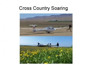
 Cross country soaring
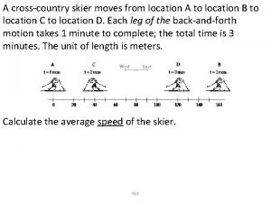
 A cross country skier moves from location a
 Wiaa rules clinic
 Wiaa cross country rules
 Woodside cross country
 Oxford university cross country
 Polish national sport
 Directorate of town & country planning
 Test cross and back cross
 Test cross and back cross with example
 Codominant inheritance
 Monohybrid cross vs dihybrid cross
 In the cross, in the cross be my glory ever
 Balanced occlusion
 Strategic planning vs tactical planning
 Goal achievement matrix
 Role segmentation workforce planning
 Inactivism planning
 Perencanaan kapasitas dan agregat
 Short term planning and long term planning
 Types of language planning slideshare
