
Creative NYC Zoning Fall 2016 Professor Raquel Ramati



- Slides: 42
Creative NYC Zoning Fall 2016 Professor Raquel Ramati
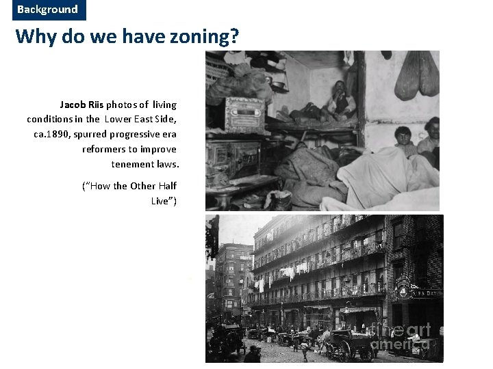
Background Why do we have zoning? Jacob Riis photos of living conditions in the Lower East Side, ca. 1890, spurred progressive era reformers to improve tenement laws. (“How the Other Half Live”) -
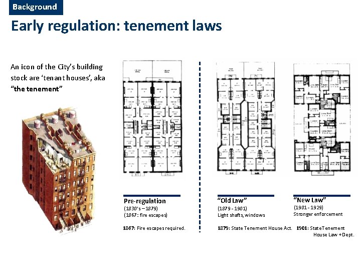
Background Early regulation: tenement laws An icon of the City’s building stock are ‘tenant houses’, aka “the tenement” Pre-regulation “Old Law” “New Law” (1901 - 1929) Stronger enforcement (1830’s – 1879) (1867: fire escapes) (1879 - 1901) Light shafts, windows 1867: Fire escapes required. 1879: State Tenement House Act. 1901: State Tenement House Law + Dept.
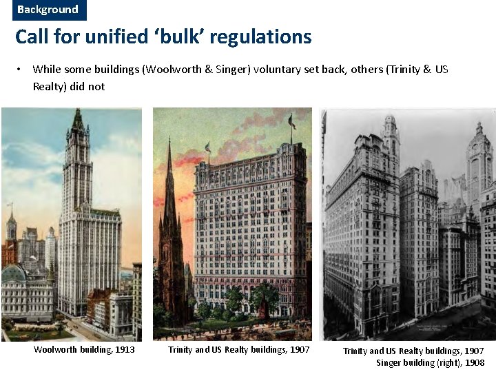
Background Call for unified ‘bulk’ regulations • While some buildings (Woolworth & Singer) voluntary set back, others (Trinity & US Realty) did not Woolworth building, 1913 Trinity and US Realty buildings, 1907 Singer building (right), 1908
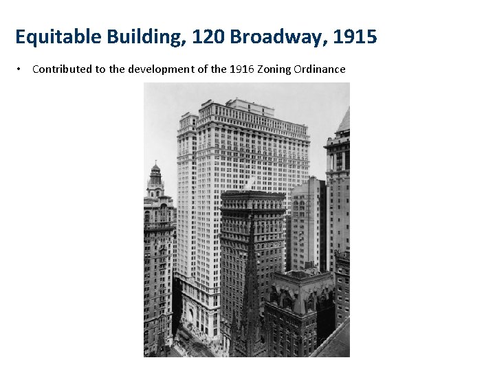
Equitable Building, 120 Broadway, 1915 • Contributed to the development of the 1916 Zoning Ordinance
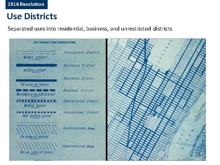
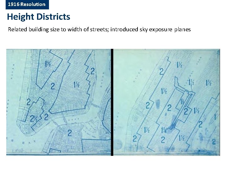
1916 Resolution 1916 Zoning Resolution New York City established the first Comprehensive Zoning Resolution in the United States Set of regulations related to 3 volumes of maps: Use Districts Separated uses (residential, retail, business, unrestricted) Height Districts Related building size to width of streets; introduced sky exposure planes Area Districts Specified yards, courts, types & size of residences
1916 Resolution Use Districts Separated uses into residential, business, and unrestricted districts
1916 Resolution Height Districts Related building size to width of streets; introduced sky exposure planes
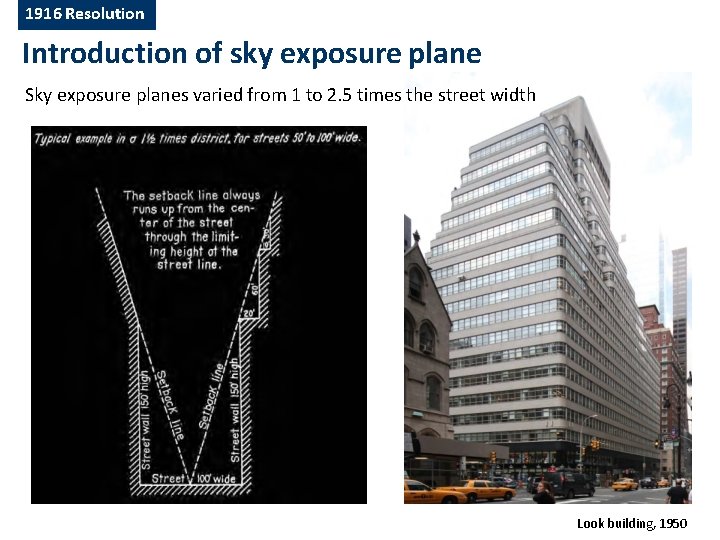
1916 Resolution Introduction of sky exposure plane Sky exposure planes varied from 1 to 2. 5 times the street width Look building, 1950
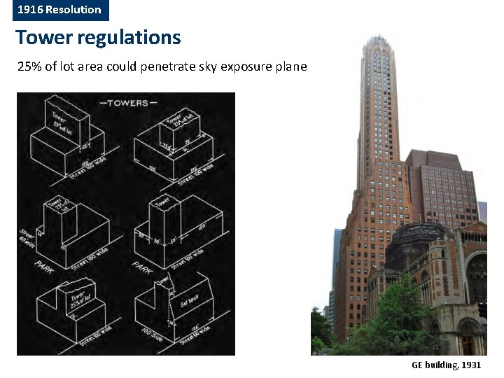
1916 Resolution Tower regulations 25% of lot area could penetrate sky exposure plane GE building, 1931
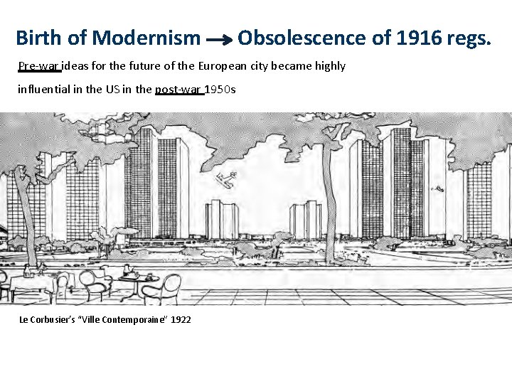
1916 Resolution Birth of Modernism Obsolescence of 1916 regs. Pre-war ideas for the future of the European city became highly influential in the US in the post-war 1950 s Le Corbusier’s “Ville Contemporaine” 1922
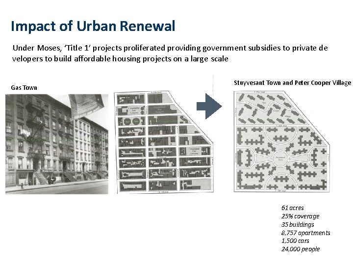
1916 Resolution Impact of Urban Renewal Under Moses, ‘Title 1’ projects proliferated providing government subsidies to private de velopers to build affordable housing projects on a large scale Gas Town Stuyvesant Town and Peter Cooper Village 61 acres 25% coverage 35 buildings 8, 757 apartments 1, 500 cars 24, 000 people
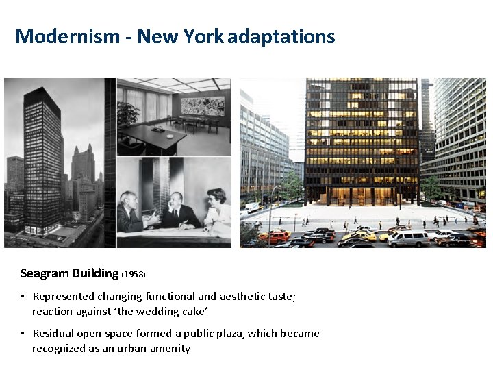
1916 Resolution Modernism - New York adaptations Seagram Building (1958) • Represented changing functional and aesthetic taste; reaction against ‘the wedding cake’ • Residual open space formed a public plaza, which became recognized as an urban amenity
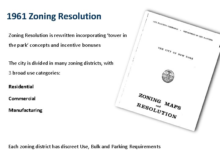
1961 Resolution 1961 Zoning Resolution is rewritten incorporating ‘tower in the park’ concepts and incentive bonuses The city is divided in many zoning districts, with 3 broad use categories: Residential Commercial Manufacturing Each zoning district has discreet Use, Bulk and Parking Requirements
1961 Resolution Zoning Districts Residence Districts: R 1 -R 10 Commercial Districts: C 1 -C 8 Manufacturing Districts: M 1 -M 3 Numbers indicate intensity of use- ranging from low to high R 1 - R 2 Residence Districts R 3 - R 4 Residence Districts R 5 - R 6 Residence Districts R 7 - R 8 w/ Residence Districts w/ R 9 – R 10 Residence Districts and C 4 – C 6 Numbers range from low-intensity to high-intensity C 1 or C 2 Commercial Districts Overlays
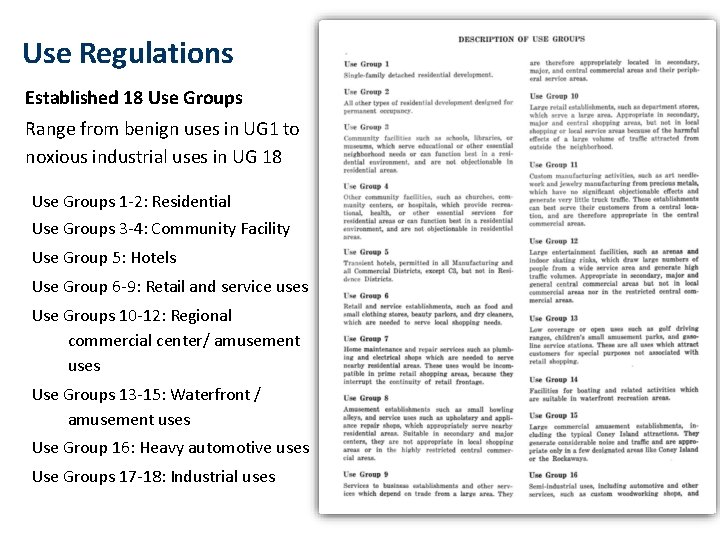
1961 Resolution Use Regulations Established 18 Use Groups Range from benign uses in UG 1 to noxious industrial uses in UG 18 Use Groups 1 -2: Residential Use Groups 3 -4: Community Facility Use Group 5: Hotels Use Group 6 -9: Retail and service uses Use Groups 10 -12: Regional commercial center/ amusement uses Use Groups 13 -15: Waterfront / amusement uses Use Group 16: Heavy automotive uses Use Groups 17 -18: Industrial uses
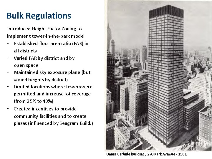
1961 Resolution Bulk Regulations Introduced Height Factor Zoning to implement tower-in-the-park model • Established floor area ratio (FAR) in all districts • Varied FAR by district and by open space • Maintained sky exposure plane (but varied heights by district) • Limited locations where towers were permitted and increase lot coverage (from 25% to 40%) • Created incentives to provide community facilities and to create plazas (influenced by Seagram Build. ) Union Carbide building , 270 Park Avenue - 1961
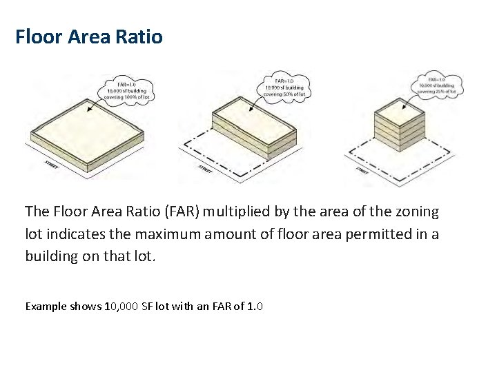
1961 Resolution Floor Area Ratio The Floor Area Ratio (FAR) multiplied by the area of the zoning lot indicates the maximum amount of floor area permitted in a building on that lot. Example shows 10, 000 SF lot with an FAR of 1. 0
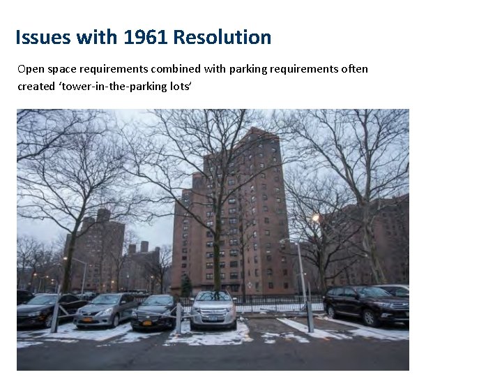
1961 Resolution Issues with 1961 Resolution Open space requirements combined with parking requirements often created ‘tower-in-the-parking lots’
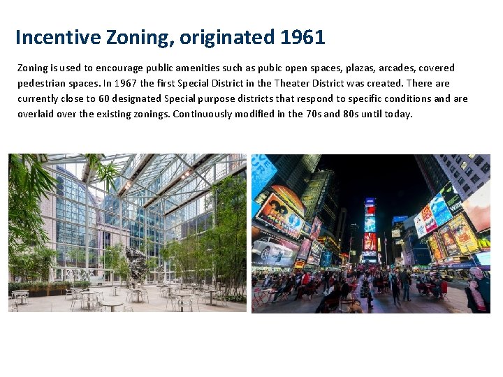
Incentive Zoning, originated 1961 Zoning is used to encourage public amenities such as pubic open spaces, plazas, arcades, covered pedestrian spaces. In 1967 the first Special District in the Theater District was created. There are currently close to 60 designated Special purpose districts that respond to specific conditions and are overlaid over the existing zonings. Continuously modified in the 70 s and 80 s until today.
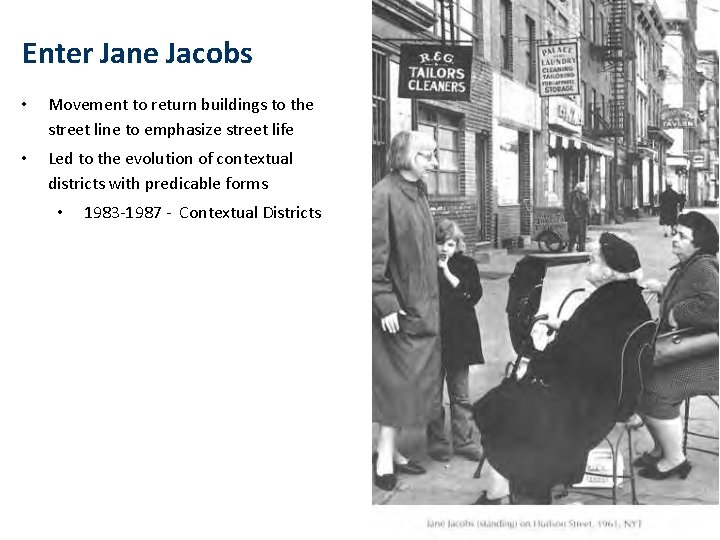
1961 Resolution Enter Jane Jacobs • Movement to return buildings to the street line to emphasize street life • Led to the evolution of contextual districts with predicable forms • 1983 -1987 - Contextual Districts
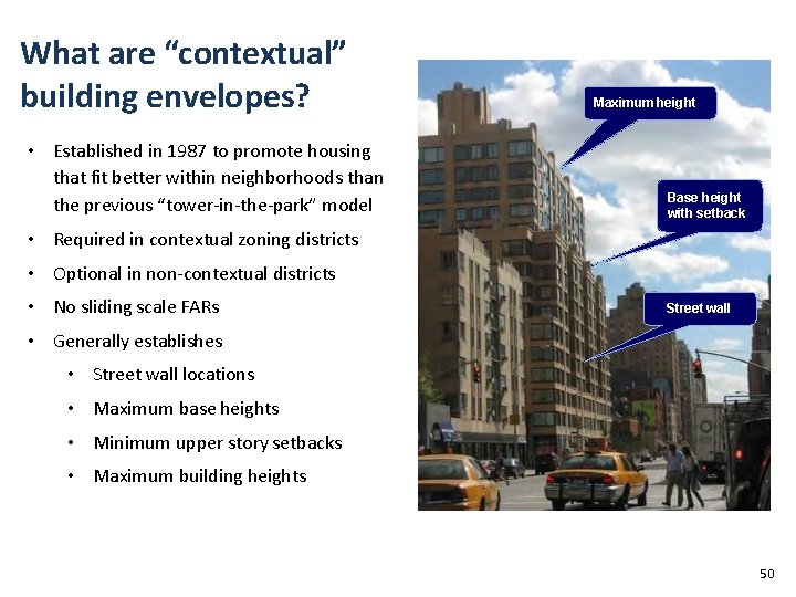
1961 Resolution What are “contextual” building envelopes? • Established in 1987 to promote housing that fit better within neighborhoods than the previous “tower-in-the-park” model Maximum height Base height with setback • Required in contextual zoning districts • Optional in non-contextual districts • No sliding scale FARs Street wall • Generally establishes • Street wall locations • Maximum base heights • Minimum upper story setbacks • Maximum building heights 50
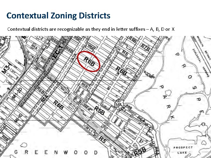
1961 Resolution Contextual Zoning Districts Contextual districts are recognizable as they end in letter suffixes – A, B, D or X
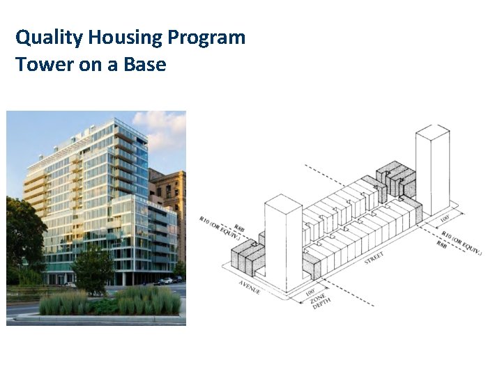
1961 Resolution Quality Housing Program Tower on a Base
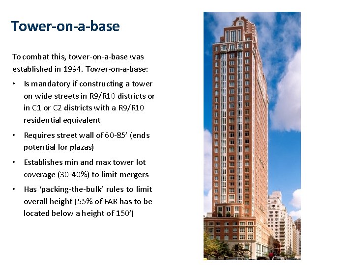
1961 Resolution Tower-on-a-base To combat this, tower-on-a-base was established in 1994. Tower-on-a-base: • Is mandatory if constructing a tower on wide streets in R 9/R 10 districts or in C 1 or C 2 districts with a R 9/R 10 residential equivalent • Requires street wall of 60 -85’ (ends potential for plazas) • Establishes min and max tower lot coverage (30 -40%) to limit mergers • Has ‘packing-the-bulk’ rules to limit overall height (55% of FAR has to be located below a height of 150’)
How to use the ZR To access Zoning text and maps, go to: Department of City Planning Website www. nyc. gov/planning
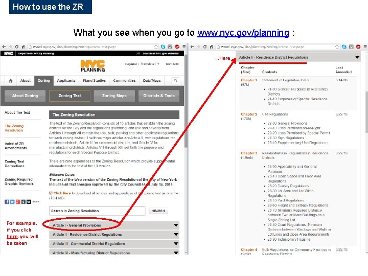
How to use the ZR What you see when you go to www. nyc. gov/planning : …Here For example, if you click here, you will be taken
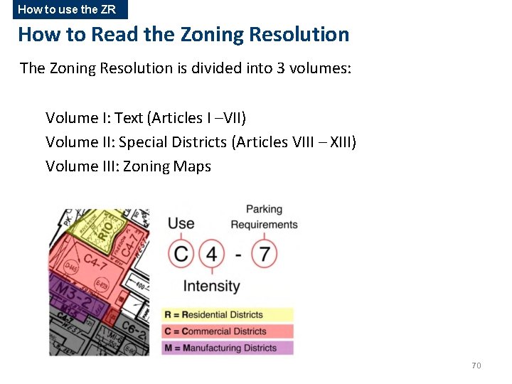
How to use the ZR How to Read the Zoning Resolution The Zoning Resolution is divided into 3 volumes: Volume I: Text (Articles I –VII) Volume II: Special Districts (Articles VIII – XIII) Volume III: Zoning Maps 70
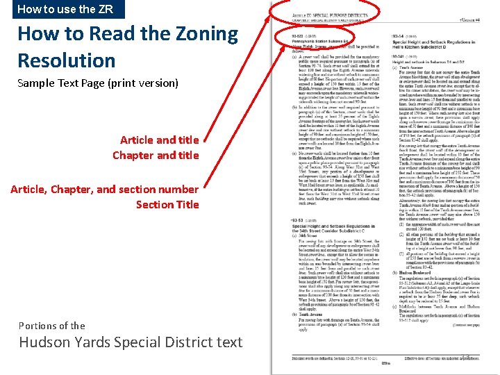
How to use the ZR How to Read the Zoning Resolution Sample Text Page (print version) Article and title Chapter and title Article, Chapter, and section number Section Title Portions of the Hudson Yards Special District text 73
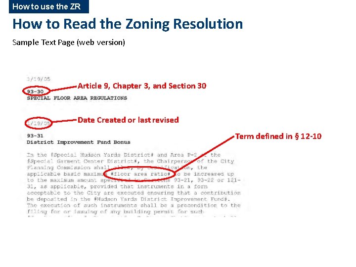
How to use the ZR How to Read the Zoning Resolution Sample Text Page (web version) Article 9, Chapter 3, and Section 30 Date Created or last revised Term defined in § 12 -10
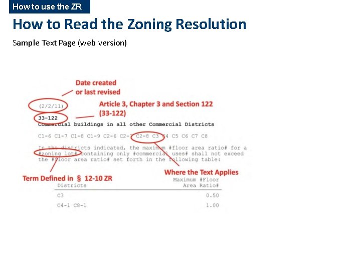
How to use the ZR How to Read the Zoning Resolution Sample Text Page (web version)
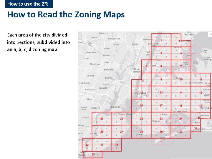
How to use the ZR How to Read the Zoning Maps Each area of the city divided into Sections, subdivided into an a, b, c, d zoning map
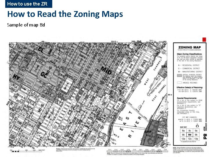
How to use the ZR How to Read the Zoning Maps Sample of map 8 d
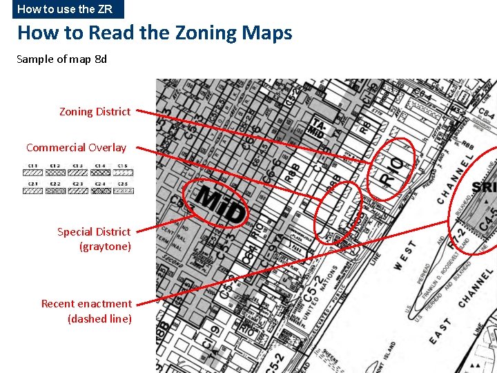
How to use the ZR How to Read the Zoning Maps Sample of map 8 d Zoning District Commercial Overlay Special District (graytone) Recent enactment (dashed line)
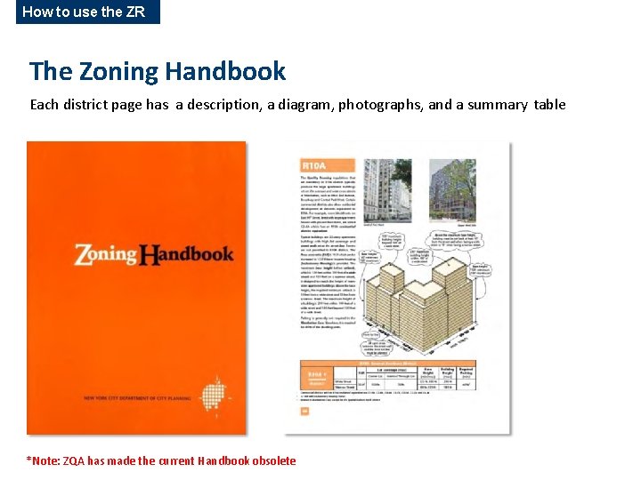
How to use the ZR The Zoning Handbook Each district page has a description, a diagram, photographs, and a summary table *Note: ZQA has made the current Handbook obsolete
Process of Zoning Howard Goldman Senior Partner, Goldman Harris LLC
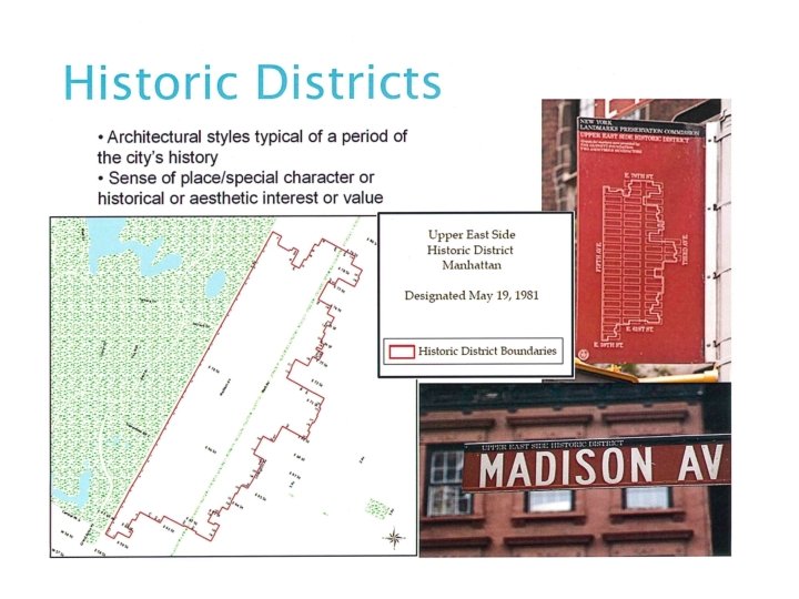
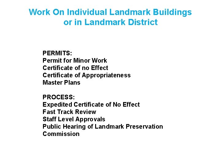
Work On Individual Landmark Buildings or in Landmark District PERMITS: Permit for Minor Work Certificate of no Effect Certificate of Appropriateness Master Plans PROCESS: Expedited Certificate of No Effect Fast Track Review Staff Level Approvals Public Hearing of Landmark Preservation Commission
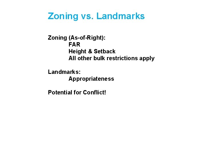
Zoning vs. Landmarks Zoning (As-of-Right): FAR Height & Setback All other bulk restrictions apply Landmarks: Appropriateness Potential for Conflict!