Correlating extremes in rain with extremes in wind
- Slides: 13

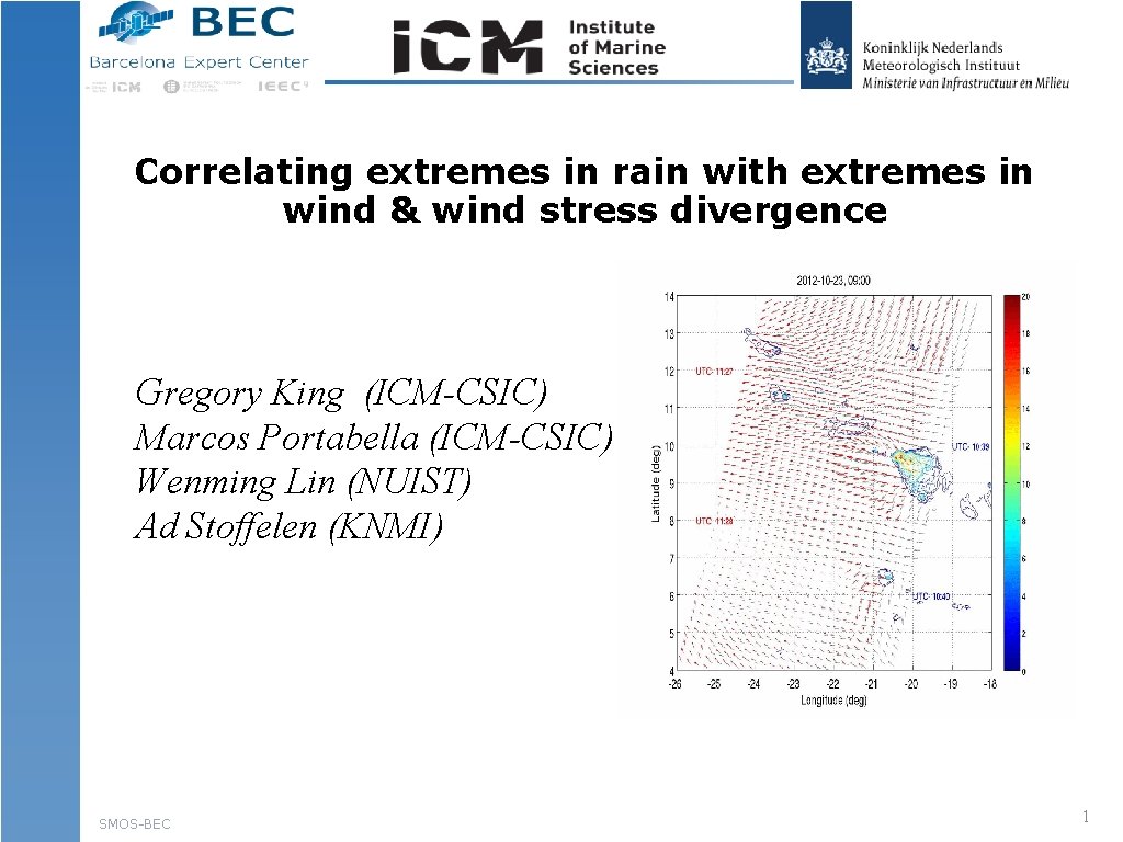
Correlating extremes in rain with extremes in wind & wind stress divergence Gregory King (ICM-CSIC) Marcos Portabella (ICM-CSIC) Wenming Lin (NUIST) Ad Stoffelen (KNMI) SMOS-BEC 1

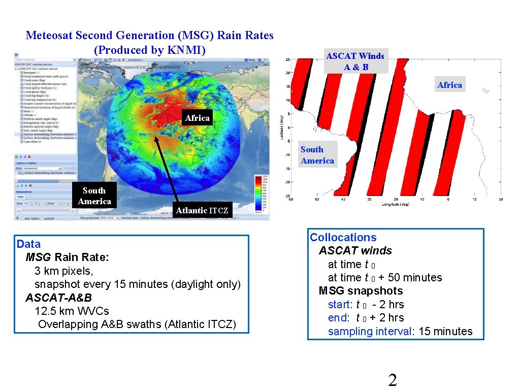
Meteosat Second Generation (MSG) Rain Rates (Produced by KNMI) ASCAT Winds A&B Africa South America Atlantic ITCZ Data MSG Rain Rate: 3 km pixels, snapshot every 15 minutes (daylight only) ASCAT-A&B 12. 5 km WVCs Overlapping A&B swaths (Atlantic ITCZ) Collocations ASCAT winds at time t 0 + 50 minutes MSG snapshots start: t 0 - 2 hrs end: t 0 + 2 hrs sampling interval: 15 minutes 2

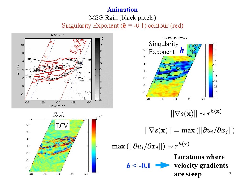
Animation MSG Rain (black pixels) Singularity Exponent (h = -0. 1) contour (red) Singularity Exponent h DIV h < -0. 1 Locations where velocity gradients 3 are steep

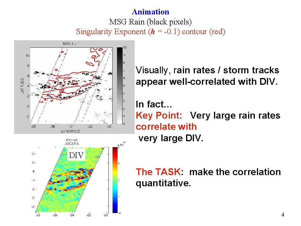
Animation MSG Rain (black pixels) Singularity Exponent (h = -0. 1) contour (red) Singularity Exponent h Visually, rain rates / storm tracks appear well-correlated with DIV. In fact… Key Point: Very large rain rates correlate with very large DIV The TASK: make the correlation quantitative. h < -0. 1 Locations where velocity gradients 4 are steep

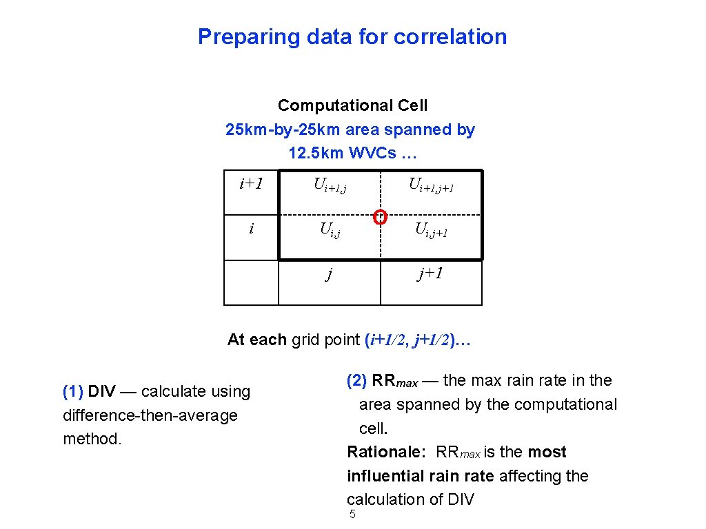
Preparing data for correlation Computational Cell 25 km-by-25 km area spanned by 12. 5 km WVCs … i+1 Ui+1, j i Ui, j Ui+1, j+1 O j Ui, j+1 At each grid point (i+1/2, j+1/2)… (1) DIV — calculate using difference-then-average method. (2) RRmax — the max rain rate in the area spanned by the computational cell. Rationale: RRmax is the most influential rain rate affecting the calculation of DIV 5

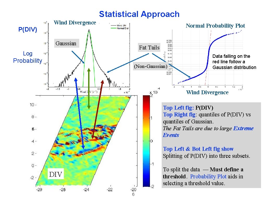
Statistical Approach Wind Divergence Normal Probability Plot P(DIV) Gaussian Fat Tails Log Probability (Non-Gaussian) Data falling on the red line follow a Gaussian distribution Wind Divergence Top Left fig: P(DIV) Top Right fig: quantiles of P(DIV) vs quantiles of Gaussian. The Fat Tails are due to large Extreme Events Top Left & Bot Left fig show Splitting of P(DIV) into three subsets. To split the data — Must define a threshold. Probability Plot aids in selecting a threshold value. DIV 6

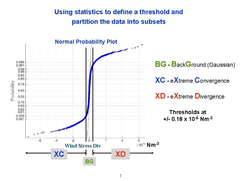
Using statistics to define a threshold and partition the data into subsets Normal Probability Plot BG - Back. Ground (Gaussian) XC - e. Xtreme Convergence XD - e. Xtreme Divergence Thresholds at +/- 0. 18 x 10 -5 Nm-3 Nm Wind Stress Div XC BG -3 Nm-3 XD 7

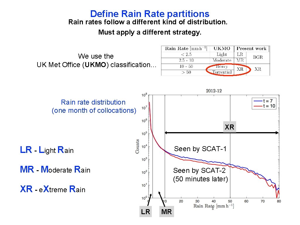
Define Rain Rate partitions Rain rates follow a different kind of distribution. Must apply a different strategy. We use the UK Met Office (UKMO) classification… Rain rate distribution (one month of collocations) XR LR - Light Rain Seen by SCAT-1 MR - Moderate Rain Seen by SCAT-2 (50 minutes later) XR - e. Xtreme Rain LR MR 8

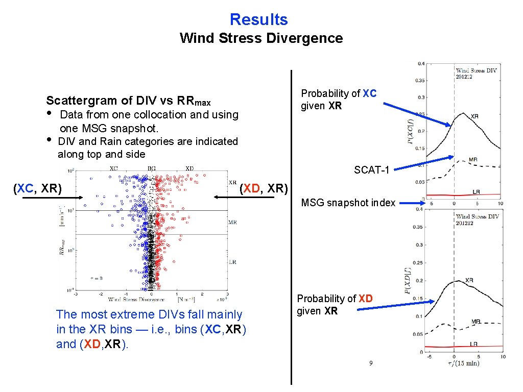
Results Wind Stress Divergence Probability of XC given XR Scattergram of DIV vs RRmax • • Data from one collocation and using one MSG snapshot. DIV and Rain categories are indicated along top and side SCAT-1 (XC, XR) (XD, XR) MSG snapshot index The most extreme DIVs fall mainly in the XR bins — i. e. , bins (XC, XR) and (XD, XR). Probability of XD given XR 9

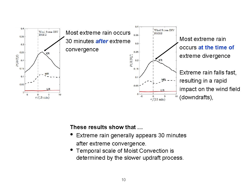
Most extreme rain occurs 30 minutes after extreme convergence Most extreme rain occurs at the time of extreme divergence Extreme rain falls fast, resulting in a rapid impact on the wind field (downdrafts), These results show that … • Extreme rain generally appears 30 minutes after extreme convergence. • Temporal scale of Moist Convection is determined by the slower updraft process. 10

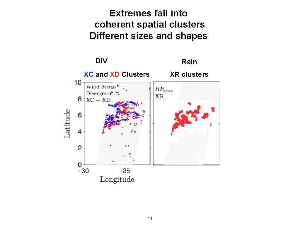
Extremes fall into coherent spatial clusters Different sizes and shapes DIV Rain XC and XD Clusters 11 XR clusters

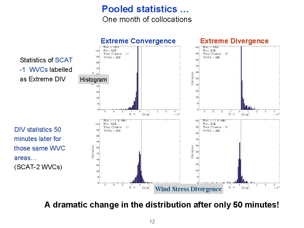
Pooled statistics … One month of collocations Extreme Convergence Statistics of SCAT -1 WVCs labelled as Extreme DIV Extreme Divergence Histogram DIV statistics 50 minutes later for those same WVC areas… (SCAT-2 WVCs) Wind Stress Divergence A dramatic change in the distribution after only 50 minutes! 12

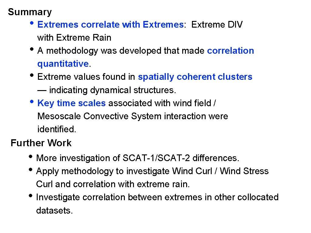
Summary • Extremes correlate with Extremes: • • • Extreme DIV with Extreme Rain A methodology was developed that made correlation quantitative. Extreme values found in spatially coherent clusters — indicating dynamical structures. Key time scales associated with wind field / Mesoscale Convective System interaction were identified. Further Work • More investigation of SCAT-1/SCAT-2 differences. • Apply methodology to investigate Wind Curl / Wind Stress • Curl and correlation with extreme rain. Investigate correlation between extremes in other collocated datasets.