
Copernicus Global Land Service for Water Observation from
Copernicus Global Land Service for Water Observation from Space Land Monitoring CEOS Freshwater from Space Workshop 14 November 2018, Delft Lionel Zawadzki, Joël Dorandeu – CLS Michael Cherlet – DG JRC
Global Land Operations Copernicus Entrusted Entity https: //land. copernicus. eu/global
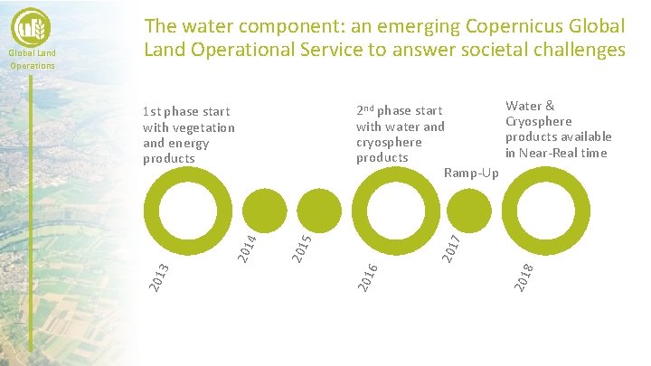
201 6 201 8 201 5 201 4 201 3 Water & Cryosphere products available in Near-Real time 7 2 nd phase start with water and cryosphere products Ramp-Up 1 st phase start with vegetation and energy products 201 Global Land Operations The water component: an emerging Copernicus Global Land Operational Service to answer societal challenges
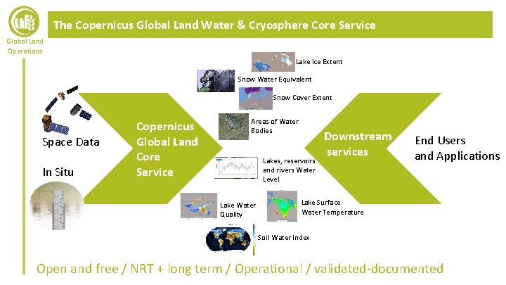
The Copernicus Global Land Water & Cryosphere Core Service Global Land Operations Lake Ice Extent Snow Water Equivalent Snow Cover Extent Space Data In Situ Copernicus Global Land Core Service Areas of Water Bodies Lakes, reservoirs and rivers Water Level Lake Water Quality Downstream services End Users and Applications Lake Surface Water Temperature Soil Water Index Open and free / NRT + long term / Operational / validated-documented
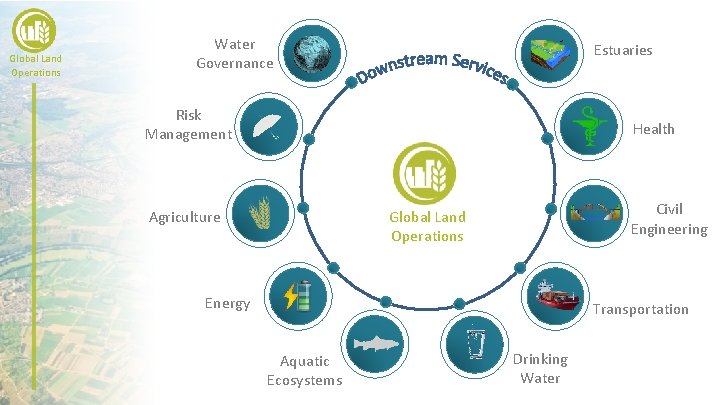
Global Land Operations Water Governance Estuaries Risk Management Health Agriculture Civil Engineering Global Land Operations Energy Transportation Aquatic Ecosystems Drinking Water
User Uptake in the Copernicus Global Land Service Global Land Operations A high potential of downstream applications for the Water CGL Service: • A large variety of thematic areas (downstream applications) • Strong impact in the socio-economic sector (drinking water, energy, transport…) • Objective: – maximise the benefit of the Water services to applications and end users – Ensure that products and services are fit for purpose Developing the link with the user community: • Awareness • Reach the already existing user community: • Engage users in the Service definition and validation process (User workshops, User Requirement Documents, Gap analysis, Surveys, External reviews) • Consider needs at different levels: Member States, Decision Makers, Intermediate Users, End Users
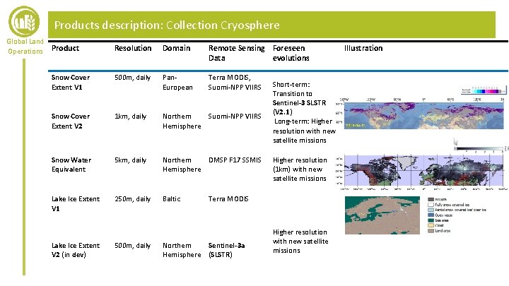
Products description: Collection Cryosphere Global Land Operations Product Resolution Domain Remote Sensing Foreseen Data evolutions Snow Cover Extent V 1 500 m, daily Pan. European Terra MODIS, Suomi-NPP VIIRS Snow Cover Extent V 2 1 km, daily Northern Suomi-NPP VIIRS Hemisphere Snow Water Equivalent 5 km, daily Northern DMSP F 17 SSMIS Hemisphere Lake Ice Extent V 1 250 m, daily Baltic Lake Ice Extent V 2 (in dev) 500 m, daily Short-term: Transition to Sentinel-3 SLSTR (V 2. 1) Long-term: Higher resolution with new satellite missions Higher resolution (1 km) with new satellite missions Terra MODIS Northern Sentinel-3 a Hemisphere (SLSTR) Higher resolution with new satellite missions Illustration
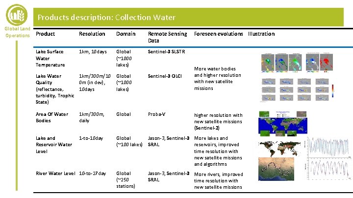
Products description: Collection Water Global Land Operations Product Resolution Domain Remote Sensing Data 1 km, 10 days Global (~1000 lakes) Sentinel-3 SLSTR Lake Water 1 km/300 m/10 Quality 0 m (in dev), (reflectance, 10 days turbidity, Trophic State) Global (~1000 lakes) Sentinel-3 OLCI Area Of Water Bodies 1 km/300 m, daily Global Proba-V Lake and Reservoir Water Level 1 -to-10 day Global Jason-3, Sentinel-3 More lakes and (~100 lakes) SRAL reservoirs, improved time resolution with new satellite missions and algorithms Lake Surface Water Temperature River Water Level 10 -to-27 day Global (~250 stations) Foreseen evolutions Illustration More water bodies and higher resolution with new satellite missions (Sentinel-2) Jason-3, Sentinel-3 More rivers, improved SRAL time resolution with new satellite missions
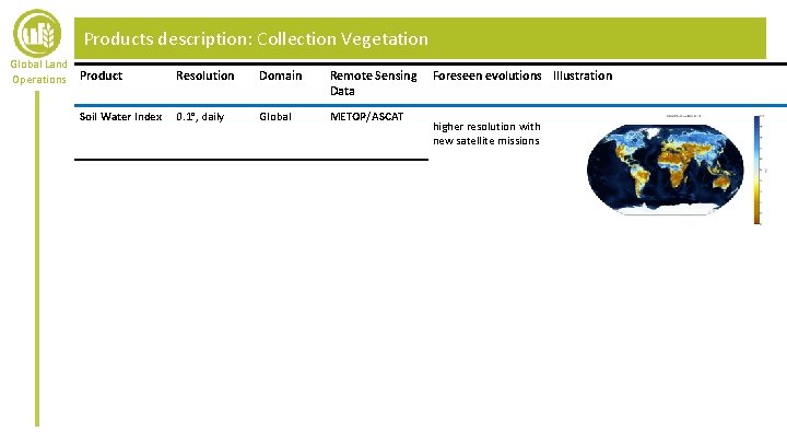
Products description: Collection Vegetation Global Land Operations Product Soil Water Index Resolution Domain Remote Sensing Data 0. 1°, daily Global METOP/ASCAT Foreseen evolutions Illustration higher resolution with new satellite missions
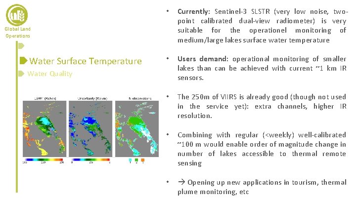
• Currently: Sentinel-3 SLSTR (very low noise, twopoint calibrated dual-view radiometer) is very suitable for the operationel monitoring of medium/large lakes surface water temperature • Users demand: operational monitoring of smaller lakes than can be achieved with current ~1 km IR sensors. • The 250 m of VIIRS is already good (though not used in the service yet): extra channels, higher IR resolution. • Combining with regular (<weekly) well-calibrated ~100 m would enable order of magnitude change in number of lakes accessible to thermal remote sensing • Opening up new applications in tourism, thermal plume monitoring, etc Global Land Operations Water Surface Temperature Water Quality
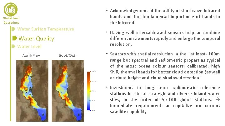
Global Land Operations Water Surface Temperature Water Quality Water Level • Acknowledgement of the utility of shortwave infrared bands and the fundamental importance of bands in the infrared. • Having well intercalibrated sensors help to combine different instruments rapidly and enlarge the temporal resolution. • Sensors with spatial resolution in the –at least- 100 m range but spectral and radiometric properties typical of the most ocean colour sensors: calibrated, high SNR, thermal bands for better cloud detection (as well as cloud height and cloud shadow detection). • Investment in long term radiometric reference stations in situ at strategic and diverse inland water sites, in the order of 50 -100 global stations. Immediate requirement to capitalize on current satellite capability
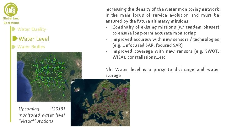
Global Land Operations Water Quality Water Level Water Bodies Increasing the density of the water monitoring network is the main focus of service evolution and must be ensured by the future altimetry missions: - Continuity of existing missions (w/ tandem phases) to ensure long-term accurate monitoring - Improved accuracy with new sensors / technologies (e. g. Unfocused SAR, focused SAR) - Improved coverage with new sensors (e. g. SWOT, WISA), constellations…etc Nb: Water level is a proxy to discharge and water storage Upcoming (2019) monitored water level “virtual” stations
Outlook Global Land Operations • Currently, the service is mostly build on Sentinel-3 a but also Terra MODIS, VIIRS, SSM/I, Jason-3. Short-term evolutions include the integration of Sentinel-3 b • Short-term evolution (few years): improve resolution of products to the resolution of Sentinel-2, improve temporal resolution when relevant • Wished Long-term evolutions (decade): – Monitor rivers, wetlands, floodplains requires higher resolution sensors – Add new variables: storage, discharge, floods indicators – Assimilation in hydrological models, forecasts, monitoring of water from source (glaciers, lakes…) to the outlet (sea, lake. . . )
Outlook Global Land Operations • Operational requirements: – maintain the current orbits without discontinuity – Intercalibration/Tandem phases between successive missions – Complementarity with the maintenance/development of the in situ observation network is essential. In situ data also concerns space for dissemination. – Accurate reference ancillary data: land/water mask (GSWE), DEMs, propagation/geophysical correction such as troposphere, ionosphere, earth/pole/water tides, clouds…etc
Outlook Global Land Operations • Complementarity between lower-accuracy frequent revisit of (e. g. nanosatellites constellation) and higher-accuracy less frequent revisit (historical approach) • Improving the technology (accuracy / resolution) is essential to meet user requirements and should be done ensuring the continuity and consistency of products.
- Slides: 15