
COOPS GOES Usage Warren Krug NOAA Center for




- Slides: 31
CO-OPS GOES Usage Warren Krug NOAA Center for Operational Oceanographic Products and Services (CO-OPS) Chesapeake, VA GOES Users Symposium April 2015
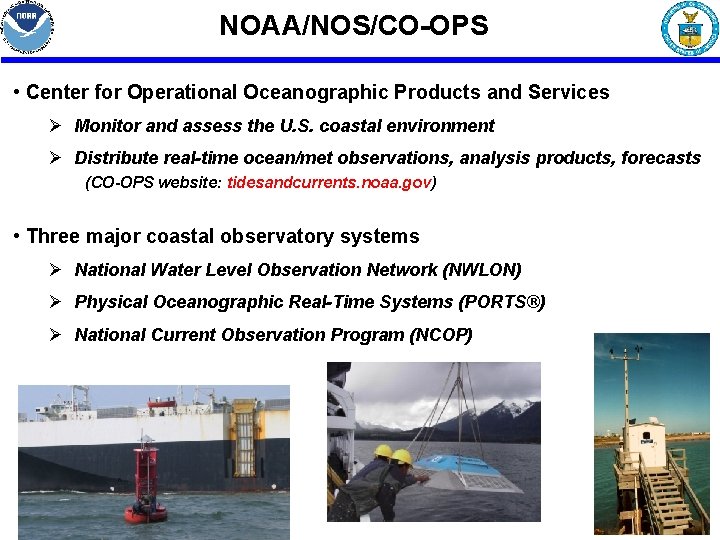
NOAA/NOS/CO-OPS • Center for Operational Oceanographic Products and Services Ø Monitor and assess the U. S. coastal environment Ø Distribute real-time ocean/met observations, analysis products, forecasts (CO-OPS website: tidesandcurrents. noaa. gov) • Three major coastal observatory systems Ø National Water Level Observation Network (NWLON) Ø Physical Oceanographic Real-Time Systems (PORTS®) Ø National Current Observation Program (NCOP) Heitsenrether
Applications of CO-OPS Water Level Observations • US water level datum reference system • Navigational safety; economic efficiency • Support bathymetric surveys • Real-time storm surge assessment • Tsunami warning system • Coastal resource protection • Long term sea level trends • Climate change Heitsenrether
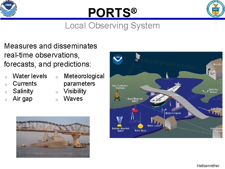
PORTS Local Observing System Measures and disseminates real-time observations, forecasts, and predictions: o o Water levels Currents Salinity Air gap o o o Meteorological parameters Visibility Waves Heitsenrether
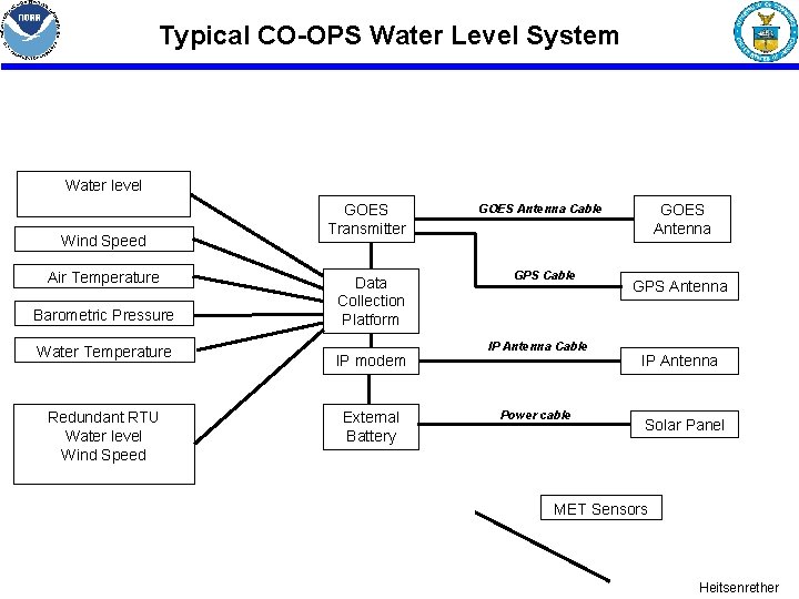
Typical CO-OPS Water Level System Water level Wind Speed Air Temperature Barometric Pressure Water Temperature Redundant RTU Water level Wind Speed GOES Transmitter Data Collection Platform IP modem External Battery GOES Antenna Cable GPS Cable IP Antenna Cable Power cable GPS Antenna IP Antenna Solar Panel MET Sensors Heitsenrether
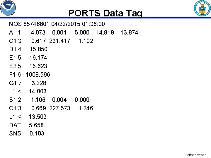
• Primary DCP collects and stores data from sensors and redundant RTU in various inputs (RS 232, SDI 12, analog, digital) • Creates a pseudo-binary GOES message • 96 bytes for a 5 -second window • 128 bytes for a 6 second window • One redundant WL value ( previous 6 minute ) • Six 1 minute Tsunami values added to the end of the message • Creates a PORTS Tag Heitsenrether
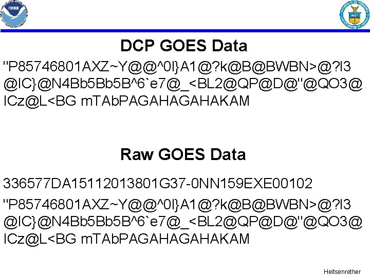
DCP GOES Data "P 85746801 AXZ~Y@@^0 l}A 1@? k@B@BWBN>@? l 3 @IC}@N 4 Bb 5 B^6`e 7@_<BL 2@QP@D@"@QO 3@ ICz@L<BG m. TAb. PAGAHAKAM Raw GOES Data 336577 DA 15112013801 G 37 -0 NN 159 EXE 00102 "P 85746801 AXZ~Y@@^0 l}A 1@? k@B@BWBN>@? l 3 @IC}@N 4 Bb 5 B^6`e 7@_<BL 2@QP@D@"@QO 3@ ICz@L<BG m. TAb. PAGAHAKAM Heitsenrether
PORTS Data Tag NOS 85746801 04/22/2015 01: 36: 00 A 1 1 4. 073 0. 001 5. 000 14. 819 C 1 3 0. 617 231. 417 1. 102 D 1 4 15. 850 E 1 5 16. 174 E 2 5 15. 623 F 1 6 1008. 596 G 1 7 3. 228 L 1 < 14. 003 B 1 2 1. 106 0. 004 0. 000 C 1 3 0. 669 227. 573 1. 246 L 1 < 13. 503 DAT 5. 658 SNS -0. 103 13. 874 Heitsenrether
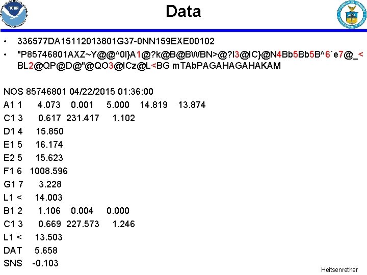
Data • • 336577 DA 15112013801 G 37 -0 NN 159 EXE 00102 "P 85746801 AXZ~Y@@^0 l}A 1@? k@B@BWBN>@? l 3@IC}@N 4 Bb 5 B^6`e 7@_< BL 2@QP@D@"@QO 3@ICz@L<BG m. TAb. PAGAHAKAM NOS 85746801 04/22/2015 01: 36: 00 A 1 1 4. 073 0. 001 5. 000 14. 819 C 1 3 0. 617 231. 417 1. 102 D 1 4 15. 850 E 1 5 16. 174 E 2 5 15. 623 F 1 6 1008. 596 G 1 7 3. 228 L 1 < 14. 003 B 1 2 1. 106 0. 004 0. 000 C 1 3 0. 669 227. 573 1. 246 L 1 < 13. 503 DAT 5. 658 SNS -0. 103 13. 874 Heitsenrether
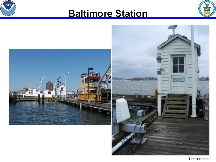
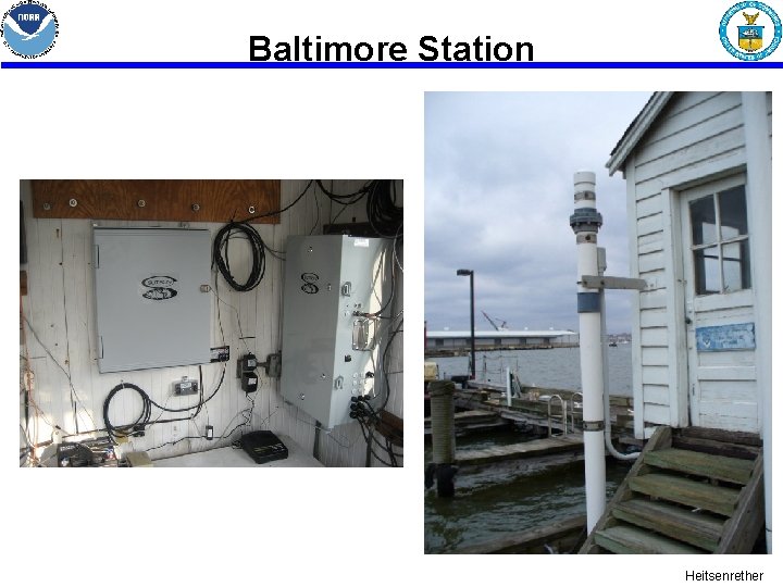
Baltimore Station Heitsenrether
Baltimore Station Heitsenrether
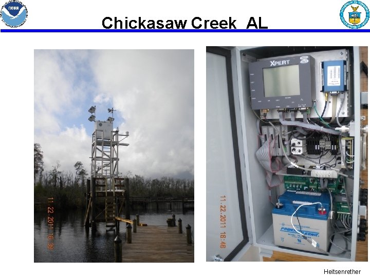
Chickasaw Creek AL Heitsenrether
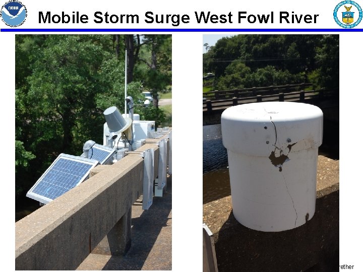
Mobile Storm Surge West Fowl River Heitsenrether
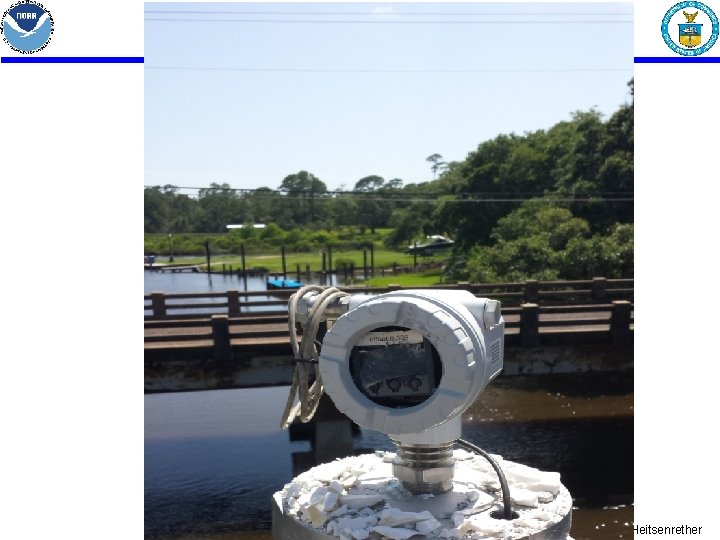
Heitsenrether
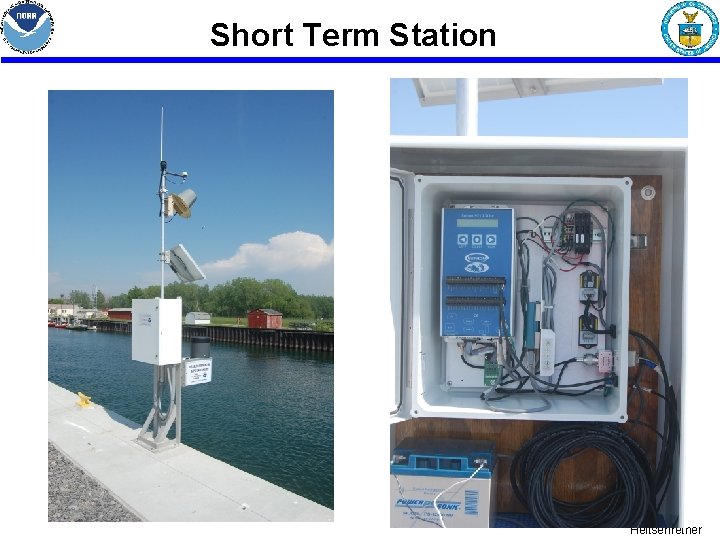
Short Term Station Heitsenrether
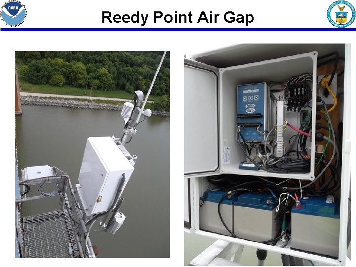
Reedy Point Air Gap Heitsenrether
Typical CO-OPS Current Meter System Data Transmitter Acoustic Current Meter Nortek, RDI, Sontek Data Collection Platform IP modem External Battery GOES Antenna Cable GPS Cable IP Antenna Cable Power cable GPS Antenna IP Antenna Solar Panel MET Sensors Heitsenrether
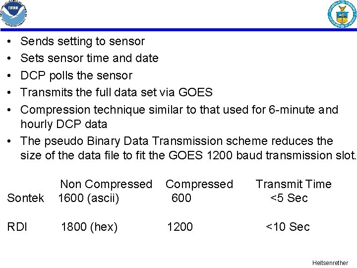
• • • Sends setting to sensor Sets sensor time and date DCP polls the sensor Transmits the full data set via GOES Compression technique similar to that used for 6 -minute and hourly DCP data • The pseudo Binary Data Transmission scheme reduces the size of the data file to fit the GOES 1200 baud transmission slot. Sontek Non Compressed 1600 (ascii) Compressed 600 RDI 1800 (hex) 1200 Transmit Time <5 Sec <10 Sec Heitsenrether
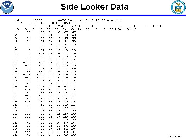
Side Looker Data Heitsenrether
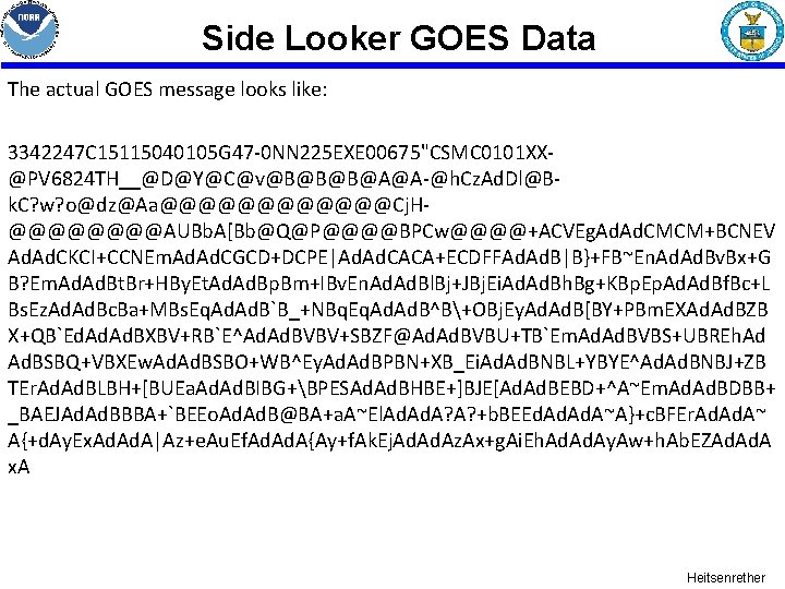
Side Looker GOES Data The actual GOES message looks like: 3342247 C 15115040105 G 47 -0 NN 225 EXE 00675"CSMC 0101 XX@PV 6824 TH__@D@Y@C@v@B@B@B@A@A-@h. Cz. Ad. Dl@Bk. C? w? o@dz@Aa@@@@@@Cj. H@@@@AUBb. A[Bb@Q@P@@@@BPCw@@@@+ACVEg. Ad. CMCM+BCNEV Ad. CKCI+CCNEm. Ad. CGCD+DCPE|Ad. CACA+ECDFFAd. B|B}+FB~En. Ad. Bv. Bx+G B? Em. Ad. Bt. Br+HBy. Et. Ad. Bp. Bm+IBv. En. Ad. Bl. Bj+JBj. Ei. Ad. Bh. Bg+KBp. Ep. Ad. Bf. Bc+L Bs. Ez. Ad. Bc. Ba+MBs. Eq. Ad. B`B_+NBq. Eq. Ad. B^B+OBj. Ey. Ad. B[BY+PBm. EXAd. BZB X+QB`Ed. Ad. BXBV+RB`E^Ad. BVBV+SBZF@Ad. BVBU+TB`Em. Ad. BVBS+UBREh. Ad Ad. BSBQ+VBXEw. Ad. BSBO+WB^Ey. Ad. BPBN+XB_Ei. Ad. BNBL+YBYE^Ad. BNBJ+ZB TEr. Ad. BLBH+[BUEa. Ad. BIBG+BPESAd. BHBE+]BJE[Ad. BEBD+^A~Em. Ad. BDBB+ _BAEJAd. BBBA+`BEEo. Ad. B@BA+a. A~El. Ad. A? A? +b. BEEd. Ad. A~A}+c. BFEr. Ad. A~ A{+d. Ay. Ex. Ad. A|Az+e. Au. Ef. Ad. A{Ay+f. Ak. Ej. Ad. Az. Ax+g. Ai. Eh. Ad. Ay. Aw+h. Ab. EZAd. A x. A Heitsenrether
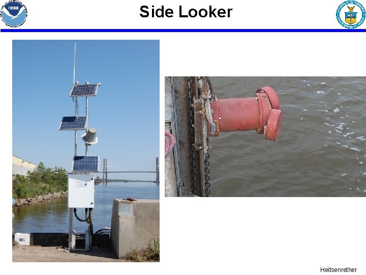
Side Looker Heitsenrether
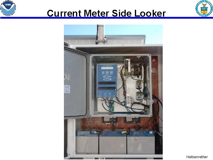
Current Meter Side Looker Heitsenrether
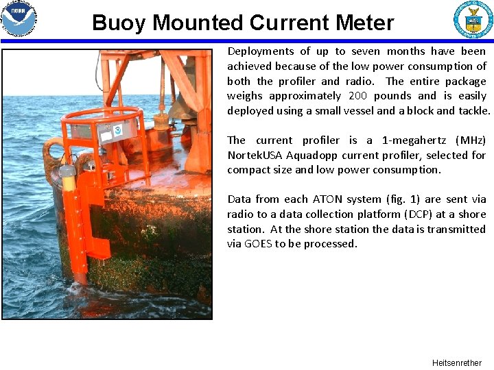
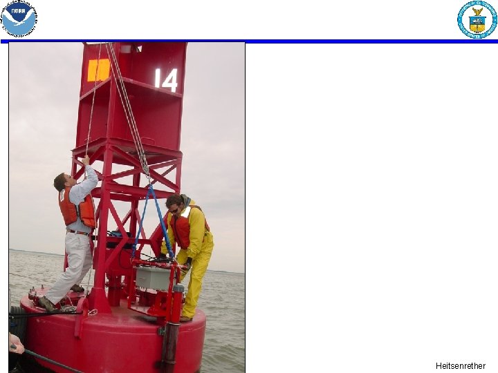
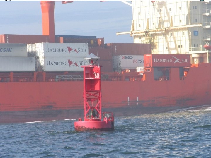
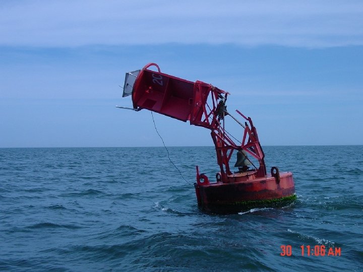
Buoy Mounted Current Meter Deployments of up to seven months have been achieved because of the low power consumption of both the profiler and radio. The entire package weighs approximately 200 pounds and is easily deployed using a small vessel and a block and tackle. The current profiler is a 1 -megahertz (MHz) Nortek. USA Aquadopp current profiler, selected for compact size and low power consumption. Data from each ATON system (fig. 1) are sent via radio to a data collection platform (DCP) at a shore station. At the shore station the data is transmitted via GOES to be processed. Heitsenrether
Heitsenrether
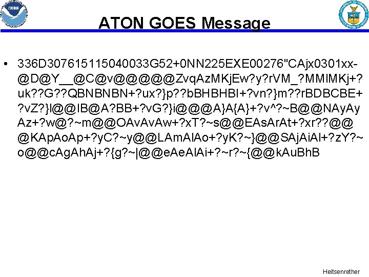
ATON GOES Message • 336 D 307615115040033 G 52+0 NN 225 EXE 00276"CAjx 0301 xx@D@Y__@C@v@@@@@Zvq. Az. MKj. Ew? y? r. VM_? MMl. MKj+? uk? ? G? ? QBNBNBN+? ux? }p? ? b. BHBHBI+? vn? }m? ? r. BDBCBE+ ? v. Z? }l@@IB@A? BB+? v. G? }i@@@A}A{A}+? v^? ~B@@NAy. Ay Az+? w@? ~m@@OAv. Aw+? x. T? ~s@@EAs. Ar. At+? xr? ? @@ @KAp. Ao. Ap+? y. C? ~y@@LAm. Al. Ao+? y. K? ~}@@SAj. Ai. Al+? z. Y? ~ o@@c. Ag. Ah. Aj+? {g? ~|@@e. Al. Ai+? ~r? ~{@@k. Au. Bh. B Heitsenrether
Heitsenrether
Heitsenrether
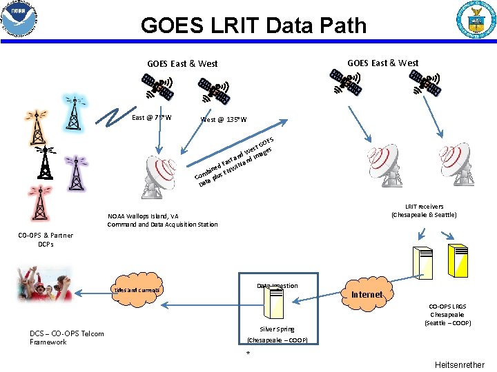
GOES LRIT Data Path GOES East & West East @ 75°W West @ 135°W ES GO t s We ges nd d Ima a t an Eas ed NWIN n i b E Com a plus t Da LRIT receivers (Chesapeake & Seattle) NOAA Wallops Island, VA Command Data Acquisition Station CO-OPS & Partner DCPs Data Ingestion tides and currents DCS – CO-OPS Telcom Framework Silver Spring Internet CO-OPS LRGS Chesapeake (Seattle – COOP) (Chesapeake – COOP) * Heitsenrether
GOES DOMSAT Data Path DOMSAT GOES East & West @ 135°W East @ 90°W ed in mb S OE ta Da G Co DRGS EDDN NOAA Wallops Island, VA Sioux Falls, SD Command Data Acquisition Station DOMSAT receivers (Chesapeake & Seattle) CO-OPS & Partner DCPs Internet Data Ingestion tides and currents DCS – CO-OPS Telcom Framework Silver Spring Internet CO-OPS LRGS Chesapeake (Seattle – COOP) (Chesapeake – COOP) * Heitsenrether
CO-OPS Publications • http: //tidesandcurrents. noaa. gov Heitsenrether
This page intentionally left blank Heitsenrether