ConvectiveScale Numerical Weather Prediction and Data Assimilation Research
- Slides: 18

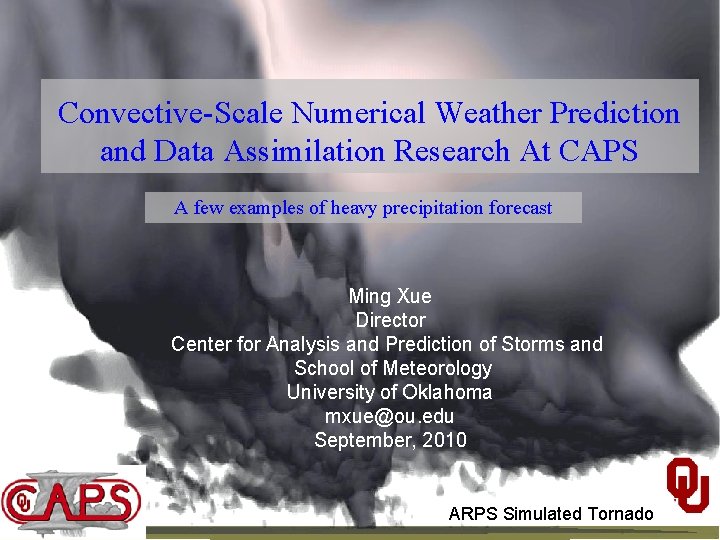
Convective-Scale Numerical Weather Prediction and Data Assimilation Research At CAPS A few examples of heavy precipitation forecast Ming Xue Director Center for Analysis and Prediction of Storms and School of Meteorology University of Oklahoma mxue@ou. edu September, 2010 ARPS Simulated Tornado

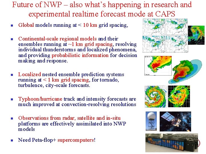
Future of NWP – also what’s happening in research and experimental realtime forecast mode at CAPS n n n Global models running at < 10 km grid spacing, Continental-scale regional models and their ensembles running at ~1 km grid spacing, resolving individual thunderstorms and localized phenomena, and providing probabilistic information for decision making and response. Localized nested ensemble prediction systems running at < 1 km grid spacing, for tornado, turbulence, city-scale forecasts. Typhoon/hurricane track and intensity forecasts are much improved at convection-resolving resolutions Observations from radar, satellite and in-situ platforms are effectively assimilated into NWP models Need Peta-flop+ supercomputers!

Storm-Scale Convection-Allowing Ensemble and Convection-Resolving Deterministic Forecasting n n n CAPS/OU has been carrying out a project since 2007 to develop, conduct and evaluate realtime high-resolution ensemble and deterministic forecasts for convective-scale hazardous weather. Forecasts were directly fed to the NOAA HWT (Hazardous Weather Testbed) and evaluated in realtime by forecasters and researchers in an organized effort. Goals: To determine the optimal design, configurations, and postprocessing of storm-scale ensemble prediction, and to provide the products for evaluation by forecasters and researchers, and test stormscale data assimilation methods. Spring 2010: 26 -member 4 -km ensemble and one 1 -km forecasts for full CONUS domain. 30 -hourly daily forecasts over 7 weeks. Assimilation of data from 120+ radars. Multi-model (WSR-ARW, WRF-NMM and ARPS), multi-physics, perturbed IC and LBC (from SREF).

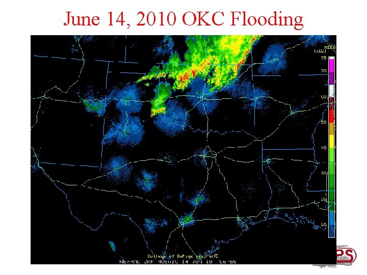
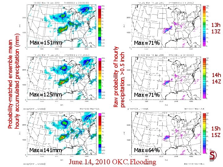
June 14, 2010 OKC Flooding

Probability-matched ensemble mean hourly accumulated precipitation (mm) Max=125 mm Max=141 mm Raw probability of hourly precipitation >0. 5 inch 13 Z Max=151 mm Max=71% 14 h 14 Z Max=71% 15 h 15 Z Max=64% June 14, 2010 OKC Flooding

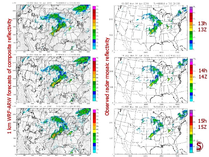
Observed radar mosaic reflectivity 1 km WRF-ARW forecasts of composite reflectivity 13 h 13 Z 14 h 14 Z 15 h 15 Z

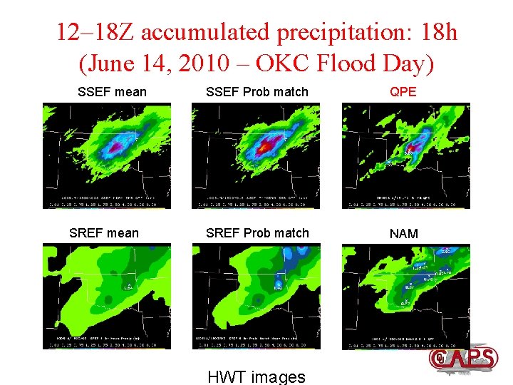
12– 18 Z accumulated precipitation: 18 h (June 14, 2010 – OKC Flood Day) SSEF mean SREF mean SSEF Prob match QPE SREF Prob match NAM HWT images

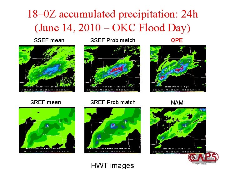
18– 0 Z accumulated precipitation: 24 h (June 14, 2010 – OKC Flood Day) SSEF mean SREF mean SSEF Prob match QPE SREF Prob match NAM HWT images

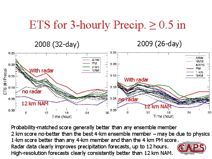
ETS for 3 -hourly Precip. ≥ 0. 5 in 2008 (32 -day) 2009 (26 -day) With radar no radar 12 km NAM Probability-matched score generally better than any ensemble member 2 km score no-better than the best 4 -km ensemble member – may be due to physics 1 -km score better than any 4 -km member and than the 4 km PM score. Radar data clearly improves precipitation forecasts, up to 12 hours. High-resolution forecasts clearly consistently better than 12 km NAM.

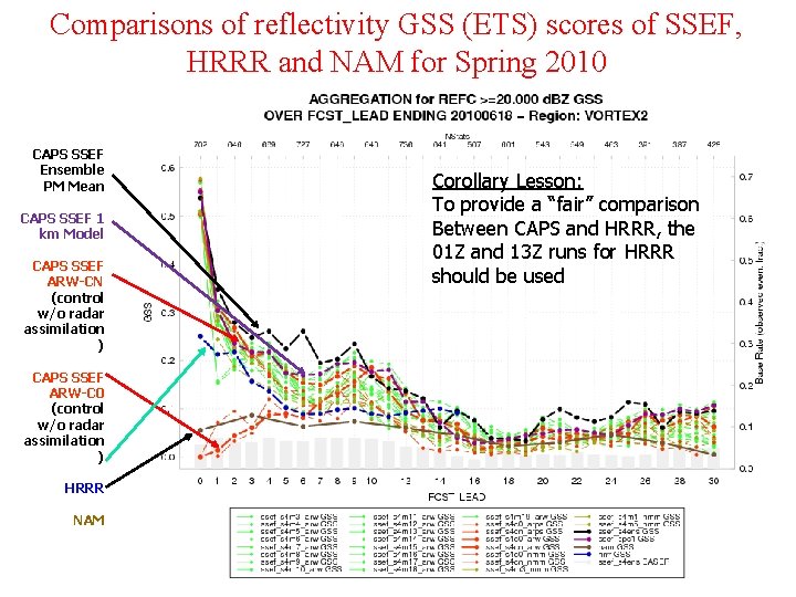
Comparisons of reflectivity GSS (ETS) scores of SSEF, HRRR and NAM for Spring 2010 CAPS SSEF Ensemble PM Mean CAPS SSEF 1 km Model CAPS SSEF ARW-CN (control w/o radar assimilation ) CAPS SSEF ARW-C 0 (control w/o radar assimilation ) HRRR NAM Corollary Lesson: To provide a “fair” comparison Between CAPS and HRRR, the 01 Z and 13 Z runs for HRRR should be used

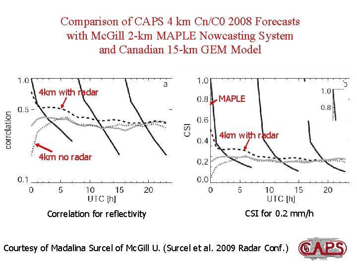
Comparison of CAPS 4 km Cn/C 0 2008 Forecasts with Mc. Gill 2 -km MAPLE Nowcasting System and Canadian 15 -km GEM Model 4 km with radar MAPLE 4 km with radar 4 km no radar Correlation for reflectivity CSI for 0. 2 mm/h Courtesy of Madalina Surcel of Mc. Gill U. (Surcel et al. 2009 Radar Conf. )

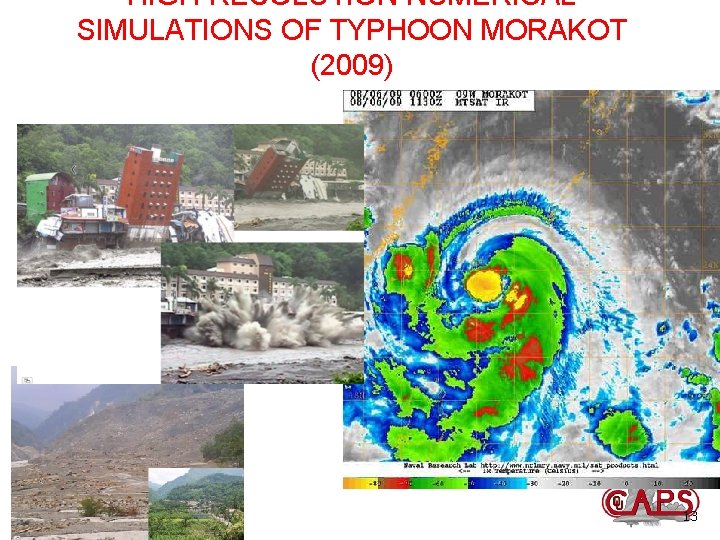
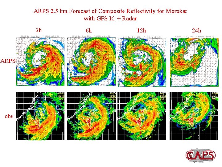
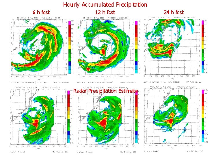
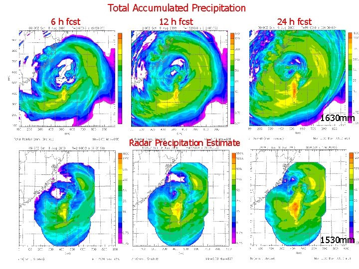
HIGH-RESOLUTION NUMERICAL SIMULATIONS OF TYPHOON MORAKOT (2009) 13

ARPS 2. 5 km Forecast of Composite Reflectivity for Morokat with GFS IC + Radar 3 h ARPS obs 6 h 12 h 24 h

Hourly Accumulated Precipitation 6 h fcst 12 h fcst Radar Precipitation Estimate observation 24 h fcst

Total Accumulated Precipitation 6 h fcst 12 h fcst 24 h fcst 1630 mm Radar Precipitation Estimate 1530 mm

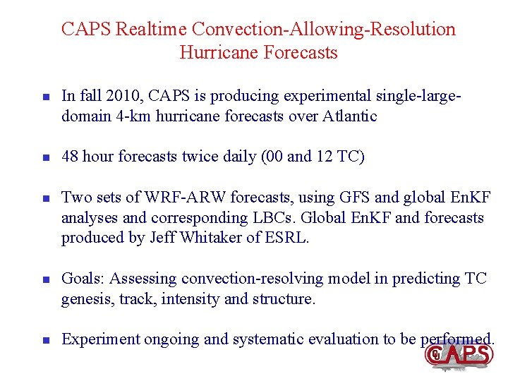
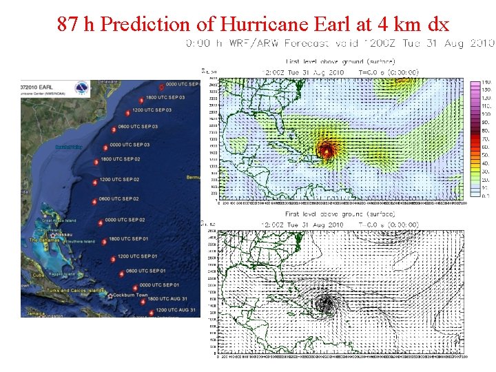
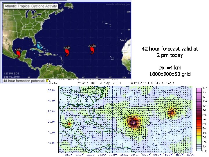
CAPS Realtime Convection-Allowing-Resolution Hurricane Forecasts n n n In fall 2010, CAPS is producing experimental single-largedomain 4 -km hurricane forecasts over Atlantic 48 hour forecasts twice daily (00 and 12 TC) Two sets of WRF-ARW forecasts, using GFS and global En. KF analyses and corresponding LBCs. Global En. KF and forecasts produced by Jeff Whitaker of ESRL. Goals: Assessing convection-resolving model in predicting TC genesis, track, intensity and structure. Experiment ongoing and systematic evaluation to be performed.

87 h Prediction of Hurricane Earl at 4 km dx

42 hour forecast valid at 2 pm today Dx =4 km 1800 x 900 x 50 grid