Continuous Improvement of the NOAH Initiative through the


 is a disaster")


")


 •")

 (http: //beta. noah. dost. gov. ph)")
 (http: //beta. noah. dost. gov. ph)")
 (http: //beta. noah. dost. gov. ph)")
")


- Slides: 25
Continuous Improvement of the NOAH Initiative through the Use of Free and Open Source Software FOSS 4 G Seoul 17 September 2015 Eric Jay dela Peña DOST Project NOAH - Philippines Disaster Management Using Web. GIS
• • What is Project NOAH Website v 1 Success Stories using NOAH v 1 Limitations “New” NOAH Website Open Source Technologies Success Stories using NOAH v 2
What is Project NOAH? Project NOAH (Nationwide Operational Assessment of Hazards) is a disaster management program that aims to improve the Philippine government and Filipino people’s capacity to respond against the impact and effect of extreme weather conditions
What is Project NOAH? As per President Aquino’s directive to put in place a responsive program for disaster prevention & mitigation, the Department of Science & Technology launched Project NOAH last July 2012 in Marikina City. Nartea, 2012 Specifically, Project NOAH aims to provide: • flood mitigation system, specifically targeting a 6 hour flood early warning system for communities along 18 major river systems; • enhancement of geohazard maps
how do we do this? ü advanced disaster science research ü multidisciplinary assessment of hazards ü develop accessible tools that enable prevention & mitigation of disasters (LGUs, planners, policy makers, communities, individuals, families)
Project NOAH Website (http: //noah. dost. gov. ph)
International name: Bopha Area of interest: Cagayan de Oro City Pablo December 2012 Floods • From 1000+ deaths in Sendong 2011, CDO City managed to reduce the number to 0 deaths a year later. • The city used water level sensors streamed from the NOAH website for early warning and evacuation measures
• Cagayan de Oro City
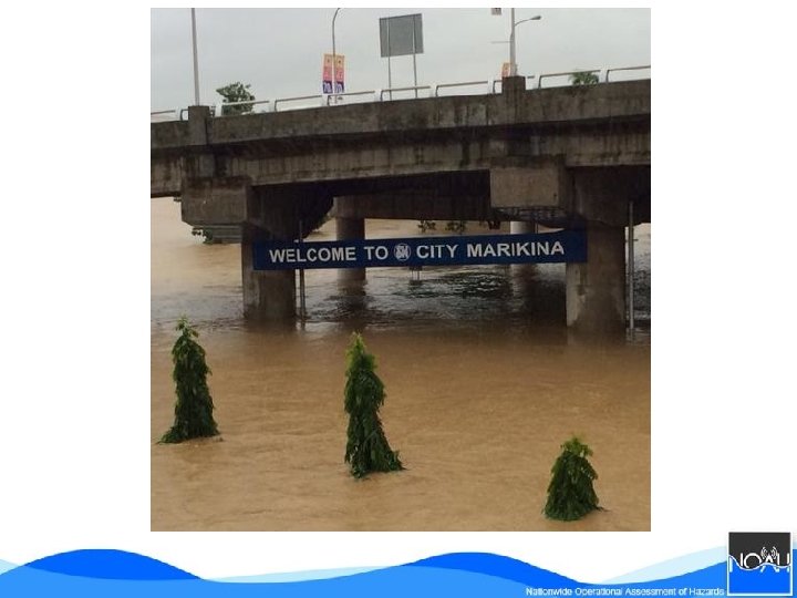
Habagat A. k. a. : August Monsoon rains 2013 Area of interest: Marikina City Floods • Marikina City was one of the most devastated areas during Typhoon Ketsana 2009 • The city has used the products of Project NOAH to monitor the water level of the Marikina River and has been using it as an early warning system to augment their existing resources
Limitations • Google Maps API KML size limit • Limited basemaps (Google Maps) • Limited knowledge on Open Source Technologies
WEB Technologies
“NEW” Project NOAH Website (Beta) (http: //beta. noah. dost. gov. ph)
“NEW” Project NOAH Website (Beta) (http: //beta. noah. dost. gov. ph)
“NEW” Project NOAH Website (Beta) (http: //beta. noah. dost. gov. ph)
WEB Technologies (New)
WEB Technologies Database and Caching
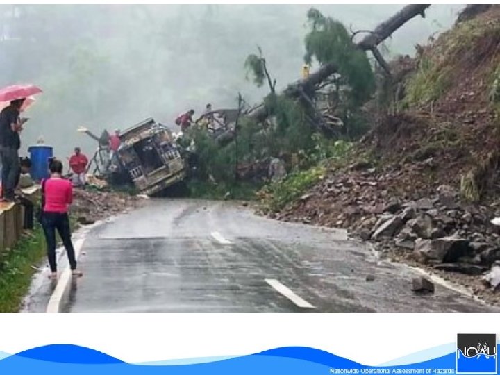
Calungbuyan-Casiber-Rancho bridge in Santa, Ilocos Sur
Thank you! Visit our websites: noah. dost. gov. ph beta. noah. dost. gov. ph Be informed by: E-mail us: blog. noah. dost. gov. ph Follow us: @nababaha Like us: DOST-Project NOAH info@noah. dost. gov. ph