Colorado Height Modernization Forum August 28 2007 Existing


- Slides: 14
Colorado Height Modernization Forum August 28, 2007
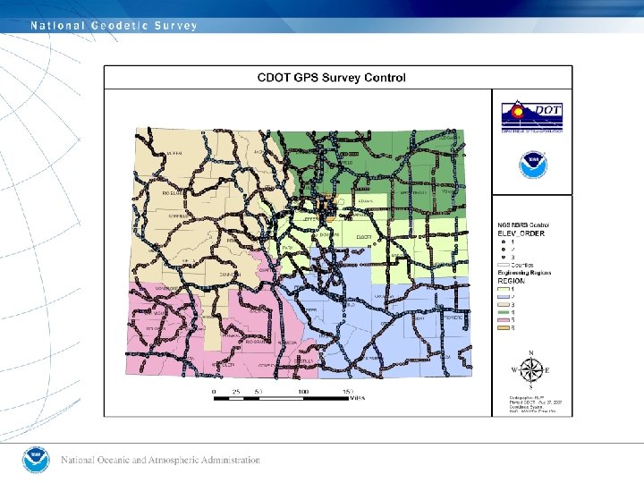
Existing HT MOD Projects in Colorado • I -70 • DIA • On-going Leveling/GPS Measurements
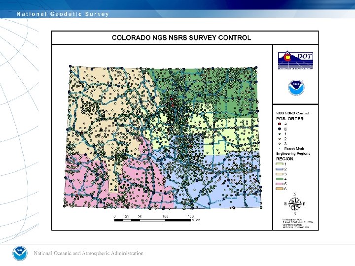
Colorado CORS
Investment in Arizona Height Modernization will: • Provide a more accurate, consistent, and efficient statewide digital land ownership model and improved accuracy for GIS data bases and mapping • Enable reliable sharing of spatial information between organizations and reduce unnecessary duplication of data • Lower the costs of surveying, mapping, and aerial photography throughout the state • Allow a more economical determination of elevations for local engineering and mapping projects
Applications Identified in Arizona • • Homeland Security Wildland Fires Drought Monitoring Flood Insurance Mapping
Players in Arizona Height Mod • • Arizona State Lands Department Arizona DOT NGS Private Sector • AZ Professional Land Surveyors Association • AZ Geographic Information Council
Transportation Related Height Mod. Benefits • Reduce Time and Cost • Increase Safety • Reduce mark maintenance • Less dependence on existing Benchmarks • Fewer “terrestrial monuments” required • Refine Geoid Model • Minimize access issues
DIA
Transportation Leveling Problems • Time and Cost • Safety • NGS mark maintenance delegated to state • Destruction of existing Benchmarks • Loss of stable “terrestrial monumentation” • Unrefined Geoid Model • Lack of access
Next Steps