Coastal landforms Beach profile The beach is the

Coastal landforms

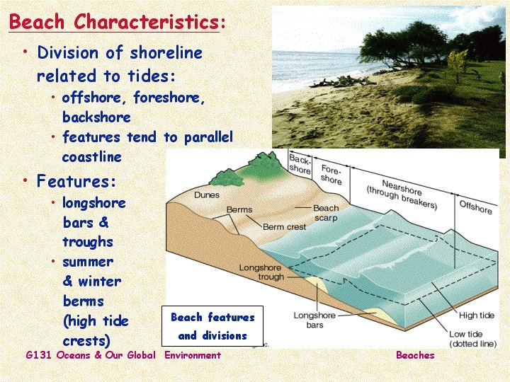
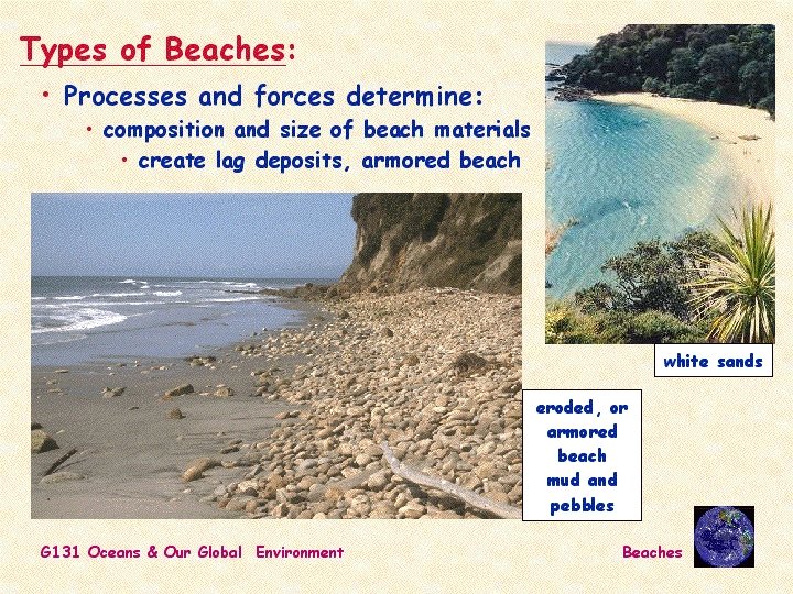
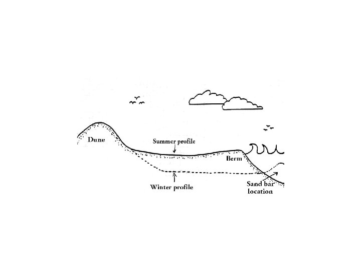

Beach profile • The beach is the strip of the shoreline that is washed by waves and tides. • It is divided into two zones: • The foreshore, called the intertidal zone that lies between the high and low tide lines. • The backshore is usually dry but is washed by waves during storms. • The berm is a higher point on the beach separating the backshoreforeshore boundary.

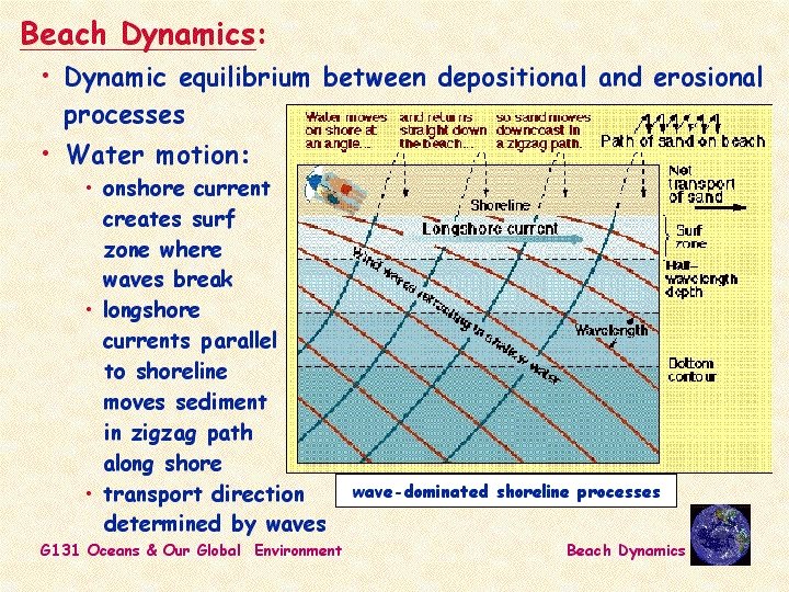
• A wave is a periodic oscillation of water. • A current is a continuous flow of water in a particular direction. • If waves regularly strike shore at an angle, they create a longshore current that flows parallel to the beach.

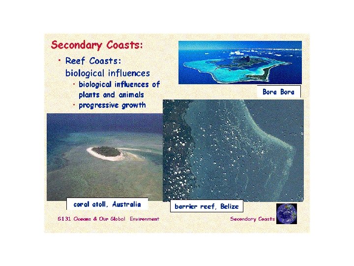
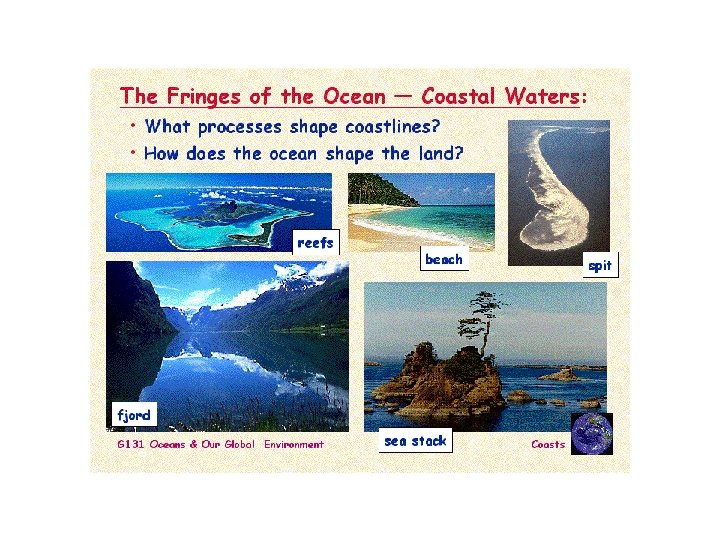
• The Atolls are a circular coral reef that forms a ring of islands around a lagoon and are surrounded by deep water of the open sea.

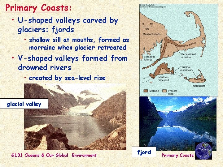
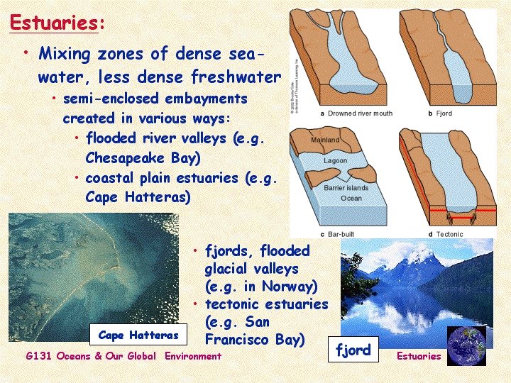
Emergent and submergent coastlines • An emergent coastline forms when a portion of a continent that was previously under water becomes exposed as dry land. • A submergent coastline develops when the shoreline moves inland

Emergent and submergent coastlines • Tectonic processes, such as mountain building or basin formation, and isostatic adjustment depress or elevate a portion of a coastline. These processes cause local or regional sea level changes but do not affect global sea level. • Sea level can also change globally. A global sea level change, called eustatic change, occurs by three mechanisms; • 1 changes in water temperature, • 2 changes in the volume of the mid-oceanic ridge, • 3 growth and melting of glaciers.

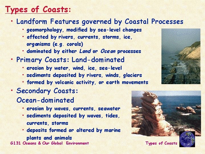
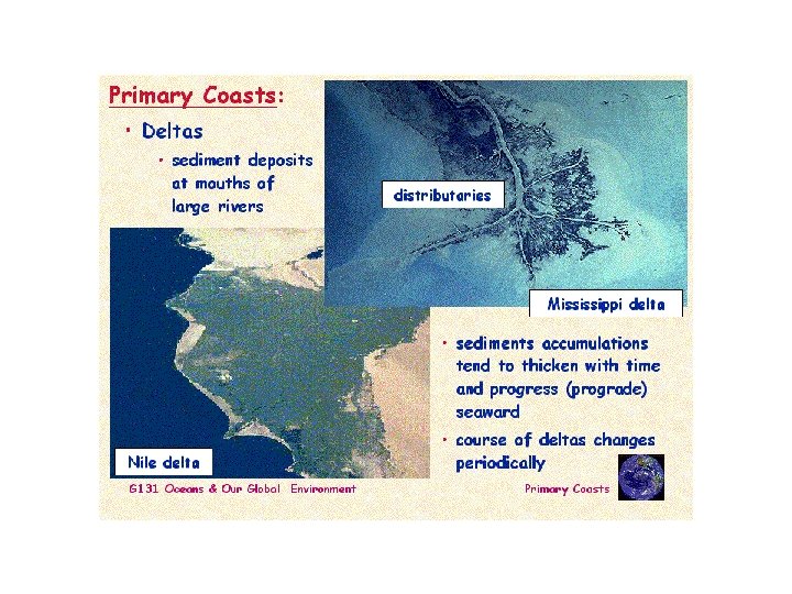
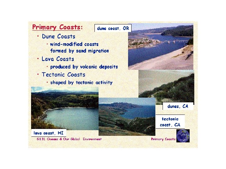
Sandy, rocky coastalines • Sandy coastlines are developed with emergent coasts due to abundant sediments • Rocky coastlines are characteristic features of submerged coastal line and occur where sandy size sediment is scarce.

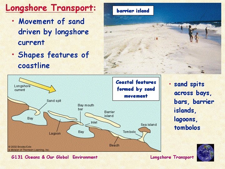
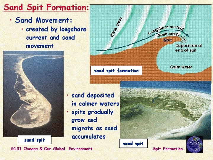
Sandy coastalines • Longshore currents form a long ridge of sand extending out from a beach that is called a spit.

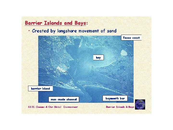
Sandy coastalines • A spit may block the entrance to a bay, forming a baymouth bar.

Sandy coastalines • A barrier island is a long, low-lying island that extends parallel to the shoreline; and is separated from the mainland by a sheltered body of water called a lagoon.

Sandy coastalines • At shallow coast, breaking storm waves may carry sand toward shore and deposit it just offshore as a barrier island. • Alternatively, if a longshore current veers out to sea, it slows down and deposits sand where it reaches deeper water. • Other mechanisms involve sea-level change. • Sand dunes or beaches may form barrier islands if a coastline sinks.

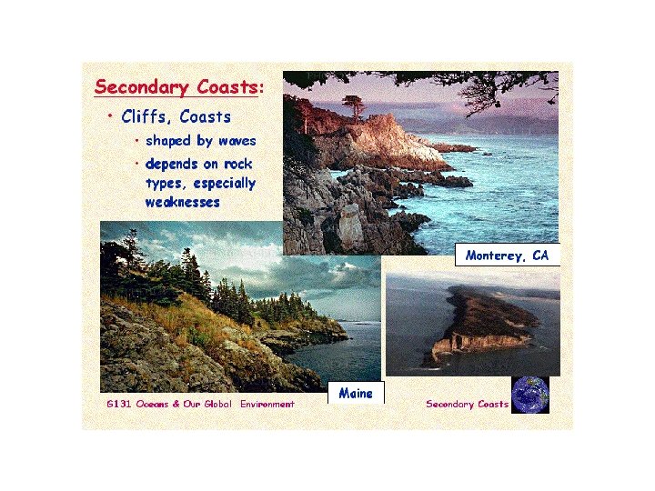
Rocky coastalines • Submergent coastlines are commonly sediment poor and are characterized by steep, rocky shores. • Irregular coastaline with many bays and headlands.

Rocky coastalines • Small sandy beaches form in protected coves, but most of the headlands are rocky and steep.

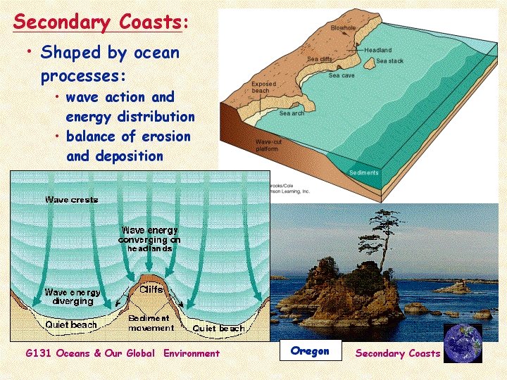
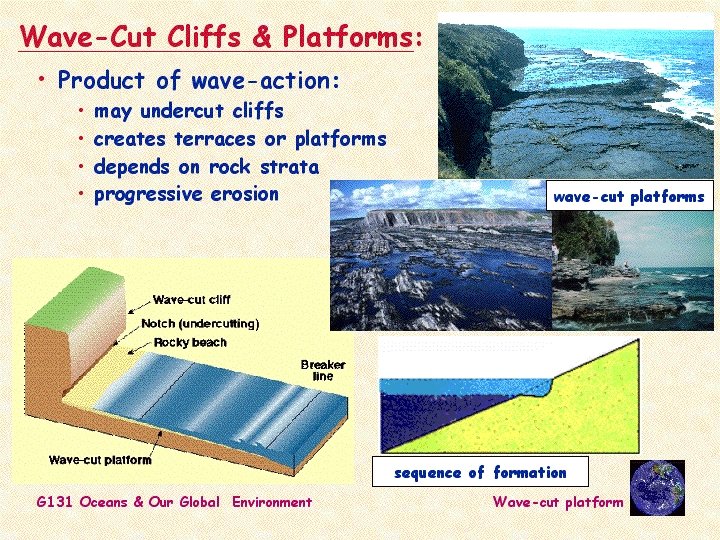
Rocky coastalines • A wave-cut cliff forms when waves erode a rocky headland into a steep profile. • As the cliff erodes, it leaves a flat or gently sloping wave-cut platform.

Rocky coastalines • If waves cut a cave into a narrow headland, the cave may eventually erode all the way through the headland, forming a scenic sea arch.

Rocky coastalines • When an arch collapses or when the inshore part of a headland erodes faster than the tip, a pillar of rock called a sea stack forms.
- Slides: 46