Coastal Landforms Basic Concepts I Sea level changes

Coastal Landforms

Basic Concepts I. Sea level changes repeatedly • 422 ft. eustatic rise since 18, 000 years ago. • specific landscapes submergent or emergent depending on tectonic change II. Waves and resultant currents erode, transport, and deposit sediment load. • rocky headlands • beaches III. Tides affect all coastal life but have little topographic effect. • tidal bores

Eustatic Change and Submergent vs. Emergent Coastlines • during ice ages sea level sinks as ocean water compresses and more water is tied up in glaciers. • During interglacial periods sea level rises, flooding many former river valleys creating bays and estuaries. • In areas with rapid tectonic uplift emergent cliffs common and bays rare.

Submergent Coastlines Sea level rise inundated many coastal valleys creating bays and estuaries. These coasts are referred to as ria coastlines. Estuary - An arm of the sea that extends inland to meet the mouth of a river.

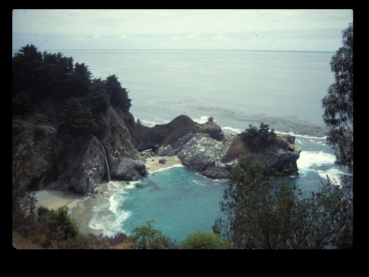
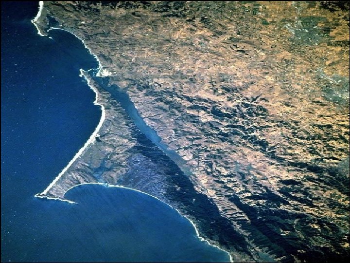
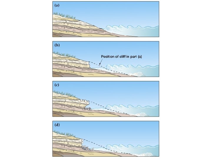
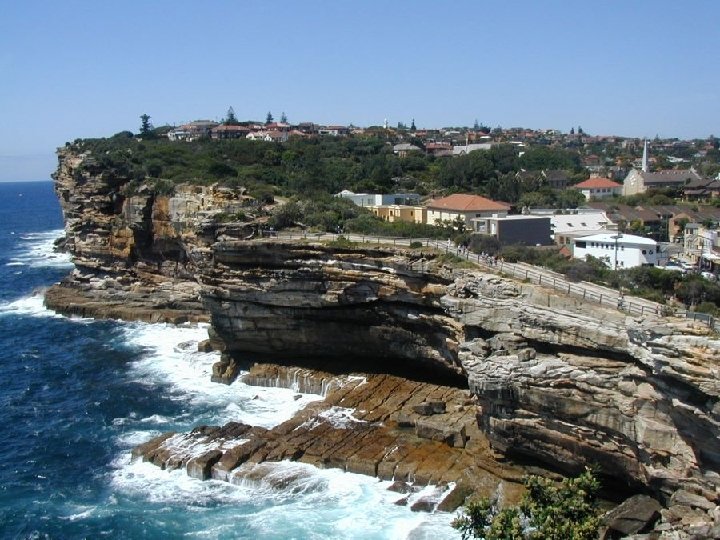
Emergent Coastlines Tectonic forces lift coastlines faster than sealevel rises. Dramatic cliffs and marine terraces tower above the sea.

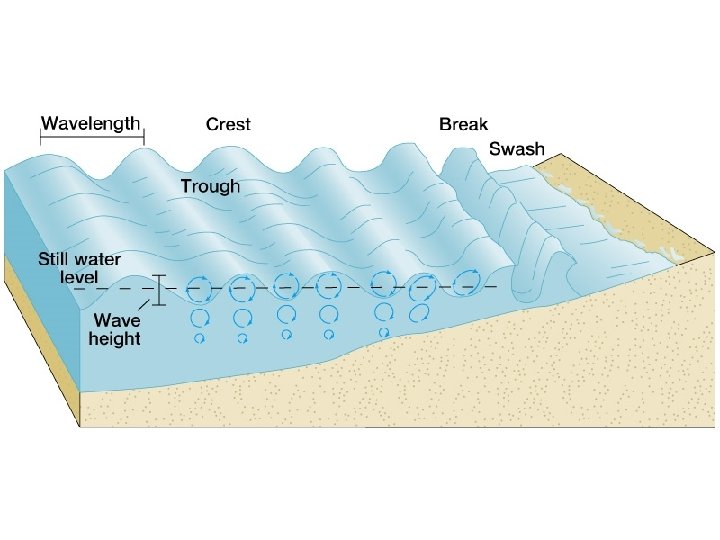
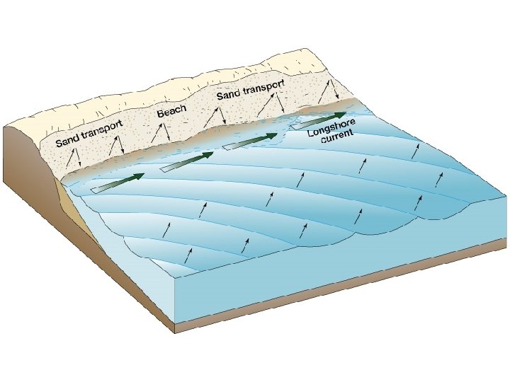
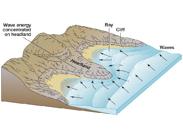
COASTAL FLUVIAL PROCESSES/LANDFORMS Coastal Erosion - dependent on wave size, angle, and frequency. Focused where waves contact coast. • Headlands, sea cliffs, bluffs, sea stacks, natural bridges • Beach Erosion • Coastal Transportation - wave action creates strong currents parallel to shore. Large waves move beach sand offshore. Small waves push it back on shore. • Longshore current Coastal Deposition – where wave action is reduced, beaches and dunes form. • beaches • dunes • sand spits

Isla Vista Beach, October 2001

Isla Vista Beach, December 2002

Beach Erosion
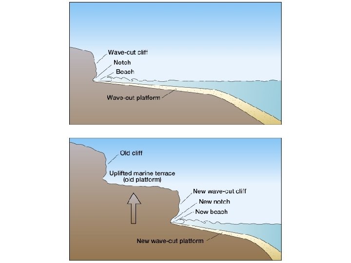

Marine Terraces

Point Reyes National Seashore

Wave Refraction - waves change directional trend as they approach shore. Raglan, New Zealand
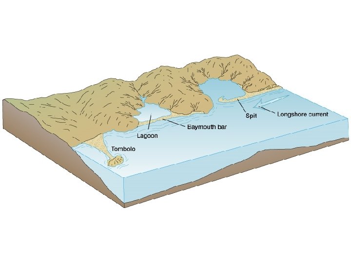

Tombolo

Tombolo

Sand Spit

Sand Spit

Sand Spit

Sea Stacks

Natural Bridges and Arches

Barrier Islands

Barrier Islands

Outer Banks, North Carolina

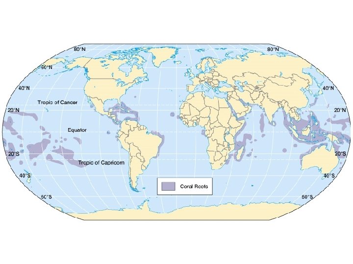
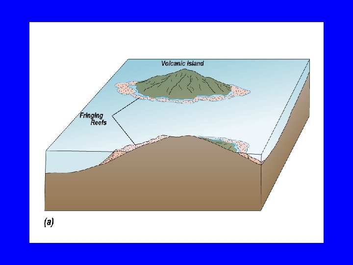
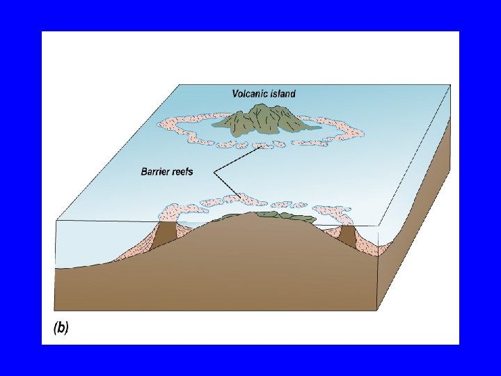
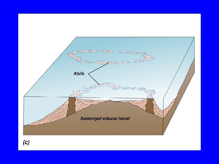
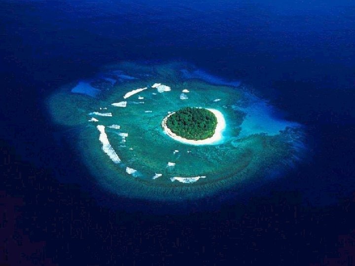
Tropical Coasts

Factors Correlated with Healthy Coral Reef Growth • • • water temperature range: 18 – 29 C normal seawater salinity: 32 – 35 ‰ clear, transparent water little or no sedimentation vigorous water motion

Tropical Mangroves

Mangroves create tidal forests. These rich ecosystems provide habitat for countless creatures and help to stabilize and, by catching sediment, even create coastline.

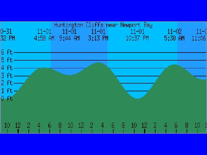
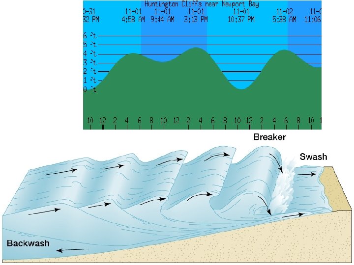
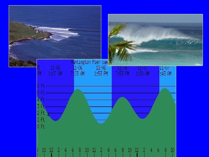
Tides rise and fall with the rising moon, an interval of 24 hours and 50 minutes. There is a bulge on both sides of the earth. Thus two high tides each cycle. Flood tide (low to high) takes 6: 13 and then ebb tide (back to low) is another 6: 13.

Tides Tide range dependent on relative position of earth, moon, and sun. Spring Tides - highest tidal range Neap Tides - lowest tidal range

Tides Tide range dependent on relative position of earth, moon, and sun. Spring Tides - highest tides. Full Moon Neap Tides - lowest tides. Half Moon

Tides Low Tide, New Brunswick

Tides
- Slides: 48