Climograph Graph that indicates average temperature and precipitation


- Slides: 48
Climograph • Graph that indicates average temperature and precipitation for a place. • Line Graph shows temperature • Bar Graph shows precipitation If the line graph goes up in the middle – it is showing a place in the northern hemisphere. If the line graph goes down in the middle – it is showing a place in the southern hemisphere. If the line is fairly straight – it is showing a place that is near or on the Equator.
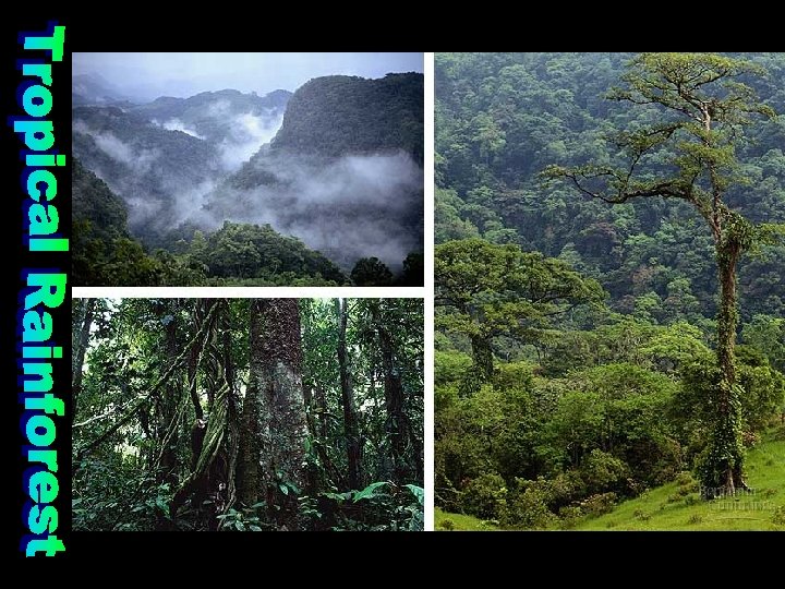
• Description – hot and wet throughout the year. • Precipitation Wet – 80 + inches a year - Rains daily • Temperatures about 80 all year • vegetation - Lush and diverse – 6% of earth, but more than half the plant and animal species. Canopy – layers of broadleaf evergreen trees. Amazon River Basin Congo River Basin Leaching – continuous rain pulls the nutrients out of the soil (not arable) Indonesia • Biome: Rainforest
Rio Temperatures are about even so it must be near the Equator. Tons of precipitation every month. Belem
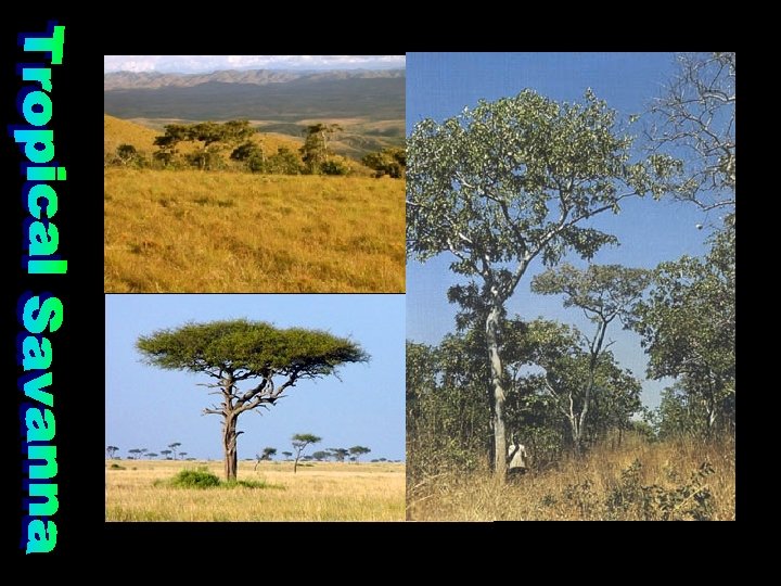
• Description – grassland with distinct dry and wet seasons. Winter is dry. • Summers have 20 – 100 inches of precipitation a year. Winter is dry. Dry season is dramatic. • High year round temperatures around 80. • Vegetation – clumps of coarse grass and few trees. • Llanos of Venezuela • Caribbean Islands • Serengeti of Tanzania • Biome: savanna
COLD DRY Darwin Dakar Near the Equator
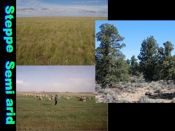
• Description – dry, largely treeless grassland. • Location – Low & mid latitudes. Border deserts & interior of continents (leeward side) • Precipitation 10 – 20 inches a year • Vegetation - Grassland with few trees or cactus. Desertification - spread of desert-like conditions to semi-arid areas is a serious problem in the Steppe • Biome: grassland
Alice Spring Northern Southern Hemisphere
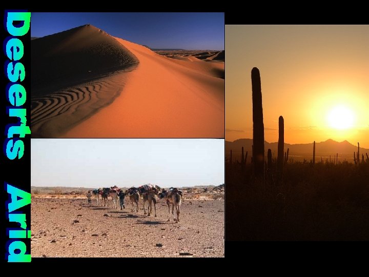
Description – dry area with sparse plant life that covers about 1/3 of the world’s land. There are two types of terrain: reg – desert pavement (gravel, rocks, and sand) and erg – dunes • Precipitation – 10 in. or less a year • Temperatures: Desert does not mean hot – it means dry!!! Day and night temperatures vary drastically. • Vegetation - scrub and cactus Oasis is an area in the desert where water is available. • Biome: Desert / Desert Scrub
Cairo Tehran Lima
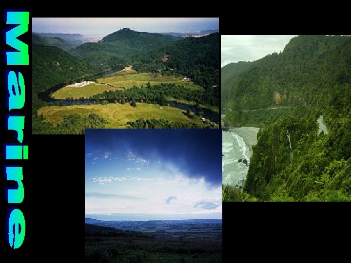
• Description – ocean winds bring cool summers and damp winters. • Location – 30 -60º on the west coast in N. Hemisphere and east coast in S. Hemisphere. Located on Westerlies. Precipitation: Ocean air brings abundant rainfall. • Vegetation: large coniferous – evergreen forests called temperate rainforests and mixed forests - both coniferous and deciduous trees. • Biome: Deciduous Forest
London Sydney Abundant rainfall year. High around 70. Low around 40. Vancouver
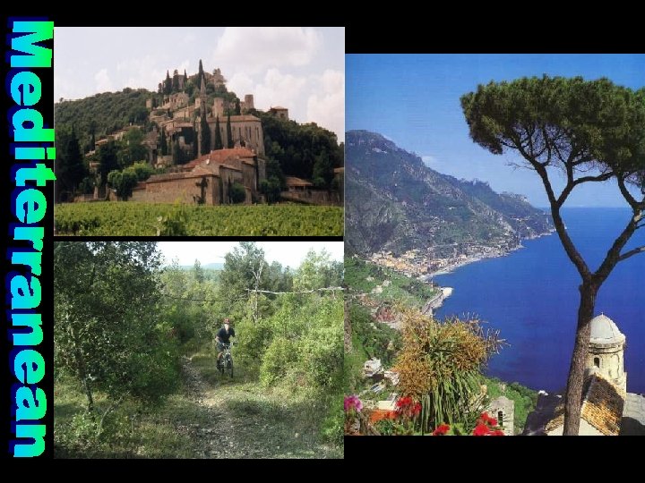
• Description – mild, rainy winter and hot sunny summers. • Precipitation: 15 – 30 in (mostly in the winter) • Vegetation - Chaparral – underbrush, woody bushes and short trees – cork, olives, grapes, etc. Leathery leaves hold moisture • Biome: chaparral
COLD WET Perth Athens Jordan Santiago COLD WET
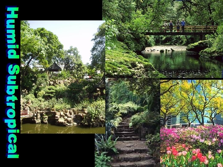
• Description – short, mild winters and nearly year round rainfall. hurricanes & typhoons. • HOUSTON is in HST • Precipitation: year round Vegetation – fruits, rice, vegetables, inland grasslands, and mixed forests - deciduous and coniferous trees. Biome: Deciduous Forest
Buenos Aires Southern hemisphere Shanghai Northern hemisphere
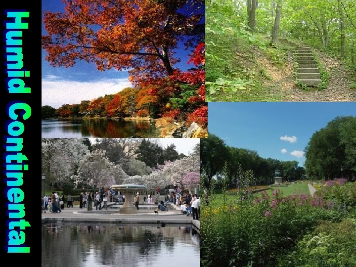
• Description - 4 distinct seasons. Storms and continentality - far in the interior of continents influence climate. • Location - interior mid-latitude in N. Hemisphere • Temperatures: winters longer as you travel north and inland. • Vegetation: Agriculture has replaced natural prairie grass, and short coniferous forests. • Biome: Deciduous Forest
Moscow Helsinki Northern Hemisphere
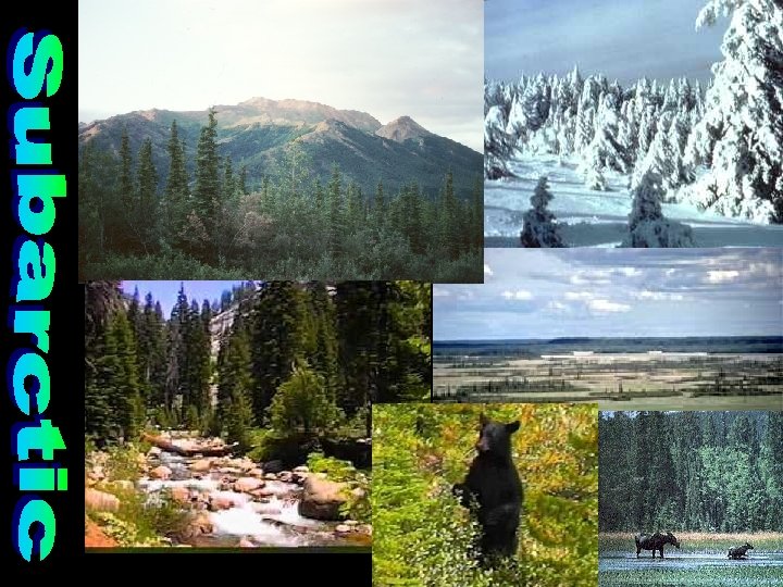
• Description – bitterly cold winter and short, cool summers. • Temperatures: Widest temperature range between summer and winter. Vegetation: Taiga (Russian word forest) a boreal forest – needled evergreens. • Permafrost – only a small layer of the ground thaws. • Biome: Taiga
Omsk Saskatoon Northern Hemisphere
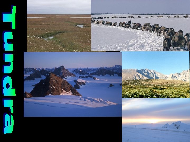
• Description – very cold with polar night for ½ of the year. • Location – far north in the northern hemisphere • Temperature: Cold: rarely above 50° - at least 9 months below freezing – some below 0º • Vegetation: Short bushes, short grass, mosses, and lichen. permafrost bogs in summer. • Biome: Tundra
Freezing Northern Hemisphere
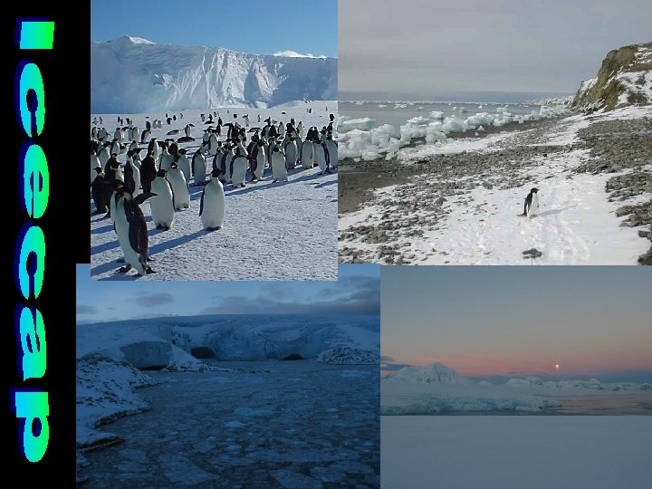
• Description – snow and ice cover this area up to 2 miles thick • Polar night – 6 months a year the sun does not rise above the horizon (24 hours dark) • Polar desert – moisture in the air does not reach the dew point, so it does not precipitate. Far away from Equator (dry & cold as move away) • Temperature: Below freezing all year - Many months below zero. • Vegetation: Possibly lichen and moss
Freezing Thuls Air Force Base Northern Southern Hemisphere
• Located in mountain systems throughout the world • Precipitation – affected by the Orographic Effect. Leeward is dry – windward is wet. • Temperature – varies with elevation – for every 1, 000 feet increase in elevation the temperature decreases 3. 5 • Vegetation – usually mixed forests at the base. Meadows with small trees, shrubs, and wildflowers line the mountainsides. • Biome: Alpine
Northern Hemisphere Near Equator Mexico City
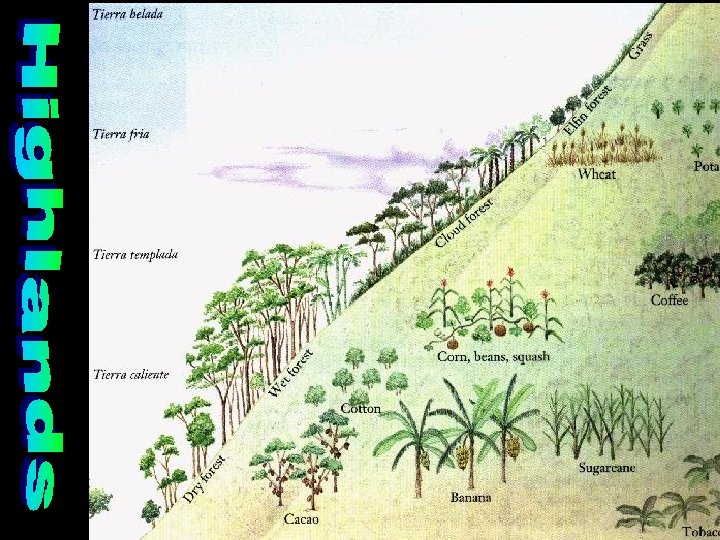
• Hot land. • 0 - 2, 500 ft. • 68 -91ºF. • Grow: rice, Banana, sugar cane, cacao, pineapple • Forests: Sea level – swamps up to dry forests around 2, 000 feet
• Temperate land. • 2, 500 – 6, 500 ft. • 60 -70ºF. • Grow coffee, cotton, tobacco, citrus fruit, squash, beans, and corn • Forests: Wet forest
• Cold land. • 6, 500 – 10, 000 ft. • Less than 60 degrees. • Grow grains such as wheat, oats, rye, and barley, apples, and also potatoes. • Forests: Cloud forests
• Most above the tree line. • 10, 000 – 14, 000 feet • temperatures: 20 – 55º • Grow: Grassland hardy shrubs. • Elfin forest at lowest elevations • Grazing of sheep, alpacas, and llamas.
• Snow line and above. • Above 14, 000 feet • Below 20º. • Nothing grows here except maybe a few moss and lichen in summer.