Cirrus Clouds near the midlatitude tropopause from CALIPSO
- Slides: 11

Cirrus Clouds near the mid-latitude tropopause from CALIPSO Steven T Massie ACD/NCAR January 8, 2008

Outline How likely is it to observe cirrus between double tropopauses? Data: Lidar observations over France FNL (NCEP) analyses of multiple tropopauses CALIPSO observations over North America

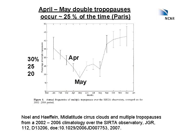
April – May double tropopauses occur ~ 25 % of the time (Paris) 30% 25 20 Apr May Noel and Haeffeln, Midlatitude cirrus clouds and multiple tropopauses from a 2002 – 2006 climatology over the SIRTA observatory, JGR, 112, D 13206, doe: 10. 1029/2006 JD 007753, 2007.

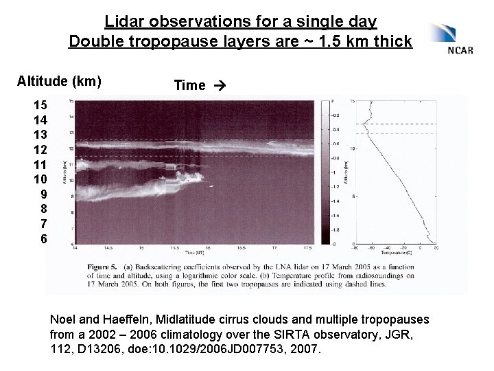
Lidar observations for a single day Double tropopause layers are ~ 1. 5 km thick Altitude (km) Time 15 14 13 12 11 10 9 8 7 6 Noel and Haeffeln, Midlatitude cirrus clouds and multiple tropopauses from a 2002 – 2006 climatology over the SIRTA observatory, JGR, 112, D 13206, doe: 10. 1029/2006 JD 007753, 2007.

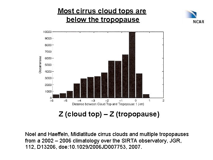
Most cirrus cloud tops are below the tropopause Z (cloud top) – Z (tropopause) Noel and Haeffeln, Midlatitude cirrus clouds and multiple tropopauses from a 2002 – 2006 climatology over the SIRTA observatory, JGR, 112, D 13206, doe: 10. 1029/2006 JD 007753, 2007.

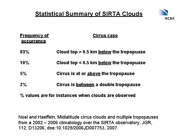
Statistical Summary of SIRTA Clouds Frequency of occurrence Cirrus case 83% Cloud top > 0. 5 km below the tropopuase 10% Cloud top < 0. 5 km below the tropopuase 5% Cirrus is at or above the tropopause 2% Cirrus is between a double tropopause % values are for instances when clouds are observed Noel and Haeffeln, Midlatitude cirrus clouds and multiple tropopauses from a 2002 – 2006 climatology over the SIRTA observatory, JGR, 112, D 13206, doe: 10. 1029/2006 JD 007753, 2007.

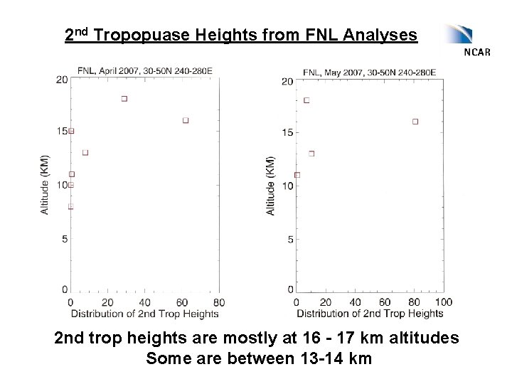
2 nd Tropopuase Heights from FNL Analyses 2 nd trop heights are mostly at 16 - 17 km altitudes Some are between 13 -14 km

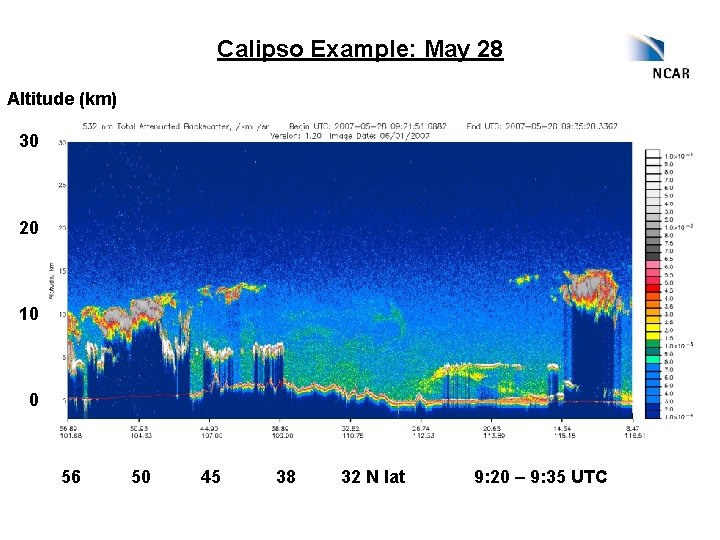
Calipso Example: May 28 Altitude (km) 30 20 10 0 56 50 45 38 32 N lat 9: 20 – 9: 35 UTC

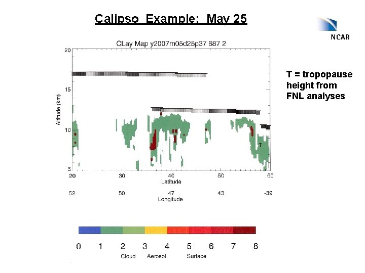
Calipso Example: May 25 T = tropopause height from FNL analyses

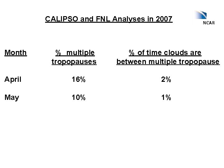
CALIPSO and FNL Analyses in 2007 Month % multiple tropopauses % of time clouds are between multiple tropopause April 16% 2% May 10% 1%

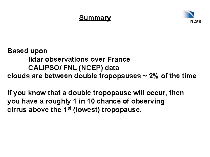
Summary Based upon lidar observations over France CALIPSO/ FNL (NCEP) data clouds are between double tropopauses ~ 2% of the time If you know that a double tropopause will occur, then you have a roughly 1 in 10 chance of observing cirrus above the 1 st (lowest) tropopause.