Chapter 9 Surface Water Surface Water Movement Earths


- Slides: 50
Chapter 9 Surface Water
Surface Water Movement • Earth’s water supply is recycled in a continuous process called the water cycle. • Water molecules move continuously through the water or the surface of Earth, condense into cloud droplets, fall as precipitation back to Earth’s surface, and soak into the ground. • As part of a continuous cycle, the water eventually evaporates back into the atmosphere, again forms clouds, again falls as precipitation, and so on.
The Hydrologic Cycle • Runoff = Surface Water System • Infiltration = Groundwater System
Where is the Water ?
Runoff: Water flowing downslope along Earth’s surface.
Factors that affect Runoff 1. Vegetation 2. Rate of precipitation 3. Soil composition 4. Slope
Vegetation • Soils that contain grasses or other vegetation allow more water to enter the ground than do soils with no vegetation. • Precipitation falling on vegetation slowly flows down leaves and branches, and it eventually drops gently to the ground. • In contrast, precipitation falls with far more force onto barren land. In such areas, soil particles clump together and form dense aggregates with few pores or spaces between them. • The force of falling rain may then push the soil clumps together, thereby closing pores and allowing less water to enter.
Rate of Precipitation • Light, gentle precipitation infiltrates the dry ground. However, the rate of precipitation may temporarily exceed the rate of infiltration. • For example, during heavy precipitation, water falls too quickly to soak into the ground and becomes runoff. • Thus, a gentle, long-lasting rainfall is more beneficial to plants and causes less erosion by runoff than a torrential downpour.
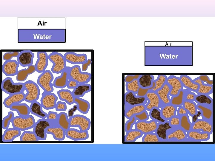
Soil Composition • The physical and chemical composition of soil also affects its waterholding capacity. • Soil consists of decayed organic matter, called humus, and minerals. • Humus creates pores in the soil, thereby increasing a soil’s ability to retain water. • The minerals in soil have different particle sizes, which are classified as sand, silt, or clay. • Soil with a high percentage of course particles, such as sand, has relatively large pores between its particles that allow water to enter and pass through the soil quickly. • In contrast, soil with a high percentage of fine particles, such as clay, clumps together and has few or no spaces between the particles. • Such small pores restrict both the amount of water that can enter the ground and the ease of movement of water through the soil.
Slope • The slope of a land area plays a large role in determining the ability of water to enter the ground. • Water from precipitation falling on slopes flows to areas of lower elevation. • The steeper the slope, the faster the water flows. • There is also greater potential for erosion on steep slopes. In areas with steep slopes, little water seeps into the ground before it runs off.
Stream Systems
• Precipitation that does not enter the ground usually runs off the surface quickly. Some surface water flows in thin sheets and eventually collects in small channels. • As the amount of runoff increases the channels widen, deepen, and become larger. • Although it is common for these small channels to dry up shortly after precipitation stops, the channels again fill with water each time it rains and becomes larger and longer. • If a sufficient supply of water develops, the water begins to flow more permanently in a channel and can become a stream.
Watersheds and Divides • All of the land areas whose water drains into a stream system is called the system’s watershed, or drainage basin. • Watersheds can be relatively small or extremely large in area. • A divide is a high land area that separates one watershed from another. • Each tributary in a stream system has its own watershed and divides, but they are all part of the larger stream system to which the tributary belongs.
Sediment Load
Stream Velocity and Stream Load • Look at the chart on page 217 • Write one sentence explaining the relationship between stream velocity and stream load.
Floodplain
• The amount of water being transported in a particular stream at any given time varies with weather conditions. • Sometimes, more water pours into a stream than the banks of the stream channel can hold. • A flood occurs when water spills over the sides of a stream’s banks onto the adjacent land. • The broad, flat area that extends out from a stream’s bank and is covered by excess water during times of flooding is known as the stream’s floodplain.
Flooding & Sedimentation
Floods • Floods are a natural occurrence. When a stream reaches its flood stage, a flood can occur. • Flood stage is the level at which a stream overflows its banks and the crest of the stream is the maximum height. • Because it takes time for runoff to collect in streams, the water continues to rise and may reach its crest days after precipitation ends. • The resulting flooding may occur over localized, small areas or across large regions. • The flooding of a small area is known as an upstream flood.
Floods • Sudden rainstorms that drop large amounts of rain within a short period of time cause upstream floods, as do dam failures. • Although they are localized, upstream floods can do a great deal of damage within a very short period of time. • Heavy accumulations of excess water from large regional drainage systems results in downstream floods. • Such floods occur during or after long-lasting, intense storms or spring thaws of large snowpacks. • The tremendous volumes of water involved in a downstream flood can result in extensive damage.
Flash Flooding
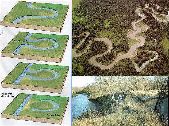
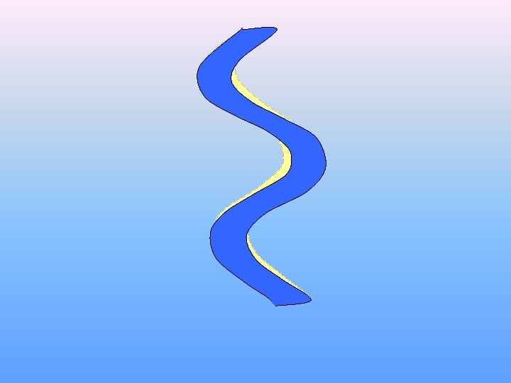
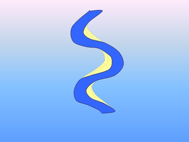
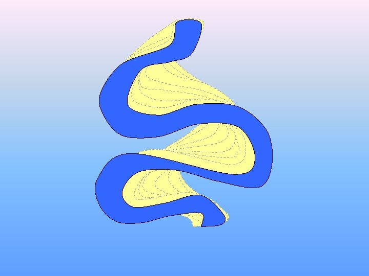
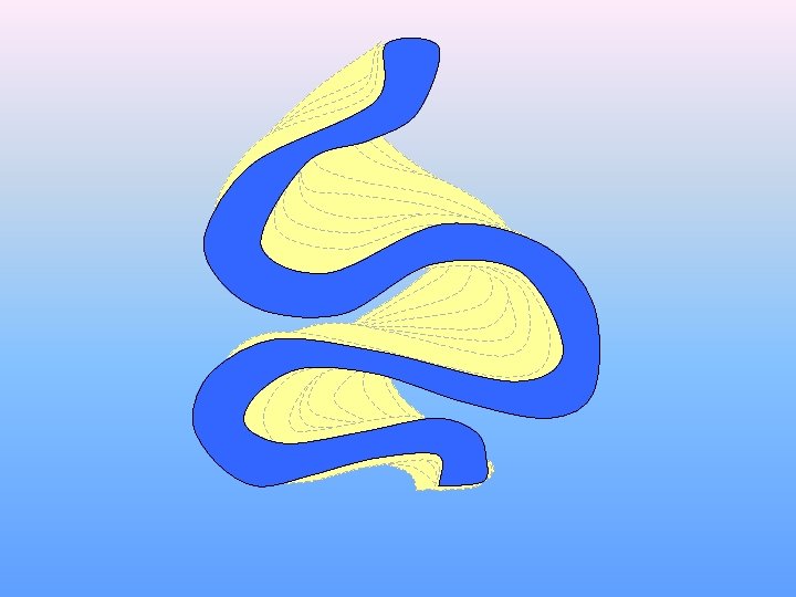
Meandering Rivers
Formation of Meanders
Point bar deposits
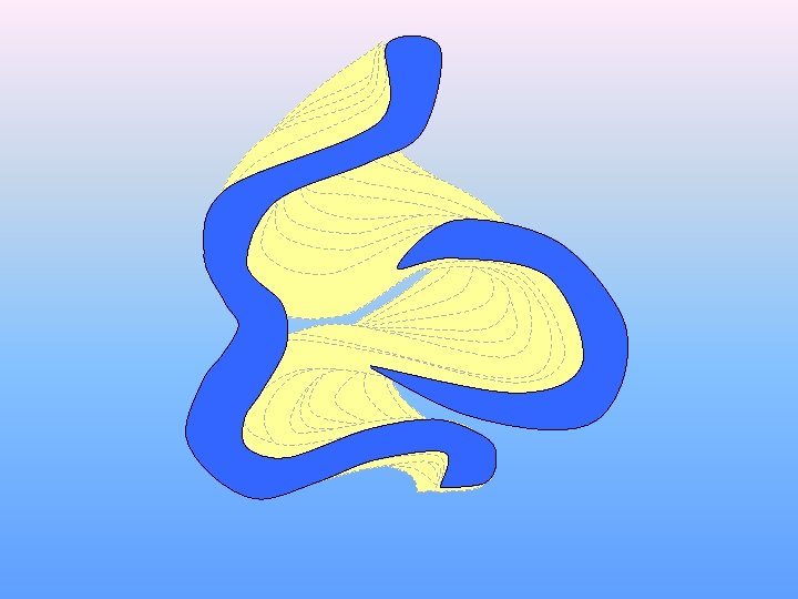
Meandering stream flowing from top of screen to bottom
Maximum deposition Maximum erosion
Meander scars Oxbow Lake Oxbow cuttoff
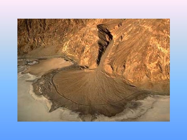
Deposition of Sediment • Steams that lose velocity also lose their ability to carry sediment. • A stream’s velocity lessens and its sediment load drops when its gradient abruptly decreases. • In dry regions, where mountain streams commonly flow down narrow valleys onto broad, flat, valley floors, a stream’s gradient may suddenly decrease causing the stream to drop its sediment as a fan-shaped deposit called an alluvial fan.
Deposition of Sediment • Streams also lose velocity and the ability to carry sediment when they join larger bodies of quiet water. • The triangular deposit that forms where a stream enters a large body of water is called a delta. • The Mississippi River Delta began forming millions of years ago. • New Oreleans is located on that delta, an area that was under seawater only 5000 years ago.
Deltas - Distribution Systems
Formation of the Mississippi River Delta More recent delta Modern sediments delta Early delta
Lakes
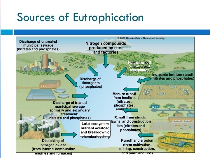
Eutrophication • Through the process of photosynthesis, plants add oxygen and waste products to lake water. • Animals that live in a lake use the water’s oxygen and add waste products to the water as they conduct their life processes. • The decay processes that occurs after plants and animals die also uses up dissolved oxygen supplies. • The amount of dissolved oxygen helps determine the quality of lake water and its ability to support life.
Eutrophication • The process by which lakes become rich in nutrients from the surrounding watershed, thereby resulting in a change in the kinds of organisms in the lake, is called eutrophication.
Wetlands
• A wetland is a land area that is covered with water for a large part of the year. • Wetlands include environments commonly known as bogs, marshes, and swamps. • They have certain soil types and support specific plant species.
There are 4 main types of Freshwater Wetlands in North America; Ponds, Marshes, Swamps, and Peat bogs. A Pond is a well defined basin that is filled with stagnant water and ringed by vegetation. It is fed mainly by rainstorms and snowmelt, and loses most of its water through seepage and evaporation. In hot, dry months, parts of a Pond may dry out, exposing mud flats. In shallow Ponds, bottom rooted plants such as water lilies can reach the surface, while milfoils, pondweeds and other submergent plants thrive below the water's surface A Marsh is usually found near a river, lake or tidal waters. Marshes are subject to periodic flooding, and the water level can change drastically in a short amount of time. The boundaries of a marsh are not well defined, and in draught, a marsh can completely dry up. Marshes are overgrown with coarse grasses, sedges and rushes. A Swamp is essentially a wooded marsh. Unlike Marshes, Swamps can support trees, tall shrubs, herbs and mosses. Swamps are covered with still or gently flowing water during wet seasons. A Peat bog is a poorly drained area that is covered by mats of moss, which slowly decompose in successive layers and eventually form a material called peat. There are 2 types of peat bogs; Bogs and Fens. The water of a Bog is much more acidic than that of a Fen, due to the larger quantities of sphagnum moss and the more advanced process of decomposition in a Bog. The vegetation of a Peat bog is mainly Sedges, Spruce and low-growing members of the Heath family.